Project pathway
The quickest route to the right decision.
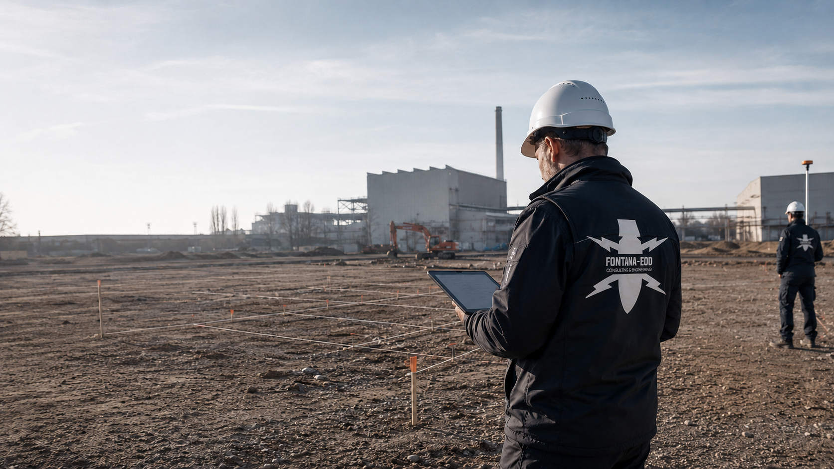
Before earthworks on an industrial or commercial site, we check which ordnance indicators are available for the planned area. FONTANA-EOD reviews site and construction documents and plans suitable investigations according to area, depth, existing infrastructure and operational processes. Send site plans, intervention depths, existing requirements and working hours so that services and evidence can be defined before conversion, foundation work or utility installation.
Check suspected ordnance and documents.
Coordinate the investigation area and depth.
Integrate the construction sequence and HSE.
Before earthworks, drilling and foundation work on industrial or commercial sites, existing suspicion indicators are used to establish which ordnance investigations are needed. The site history and available results are compared with the current construction area and planned depths. Operational processes, utilities and technical installations affect access and method selection. The evidence must show which areas were investigated and which questions remain unresolved for design and site management.
Have project documents assessedThe scope of services for “Düsseldorf-Reisholz business park, North Rhine-Westphalia” included construction-phase monitoring.
Service period: –
Service areas:Ordnance specialist supervision of groundworks
The scope of services for “Duisburg logistics centre, North Rhine-Westphalia” included ordnance monitoring.
Service period: –
Service areas:Ordnance specialist supervision of groundworks
The scope of services for “Development of a commercial area in Bergisch Gladbach, North Rhine-Westphalia” included ordnance surveys.
Service period: –
Service areas:Surface surveys: GPR, TDEM and magnetometry
References from project practice
Construction in industrial and commercial settings requires assessment of the specific intervention areas. Here you can find the locations of our published reference projects.
Project information is loaded from the reference list.
Select a project location from the place selector or choose a point on the map.
The markers show official place centres. The associated references state the construction task, services performed and documented scope.
Map data: © GeoBasis-DE / BKG (2026), VG250 / GN250, dl-de/by-2-0; Luxembourg: ACT / data.public.lu, CC0. Geometries projected and simplified for display.
At the outset, information on past use and existing structures is compared with the planned areas and intervention depths. These factors determine the appropriate investigation area and method.
Former production, storage, rail connections, military-related use, demolition or long periods of disuse may be relevant to the specialist assessment. On industrial and commercial sites, the available documents are therefore checked and the planned interventions compared with known suspicion indicators.
Review documentsMany sites have been expanded, converted or redeveloped several times. Old foundations, relocated utilities, filled pits and former traffic areas may affect present-day measurements. These changes are checked beforehand against site plans, existing-asset data and the construction objective.
Clarify existing conditionsFill, rubble, ballast, demolition material and imported soil alter the ground and signal pattern. This may influence the choice of method. Bringing geotechnical data and suspicion indicators together early makes it easier to define suitable investigation areas.
Assess ground conditionsPlant roads, building areas, utility corridors and expansion areas often involve linear interventions at varying depths. The construction sequence, access and existing utilities along these corridors are checked before a method is selected.
Choose suitable methods for traffic and utility corridorsDemolition, new industrial buildings, plant modernisation and site development often combine several types of intervention. Demolition areas, new foundations, trenches, piles and work volumes must be described separately so that the subsequent assessment remains unambiguous.
Define the interventionsWhen construction, operations and procurement are tightly scheduled, ordnance assessment should not be left until excavation is already open. The investigation area, suitable methods and required documentation are therefore agreed before earthworks begin.
Prepare the construction phaseOperators, owners, developers, designers, HSE, site management and civil-engineering contractors need the same technical information. Documentation must therefore identify technical limits while remaining understandable to the parties involved.
Agree communication arrangementsThe initial assessment may be followed by further drilling, utility trenches, foundations, traffic areas or excavation sections. The area dealt with is therefore described precisely so that later works are not mistakenly treated as already assessed.
Maintain the evidence trailPlant sites, commercial areas, industrial buildings and previously developed land involve different interventions, responsibilities and evidence requirements. The next step is selected according to use, construction phase and technical feasibility.
Coordinate investigations along plant roads and utility corridors with installations, access and operational processes.
Prepare parcel divisions, development corridors, utility trenches and later construction phases with a clear record.
Plan large building footprints, traffic areas, ramps, sprinkler tanks and earthworks with clearly defined evidence.
Assess former use, demolition, reorganisation and civil-engineering works before marketing or development.
Assess fill, former installations, the state of demolition and suspected ordnance together within the project sequence.
Coordinate investigation areas and work dates alongside production, traffic routes and existing utilities.
Plan ordnance investigations for conversions, new foundations and utility trenches during ongoing site operations.
Assess the excavation, foundations, borehole positions, floor slab and utility connections before ground intervention.
Coordinate multiple occupiers, construction phases, property boundaries and development infrastructure so that evidence remains unambiguous.
Coordinate ordnance investigations with demolition and future development; deal separately with soil and contaminant issues.
Industrial and commercial land should be assessed according to the specific project purpose. The decisive factors are the planned depth, usable area, condition of existing assets and form of evidence required.
Before acquisition, design or the approval phase, existing use-history and suspicion records help estimate investigation requirements for the proposed construction. The results show which investigations and documents still need to be planned.
Assess the project areaPlant roads, pipe corridors, utility lines, existing buildings and ongoing operations affect access, measurement methods and excavation planning. A reliable assessment starts with existing-asset data and clearly defined sections.
Coordinate existing conditions and the construction phaseInvestigation areas, service scope, documentation, reporting procedures and possible stop points must be described clearly before procurement for contractors and design offices.
Prepare evidence for procurementPiled foundations, geotechnical boreholes, retaining works, utility trenches and utility crossings require an assessment that clearly distinguishes vertical coverage from technical feasibility.
Establish target depth and borehole positionsFor areas that cannot be fully investigated in advance, the technical suitability of construction-phase ordnance surveying is assessed. Excavation layers, stop points, authority to give instructions, reporting procedures and documentation are agreed with site management before work begins.
Plan excavation monitoringClients, operators, site managers and designers need traceable documents on the initial situation, method, findings assessment, location references and next project step.
Prepare the project fileThe assessment combines documents, technical methods, construction sequence and documentation. This shows which area has been assessed and which measure is appropriate as the next step.
Former industrial, storage, transport or military uses may be relevant to suspected areas. Existing suspicion indicators are compared with the intended areas, depths and construction phases.
Review suspicion indicatorsAsphalt, concrete, ballast, reinforcement, building remains, strip foundations and utilities may affect measurement data. The methods that can provide usable results in each part of the site are therefore checked beforehand.
Establish measurement conditionsPiled foundations, driven core sampling, geotechnical investigations and deep utility trenches require an assessment that clearly records target depth, borehole diameter and probe guidance.
Agree borehole positionsDuring ongoing earthworks, procedures for anomalies, interfering objects and findings that cannot be assessed unambiguously must be clear. Competent authorities, site management and the specialist company need agreed reporting procedures.
Agree reporting procedures and communication of findingsSite plans, measurement data, investigation limits, findings assessments, photographs and recommendations must be available in a form that allows the client, operator and site management to decide the next step.
Prepare evidenceFinds and hazardous situations remain subject to the established procedures of the competent authorities. FONTANA-EOD supports the specialist project assessment, surveys, supervision and documentation within the agreed scope.
Clarify coordinationUse history, existing assets and ground conditions help determine the method. The planned areas and depths define the work volume to which the investigation relates.
Industrial and commercial sites combine existing assets, conversion, expansion, demolition, traffic areas and technical infrastructure. Before a method is selected, the areas actually affected, planned interventions and reliable data already available are established. A technical investigation without clearly stated areas and depths rarely provides the evidence subsequently needed by the client, designers and site management.
Establish investigation requirements before selecting methodsExisting utilities, service ducts, old foundations, reinforcement, ballast, steel remains and fill can affect measurement data and complicate excavation. Existing-asset plans, utility information, geotechnical data and access details are therefore brought together in advance so that avoidable uncertainties do not prevent the technical investigation.
Arrange review of existing-asset dataBoreholes, piles, retaining works, driven installations, anchors, utility trenches and infiltration trenches reach different depths. Ordnance assessment considers not only the surface but also the planned target depth of the specific intervention. The method suitable for this work volume under the existing ground and interference conditions is assessed.
Agree the target depthAsphalt, concrete, paving, ballast, vegetation, installations and ongoing operations determine whether area-wide measurements are suitable. GPR, magnetometry and TDEM respond differently to the ground, moisture and metal content. The method is therefore planned for each sub-area rather than uniformly for the entire project site.
Assess the surfaceIf an area cannot be fully investigated in advance or interventions change, the suitability of additional methods is assessed. Where construction-phase ordnance surveying is suitable, each working layer is technically surveyed and assessed. Controlled layer-by-layer removal and supplementary visual inspection then follow; the steps are repeated down to the agreed excavation bottom. Work sections, machine operation, authority to give instructions, reporting procedures, documentation and stop points are defined before work begins.
Plan excavation monitoringNot every measurement anomaly is ordnance, and not every interfering object can be assessed conclusively without exposure. A traceable findings assessment with location references, technical limits, recommendations and a clear follow-on decision is important. The documents show which area is affected and what further investigation is needed.
Clarify the findingsOperators, clients, designers, HSE, site managers and contractors need different information. The evidence must therefore connect the area, method, investigation limits, findings, photographic records and recommendations understandably without obscuring technical details.
Prepare the project fileProject managers, designers, operators, contractors, the specialist company and competent authorities need clear contacts and reporting procedures before execution. During ongoing operations or parallel trades, access, working hours and communication of plan changes are also agreed.
Coordinate interfacesBefore tendering or commissioning, investigation areas, depths, methods, documentation and possible excavation supervision should be described so that contractors and clients understand the same scope of services. Possible additional services are also described with their trigger and the evidence required.
Prepare procurement documentsGeotechnical boreholes, driven core sampling, groundwater monitoring wells, piles and retaining works may require an independent ordnance assessment before the main building or civil-engineering works. The starting positions are compared with the site plan, utility data and planned target depth.
Agree borehole positionsThe project location affects coordination procedures, contacts and document requirements. Site, federal state, municipality, area and existing requirements are considered together during technical preparation without conflating the private project service with decisions by authorities.
Check the project regionMeasurement anomalies are assessed by specialists; any necessary follow-up investigation or exposure is agreed with the competent parties. If an unexpected suspicious object is found, stop work immediately, do not touch, move or uncover it further, leave the immediate area and keep others away without putting yourself at risk. In Germany, notify the police immediately on 110; outside Germany, use the local emergency reporting procedure. The competent authorities determine the response to a find.
Document findings and subsequent decisionsA site often develops over several years. Development or an initial construction project is frequently followed by extensions, utility changes, building conversions or additional geotechnical works. Evidence should therefore be maintained so that later interventions can build on it technically.
Maintain the evidence trailAccess, work permits, contractor coordination, traffic routes, shift times and HSE requirements can strongly affect the technical sequence. Before deployment, the applicable requirements and available access at the agreed times are established. They therefore form part of the initial project assessment.
Establish operational requirementsAt the end of the assessment, it must be clear whether further surveys, excavation supervision, recovery within the permitted scope, additional document review or the planned execution should be prepared from a technical perspective. The recommendation is therefore linked to the area, depth and construction phase.
Agree the next stepThe schedule, working times, exclusion areas, access and parallel trades help determine whether an investigation should take place in advance, section by section or during construction. Investigation dates are coordinated with upcoming earthworks and available work areas.
Agree time windowsThe methods perform different tasks. A sound choice depends on the project objective, ground conditions, interference sources, area and depth.
Historical aerial-photo analysis and document review identify evidence of former use and possible ordnance effects. This is used to establish the technical investigations needed for the planned project; it does not establish the presence of objects currently in the ground.
Ground-penetrating radar can detect structures, interfering objects and utilities under suitable ground and surface conditions. Metal installations, high moisture, dense reinforcement and heterogeneous fill may limit the information obtained. Suitability is therefore determined by the specific area, not merely by the method itself.
Magnetometry responds to magnetic anomalies and may be useful on many open sites. In industrial settings, steel, fences, utilities, rails, scrap and reinforced structures may strongly affect interpretation. Interference sources and areas that cannot be interpreted sufficiently are marked on the plan.
TDEM may be suitable for certain metal targets and site conditions. The method must, however, match the surface, conductivity, interference sources and target depth. On heavily disturbed commercial sites, suitability is critically assessed beforehand.
For deep interventions such as piles, drilling, retaining works and foundations, it is assessed whether a borehole survey can cover the required work volume. The decisive factors are borehole diameter, casing, measurement interval, target depth, starting position and whether the area can be assessed sufficiently before the intervention.
For areas that cannot be fully investigated in advance, the technical suitability of construction-phase ordnance surveying is assessed. Each working layer is technically surveyed and assessed before controlled layer-by-layer removal with supplementary visual inspection. These steps are repeated down to the agreed excavation bottom. Work areas, stop points, authority to give instructions, reporting procedures and documentation are defined before work begins.
Before surveys, drilling or excavation, the conditions affecting measurability, execution and documentation are checked.
The investigation area is defined by the construction area, intervention, safety distance, access and construction section. Industrial and commercial sites should be considered not only in terms of property boundaries but also in terms of the actual earthworks.
Excavation, drilling, foundations, retaining works, utility installation and drainage reach different depths. The selected investigation must match the maximum planned depth and must not obscure deeper interventions.
Metal, utilities, rails, reinforcement, ballast, foundation remains, fences and machinery affect measurement methods. Known interference sources and the sub-areas whose assessment they restrict are checked before deployment.
Open ground, asphalt, concrete, ballast, existing buildings, vegetation and storage areas alter access and measurement conditions. The surface helps determine whether an area-wide method, a targeted assessment or supervision during excavation is appropriate.
Fill, rubble, cohesive soil, high moisture, coarse ground and groundwater conditions affect measurement data, drillability and excavation. Geotechnical documents help identify technical limits early.
Existing utilities and utility corridors must be checked against the investigation area before drilling, surveying and excavation. Uncertain utility positions require additional coordination and may change execution.
Shift operation, plant traffic, safety induction, exclusion areas, contractor coordination and access control may determine the sequence. The ordnance assessment must incorporate these requirements before deployment begins.
Before work begins, it should be clear whether the evidence is needed for tendering, the project file, site management, operator communication or a follow-on decision. This determines how location references, findings and recommendations are structured.
The evidence assigns investigated areas, depths, methods and outstanding tasks to the relevant construction sections. Operators, designers, clients and contractors receive the same location and plan references.
Site plans, land parcels, sub-areas, construction sections, earlier expert reports and existing requirements form the basis of a traceable assessment. Incomplete data are identified so that later decisions do not rely on unstated assumptions.
Bring documents togetherThe investigation area is defined according to intervention, construction phase, safety distance, access and evidence requirements. The boundaries show which subsequent earthworks lie within the investigated area and which lie outside it.
Define the investigation areaThe method is determined by the surface, ground, interfering objects, target object, depth and construction sequence. Limits are stated openly so that measurement data and findings can be interpreted correctly.
Agree the methodAnomalies are not considered in isolation but assessed with their location, measurement conditions, interference sources and construction objective. This provides a technical basis for a follow-on decision in design or execution.
Assess the findingsReports, measurement records, location references, photographic records and recommendations are assembled for the client, site management, HSE and procurement. After actual exposure or clearance work, the corresponding findings and clearance records are included.
Prepare the project fileClear responsibilities, reporting procedures, work windows and stop points help during ongoing works. Site management, the operator and the specialist company agree these details before execution.
Agree communication arrangementsThe documented assessment brings together the area, documents, methods, limits, findings and next step in a traceable form.
The documented assessment begins with an unambiguous description of the area, use, construction objective and intervention. For the industrial or commercial site, it records the sub-areas considered, the upcoming construction phase and the result required by the client, designers or site management. The report keeps clear which plan revision and construction sections were investigated.
Before technical execution, the available documents and missing information are stated. These include site plans, land parcels, existing utilities, geotechnical data, earlier expert reports, aerial-photo analyses, old plans, requirements and construction-sequence information. Missing data are not concealed but included as matters to resolve during further coordination.
The investigation area is not described merely as a total area. Sub-areas, construction sections, borehole positions, trenches, foundations, traffic areas and technical installations are decisive. The planned depth is considered for each area because near-surface work, utility installation, piled foundations and excavation create different technical requirements.
The choice of aerial-photo analysis, GPR, magnetometry, TDEM, borehole surveys, deep-ground surveys or excavation monitoring is based on the specific project situation. The report explains why a method is suitable, where interference sources act and which areas require further coordination before assessment.
Measurement points, investigation areas, anomalies, exposures and findings are documented with location references. Site management and the client can therefore identify the area dealt with and the scope of the follow-on decision. In later construction phases, this assignment is used to check which results can be used for the new interventions.
When earthworks are supervised, work sections, machine operation, reporting procedures and stop points are documented so that the construction sequence remains traceable. If anomalies occur, a clear communication line between the specialist company, site management, operator and competent authorities is essential.
The result should do more than collect findings: it should support a technical follow-on decision. Depending on the project situation, further document review, additional surveying, excavation supervision, technical exposure, recovery within the permitted scope or continuation of the planned work may be prepared.
The completed documents must remain readable for the client, designers, operator, HSE, procurement and site management. Results, investigation scope, limits, location references and recommended follow-on measures are therefore structured so that the information can be used in the project file, construction sequence and coordination.
The sequence is prepared so that the technical investigation, operational requirements and construction work fit together.
The address, site plan, construction-area boundaries, planned interventions, construction phase and known suspicion indicators are brought together at the outset. This allows a technically traceable definition of the investigation area.
Aerial photographs, historical use, existing-asset plans, old expert reports, utility data, geotechnical documents and existing requirements are assessed for their relevance to the specific area.
Excavation depth, drilling depth, foundation depth, utility trenches, retaining works and other interventions determine which investigation is technically appropriate and where its limits lie.
GPR, magnetometry, TDEM, borehole surveys, deep-ground surveys or excavation monitoring are combined or used separately according to the surface, ground, interfering objects and construction phase.
The agreed areas, borehole positions or excavation sections are investigated with location references, equipment deployment, working windows and interfaces with site management.
Measurement data and anomalies are assessed with regard to interference sources and technical limits. Outstanding investigations and any further work required are identified.
The report, location references, investigation scope, findings assessment and recommendations are compiled in a traceable form for the client, designers, operator and site management.
Depending on the result, construction work, further surveys, excavation monitoring, ordnance recovery or renewed coordination with the competent authorities are prepared.
Each project situation requires its own technical definition of the area, intervention, method and evidence requirements.
Coordinate investigations along plant roads and utility corridors with installations, access and operational processes.
Agree the investigation area within the plantPrepare parcel divisions, development corridors, utility trenches and later construction phases with a clear record.
Arrange specialist assessment of a commercial areaPlan large building footprints, traffic areas, ramps, sprinkler tanks and earthworks with clearly defined evidence.
Assess a logistics siteAssess former use, demolition, reorganisation and civil-engineering works before marketing or development.
Prepare a conversion siteAssess fill, former installations, the state of demolition and suspected ordnance together within the project sequence.
Arrange an assessment of a former siteCoordinate investigation areas and work dates alongside production, traffic routes and existing utilities.
Coordinate a plant expansionPlan ordnance investigations for conversions, new foundations and utility trenches during ongoing site operations.
Assess a production areaAssess the excavation, foundations, borehole positions, floor slab and utility connections before ground intervention.
Prepare a new industrial buildingCoordinate multiple occupiers, construction phases, property boundaries and development infrastructure so that evidence remains unambiguous.
Assess a business parkCoordinate ordnance investigations with demolition and future development; deal separately with soil and contaminant issues.
Assess an industrial brownfieldThe technical suitability of a method depends on the surface, ground, interference sources, depth and access. These factors are brought together before work begins.
Industrial and commercial sites have traffic routes, utility corridors, plant traffic and ongoing use. The investigation is therefore incorporated into specific work windows, exclusion areas and responsibilities.
Metal, fill, foundation remains, reinforcement, utilities and ballast may affect measurement data. The interpretation states these limits; the choice of method is justified for each sub-area.
Area surveys, borehole surveys and excavation monitoring are not interchangeable. The determining factors are target object, intervention depth, surface, construction phase and evidence requirements.
Extensions, new buildings, plant conversions and utility installation frequently encounter old existing-asset records. The project assessment combines technical feasibility with traceable documentation.
Clear stop points, reporting procedures, access requirements and documents are important for site management, operators and safety coordination. These details are included in the investigation sequence.
An investigation result must enable a next step: further surveying, excavation supervision, technical exposure, recovery within the permitted scope or continuation of the planned construction sequence.
Commercial sites, plant sites, logistics, former sites and industrial buildings require different investigation areas.
Surface, ground, interfering objects, depth and access determine the choice of methods.
Reports, site plans, findings assessments and recommendations must remain understandable for the project file and site management.

Former uses and existing investigations are related to building footprints, traffic areas, utility corridors and demolition zones. A general site description does not replace the spatial definition of the planned interventions. Location, depth and construction condition determine further investigation requirements.
Compare existing documents with the construction area
Surfacing, foundations and metal installations can restrict investigations. Suitable methods and timing are agreed for freely accessible areas, deep foundations and areas accessible only after demolition. Necessary investigations and protective measures are planned before ground interventions during demolition, surface opening or the creation of access. Outstanding tasks remain assigned to their respective work volume.
Choose suitable methods for changed measurement accessFONTANA-EOD reviews site and construction documents, plans suitable investigation methods and documents the areas and depths dealt with. Site management, designers and operators receive the results with location references and the relevant investigation limits.
Agree the working approachBefore technical deployment, the location, use, requirements, utilities and construction objective are assessed.
Surveys, excavation supervision and document review are selected according to the intervention, not applied uniformly.
Work windows, access, HSE and contractor coordination are incorporated into planning.
Reports and location references are structured so that the next project step can be decided.
The scope of services is defined according to the interventions actually planned. Excavation, drilling, foundations, utilities and traffic areas are not treated alike because their depths, work volumes and evidence requirements differ.
Existing utilities, buildings, traffic routes, operational windows and access requirements are considered before execution. This helps integrate ordnance assessment into ongoing site or development operations.
Interference sources, ground structure, surfacing, moisture and installations are not ignored. If a method provides only limited information, the reason is stated and a technically suitable follow-up measure is prepared.
Procedures for anomalies, stop points and necessary coordination are prepared so that site management, operators, clients and competent authorities can respond systematically when an incident occurs.
Results are brought together with location references, area boundaries, findings assessments and recommendations. The next project step can therefore be traced through the project file.
Service limits, method selection, documentation needs and possible earthworks supervision are described so that design and procurement remain easier to manage before execution.
Ordnance assessment on industrial and commercial sites involves clients, designers, operators, construction teams and competent authorities. Clear allocation of roles supports the construction sequence and documentation.
They define the project objective, construction section, intervention depth, time window and desired form of evidence. The earlier these details are available, the more reliably ordnance assessment can be prepared.
Designers turn investigation areas, borehole positions, geotechnical data, tender requirements and construction sequences into technically unambiguous documents. FONTANA-EOD provides specialist assessment and documentation for this purpose.
Contractors need clear service limits, work areas, stop points and reporting procedures. Coordination before construction starts is particularly important for excavation and utility trenches.
Operating sites contribute access requirements, contractor coordination, operational safety, utility data and work permits. These factors influence the method and sequence.
In Germany, the ordnance disposal services of the federal states and the locally competent authorities carry out hazard-response and find-management duties. Their involvement is established for the project location; outside Germany, local responsibilities apply.
The local public-order authority and, where relevant, the building-control authority are involved in their project-specific roles. Requirements and contacts are assigned to the actual plant areas and construction sections; reporting procedures are defined before work begins.
FONTANA-EOD reviews documents, plans suitable methods, supervises defined interventions and prepares traceable evidence for the client, designers and site management.
Ordnance work, site organisation and finds are subject to established responsibilities and technical requirements. For the project, it matters which investigation is commissioned and what evidence it produces.
In Germany, § 7 SprengG concerns the commercial authorisation for activities requiring authorisation; § 20 SprengG concerns the certificate of competence of responsible persons. Under § 1b SprengG, searching for found munitions also counts as handling them. The requirements applicable to the project depend on the activity actually commissioned and the allocation of responsibilities.
The First Ordinance to the Explosives Act (1. SprengV) includes requirements for specialist knowledge and state-recognised training courses. On industrial and commercial sites, the required qualification is determined by the tasks and work volumes actually assigned.
DGUV Information 201-027 concerns protective measures during ordnance clearance work. DGUV Rule 113-003 concerns the dismantling or destruction of explosives or corresponding objects and also includes the disposal of found munitions. It applies according to this field of activity; it does not replace a risk assessment specific to the planned ground intervention.
In Germany, ordnance work, qualifications, authorisations and responsibilities form part of a regulated specialist framework. For projects, it matters which service is commissioned and which interfaces result.
Risk assessment, site organisation, exclusion areas, access and reporting procedures must match the specific work. This applies particularly to excavation, drilling, foundations and work during ongoing operations.
The Baufachliche Richtlinien Kampfmittelräumung contain requirements for historical and technical investigation, clearance planning, procurement and documentation within their defined remit for the German federal government. Their application to the specific industrial or commercial site is established separately.
DGUV rules, operational safety requirements and HSE requirements may be relevant to execution, access, contractor coordination and documentation.
If an unexpected suspicious object is found, stop work in the affected area immediately. Do not touch, move or uncover the object further. Leave the immediate area and keep others away without putting yourself at risk. In Germany, notify the police immediately on 110; outside Germany, use the local emergency reporting procedure. The competent authorities determine the response to a find; project assessment, surveying and site management retain their distinct tasks.
Before work begins, the commissioned area, depth, method, documentation and follow-on decision should be defined. This keeps expectations, the construction sequence and later evidence clear.
The service is selected according to the available documents, area, construction phase and planned intervention depth.

Former use, aerial photographs, old plans and existing-asset information are brought together before the technical investigation.
Review suspicion indicators
Borehole positions, measurement intervals and target depth are coordinated with the intervention, geotechnical data and technical feasibility.
Establish depth and borehole positions
In suitable areas, ordnance surveying can take place section by section before each excavation stage. Investigation limits and layers dealt with are documented.
Plan excavation monitoringReports, location references, measurement data and recommendations are structured for the client, designers and site management.
Prepare evidence

The services required depend on existing suspicion indicators, the planned ground interventions and investigation conditions. Other construction tasks can be found in the sector overview.
Select suitable assessment, surveys, excavation monitoring, recovery and documentation according to the project situation.
View the service overviewAssess former use, aerial-photo findings, old documents and suspicion indicators before technical deployment.
Assess the suspected hazardPrepare deep interventions, borehole positions, piles, utility trenches and foundations technically.
Agree borehole positionsIntegrate excavation sections, stop points, machine operation and communication of findings into the construction sequence.
Plan excavation supervisionStructure documentation, location references, reports, the project file and handovers for the client and site management.
Prepare evidence
Send the site plan, construction phase, intervention depth, existing-asset data and available documents for the initial assessment.
Send project documents
The project location, property boundaries and building and installation identifiers connect the documents with the specific project. State which construction sections are within ongoing operations and which access arrangements need to be agreed. Existing requirements and contacts are assigned to the relevant sub-areas.
Technical information
Work on industrial and commercial sites combines existing installations, operational processes and new ground interventions. The brochure explains how ordnance assessment is coordinated with these conditions.
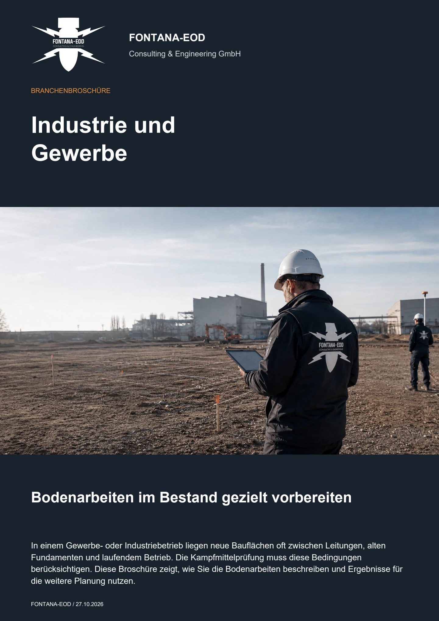
Before earthworks, drilling, foundations, utility installation and demolition, the investigations required for the project are established. The determining factors are the suspected contamination, intervention depth, existing utilities, construction phase and the evidence required by the client.
Useful documents include a site plan, land parcels, construction-area boundaries, planned intervention depths, borehole positions, utility plans, construction schedules, existing expert reports, aerial-photo analyses, contaminated-land records and known requirements. These details help establish which areas and depths need investigation and which documents are still missing. Information and requirements from authorities are supplied with their date, complete appendices and geographical scope.
Depending on the project, historical aerial-photo analysis, GPR, magnetometry, TDEM, deep-ground surveys, borehole surveys, area clearance, excavation monitoring or ordnance recovery may be relevant. The choice depends on the surface, interfering objects, ground conditions, investigation depth and access. Plant areas that cannot be interpreted sufficiently because of metal installations or other interference remain documented as unresolved; any further investigation required is established separately.
For operating sites, investigation areas, exclusion zones, access routes, shift windows, utility corridors and operational safety requirements are incorporated into planning. The aim is a sequence that integrates ordnance assessment properly into construction and operational processes.
In Germany, the ordnance disposal services of the federal states and the locally competent authorities carry out hazard-response and find-management duties. Their specific involvement is established for the project location; outside Germany, local responsibilities apply. The local public-order authority and, where relevant, the building-control authority are involved in their project-specific roles. As a private specialist company, FONTANA-EOD supports the agreed project assessment, surveys, documentation and communication between the parties.
Typical documents include analyses, location references, measurement records, survey or clearance reports, findings assessments, photographic records and recommendations for the next project step. The specific form of evidence depends on the scope of services, project phase and the parties concerned.
The determining factors are area, access, surfacing, interfering objects, ground conditions, intervention depth, construction phase, available documents, required methods and documentation scope. A reliable estimate can only be made after reviewing the project data.
If an unexpected suspicious object is found, stop work. Do not touch, move or uncover it further. Leave the immediate area and warn others without putting yourself at risk. In Germany, notify the police on 110; outside Germany, use the local emergency reporting procedure. The competent authorities determine what happens next; a project enquiry does not replace reporting the find.
Send the available site plans, intended intervention depths and details of the next construction sections. Include known suspicion indicators and operational access requirements.
Address, land parcels, site plan, construction-area boundaries, sub-areas, existing buildings, plant roads and access routes.
Excavation, drilling, foundations, utility trenches, demolition, expansion, planned target depth and construction phase.
Utility plans, utility corridors, old plans, earlier expert reports, aerial-photo analysis, geotechnical data and known requirements.
Work windows, access, HSE requirements, contractor coordination, traffic routes, exclusion areas and contacts.
Tendering, project file, site management, operator communication, HSE documents or a decision before the next intervention.
Preliminary design, procurement, construction preparation, excavation in progress, drilling date or short-notice coordination needs.
Send the available documents as completely as possible. Incomplete data can also be assessed if the project location, area, planned intervention and desired next step are identifiable. FONTANA-EOD checks which investigations are needed, which methods are suitable and which information is still missing.
+49 (0) 6843 - 999 499 7
info@fontana-eod.de
Location, area, depth, construction phase
Plans, requirements, existing-asset data
Whether historical aerial photograph analysis, explosive ordnance surveying, surface surveying using GPR, magnetometry or TDEM, deep-ground surveys, downhole surveys, excavation supervision, area clearance or ordnance recovery is needed depends on the location, ground disturbance, depth, ground and existing documents. An early ordnance assessment provides clarity for tendering, programming, occupational safety and construction.
FONTANA-EOD combines its Section 7 SprengG licence, specialists holding Section 20 SprengG certificates of competence, suitable survey and clearance methods, and traceable documentation. Send the site plan, depth of ground disturbance, construction phase and existing documents for an initial technical assessment.


