Project pathway
The quickest route to the right decision.
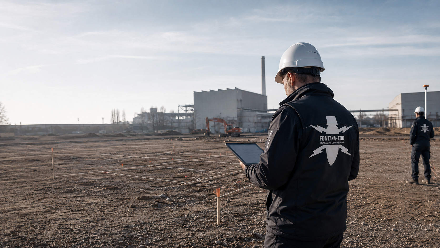
Before road construction, utility works or handover of individual plots, we establish which parts of the commercial area have already been investigated. FONTANA-EOD compares existing explosive ordnance documents with the planned areas, routes and intervention depths and plans the necessary surveys and documentation. Send site and plot subdivision drawings with depths, construction sections and existing authority conditions so that investigation requirements can be specified before procurement or earthworks.
Investigate roads, chambers and utilities.
Document investigation status for each subarea.
Agree specialist supervision and documentation.
When developing a commercial area, existing indications of suspected ordnance are used to establish which explosive ordnance investigations are needed for roads, utility routes, retention systems and subsequent building plots. Each subarea is considered by location, depth and proposed construction method. Earlier results are adopted only insofar as they actually cover the planned ground interventions. Documentation assigns findings, survey limitations and outstanding tasks to the relevant construction sections.
The scope of services for “Development of a commercial area in Bergisch Gladbach, North Rhine-Westphalia” included ordnance surveys.
Service period: –
Service areas:Surface surveys: GPR, TDEM and magnetometry
Investigation areas and results are organised by subareas, routes, intervention depths and the documentation required.
An area of suspected ordnance is a zone where historical land use, aerial photograph findings, historical documents or the circumstances of a find indicate a need for specialist investigation.
Clarify the term in the project contextThe subarea reference ensures that development routes, plots and subsequent building areas are not conflated in an unclear overall conclusion.
Clarify the term in the project contextInvestigation depth depends on the utility trench, chamber, stormwater retention system, drilling point, foundation or excavation and must be specified before construction.
Clarify the term in the project contextSurface, accessibility, fill, existing utilities, interference sources and ground structure affect which method is technically appropriate.
Clarify the term in the project contextBefore work starts, it is specified how work is stopped and anomalies reported. If a suspicious object is encountered, the immediate emergency notification procedure applies.
Clarify the term in the project contextDocumentation for procurement describes the investigation area, method, limitations and result so that the service scope and construction sequence remain traceable.
Clarify the term in the project contextFor commercial areas, the key question is which previous use is documented or can plausibly be investigated for the specific plot, route or development area.
Documents on former businesses, storage areas and technical installations are checked for indications relevant to the new project.
Roads, rail connections, loading areas and shunting areas are relevant to assessment where they coincide with the current site.
Commercial areas often grow section by section. Earlier utility or road works may change ground structure and the documentation available.
Embankments, relocated soil and imported material affect both suspected ordnance conditions and technical survey feasibility.
Contaminated-land or ground investigation documents can provide useful information on layers, fill, interference sources and earlier ground interventions.
Historical indications are assigned to the affected plots or routes. Outstanding questions are recorded for later construction phases.
Aerial photographs are compared with the current site plan, site boundaries and depth planning, rather than interpreted in isolation.
If sources are missing or unclear, the uncertainty is carried into further planning as a specialist investigation item.
Where site development, utility works and later building projects take place at different times, investigations and results are assigned to the relevant sections.

Roads, utilities, chambers and stormwater installations often entail linear ground interventions with different depths and construction sections.
Select methods for site-development volumes
With several commercial plots, it must be clear which subareas have already been investigated, which remain unresolved and how documentation is maintained for each construction section.
Prepare documentation for each subarea
Previous commercial, industrial or transport use may substantiate areas of suspected ordnance that should be assessed by specialists before site development.
Have the land-use history assessedWhen excavation starts, site management needs clear responsibilities, reporting procedures and documentation for indications of suspected ordnance.
Agree responsibilities and documentation of findingsExtensions within existing sites bring new construction sections into contact with old utilities, fill, foundations and restricted survey areas.
Obtain specialist assessment of the existing areaSurvey anomalies assessed by specialists receive targeted further investigation or exposure. If an unexpected suspicious object is encountered, stop work immediately, do not touch, move or expose the object further, leave the immediate area and keep others away without putting yourself at risk. In Germany, notify the police immediately on 110; outside Germany, use the local emergency contact procedure. Further handling follows the responsible authorities' decisions.
Document findings and follow-up measuresIn commercial areas, explosive ordnance investigation depends on the federal state, municipality, land parcel, suspected ordnance, route alignment and construction section.

Municipalities, site-development bodies and developers need clear location references for subareas, routes and subsequent building plots.
Check the project region
Authority conditions, historical documents, aerial photograph assessments, ground investigation data and utility drawings are compared with the actual commercial area.
Have documents assessed by specialistsRegional coordination should consider whether site development, plot subdivision and building construction take place at different times.
Document construction sectionsFor projects connected with Luxembourg or involving cross-border project communication, document requirements, responsibilities and reporting procedures are agreed with the parties at the project location.
Establish the operating areaInvestigation planning identifies the affected areas, depths and results required for each construction section.
Site plans, historical documents, aerial photographs and known authority conditions available early help delineate areas of suspected ordnance. They can indicate which project components should be prioritised for investigation before tendering, ground investigation or site development.
Have suspected ordnance assessed by specialistsThe depth and width of utility routes follow the specific design. Explosive ordnance investigation must address the alignment, width, depth, crossings, existing utilities and planned construction method, rather than only the commercial area's total surface.
Determine suitable investigation for sewer and utility worksTemporary roads, access roads, turning areas and parking areas may create extensive excavation and compaction zones. The deciding factor is whether areas can be surveyed in advance or investigation must proceed section by section with construction. Necessary investigations and protective measures are planned before ground disturbance during breaking out, demolition, utility exposure or creation of access routes and working areas.
Coordinate method selection with traffic areasWhen individual properties are later handed over to occupiers, documentation should clearly show which subareas were considered, which depths were investigated and which follow-up questions may remain for later building projects.
Agree documentation for each plotExisting commercial areas often contain earlier construction stages, infill developments, utility alterations and technical installations. Alteration projects must therefore link the current design with previous uses, available documents and local survey feasibility.
Obtain specialist assessment of the sector contextBefore work starts, work stoppage, reporting procedures and notification of site management are agreed. If a suspicious object is encountered, internal notification must not delay the emergency call.
Establish communication of findings before work startsInvestigations and results are assigned to the relevant development routes, plots and subsequent construction projects.
Sewers, roads, stormwater retention, utility lines and supply routes often start before later occupiers' building projects. Explosive ordnance investigation should therefore distinguish early between the overall site, development routes, traffic areas and individual plots. This produces documentation reflecting the actual construction sequence.
Distinguish site-development investigation tasksA commercial area may contain different land-use histories, fill, interference sources and intervention depths within the same overall site. For later property handovers, it is important to know which subarea was investigated, which method was used and which limitations apply to later occupiers or building designs.
Prepare plot-specific documentationWindow sampling, drilling and foundation investigations disturb the ground at an early stage. If suspected ordnance or authority conditions apply, these points should receive an explosive ordnance assessment before work starts. Comparing borehole schedules, target depths and site plans is a central part of this.
Agree deep investigation before ground investigationsInvestigation areas, depths, accessibility and required documentation are described in the tender. Outstanding information and services whose scope becomes clear only after investigation are explicitly identified.
Prepare procurement documentsResults from initial investigations are documented with clear area and depth information for later site development, plot handover, changes of occupier and building projects.
Site development, utility works, road construction, retention, plot handover and new industrial buildings often take place at different times. Documentation should therefore show which step was considered and which later interventions need separate assessment.
Document development stagesLater occupiers of a commercial area often plan their own buildings, access routes, foundations, utility connections or extensions. Existing explosive ordnance documents are compared with the areas and depths of these new projects.
Prepare occupier requirementsIn commercial developments, the municipality, site-development body, developer, contractor and later occupiers may have different documentation needs. For each construction section, it is recorded who provides background information, who commissions the work and who receives the results.
Assess roles with specialist inputWhen routes, plot boundaries or construction dates change, it is checked whether the previous investigation scope still matches the project. This requires clear drawings, traceable reasons for method selection and proper updating of results.
Update drawings and investigation results traceablyFor commercial areas, the specialist focus is on subareas, routes, plots, construction sections and the documentation needed before procurement or excavation.
Before road, utility and chamber construction, it is established which explosive ordnance investigations are needed for the affected areas and depths.
Have site development assessed by specialistsDevelopers and municipalities need traceable conclusions about investigated areas, unresolved areas and documentation status.
Prepare documentation for plotsExtensions encounter old utilities, foundations, fill and operational areas. Survey feasibility must be assessed for the specific project.
Have the existing area assessedGround investigations and piled foundations need a depth-specific explosive ordnance assessment where suspected ordnance and the intervention indicate this.
Agree drilling points and target depthBefore excavation, responsibilities, investigation areas, procedures for suspected ordnance and documentation for site management should be established.
Agree investigation areas and documentation with site managementClear service boundaries reduce ambiguity in tendering, variations and construction sequences.
Prepare service boundariesCommercial areas are often planned in phases. Explosive ordnance investigation must therefore distinguish routes, plots, site-development works, building areas and later documentation requirements.
Roads, chambers and utilities are often the first ground interventions. Investigation should record these routes early, with their depth and construction section.
Select methods for early site-development interventionsIndividual properties may be at different design stages. Documentation and location references must be unambiguous for each subarea.
Have subareas investigated systematicallyIndications from former commercial, industrial, railway or storage areas are assessed for their significance to the planned plot and ground intervention.
Assess the land-use historyFill, imported material, utilities and scrap metal can affect measurements. Methods must take account of these conditions.
Have survey conditions assessedWhen earthworks start, site management needs clear investigation areas, procedures for findings and documentation prepared by specialists.
Prepare findings procedures and handover of resultsTraceable service boundaries, reports and site plans are important for public and private clients.
Prepare tender documents with specialist inputInvestigation planning distinguishes site-development routes, plots and the working volumes of later construction projects.
Utility trenches, road cross-sections, chambers and stormwater installations must be described by width, depth and construction section.
Plots, traffic areas, green areas and technical infrastructure should not be combined indiscriminately where different ground interventions are planned.
Vegetation, paving, storage areas, fences, utilities and terrain profiles affect which survey or supervision methods are realistic.
Fill, imported material, moisture, cohesive layers or aggregate bodies may change the technical conclusions and method selection.
Phased site development requires documentation distinguishing investigated and unresolved areas for later construction phases.
For purchasers, site management or civil engineering contractors, location references, investigation depths, limitations and results must be documented clearly.
Commercial areas need documentation that not only describes the current commission but also provides traceable support for later subareas, occupiers and construction phases.
For commercial areas, documentation should identify which development sections, traffic areas, utility trenches, plots or ground-investigation areas were investigated. Results apply to the areas and depths described. For other sections, it is assessed separately whether existing knowledge suffices.
A reliable tender needs clear information on area, depth, methods, accessibility, interference sources, construction periods and documentation objectives. Preparing these points with specialist input allows items for surveying, borehole investigation, excavation supervision or communication of findings to be described much more precisely.
In business parks, subareas often later change occupier or client. Documentation should therefore show clearly which areas were investigated, which limits apply to the conclusions and which information must be reconsidered for later building, utility or extension works.
Ground investigations provide important information but themselves disturb the ground. For borehole points, probes and sampling, existing indications of suspected ordnance and requirements are used to establish whether an explosive ordnance investigation is needed before intervention.
Electricity, water, wastewater, fibre-optic, heating and gas lines may require different trench profiles and excavations. For explosive ordnance investigation, the actual intervention matters: alignment, width, depth, crossings, launch and reception points and whether the route is accessible and surveyable in advance.
For areas with limited preliminary investigation, the technical suitability of explosive ordnance detection during construction is assessed. Each working layer is surveyed and evaluated using technical methods before controlled removal in layers with supplementary visual inspection. These steps are repeated down to the agreed excavation base. Working areas, excavation layers, stop signals, authority to issue instructions, findings procedures and documentation are agreed with site management and the equipment operator before work starts.
The finding location, work stoppage, notification and further instructions are documented. Do not approach a suspicious object to obtain this information; the emergency call takes priority. These records are important for site management, the client, responsible authorities and later project decisions because they record the course of the measure and agreed next steps.
A commercial development often evolves over an extended period. Results should therefore be structured for reuse with new plots, variations, additional utilities or later building construction. The project file records the drawing revision investigated and later changes.
For commercial areas, documentation must clearly distinguish subareas, routes, construction sections and later follow-up decisions.
The address, land parcels, site plan, site area, routes, construction section, planned depth and project objective form the basis for specialist assessment.
Aerial photographs, archival data, historical drawings, land-use history, earlier buildings and known indications of suspected ordnance are brought into a spatial reference.
Areas, grids, borehole points, depths, accessibility, interference sources and survey limitations must be described so that data evaluators and site management can follow them.
Survey results, anomalies, findings locations, clearance or supervision measures and photographic documentation are assigned to the project stage.
The evaluation describes which areas were considered for the next step, where limitations apply and which specialist measure follows.
Reports, drawings and logs must be clearly structured for clients, site management, operators, designers and the relevant interfaces. After actual exposure or clearance work, the corresponding findings and clearance records are included.
For commercial areas, documentation must show which sections have been investigated, which depths apply and which documents can be handed over to site management or purchasers.
Location references for individual properties, site-development routes, stormwater retention and building areas.
Representation of investigated utility trenches, chambers, road profiles, borehole points and target depths.
Assessment of surface, accessibility, interference sources, ground structure and possible survey limitations.
Traceable assignment of indications of suspected ordnance, survey points, supervision measures and subsequent decisions.
Structured information for the schedule of services, site management, project file and later construction sections.
The sequence follows the question of which areas, routes and depths require specialist assessment before site development or building construction.
Plots, access roads, utility alignments, excavations and planned depths are brought together in a verifiable location reference.
Aerial photographs, historical drawings, previous land uses, existing expert reports and authority conditions are compared with the current design. Where historical evidence is missing, the required sources are researched and aerial photographs assessed for the affected plots or routes. The resulting indications are assigned spatially to the present design and considered when defining investigation boundaries.
Surveying, borehole investigation, excavation supervision or further assessment are prioritised according to accessibility, depth and construction sequence.
Investigation is tailored to site-development works, routes, plots or individual ground interventions so that the construction sequence remains traceable. The selected investigation is actually carried out within the agreed sections. Survey data acquired are assigned to the investigated areas and agreed depth reference. Omitted subareas and relevant interference are also recorded.
Survey data, indications of suspected ordnance, interference zones and assessed investigation depths are documented for use by site management and the client. The recorded data and findings are evaluated by specialists against the investigation objective and identifiable interference. Outstanding questions and necessary further investigations are identified before results are handed over.
Results are translated into a recommendation for further investigation, excavation supervision, recovery or documentation.
In commercial areas, linear site-development works, plots and later building areas are planned and documented separately according to their different intervention depths.
Before tendering, existing indications of suspected ordnance are compared with planned roads, utilities and construction areas.
Technical assessment begins with the planned land use. An access road, utility trench, stormwater retention basin, building or later piled foundation creates different investigation zones. FONTANA-EOD records the investigations required for sites, routes and plots in the investigation plan. Surface condition, ground structure, interference sources and planned depths are considered. The plan shows where further historical evidence is needed and which technical methods are suitable for the proposed areas and depths.
Development alignments are described by route, width, depth and connection areas.
Individual commercial properties are documented so that later clients and designers can follow investigation status.
Paving, fill, imported material and existing utilities affect method selection.
Service boundaries, investigation areas and findings procedures are formulated for use in construction planning and tendering.
Documents on suspected ordnance and earlier results are linked to road alignments, utility trenches, retention systems and building plots. Location, depth and construction method are stated for each subarea. This shows the investigation required for the current development phase.
Compare existing documentation by subarea and ground intervention
Investigation for a site-development trench does not automatically cover deep chambers or later building foundations. Compare these working volumes with the documented areas and depths. Supplementary methods are selected according to ground conditions, technical installations and accessibility.
Assess depth-related investigationSite development, plot subdivision, ground investigations and later building works affect different areas and depths. Investigation follows these working volumes and the results needed for procurement and site management.
Roads, sewers, property connections, stormwater retention and utility lines often disturb the ground before building construction. Explosive ordnance investigation must consider these early interventions separately so that later plot decisions are not based on an overly general area assessment.
Determine investigation requirements for site developmentCommercial areas are often developed in phases. Suspected ordnance, survey feasibility and documentation should therefore be organised by construction sections, plots, traffic areas and utility routes so that documentation later matches actual use and procurement.
Document subareasGround investigations, window sampling, piles and foundations may extend deeper than later area-based works. Borehole locations and target depths are compared with existing indications of suspected ordnance before ground interventions begin.
Agree borehole positionsExisting commercial sites often contain utilities, chambers, foundations, steel remnants, fill and paved surfaces. These conditions affect method selection and must be compared in advance with site plans and local accessibility.
Have interference assessed by specialistsFor areas that cannot be adequately investigated in advance, the technical suitability of explosive ordnance detection during construction is assessed. Technical surveying and evaluation of each working layer are followed by controlled removal in layers and supplementary visual inspection. The steps are repeated down to the agreed excavation base. Working areas, hold points, authority to issue instructions, reporting procedures and documentation are established before work starts.
Prepare ordnance specialist supervision of excavationTender documents must identify which areas are to be investigated, which depths are relevant, which methods may be used and what limitations apply. Overly broad service specifications frequently lead to queries during construction.
Prepare service boundariesIn commercial areas, site-development routes, plots and building areas differ considerably. Methods must distinguish these sections while documenting them as an overall project.
Useful for spatial assessment of areas of suspected ordnance, previous use, traces of attacks, storage areas and remodelling before technical surveying.
Suitable for accessible areas where surface, interference sources and ground structure indicate sufficient survey quality.
Magnetometry detects ferromagnetic anomalies in accessible areas. Utilities, rails, reinforcement, foundation remnants, scrap metal and vehicles can obscure survey data in commercial areas. Interpretable areas and survey limitations are documented separately.
TDEM records time-dependent electromagnetic responses from conductive objects. The target object, ground conductivity, required depth and technical infrastructure determine suitability for each subarea.
GPR records reflections at material and structural boundaries and can provide supplementary investigation of utilities or installations. Soil, moisture, surface coupling and reinforcement affect data depth. A reflection does not uniquely identify ordnance.
A relevant component for piles, excavations, shoring, deep utilities and ground interventions extending beyond near-surface conclusions.
Where explosive ordnance detection during construction is technically suitable, each working layer is surveyed and evaluated using technical methods. Controlled removal in layers and supplementary visual inspection then follow; these steps are repeated down to the agreed excavation base. Excavation layers, hold points, authority to issue instructions, reporting procedures and documentation are established before work starts.
Survey anomalies receive specialist further investigation or exposure. Recovery of confirmed explosive ordnance is coordinated with the permitted scope of activities and local responsibilities. If an unexpected suspicious object is encountered, work stoppage, distance and immediate notification apply.
The earlier routes, plots and depths are organised with specialist input, the better tendering and construction can be prepared.
Roads, utilities, chambers and stormwater installations should be included in the investigation with their alignment and depth.
Select appropriate specialist services for development routesWhere properties are developed in succession, each subarea needs a traceable location reference.
Agree documentation for each plotThe land-use history should be assessed by specialists before tendering and civil engineering works.
Assess the suspicion indicatorsWhere preliminary investigation is limited, suitable supplementary methods are assessed, including explosive ordnance detection during construction.
Plan excavation supervision into the construction sequenceSite management, the client and responsible interfaces need clear procedures for indications of suspected ordnance.
Agree findings procedures and responsibilities togetherAn enquiry should include the area, construction section, routes, depths, documents and decision required.
Have a commercial site assessed by specialistsFor commercial areas, the focus is on traceable assignment of subareas, routes, depths and construction sections.
FONTANA-EOD assesses development drawings, plans suitable surveys and documents the areas and depths actually investigated. Missing information on area, depth and interference sources is identified before construction. Local coordination procedures are established. For later construction phases, existing findings and areas or depths still requiring investigation are recorded.
Not every area needs the same method. The service scope is derived from suspected ordnance, ground intervention, surface, depth and documentation objective.
Interference sources, reinforcement, paving, utilities and ground structure are not disregarded but included in the assessment.
The client, operator, designers, site management, HSE and responsible authorities receive clearly distinguishable roles and communication procedures.
Assessment, surveying and excavation supervision are planned to fit construction sections, closure windows and procurement.
Reports and drawings are tailored for use in the project file, site management, operator communication and documentation procedures.
If an unexpected suspicious object is encountered, stop work immediately, do not touch, move or expose the object further, leave the immediate area and keep others away without putting yourself at risk. In Germany, notify the police immediately on 110; outside Germany, use the local emergency contact procedure.
The client, designers, site management and specialist company agree their tasks before work starts. Authority reporting and decision-making procedures depend on the project location.
FONTANA-EOD assesses documents, carries out commissioned surveying and supervision services, evaluates results by specialist assessment and prepares project-specific documentation.
The client provides project information, defines the construction objective, area, time window and documentation needs, and coordinates project decisions.
Designers and site management need clear investigation areas, service boundaries, findings procedures and documentation status for tendering and construction.
Contractors need organised working areas, stop procedures for indications of suspected ordnance and a clear interface with specialist supervision.
In Germany, the ordnance disposal services of the federal states and the locally competent authorities carry out hazard-response and find-management duties. Their involvement is established for the project location; outside Germany, local responsibilities apply.
The local public order authority and, where applicable, building authority are involved according to their project-specific tasks. Conditions, contacts and reporting procedures are assigned to the affected development sections and plots.
For industrial and commercial areas, operational safety requirements, exclusion zones, access and internal communication procedures are incorporated into project coordination.
The regulatory framework is considered for the specific project: qualifications, occupational safety, technical guidance, reporting procedures and documentation must match the actual ground intervention.
In Germany, § 7 SprengG concerns the commercial authorisation for activities requiring authorisation; § 20 SprengG concerns the certificate of competence of responsible persons. Under § 1b SprengG, searching for found munitions also counts as handling them. The requirements applicable to the project depend on the activity actually commissioned and the allocation of responsibilities.
The First Ordinance to the Explosives Act (1. SprengV) includes, among other things, requirements for specialist knowledge and state-recognised training courses. When developing commercial areas, the required qualifications are assigned to the specific investigation or clearance commission.
DGUV Information 201-027 concerns protective measures during ordnance clearance work. DGUV Rule 113-003 concerns the dismantling or destruction of explosives or corresponding objects and also includes the disposal of found munitions. It applies according to this field of activity; it does not replace a risk assessment specific to the planned ground intervention.
Activities involving explosive substances are subject to requirements concerning authorisation, competence and responsibility. Clients should establish qualifications and responsibilities in advance.
Risk assessment, site organisation, barriers, instructions, machinery use and conduct when suspected ordnance is encountered form part of project planning.
DGUV Information 201-027 supports risk assessment and protective measures for explosive ordnance clearance work. The Baufachlichen Richtlinien Kampfmittelräumung contain requirements for historical and technical investigation, clearance concepts, procurement and documentation within their defined federal remit. Their application to the specific site-development project is established separately.
If an unexpected suspicious object is encountered, stop work immediately in the affected area. Do not touch, move or expose the object further. Leave the danger area and keep others away without putting yourself at risk. In Germany, notify the police immediately on 110; outside Germany, use the local emergency contact procedure. The responsible authorities determine further action. Then inform the client and site management; internal notification must not delay the emergency call.
A single finding or measurement does not replace project-specific assessment of area, depth, method and limits of conclusions.
Documents should describe precisely which areas, depths, methods and results were considered.
Responsible authorities and official procedures may be involved differently depending on location and project circumstances.
For site development and later construction projects, existing documents are assessed, suitable investigations planned and their results documented.
Starting point for project-specific explosive ordnance investigation with site, operational and documentation references.
Have the project area assessedAerial photograph and document assessment helps delineate areas of suspected ordnance before technical work.
Assess historical documentsFor foundations, chambers and service ducts, it is assessed which methods can cover the required depth volume.
Establish depth and borehole positions
Where explosive ordnance detection during construction is suitable, excavation layers are investigated using technical methods and documented before removal.
Agree excavation supervision

Historical documents, survey methods and depth-specific investigations are coordinated for each development section. Other construction tasks can be found in the sector overview.
Sector page for commercial project areas, existing sites, operational interfaces and typical investigation decisions.
Assess the sector contextPreliminary assessment of land-use history, areas of suspected ordnance, historical documents and spatial indications of suspected ordnance.
Have suspected ordnance conditions assessedInvestigation of borehole points, utility trenches, chambers, piles and deeper ground interventions.
Agree borehole positionsEstablish the suitability and sequence of construction-phase ordnance surveying for remaining excavation areas.
Plan excavation monitoringPrepare documentation for procurement, site management, the project file and later construction sections.
Prepare evidence for procurementProvide design documents, routes, subareas, depths and the requested documentation objective.
Have a commercial site investigatedTechnical information
Work on industrial and commercial sites combines existing installations, operational processes and new ground interventions. The brochure explains how ordnance assessment is coordinated with these conditions.
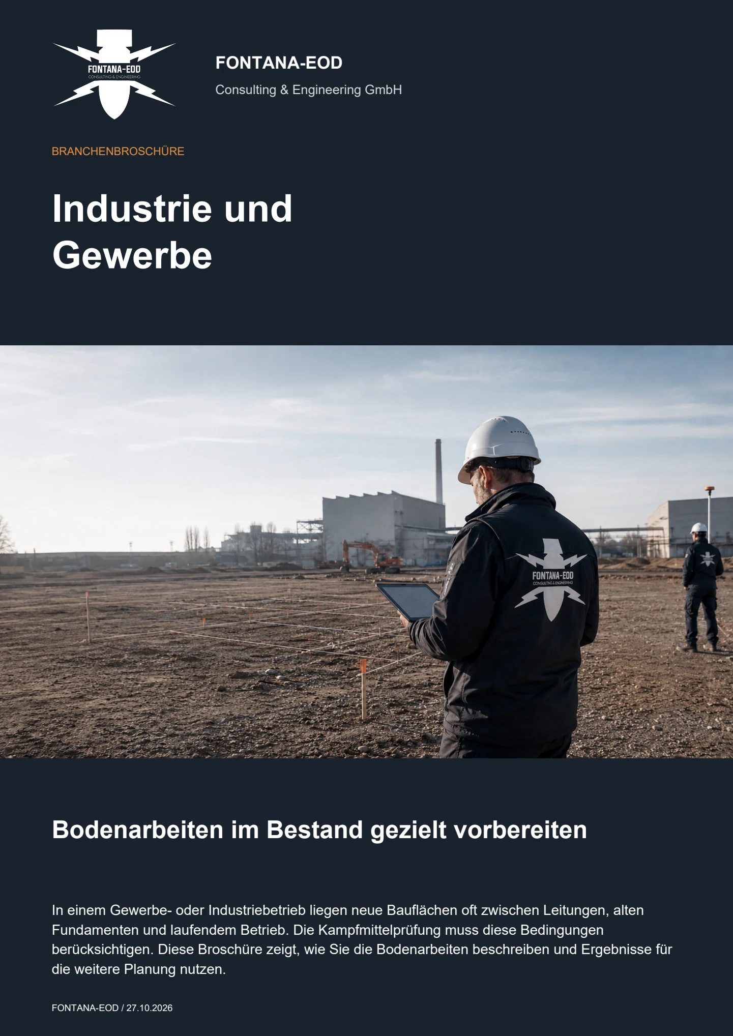
Before site development, drilling and construction, existing indications of suspected ordnance, documents and local requirements are used to establish which explosive ordnance investigations are needed for the planned areas and depths.
Typical areas include access roads, utility trenches, chambers, stormwater retention systems, commercial plots, logistics areas, foundation zones, demolition areas and edge zones with previous uses. Each may require different investigation depths and methods.
Helpful documents include an overview drawing, plot subdivision plan, site boundaries, route alignments, borehole points, planned depths, construction dates, existing utilities, available expert reports, aerial photograph assessments, historical documents and the documentation format required for procurement or site management. Information and conditions issued by authorities are included with their dates, complete attachments and geographical scope.
Depending on the area and ground intervention, historical aerial photograph assessment, surface surveys, ground-penetrating radar, magnetometry, TDEM, deep-ground surveys, borehole surveys, area clearance or ordnance specialist supervision of excavation may be used. Selection depends on accessibility, interference sources, ground structure and investigation depth. Survey limitations are identified for the subareas and depths investigated; results for a site-development route do not automatically cover later foundations.
Investigations are assigned to construction sections, routes or plots. Documentation shows the relevant investigation status. For later ground interventions, it is checked whether existing results suffice or further investigation is needed.
Municipalities, developers and designers provide project information and documentation objectives; contractors need clear investigation areas, working windows and procedures for findings. Responsible authorities remain involved through their respective reporting and decision-making procedures.
Investigation areas and depths specified early help describe the service scope for quotations and tendering. Outstanding information and possible further investigations are identified separately. Effort and cost depend on area, depth, methods, accessibility and the documents available.
Stop work immediately in the affected area. Do not touch, move or expose the object further. Leave the immediate area and keep others away without putting yourself at risk. In Germany, notify the police immediately on 110; outside Germany, use the local emergency contact procedure. The responsible authorities determine further action. Inform the client and site management; internal notification must not delay the emergency call.
Handover includes the areas and depths investigated, results and remaining limitations. For later civil engineering works, it must be clear which questions remain unresolved.
Documentation must show which sites, road alignments, utility zones, stormwater retention areas or extension zones formed part of the investigation. When individual properties are marketed, documents are assigned to the relevant plots and passed to those involved.
Agree documentation for the project fileA commercial area contains different intervention depths: shallow formation levels, utility trenches, chambers, foundations, borehole points, ground investigations and possible demolition zones. Explosive ordnance investigation should consider these interventions separately so that conclusions from one investigated subarea are not extended too far to other works.
Select methods for different ground interventionsInitial site development is often followed by building construction, external works, utility connections, charging infrastructure or later extensions. Reliable documentation therefore not only assesses the current construction section but also records which documents can be consulted again for later changes of use, property sales or planning applications.
Have documents for the commercial development assessedFor commercial areas, location, plots, routes, construction sections, planned depths and the documentation required for procurement or site management are central.
Overview drawing, plots, routes, development sections and site boundaries.
Utility trenches, chambers, road construction, stormwater retention, borehole points and building areas.
Aerial photograph assessments, historical documents, ground investigation data, existing utilities and authority conditions.
Procurement, site management, plot handover, start of excavation or subsequent technical decision.
Send the available documents as completely as possible. Incomplete data can also be assessed if the project location, area, planned intervention and desired next step are identifiable. FONTANA-EOD checks which investigations are needed, which methods are suitable and which information is still missing.
+49 (0) 6843 - 999 499 7
info@fontana-eod.de
Site plan, depth, construction phase, suspicion indicators
Site management, designers, HSE or project management
Whether historical aerial photograph analysis, explosive ordnance surveying, surface surveying using GPR, magnetometry or TDEM, deep-ground surveys, downhole surveys, excavation supervision, area clearance or ordnance recovery is needed depends on the location, ground disturbance, depth, ground and existing documents. An early ordnance assessment provides clarity for tendering, programming, occupational safety and construction.
FONTANA-EOD combines its Section 7 SprengG licence, specialists holding Section 20 SprengG certificates of competence, suitable survey and clearance methods, and traceable documentation. Send the site plan, depth of ground disturbance, construction phase and existing documents for an initial technical assessment.


