Project pathway
The quickest route to the right decision.
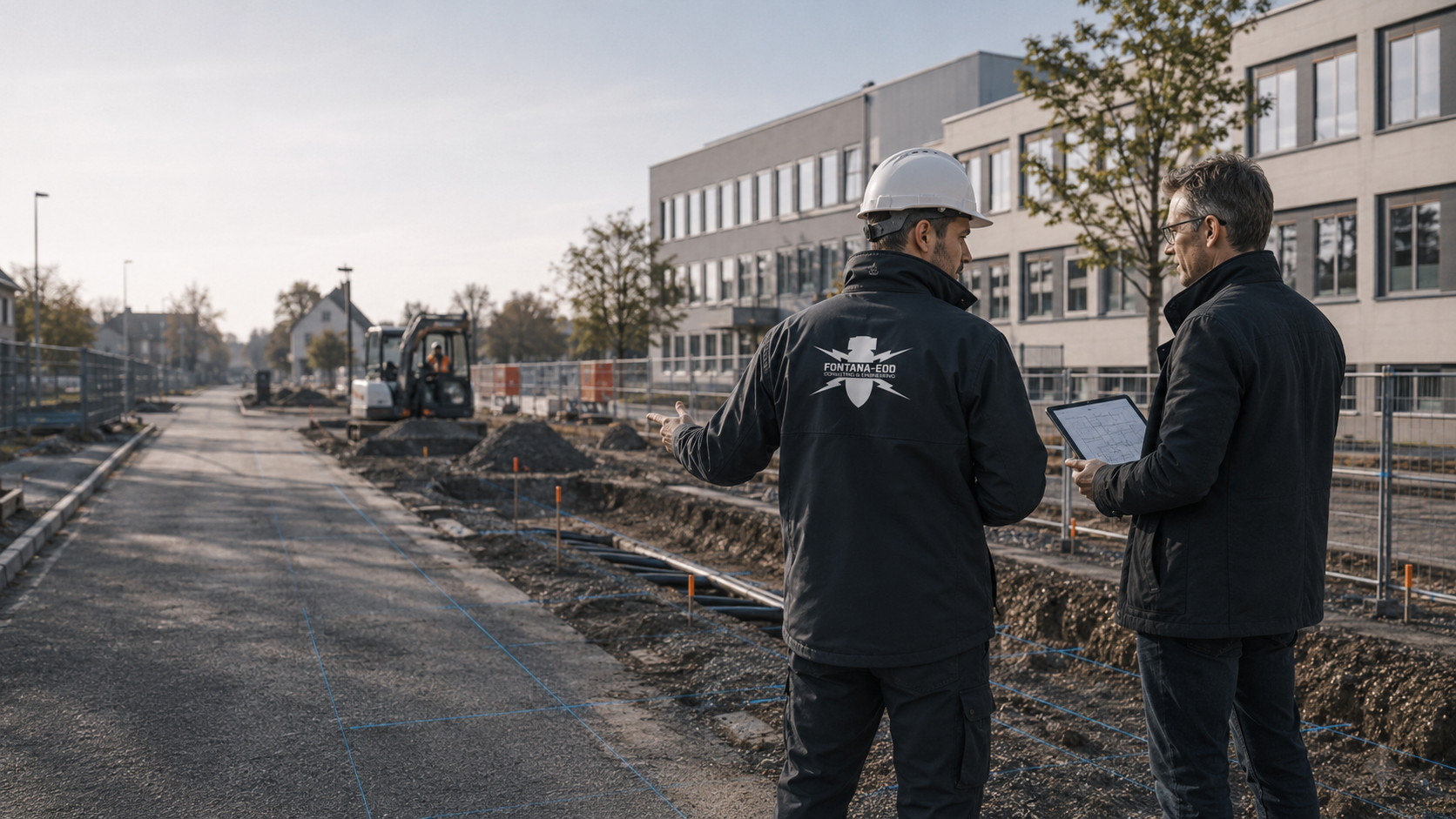
Construction on municipal land requires coordination of planned earthworks, continuing use and handover of investigation results. FONTANA-EOD assesses suspicion indicators, intervention depth, construction phase and evidence needs so that administration, designers, procurement and site management can proceed on a reliable basis. Send the site plan, planned interventions and depths, use and procurement status to agree the investigation scope with the technical department, designers and site management.
Define the scope of services clearly.
Coordinate use and exclusion areas.
Maintain a traceable project file.
Ordnance assessment for municipalities and public-sector clients becomes relevant when construction, civil engineering, renovation or development affects areas with unclear suspicion indicators. The decisive factor is not only the land parcel or project name but the specific activity: drilling, excavation, sewers, foundations, utility trenches, paths, construction pits, demolition or expansion. FONTANA-EOD compares these details with existing knowledge and identifies the investigations and evidence required for each intervention. Requirements are established before tendering, geotechnical investigation, civil-engineering procurement or earthworks so that investigation areas, methods, exclusion zones and phases can be planned.
The scope of services for “Schule am Engelshof, 51149 Köln” included ordnance specialist supervision of groundworks.
Service period: 2026-08
Service areas:Ordnance specialist supervision of groundworks
View project details · Ordnance specialist supervision of groundworks · Project location: Köln
The scope of services for “Bank and floodplain restoration – Rhine bank, Mainz-Laubenheim, Rhineland-Palatinate” included ordnance surveys in selected areas.
Service period: –
Service areas:Surface surveys: GPR, TDEM and magnetometry
The scope of services for “Stadtpark Leichlingen, 42799 Leichlingen” included ordnance specialist supervision of groundworks / specialist technical oversight.
Service period: 2022-12
Service areas:Ordnance specialist supervision of groundworks
View project details · Ordnance specialist supervision of groundworks
References from project practice
Municipal construction tasks range from site development and transport facilities to public buildings. The map shows locations of published reference projects.
Project information is loaded from the reference list.
Select a project location from the place selector or choose a point on the map.
The markers show official place centres. The associated references state the construction task, services performed and documented scope.
Map data: © GeoBasis-DE / BKG (2026), VG250 / GN250, dl-de/by-2-0; Luxembourg: ACT / data.public.lu, CC0. Geometries projected and simplified for display.
Municipal project areas differ considerably. Use, operations, public access, construction timing, accessibility and depth references determine the technical assessment.
Town halls, administration buildings, fire stations, municipal depots, schools and sports halls create their own excavations, utilities, foundation points and external works. The investigation area is tied to the actual interventions.
Assess the construction projectFor educational facilities, use, holiday windows, safety areas, external works and access matter alongside the construction area and depth. Investigation must fit municipal operating arrangements.
Arrange assessment of school groundsMunicipal roadworks, sewer renovation and square redesign follow a route and section approach. Utilities, chambers, crossings, paving and traffic arrangements influence methods and documentation.
Clarify the road sectionParks, playgrounds, sports facilities, cemetery extensions, banks and retention basins combine open areas with individual deep interventions and sensitive use. This requires precise boundaries.
Assess the open areaPublic-sector clients need a reliable service specification, clear responsibilities, evidence and traceable handovers. Technical investigation is prepared so that it remains usable in tendering and site management.
Prepare procurement documents
Measurement anomalies are assessed by specialists and assigned the necessary follow-up investigation. If an unexpected suspicious object becomes visible, work stops immediately. Do not touch, move or uncover it further; leave the immediate area and keep others away without putting yourself at risk. In Germany, notify the police immediately on 110; outside Germany, use the local emergency reporting procedure. The competent authorities determine what happens next.
Document communication of findings and follow-on decisionsMunicipal ordnance assessment is particularly effective when integrated before procurement, geotechnical work, civil engineering and closure to users.
Early design stages can be assessed if location, area, use, likely interventions and available documents are identifiable. This assessment supports the budget, schedule and tendering.
Arrange assessment of the project stageBills of quantities need clear service limits, investigation areas, documentation scope and interfaces. Unclear statements often cause queries and variations during construction.
Prepare procurement documentsSchools, childcare facilities, sports facilities, depots, squares and roads often remain partly in use. Investigation times, exclusion areas, access, traffic arrangements and communication must fit this situation.
Agree investigation times and handovers during ongoing useSewers, chambers, retention basins, foundation pits and utility works require different consideration from shallow paths or external works. Target depth is considered with suspicion indicators, ground and measurement conditions when selecting the technical method.
Clarify intervention depthOlder public sites often have incomplete records of utilities, fill, former uses or earlier construction phases. Structured document review can prepare the next technical step.
Organise the available documentsFindings procedures, work areas, contacts and documentation must be clear during construction. Technical preparation supports considered decisions when conditions change.
Clarify evidence for site managementDesigners, procurement and site management need a description of the areas and depths to investigate, existing results and outstanding tasks. Details are assigned to the relevant activities and responsible parties.
Schoolyard renovation, a road section, sewer renovation and a retention basin affect the subsurface differently. Ordnance assessment must consider these activities separately rather than treating municipal land uniformly.
Tendering must describe investigation areas, methods, depths, documentation, timing and responsibilities understandably. Bidders and site management can then identify the intended service more clearly.
For schools, childcare facilities, playgrounds, sports areas, market squares and roads, access, closure times, residents, user groups and traffic arrangements form part of project organisation. They influence when and how an investigation can be carried out.
Foundations, excavations, utility trenches, chambers, paths, paving and landscaping have different depths. Evidence should identify the construction activity to which its statement relates.
Municipal land has often changed over many years through alterations, utilities, fill, paths, sports surfaces, play equipment, trees or structures. These changes may affect survey feasibility and statement limits.
Building, civil-engineering, school, green-space, procurement, property and project-management departments need the same technical basis. A clear project file prevents information from being lost between separate responsibilities.
If an unexpected suspicious object is found, stop work in the affected area immediately. Do not touch, move or uncover the object further. Leave the immediate area and keep others away without putting yourself at risk. In Germany, notify the police immediately on 110; outside Germany, use the local emergency reporting procedure. The competent authorities determine what happens next. Inform site management and the client; internal reporting must not delay the emergency call.
Municipal areas are extended, repaired and reopened over the years. Clear location and section references support later utility work, renovation, expansion and maintenance.
Documentation must be technically reliable and usable in municipal procedures. It connects available documents, investigation area, method, result and next step.
Plans, aerial-photo analyses, earlier reports, geotechnical data, utility plans and known requirements are linked to the relevant project stage.
Buildings, schoolyards, roads, sewers, sports areas, parks, squares and watercourse works are distinguished by actual activity and planned intervention depth.
Method, access, surface, interfering objects, utilities, reinforcement, ground structure and restrictions are documented traceably.
Anomalies, suspected objects and restrictions are connected with position, depth, project context and possible follow-on decisions.
Results are worded so that they can be incorporated into the bill of quantities, site management, project file and handover to contractors.
For plan changes, variations, later sections or maintenance, it remains clear which areas have been considered and which need reassessment. After actual exposure or clearance work, the corresponding findings and clearance records are included.
A municipal evidence dossier must remain understandable for administration, designers, procurement, site management, operators and competent parties.
Progress is linked to the project phase, procurement status and plan revision. This makes clear whether a statement was prepared for preliminary design, tendering or construction.
Schools, childcare facilities, playgrounds, cemeteries, ambulance stations and market squares need specific sequence planning. The dossier records how use, exclusion areas and access were considered.
Sewers, chambers, supply lines, lighting, drainage and foundations are described with depth and location references. This prevents unclear transfer to other interventions.
For finds or anomalies, site management and the client must be able to identify who is informed, which area is affected and which follow-on decision is technically appropriate.
Municipal land remains a public responsibility for many years. Clear records support later renovation, repairs, expansion and changes of owner or operator.
Building, civil-engineering, procurement, school, green-space and property departments can use the same basis if the investigation area and result are described clearly.
The sequence connects document review, technical method selection, execution, documentation and handover to project parties.
Project location, use, construction objective, sections, depths, documents and municipal contacts are assembled. Schools, roads, sewers, parks, sports areas, squares, watercourse works and operating sites are linked to the actual activity.
Site plans, aerial-photo analyses, utility plans, geotechnical data, old records and known requirements are reviewed by specialists.
Areas, alignments, excavations, chambers, utilities, external works and later sections are described separately.
Historical analysis, surveys, deep investigation, excavation monitoring or clarification of findings are selected for the project.
Access, exclusion areas, operating times, traffic arrangements, occupational safety and contacts are agreed on site.
The commissioned investigation is performed in the defined area. Measurement data and findings receive position, depth and section references; restrictions are documented.
Measurement data and findings are assessed; method, location references, conditions, result, restrictions and follow-on decision are prepared for the project file and site management.
Evidence is incorporated into procurement, execution, committee procedures, maintenance or further coordination.
Municipal projects differ by use, intervention depth, operations and evidence requirements. Each type needs its own technical assignment of area, construction activity and documentation.
Town halls, schools, sports areas, squares, roads, sewers and flood protection need project-specific assessment of suspicion indicators, intervention depth and evidence requirements.
Assess the public construction projectHours of use, access, safety areas, external works and sections are connected with suspicion indicators and the construction sequence.
Arrange assessment of a school or childcare facilityPlaying fields, running tracks, impact-absorbing surfaces, foundation points, utilities and extensions create distinct investigation areas and evidence questions.
Assess the sports facilityRoad alignments, footways, lighting, utilities, crossings and construction sections are assessed by route.
Assess the roadworks sectionChambers, sewer reaches, excavations, liner access points and deep interventions need their own depth and sequence assessment.
Coordinate sewer renovationGreen spaces, paths, play areas, tree locations, utilities and landscaping interventions are distinguished by actual activity.
Arrange specialist assessment of green spaceOperating sites combine buildings, external areas, training areas, utilities and continuing operational readiness.
Arrange assessment of the operating siteService specifications, evidence, investigation areas, responsibilities and documentation requirements are prepared for tendering.
Prepare procurement documentsBanks, slopes, beds, paths, demolition, utilities and earthworks near water need their own area and depth references.
Assess watercourse worksExtensions, paths, utilities, burial areas and operating areas require sensitive planning of access, depths and sections.
Assess cemetery landPaving, utilities, street furniture, events, neighbours and restricted site logistics are included in assessment.
Assess the squareDykes, retention basins, earthworks, paths, structures and drainage need clear investigation areas and documented handovers.
Coordinate flood protection
Existing information, reports and historical knowledge are assigned to the actual intervention. If the basis is missing or cannot be assigned sufficiently, the additional analysis needed is established first. A municipal project name or long-standing use does not replace this specialist assessment.
Assess existing knowledge
Area-wide removal, individual borehole positions and deep pits are different tasks. Investigation is selected according to position, depth, ground and achievable conditions. New or changed components are checked against the existing status before results are reused.
Select methods for the actual investigation volumeMunicipal construction ranges from schools and roads to sewers, green spaces, squares and flood protection. Each area has its own use, access, depth, phase and documentation requirements.
The planned construction area, organisational exclusion area and area actually investigated are different details. Their relationship must be traceable on the plan. This is especially important for temporary arrangements, working spaces and later sections to identify which ground volumes have already been covered.
Planned excavation bottoms and deeper individual components receive an unambiguous height reference. Design changes identify additional areas and depths. The existing report is checked against these changes rather than reused solely because the project address is unchanged.
The approach connects municipal use, construction activity, procurement, responsibilities, technical methods and documentation.
FONTANA-EOD considers municipal projects according to actual use and activity. A school, sewer, market square and retention basin need different investigation areas, time windows and evidence. Assessment separates area, depth, method, operations and interfaces so public clients can agree the next steps with designers and site management.
Coordinate the municipal projectUse, intervention and phase are described separately rather than mixed together.
Service scope, documentation and interfaces become tangible for tendering and site management.
User groups, exclusion areas, traffic arrangements and access are included in planning.
Reports and plans remain usable for administration, contractors and later maintenance.
Municipal ordnance assessment involves administration, designers, procurement, site management, specialist companies, contractors and competent authorities.
The responsible body brings together the objective, area, budget or project requirements, procurement status and evidence needs. Clear construction areas, depths and time windows matter more for assessment than a completely finalised design.
Designers and project management turn design, geotechnics, utilities, phases and procurement into assessable subtasks. Reliable information is needed to fit surveys, excavation monitoring and documentation into the schedule and bill of quantities.
Contractors work with specific areas, equipment, depths and daily outputs. For safe construction, assessed areas, unresolved areas, findings procedures and handovers must be described unambiguously.
FONTANA-EOD assesses suspicion indicators, methods, investigation depth, interference, phase and evidence for the project. The commissioned service remains focused on technical investigation, supervision, assessment and documentation.
In Germany, state ordnance disposal services and locally competent authorities carry out hazard-response and find-management duties. Their involvement is established for the project location; outside Germany, local responsibilities apply. Private specialist services support clients and project parties in preparation, execution and traceable communication.
The local public-order authority and, where relevant, building control are involved in their project-specific roles. Requirements, contacts and reporting procedures are assigned to the municipal projects and sections concerned.
Occupational safety and site management need organised work areas, clear response procedures, protection of personnel and clear handovers. These matters are connected with technical evidence so the project retains a basis for action.
Before commissioning, investigation scope, responsibilities, safety and evidence are established for the municipal project. Designers, procurement and site management use the same area and depth references.
In Germany, § 7 SprengG concerns the commercial authorisation for activities requiring authorisation; § 20 SprengG concerns the certificate of competence of responsible persons. Under § 1b SprengG, searching for found munitions also counts as handling them. The requirements applicable to the project depend on the activity actually commissioned and the allocation of responsibilities.
The First Ordinance to the Explosives Act (1. SprengV) includes requirements for specialist knowledge and state-recognised training courses. For municipal projects, the qualification needed is related to the specific investigation or clearance commission and actual work areas.
DGUV Information 201-027 concerns protective measures during ordnance clearance work. DGUV Rule 113-003 concerns the dismantling or destruction of explosives or corresponding objects and also includes the disposal of found munitions. It applies according to this field of activity; it does not replace a risk assessment specific to the planned ground intervention.
Ordnance activities involve authorisation, competence and responsibility. Commissioned services must be assessed for technical suitability, competent interfaces considered and documents maintained traceably.
Earthworks, drilling, utility trenches and excavation require organised consideration of hazards, work areas and reporting procedures. Ordnance assessment is therefore coordinated with site management, HSE and contractors.
The Baufachliche Richtlinien Kampfmittelräumung contain requirements for historical and technical investigation, clearance planning, procurement and documentation within their defined federal remit. Their application to the municipal project is established separately. DGUV requirements and other project rules are considered according to activity, intervention and local responsibilities.
Project owners, designers, contractors, specialist companies and authorities have different tasks. A reliable project file keeps these roles distinct and connects technical results with the next construction step.
If an unexpected suspicious object is found, stop work in the immediate area at once. Do not touch, move or uncover the object further.
Leave the immediate area and keep others away without putting yourself at risk. In Germany, notify the police immediately on 110; outside Germany, use the local emergency reporting procedure. The competent authorities determine what happens next. Internal reports to site management and the client must not delay the emergency call. Already known details of position, depth and surroundings are communicated through the safe reporting channel.
Reports, location references, measurement data, photographs and findings assessments should allow clients, site management, procurement and competent parties to follow the same progress status.
Surface, utilities, interfering objects, reinforcement, ground, moisture, access and investigation depth affect technical conclusions. These conditions are documented so results are not transferred to other areas.
After an assessment, further document analysis, surveying, excavation monitoring, clarification of findings, recovery or coordination with authorities may be needed. The specific project situation is decisive.
Municipal projects often combine several departments, phases and use requirements. Technical assessment must reflect this structure.
Construction area, use, access and phase are described early so the investigation scope remains identifiable.
Assess the construction projectSite plans, aerial photographs, utility data, old documents and requirements are related to the actual activity.
Assign documents and results to the project
Borehole positions, chambers, sewers, foundations and excavation areas are connected with depth, access and method.
Clarify intervention depthResults, restrictions and follow-on decisions are recorded traceably for procurement, site management and administration.
Prepare evidence

Before new ground interventions, existing documents are reviewed and suitable investigations agreed for the affected ground volume. Location, use and evidence requirements determine the enquiry details needed.

Assess municipal projects in the context of construction, civil engineering, energy, housing and critical infrastructure.
Compare project typesPrepare suspicion assessment before procurement, geotechnics, drilling or civil engineering.
Assess the suspected hazardConnect borehole positions, chambers, foundations and deep interventions with the appropriate investigation depth.
Coordinate deep interventions
Integrate earthworks on municipal land into construction and communication of findings.
Plan excavation supervision
Prepare the region, federal state and regional interfaces for initial assessment.
Check the project region
Submit project documents, plan revision, construction phase and evidence requirements.
Send project documentsProvide the actual site with a plan and affected properties. Existing information, requirements and reports are assigned to this area. Regional requirements must be established for the specific project; showing a service area does not promise a particular official service or an investigation already completed. The regional overview provides orientation, while the plan and documents determine the technical task.
A statement is understandable only with its investigation task. Check the area and depth described, methods used and restrictions. A report title or single result line is insufficient. For new work, these details are compared with the current plan to establish which knowledge remains usable and which question is unresolved.
Explore results and terminologyDocument review, surveying, construction-phase specialist work and recovery are different tasks. An enquiry need not identify the correct method in advance. An accurate description of the intervention and required decision is more useful. This establishes the appropriate technical scope and prevents a general term from meaning different things in design, procurement and execution.
Understand the service scopeTechnical information
The brochure explains ordnance assessment for municipal construction, from preparation and method selection to evidence for subsequent work.
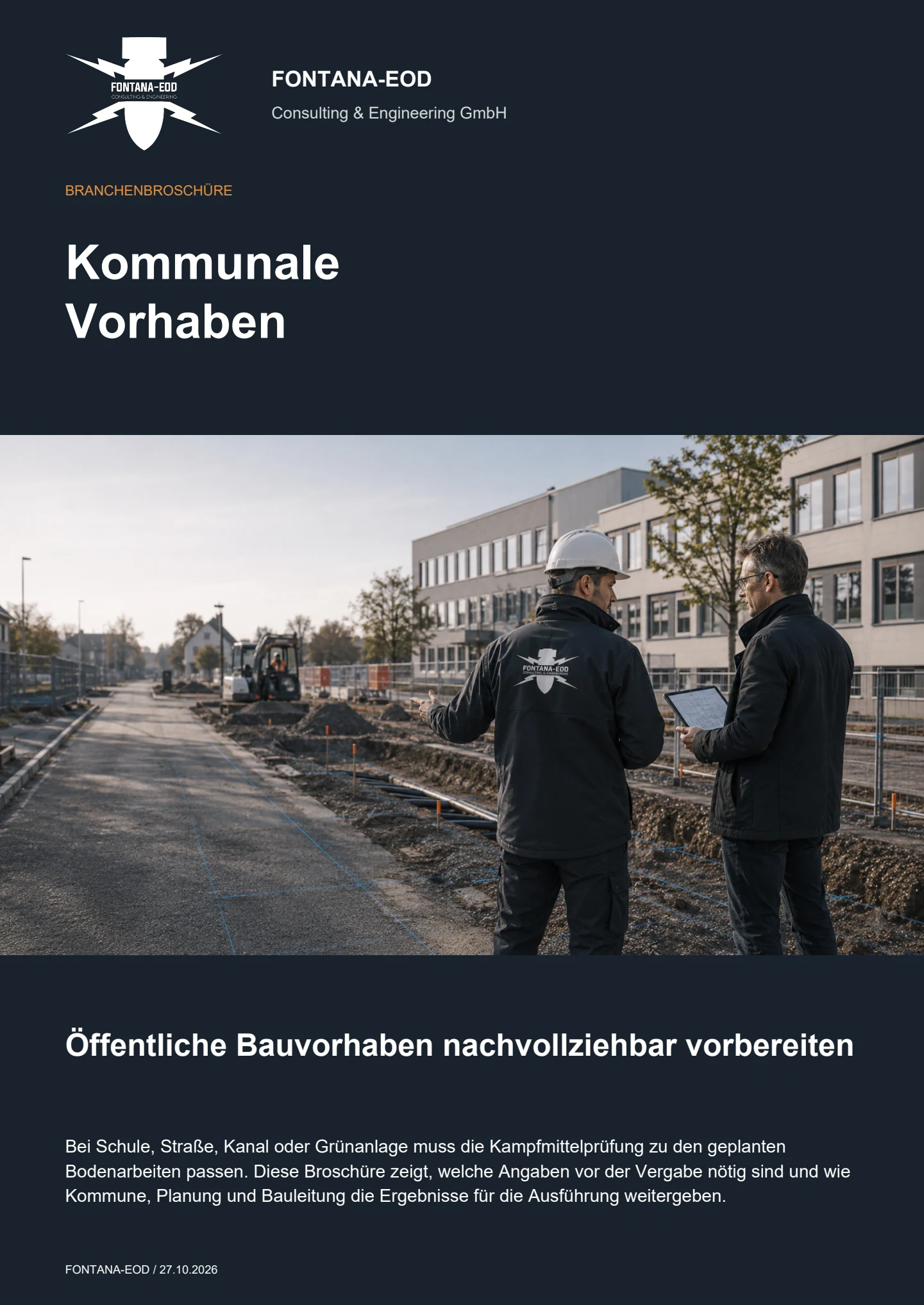
An assessment is useful as soon as public construction, civil engineering, drilling, sewer renovation, school or sports areas, squares, green spaces or flood-protection works affect areas with an unclear use history. The determining factors are suspicion indicators, intervention depth, construction phase, procurement status and evidence requirements.
Useful documents include the site plan, land parcels, construction sections, depths, draft bill of quantities, utility plans, geotechnical data, aerial-photo analyses, earlier expert reports, known requirements and contacts in design, site management or administration. An early design stage can also receive specialist assessment.
Assessment can structure the service scope, investigation areas, methods, documentation needs and interfaces to provide a firmer basis for tendering and site management. Statements must remain tied to specific areas, depths and construction activities.
Particular interfaces arise with schools, childcare facilities, sports areas, playgrounds, roads, sewers, green spaces, fire stations, municipal depots, squares, watercourse works, cemeteries, retention basins and flood protection. Each type has its own access constraints, sensitivities of use and construction sequences.
If an unexpected suspicious object is found, stop work in the affected area immediately. Do not touch, move or uncover the object further. Leave the immediate area and keep others away without putting yourself at risk. In Germany, notify the police immediately on 110; outside Germany, use the local emergency reporting procedure. The competent authorities determine what happens next. Inform site management and the client; internal reporting must not delay the emergency call.
For schools, childcare facilities, sports facilities, depots, roads and public squares, users, exclusion areas, access, schedules, traffic arrangements and safety organisation are considered early. Specialist services must fit the actual municipal sequence.
Traceable information is needed on the investigation area, method, available documents, result, findings assessment, restrictions and follow-on decision. Documentation should remain understandable for administration, designers, procurement, site management and later maintenance. Measurement areas that cannot be interpreted sufficiently are marked spatially; the appropriate supplement is selected according to interference, required depth and construction task.
The determining factors are area, intervention depth, soil, interference sources, existing utilities, access, continuing use, closure periods, construction sections, existing documents, required methods and documentation scope. Calculation refers to the commissioned investigation volume and services actually required.
Clear details of project type, area, use, depth, procurement status and evidence requirements are especially important for public-sector clients.
Address, land parcels, project type, public use, sections and responsible contacts.
Borehole positions, excavations, sewers, chambers, foundations, utilities, paths, squares or external works.
Aerial-photo analysis, old plans, utility plans, geotechnical data, earlier reports and known requirements.
Bill of quantities, timing, exclusion areas, continuing use, HSE, site management and evidence requirements.
Send existing documents together where possible. Early designs can also be assessed if location, use, interventions, depth, phase and the desired next step are identifiable. FONTANA-EOD then assesses which service, method or coordination is appropriate for the municipal situation.
+49 (0) 6843 - 999 499 7
info@fontana-eod.de
Site plan, depth, use, construction phase
Administration, designers, procurement or site management
Municipal projects may combine document review, technical surveys, excavation supervision, clarification of findings and documentation. Selection depends on use, depth and construction phase.
Aerial photographs, old plans and previous uses help assess suspicion and investigation areas before tendering or geotechnics. This is particularly useful for sites used by municipalities for many years.
Accessible open land, sports areas, paths, squares and green spaces may require near-surface technical methods. Surface, installations, utilities and metal interference determine the information obtainable.
Magnetometry detects ferromagnetic anomalies in accessible areas. Utilities, reinforcement, foundation remains, fences and site equipment may mask the data. Interpretable areas and measurement limits are documented separately for each section.
TDEM detects time-dependent electromagnetic responses from conductive objects. The target object, soil conductivity, required depth and technical installations determine suitability for the excavation or development alignment.
GPR records reflections at material and structural boundaries and can provide supplementary investigation of utilities or installations. Soil, moisture, surface coupling and reinforcement affect data depth. A reflection does not uniquely identify ordnance.
For sewers, chambers, foundations, borehole positions, retention basins and excavations, it is first checked whether suitable surface methods cover the required ground volume sufficiently. Where coverage is inadequate, additional investigation is planned for the position and target depth. If survey boreholes are needed, the grid, casing, depth and documentation are coordinated with the intervention and local conditions.
Where preliminary investigation is limited, the suitability of construction-phase ordnance surveying is assessed for the specific volume. Each working layer is technically surveyed and assessed before controlled layer-by-layer removal with supplementary visual inspection. Steps repeat down to the agreed excavation bottom. Layers, stop signals, authority to give instructions, reporting and documentation are agreed with site management and specialists before work starts.
Measurement anomalies are assessed with location, depth, affected use and measurement conditions. Necessary follow-up investigations or exposures are assigned to the affected section. Recovery of confirmed ordnance is coordinated with permitted activities, local responsibilities and documentation.
Municipal evidence must remain understandable for administration, designers, procurement, site management and later maintenance. Its scope is therefore clearly defined.
Municipal projects often take place in spaces that remain in use. Specialist services must fit operations, traffic, access and safety organisation.
Schools, childcare facilities, sports areas, markets and roads have their own hours. Investigation and work times should allow realistic exclusion areas and user routing.
Barriers, communication and site management are particularly important on publicly accessible land. Organisation must prevent users entering work areas unintentionally.
Municipal works are often tendered and built section by section. Documentation must show which section was investigated and which area needs separate later assessment.
Trees, monuments, play equipment, cemetery areas, water structures and utilities may restrict access. These conditions influence the technical method.
Investigation areas, service limits and documentation needs should be usable in tendering and site management without reinterpretation.
Suspected situations require defined contacts, area protection and communication with authorities. This protects personnel, users and construction.
Building, civil-engineering, school, green-space, property and procurement departments need the same technical basis. A shared plan revision reduces coordination losses.
Roads, sewers, playgrounds, parks and buildings are later reopened or extended. Clear evidence supports later municipal decisions.
A reliable enquiry needs location, use, intervention, phase, documents, responsibilities and intended evidence use.
Land is not assessed solely by its public use. What matters is whether drilling, foundations, trenches, chambers, paths, landscaping or excavation actually affect the subsurface.
Early designs are usable if their limits remain clear. Later changes of position, depth or section increase the need to update the specialist assessment.
Municipal land often contains old and new services. Utility plans, operator information and chamber data help identify interference and safety questions before execution.
A sound tender describes the technical task precisely without demanding inappropriate guarantees or blanket area statements. Scope must match the project stage.
The more departments involved, the more important a clear file becomes. Site management, designers and procurement should use the same map and document basis.
Later extensions, connecting services, variations and maintenance should remain identifiable as possible follow-on areas to prevent incorrect transfer of evidence.
Public clients need technical information usable in decisions, procurement, site management and later maintenance.
Investigation area, service, method, documentation purpose and interfaces must be usable in procurement and site management without further interpretation.
Early specialist assessment does not replace detailed calculation but helps reduce unclear service limits, variations and schedule pressure.
Municipal projects often need traceable documents for internal coordination. A clear file helps present suspicion, the investigated area and further action.
Schools, childcare facilities, depots, ambulance stations, roads and squares have their own use requirements. Investigation times, exclusion areas and communication must remain compatible with operations.
Building, civil-engineering, green-space, property, school, procurement and external design teams often have different priorities. A shared technical status reduces misunderstandings.
Municipalities remain responsible for roads, squares, parks, sewers and buildings after completion. Evidence should remain understandable for later repairs, extensions and utility work.
Schools, roads, green spaces and water projects have different ground interventions and execution conditions. Requirements are described for each sub-area.
Educational areas need particular coordination of use, grounds, access, holidays and construction sections.
Civil engineering follows alignments, chambers, sewer reaches, utilities and depths. Its documentation is maintained by route or section.
Open areas combine paths, utilities, foundations, play areas, sports surfaces, tree positions and later maintenance.
Structures near water, retention basins, banks and restoration need clear areas, depths and sections.
Municipal clients must manage technical risks, formal procedures and public use together. Ordnance assessment is more reliable when linked early to project status, responsibilities and evidence requirements.
Building, civil-engineering, property, school or green-space departments or an intermunicipal body may lead depending on the project. The enquiry should clearly identify the responsible unit and contact.
Many municipal projects pass through internal approvals, budget allocations and committees. An understandable technical account of suspicion, intervention and next steps helps prepare these decisions.
Different information is needed before tendering than during construction. Service limits, investigation areas, expected evidence and possible follow-on services should match the procurement stage.
Schools, childcare facilities, sports areas, squares, cemeteries, depots and ambulance stations may remain in use during design and construction. Closures, schedules and access therefore need project-specific coordination.
Public construction is often visible and needs explanation. Clients and site management need clear technical statements to communicate suspicion, work and findings procedures factually.
Civil engineering, building, green spaces, drainage, traffic, property and procurement view the same site differently. A shared file reduces repeated queries.
Before earthworks, site management needs clear work areas, reporting procedures, contacts and documentation requirements. Unclear investigation boundaries make decisions harder during construction.
Municipal facilities are repaired, extended and adapted over long periods. Evidence should support not only current completion but also later work on utilities, paths and areas.
Municipal files must hold technical, organisational and formal requirements together. Unambiguous initial data are decisive for ordnance assessment.
Address, parcels, plan revision, sections and sub-areas show where the assessment applies. This prevents incorrect assignment between tendering, design and site management.
Excavation, drilling, foundations, sewers, utility installation, paths, demolition and external works are named separately because they may require different depths and methods.
Aerial-photo analysis, old plans, utility plans, earlier reports and geotechnical data determine how reliable the initial assessment can be and which gaps remain.
Clients, designers, site management, specialists, contractors and authorities are named with their project roles. This clarifies reporting and decision channels.
Procurement, site management, project files, handover to operators and later maintenance have different requirements for documentation depth and structure.
Plan changes, added areas and new depths are checked against existing technical scope rather than treated casually.
Many public facilities remain at least partly accessible during design or construction. This creates requirements for work areas, time windows and communication.
Markets, squares, schools, sports facilities and cemeteries have set hours of use. Investigation and construction should coordinate access, barriers and information.
Fire stations, depots, ambulance stations and administration need functioning access and operating areas. Specialist work is therefore coordinated with operational readiness and site organisation.
Schools, childcare facilities and playgrounds need particularly clear separation of construction areas, occupied areas and site access. Technical investigation must fit this organisation.
Municipal facilities remain in use after construction. Traceable documentation supports later utility work, renovations and local repairs.
Service limits, plan revision and evidence requirements should be clearly defined before commissioning.
The text describes area, intervention, depth, method and documentation so specifically that bidders and site management understand the same scope.
The client states whether documents are needed for procurement, construction, operator handover or later maintenance.
Ordnance assessment should be integrated into procurement so that purchasing, technical departments, designers and site management use the same technical basis.
Scope describes not only area but also construction activity. Sewer trenches, foundations, play equipment, paving, bank works or flood-protection structures may create different investigation areas.
Procurement documents should identify the plan revision underlying the service. Later redesign can then be checked against existing evidence.
Traffic protection, access, vegetation clearance, ordnance documentation, data handover and site-management communication should be established early rather than negotiated during execution. Necessary investigations and protection are planned before ground interventions during vegetation clearance, uprooting, breaking out or creation of work areas and access. Areas accessible later are investigated before the relevant follow-on interventions.
Suspicion or finds require an agreed reporting channel connecting the site, client, specialist company and authorities.
Municipal projects often depend on holidays, closures, funding deadlines or traffic phases. Surveys, document review and excavation monitoring should fit this schedule.
Service limits and documentation scope help verify work performed traceably, especially when added depths, areas or findings arise during the project.
Before earthworks, site management and contractors need an understandable account of area, depth, method and reporting.
The briefing connects plan revision, investigated area, unresolved items and conduct in response to findings. The technical status thus becomes effective on site as well as in the file.
Barriers, access, equipment movements and user traffic are checked against the intended investigation and construction areas, especially at schools, squares, roads and operating sites.
Before starting, the client, site management, specialist company and contractor know who must be involved for suspicion indicators, plan changes or additional depths.
Added areas or depths do not receive a blanket transfer of existing conclusions. The assessment is supplemented and documented.
Assessed areas, unresolved items and later follow-on work remain relevant after completion.
Evidence is filed with the plan revision, area, depth and section so that later departments can identify its scope.
For repairs, extensions or additional utilities, existing status is reviewed and supplemented technically where needed.
Whether historical aerial photograph analysis, explosive ordnance surveying, surface surveying using GPR, magnetometry or TDEM, deep-ground surveys, downhole surveys, excavation supervision, area clearance or ordnance recovery is needed depends on the location, ground disturbance, depth, ground and existing documents. An early ordnance assessment provides clarity for tendering, programming, occupational safety and construction.
FONTANA-EOD combines its Section 7 SprengG licence, specialists holding Section 20 SprengG certificates of competence, suitable survey and clearance methods, and traceable documentation. Send the site plan, depth of ground disturbance, construction phase and existing documents for an initial technical assessment.


