Project pathway
The quickest route to the right decision.
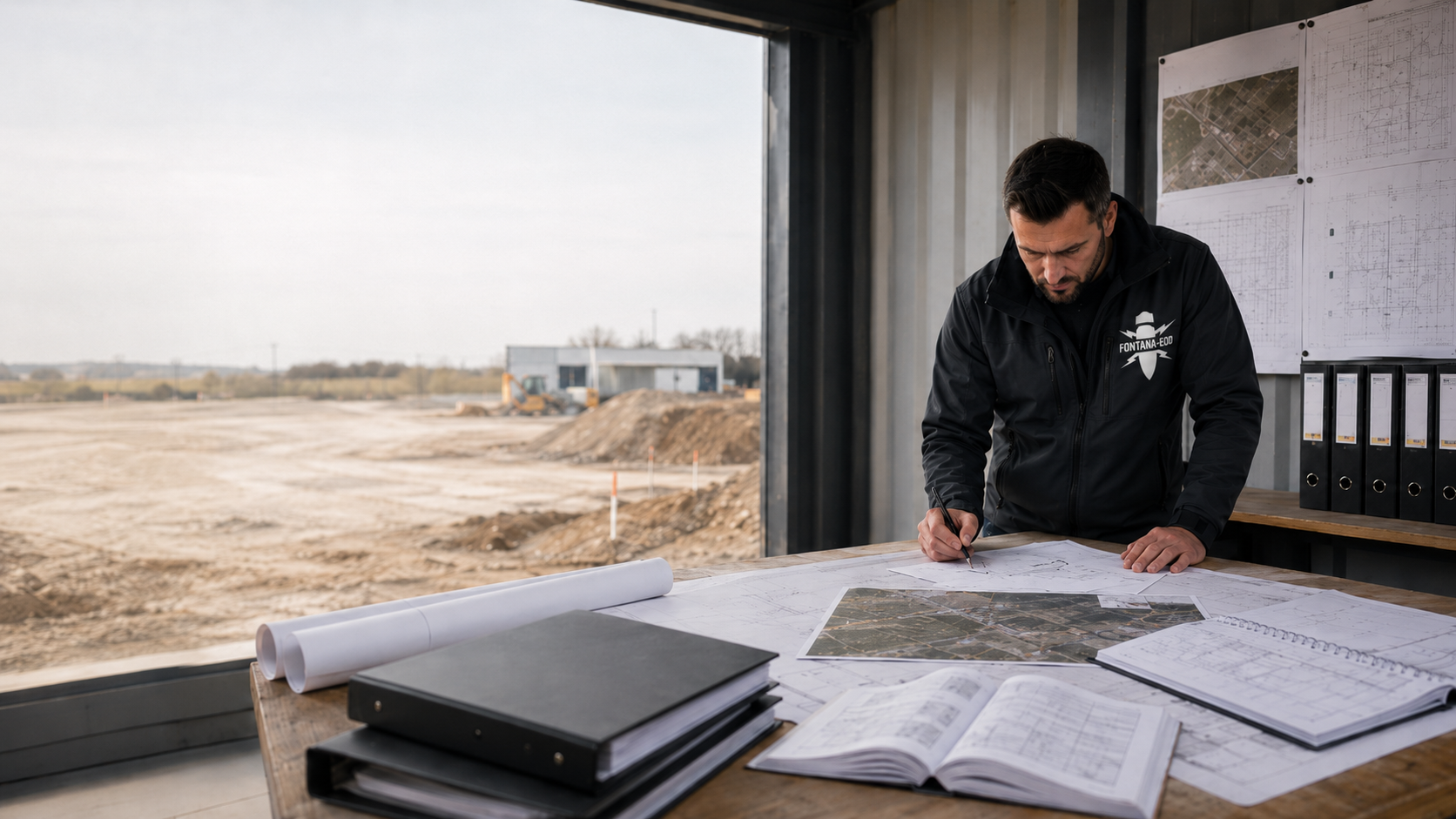
Anyone planning construction or taking over existing ordnance documents must clarify responsibilities, survey limits and next steps. The proposed groundworks, their depth and the existing survey results are decisive. Have a site plan and the complete existing documents ready for technical coordination.
Authority or specialist contractor: whom should you ask?
What can be surveyed, and how?
What do a report and a clearance statement establish?
Before drilling, earthworks or reusing a survey report, the suspected hazard, intervention area and existing knowledge must be consistent. Clients and designers need both a technically described survey task and clarity about the responsible bodies. FONTANA-EOD supports project-specific surveying and assessment within the commissioned scope. The next step depends on which decision the existing documents can already support and which findings are still missing.
Many misunderstandings arise because the same expression is used for different work stages. What matters is the conclusion you need for the proposed intervention. If terms in information, quotations and reports do not agree, first clarify the work scope intended in each case and the associated area.
Suspected ordnance is a technical reason for further clarification. A suspected area describes the spatial reference of the underlying findings. This does not yet establish the presence of a particular object in the ground. Ask what the assessment is based on, which area it covers and what uncertainties exist. For example, a historical representation may locate a previous use or suspected point, while the current excavation has a different outline. Only comparing the two shows which part of the project is affected by the existing finding. A client's assumption and a documented specialist assessment remain distinguishable.
Assess suspected ordnance in the construction projectSurveying acquires and interprets measurement data for a specific task. An anomaly can have different causes. The measurement finding, its technical interpretation and subsequent identification are separate steps. A coloured point in a result display alone is neither evidence of a find nor clearance. For further planning it must be clear which anomalies have already been assessed and which still require investigation. Undisturbed measurement areas must also be distinguished from areas that cannot be adequately measured for technical reasons. Otherwise, a clear map may imply a uniform investigation status that the underlying data do not support.
Compare survey methodsOrdnance clearance follows a defined clearance objective for a spatially described area. Recovery concerns handling ordnance found by the bodies competent and authorised to do so. Project planning must describe surveying, further investigation, authority interfaces and documentation separately; commissioning measurements does not automatically include all subsequent services. The enquiry should therefore already state whether findings are to be obtained first or previously assessed anomalies are to be investigated further. The scope, responsibilities and handover of results for necessary follow-up work are coordinated separately. The intended use of the treated area remains relevant to the agreed objective.
Distinguish the stages of explosive ordnance disposalA clearance statement must be read together with its spatial and technical scope. Documentation makes the work performed, results and limitations traceable. The area and depth actually surveyed and the underlying construction activity are important. The term clearance alone does not replace this information. Particularly when sections are handed over individually, the next party must be able to see which section was assessed for which activity. A cleared utility section and a deeper excavation planned beside it are different tasks. Report date, plan appendix and the construction activity described help assign the appropriate evidence to each intervention.
Read evidence and the limits of its conclusionsUXO stands for Unexploded Ordnance and means explosive ordnance prepared for use or used that has not exploded. EOD stands for Explosive Ordnance Disposal and covers specialist tasks from detection and identification to disposal of explosive ordnance. Abbreviations such as KBD or KMBD are used for public services. The abbreviation does not yet establish a specific responsibility for your project. Connect terms with the project location, task and the contact actually responsible. A quotation must also show which activity is being commissioned; the broad abbreviation EOD alone describes neither quantity nor survey objective.
Understand EOD in the project contextBFR KMR and DGUV publications address different technical or occupational safety contexts. The BFR KMR describe survey, planning and documentation tasks within their defined scope. DGUV focuses on protecting workers in connection with the work performed. The term excavation supervision must not diminish these requirements: simply watching excavation must be distinguished from a planned procedure involving ordnance surveying during the works. The appropriate approach must be clarified before the intervention. For clients, the working method described is therefore more informative than an abbreviated item description in the bill of quantities.
Distinguish methods used during groundworksThe client and designers describe the project and ensure existing findings are included in preparation. A private specialist contractor carries out the commissioned survey and documents its results. Authority tasks, handling finds and local procedures are coordinated with the responsible bodies. The project location and task are therefore as important to the initial enquiry as the name of an office already involved. An existing case reference helps assign the documents.
Area alone is insufficient for a calculation. In addition to the required depths, measurement conditions, accessibility and the proposed work scope affect the effort involved. The number of individual investigation points or measurement profiles, repeated journeys for phased work and the required plans and reports must also be considered. Two quotations can only be meaningfully compared when they are based on the same task and conditions. State which preparatory work is complete, which areas can be treated continuously and where surveying depends on ongoing construction operations.
A workable specification connects survey objective, spatial boundaries, quantities and handovers. The intervention plan must show the areas and depths required. Known limitations, existing surveys and necessary coordination also belong in the enquiry. If planning, measurement, interpretation and documentation are commissioned separately, their interfaces must be described. It then becomes clear which documents a contractor receives, which work status they are to take over and how they must hand over their results.
The historical aerial photograph analysis examines evidence from the past. Technical surveys acquire measurement signals within the proposed survey volume. A measurement anomaly is not yet an identified ordnance find. The appropriate method depends, among other things, on the suspected hazard, ground conditions, depth and interference.
Surface survey and deep-ground survey differ in their access to the survey volume required and the respective measurement conditions. For a survey from the surface, the coverage achieved must match the proposed intervention. If it is insufficient, supplementary surveys must be planned for the location and depth actually required. Environmental and geotechnical investigations introduce their own questions; their investigation points and conclusions must be coordinated with the ordnance assessment.
Plattling and Landstuhl show original measurement displays with explanations. The Hochspeyer, Kaldenkirchen and Zweibrücken examples summarise documented surveys and their limits. Measurement anomalies, checked findings and the scope of a partial clearance statement are described separately.
The case report shows the survey at track 20 and explains how the measurement display and documentation relate to each other.
Two original borehole profiles show magnetic measurements against depth. The case explains the scope of the documented partial clearance statement.
The survey revealed unresolved anomalies. The report therefore did not grant ordnance clearance.
Ground-penetrating radar and specialist supervision supported the phased survey. Marginal areas alongside existing foundations could not be confirmed clear by measurement.
A measurement anomaly was specifically investigated. The documented partial clearance remained limited to the surveyed section of the sheet-pile wall alignment.
Start with the open question and the proposed intervention. A method is then selected according to the findings required and the conditions in which they can be obtained. The equipment name alone says nothing about the scope of conclusions for the construction area.

If information about previous use is missing or historical indications exist, analysing aerial photographs and other sources can contribute to technical assessment. It answers a different question from measurement on site. Results and spatial boundaries are then considered alongside the current design. Image date, coverage and identifiable changes are important. Earlier buildings may now be concealed; conversely, subsequent earth movements may have changed the ground surface. These differences belong in the assessment before a specific survey task for the present area is derived from the historical image.

For drilling and foundations, location, starting elevation, diameter and intended depth must be considered together. A survey nearby does not automatically cover the new intervention. Check whether the planned drilling point actually lies within the assessed survey volume and whether the necessary depth was covered. A depth without an elevation reference can be ambiguous where ground levels have changed. Where possible, submit a site plan and section together and identify the ground or design level to which the depth refers. The appropriate survey method follows from this task and the local conditions.

If earthworks must be prepared in sections, technical checks, construction progress and stop-work procedures must be connected. Simply observing excavated soil is not an equivalent substitute for the necessary survey. Before work begins, define the sequence, the areas requiring specialist investigation and how anomalies will be handled. Site management must know which section it can take over on the basis of which documented investigation status. A change in excavation depth or construction method may require renewed coordination. Communicating such changes is therefore part of ongoing cooperation between the construction team and specialist contractor.
The sector alone determines neither suspected ordnance nor the method. It does, however, change the construction activity, the working areas available and the handovers between parties. Relate your question to the actual intervention and use the sector section for further project preparation.

A building footprint is only part of the intervention. Excavation, foundations, working spaces and subsequent external works can affect different areas. The current design with the proposed depths is therefore more useful for initial assessment than plot size alone or a general project description.
Assess the construction area and taskIn civil engineering, working spaces and accessibility often change as construction progresses. The technical question then also concerns intermediate states and the handover of sections. Describe which areas are needed first, which follow later and where existing results must be checked against a changed design.
Prepare civil engineering sections on a technical basisA route corridor, individual chambers and excavations for connections have different spatial requirements. Existing utilities must also be considered in planning and method selection. Distinguish knowledge about existing utility infrastructure from the question of suspected ordnance; both bodies of information must be brought together for the intervention.
Identify utility construction and connectionsTracks, cable routes and operating conditions can affect accessibility and measurement conditions. For rail projects, first distinguish whether historical assessment, preparation of individual interventions or documentation of a treated section is needed. Operational requirements must also be coordinated with the responsible project parties.
Distinguish rail and route tasksTechnical installations, utilities and earlier changes can complicate the interpretation of existing documents. A new hall, foundation or extension therefore requires a specific spatial reference. Do not combine known preliminary surveys into a blanket site assessment; compare the scope of their conclusions with the current project.
Assess interventions on operational sitesFor roads, public buildings and facilities, planning, procurement and construction execution meet. A traceable task description makes it easier to pass existing knowledge between these parties. The enquiry should clearly identify the construction area and intended decision, even if several bodies hold project documents.
Make municipal project questions specificSoil samples, probing and exploratory boreholes may themselves require intervention in the ground. Their environmental or geotechnical results do not automatically answer the ordnance question. Coordinate investigation locations and depths and bring their respective conclusions and limitations together traceably in the project file.
Coordinate ground investigation and the ordnance questionAt utility and operational facilities, intervention areas, operating states and possible interruptions require particularly careful coordination. However, the term critical infrastructure does not provide a universal survey method. A technically described task is needed, with information on the specific structure, ground conditions and intended reuse of existing evidence.
Connect infrastructure and evidence requirementsA sound project decision separates observation, assessment and the next work stage. This applies to historical documents and survey reports alike. Read not only the concluding wording but also the task, reference area and limitations.
Technical information does not replace assessment of the specific area. The project location, construction activity, survey depth and existing findings remain decisive. The BFR Kampfmittelräumung provide a technical framework for federal properties; local procedures and other requirements must also be considered.
If your project file contains no documents, this initially describes only your own knowledge. Whether information or surveys already exist elsewhere must be clarified separately. Identify missing information openly instead of inferring a conclusion about the ground from the absence of a document. Also ask for appendices and earlier plans referenced in correspondence. If that very reference document is missing, a brief statement cannot reliably be transferred to the present project. Further research should preserve the source location, author and spatial reference of the documents obtained.
A marked area is only useful for planning when its location, scale and associated report are identifiable. Elevation reference and survey status may also be decisive. If different representations do not agree, this discrepancy should be clarified technically before adoption in the construction design. Check whether a line marks the plot boundary, the surveyed area or an assessed sub-area. Identical-looking outlines can represent different things. For execution, site management needs an unambiguous connection between the area on the plan and the corresponding conclusion in the report.
Existing utilities, metal installations, ground structure and accessibility can affect the selected method. These conditions are part of result assessment. An area that cannot be interpreted, or only with limitations, must remain identifiable as such; a summary must not silently equate it with a fully surveyed area. For follow-up planning it therefore matters whether a limitation concerns only data quality within a measurement area or whether no survey has yet been possible there. Only this distinction allows the next necessary step to be coordinated appropriately and the area to be considered in the construction sequence.
A relocated chamber, a greater foundation depth or an additional excavation may lie outside the previous scope of conclusions. Check whether location, depth or construction activity has changed from the assessed design. The existing documents remain valuable but require a traceable comparison with the change. Mark the change on the current plan and place the previous survey plan beside it. The commissioned specialist contractor can then specifically check which findings remain usable and where supplementary work is needed. A design change thus becomes a spatially defined technical question rather than a blanket reassessment of the entire project.
The project location, proposed construction activity and existing knowledge determine the technical question to clarify next. Existing results are checked for their usefulness for this task. A specific suspected find is reported immediately through the responsible public safety bodies.
Describe the project location and the construction activity actually proposed. Add whether the project is at preliminary design, tendering or execution stage. This identifies the decision currently requiring preparation.
Collect existing information, historical assessments, reports and plans. State their respective versions and missing appendices. Conflicting conclusions should be submitted together so that their different underlying bases remain identifiable.
Clarify which area or point is to be considered and to what depth. Identify open questions about suspected ordnance and the usability of existing results. Only this produces a task that can be addressed technically.
Method selection considers the task, ground conditions, interference sources and access. Responsibilities and local procedures must also be clear. Requirements of other project parties belong in this coordination before a service is commissioned.
Read technical results together with their limits and the agreed scope. Check which areas were actually treated and which questions remain open. A summary does not replace the associated plans and appendices.
Record which documents underpin further planning. If changes occur later, the original results and the new comparison remain distinguishable. Site management and subsequent parties can then follow the decision process.
Which plans, depth details and existing assessments are needed? A targeted compilation makes initial technical coordination easier.
Existing evidence is assessed together with survey scope, limitations and the plan for the next construction section. What matters is whether the documented conclusion covers exactly the area and depth where work is to continue.
Survey reports and clearance records must be assigned to their respective tasks. The handover must bring together, in particular, the area treated, methods used, findings identified and remaining open points with the associated plan appendices.
An understandable file connects the question with the plan used and the technical result. It facilitates enquiries and later changes. A single isolated letter or map often cannot convey this context completely.
Use the current construction design and the documents that establish the need for assessment as the basis. Date, author and spatial reference should be traceable. Distinguish your own design assumptions from existing specialist assessments.
Bring together the commission, survey scope, report and associated plans. Readers must be able to see what was surveyed and what conclusion follows. This includes documented limitations and areas outside the work scope.
Identify missing information and the next coordination required. At handover, it should be clear which question has already been answered and who is pursuing the remaining points. Simply filing an open point does not turn it into a completed assessment.
Submit the complete evidence with appendices and the current intervention plan. State project location, construction activity and depth, and the conclusion needed for the next decision. Mark changed or previously unassessed areas.
Discuss evidence and its limits in relation to the projectWithout previous findings, the first step is to obtain and assess the underlying information. If a report already exists, its relevance to the proposed intervention determines further work. For a specific commission, the task and desired result must be described adequately.
Start with the project location, construction area and activity. Historical assessment can form part of further clarification; the documents required depend on existing knowledge.
Start with historical assessmentDescribe the survey objective and proposed interventions. The service overview helps distinguish terms and methods before quantities and conditions are included in an enquiry.
Compare survey tasksPlace the complete report and its appendices beside the current intervention plan. Assign the survey scope, results and limitations to the areas actually required. Then identify which conclusion can be reused unchanged and which question still requires technical clarification.
Read evidence for reuseDescribe the open question and submit the existing design. State whether planning is to be prepared, a service defined or existing evidence understood technically.
Submit the technical question with documentsA useful statement identifies its subject and limits. It makes clear the basis on which the next decision can be made. When reading and passing it on, ensure its connection to your project is preserved.
The information addresses a named task, such as preparing drilling or assessing a report. General statements are not transferred to the entire plot without comparison.
Area, point and depth can be related to the associated plan. Areas not treated or only assessable with limitations remain identifiable and are not hidden in a blanket statement.
It is clear which survey was performed and which conditions affect its conclusions. The result is not justified solely by the name of an instrument or a display.
Client, designers, specialist contractor and authority have different tasks. A technical report is assigned to its actual purpose and not presented as a substitute for another necessary decision. For insurers and risk management ,the documented survey scope, relevant construction task and remaining open questions in particular must be assigned traceably.
Plans, legends and documented limitations are passed on with the result. Subsequent parties can then also see which work status underlies the project.
Open questions, necessary coordination and intended handovers are identified specifically. This facilitates further work without anticipating a survey stage or result that is still outstanding.
Technical clarification is easier when information comes together with the right parties. Responsibilities must be determined from the task and project location. A general designation replaces neither the commission nor local coordination.
The client and designers describe the project and provide the current intervention plan. This includes disclosing previous documents and changes so that the technical survey can address the same spatial and temporal task. Where several designers are involved, it should also be clear who consolidates the definitive design. A change to foundations or the route must also reach the technical specialists if it affects the previous survey commission. The decision on further construction progress is based on this coordinated version.
The commissioned specialist contractor matches the survey task with appropriate methods and their limits. Scope, results and limitations must be documented traceably. A conclusion remains tied to the commission actually carried out. Coordination also includes who interprets measurement data, who prepares reports and whom to contact with questions. If different parties perform parts of the service, the data and plans handed over must be technically consistent. FONTANA-EOD clarifies these interfaces for the commissioned service with the project parties.
Authority tasks and handling a find follow the local framework of responsibilities and procedures. For the project, clarify which body provides information, which documents must be submitted and how necessary coordination takes place. The private specialist service provides the commissioned survey and its documentation. Authority decisions rest with the respective responsible bodies. Keep existing correspondence with case references and appendices together so that questions relate to the same matter and existing requirements can be considered in further planning.
Legal requirements, occupational safety and technical method descriptions serve different purposes. For project planning, they must be considered together with the actual commission and local conditions.
When referring to the BFR, observe their scope; local procedures and the specific commission remain additionally relevant.
Explosives legislation requirements concern the respective scope of activities and responsible persons. The commission must therefore clearly describe the task, responsibilities and necessary prerequisites. Check suitability against the service actually proposed: planning work, a technical survey and handling ordnance found have different requirements. Responsibility for specialist work and the authority's decision are clarified separately.
The risk assessment must consider the specific activity and identifiable hazards. This includes changes in working conditions. Work methods, protective measures and the people involved must be appropriate to the proposed task. Before ground intervention, those responsible must know how work is to be stopped in the event of an anomaly and how further action will be coordinated. If access, construction equipment or the work sequence changes, check whether this creates new requirements for safe execution.
Technical rules and guidance explain how surveys and evidence can be assessed professionally. Their scope remains important. Local requirements, existing assessments and the agreed service scope are considered together when applying them to a project. Clarify which rules underpin the specific commission and which documents the recipient needs for their decision. A technical recommendation and a binding project-specific requirement should each be identifiable as such in the documents.
For research, a clear location is initially sufficient. For specific work, responsibilities, existing documents and local conditions must be brought together. General knowledge articles do not replace this location reference.

Use the regional overview to place your technical question geographically. State the municipality, location and proposed construction activity. A nearby survey or an authority with the same name in another federal state cannot automatically be transferred to your own procedure.
Connect project location and regional assessmentA longer route or several locations may involve different design versions and contacts. Assign existing information and reports to the respective sections. Record where information is missing or renewed coordination is necessary rather than assuming uniform knowledge.
Assign regional sections and documentsHistorical findings, measurements and documentation complement one another but answer different questions. The project file must separately retain the origin of information, the area actually surveyed and the conclusion for further construction in a traceable form.
Historical assessments describe findings from available sources and their evaluation. Read them with their spatial reference and stated limits. For the current intervention, these findings must then be connected with the present design and, where necessary, further surveys.
Understand historical findings and limits
A result display belongs to the agreed survey scope. Consider area, depth, method and design version alongside each other. Only in this context can you assess which conclusion exists for the proposed intervention and where a technical follow-up question remains.
Assign survey scope and methods
A handover should make the technical conclusion and its limits traceable. Report, plans and open points belong together. Agree who receives the documents and which digital or printed formats are required. The recipient must be able to assign the treated area to the current plan and identify outstanding coordination.
Bring documentation and handover together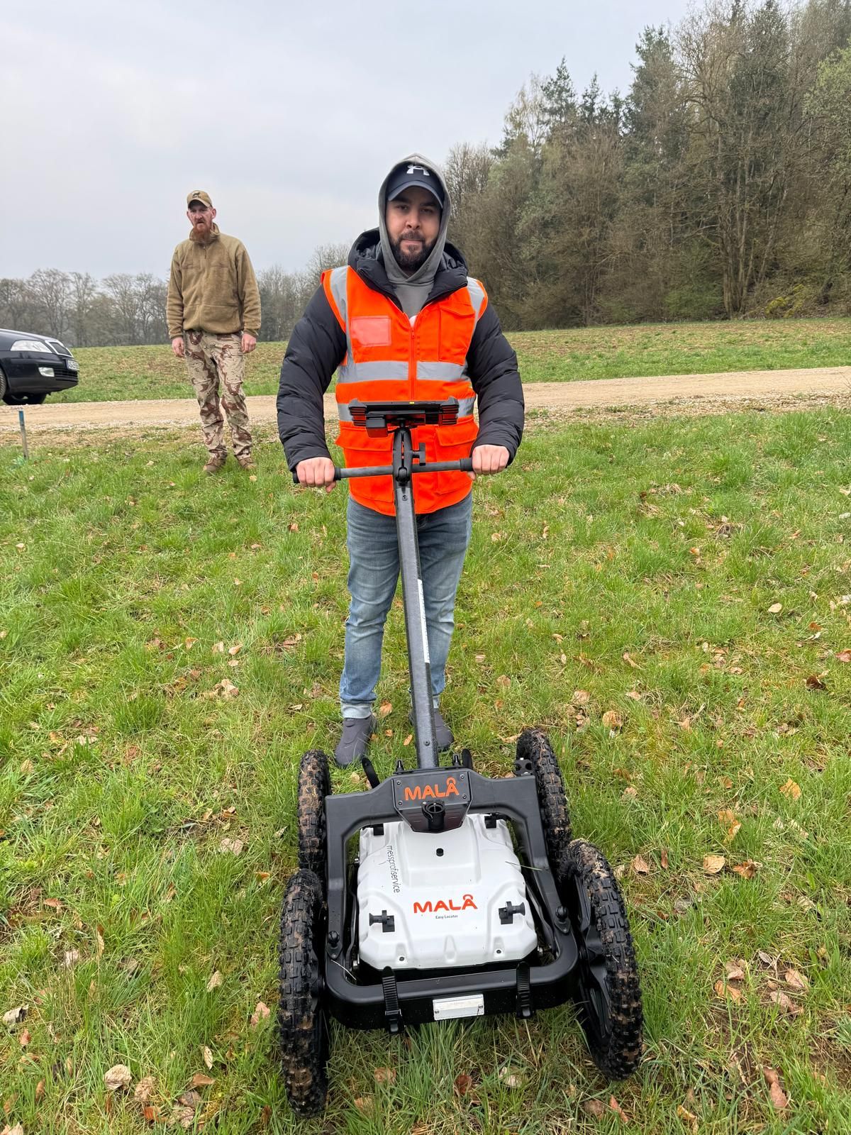

Select the next content according to the purpose of your question. General clarification of terms, choosing a survey and making a specific project enquiry are different steps.
For a commission, the survey task and suitable method must match. The starting situation, proposed intervention and known conditions determine the specialist service required and the additional points still to clarify before execution.
View appropriate survey tasksPreparation, execution and documentation must address the same task. When passing on existing results, therefore consider together the commission, the work scope actually completed and the intended use of the conclusion.
Connect reports and project decisions
Submit the open question together with the existing design version. Describe the decision required and the information or documents still missing.
Discuss the project question with plansClarify survey requirements early in planning and before work in the ground begins. State the project location, proposed construction activity and depth of intervention. Provide current plans and all existing ordnance documents with their appendices. If no findings are available yet, first clarify the local procedure and the information needed. This determines which research or survey is required next.
First define the survey objective, the volume of ground required and the existing findings. Method selection considers the surface, ground conditions, depth of intervention, access and possible interference. Execution, interpretation and the necessary follow-up measures are then coordinated. A method's suitability depends on these specific conditions and the scope of the conclusions required.
No. The organisation of authorities and procedures varies regionally. Use the overview of responsibilities and our regional pages to connect the technical question with the project location.
Stop work in the affected area immediately, do not touch or move the object, leave the danger area and keep others away without putting yourself at risk. Notify the police immediately on 110. An enquiry through this website does not replace reporting a find.
It can provide an important basis. However, compare the previous survey area, depth, method and limitations with the new intervention. Changes to the design or area require technical assessment.
The work required also depends on the survey objective, intervention depths, accessibility, measurement conditions and the documentation needed. An enquiry should describe these conditions as far as known and identify missing information.
No. A measurement anomaly is initially a finding of the method used. Its cause and significance are assessed by specialists. Subsequent identification or further investigation is a separate step.
Soil contamination, geotechnical properties and suspected ordnance concern different questions. The documents can be important for coordinated planning, but do not automatically replace the respective survey and assessment required.
An initial enquiry does not require you to prepare your own specialist assessment. Existing documents and a clear description of the open decision are helpful. Identify missing information instead of replacing it with assumptions.
State the address or location, municipality and, where applicable, plot reference. Mark the construction area, route or individual drilling and intervention points on a plan. Add the depths and working spaces currently proposed.
Describe the project stage, construction activity and desired decision date. State planned construction dates, known access restrictions and available work windows during ongoing operations. Identify coordination already completed and existing conditions imposed. For changes, the earlier design is helpful alongside the new one.
Submit information, aerial photograph assessments, survey reports and associated appendices. Utility plans and ground information may also be important for further assessment. Identify conflicting conclusions or missing documents explicitly.
Whether historical aerial photograph analysis, explosive ordnance surveying, surface surveying using GPR, magnetometry or TDEM, deep-ground surveys, downhole surveys, excavation supervision, area clearance or ordnance recovery is needed depends on the location, ground disturbance, depth, ground and existing documents. An early ordnance assessment provides clarity for tendering, programming, occupational safety and construction.
FONTANA-EOD combines its Section 7 SprengG licence, specialists holding Section 20 SprengG certificates of competence, suitable survey and clearance methods, and traceable documentation. Send the site plan, depth of ground disturbance, construction phase and existing documents for an initial technical assessment.


