Project pathway
The quickest route to the right decision.

A clearance plan connects planned ground interventions with a reasoned approach to ordnance clearance. Existing findings, investigation needs and construction phases form a traceable plan. Send FONTANA-EOD the current design and available ordnance documents. Describe the planning question you want to resolve so we can agree which questions the clearance plan should answer.
Separate established details from assumptions.
Justify the intended procedure.
Coordinate construction and records.
A clearance plan is the professional planning basis for an ordnance clearance operation. It describes the task, assesses available information, assigns clearance needs spatially and justifies the intended procedure. It also includes construction sequence, protective requirements, quality controls, documentation and traceable consideration of effort. The plan describes the planned service; it is not yet an execution record or ordnance clearance confirmation.
The service scope for “Troisdorf – AMZL Goodman DNW5” comprised borehole magnetometry / deep surveying, investigation and clearance planning, and surveying.
Service period: 2026-09
Service areas:Downhole magnetometry / deep-ground surveySetting out and marking survey areasInvestigation and clearance plan
View project details · Deep-ground and downhole surveys · Project location: Troisdorf
The service scope for “Räumkonzept - BV: Kaldenkirchen” comprised investigation and clearance planning.
Service period: 2026-09
Service areas:Investigation and clearance plan
The service scope for “Projekt SCM Augsburg” comprised investigation and clearance planning.
Service period: 2026-08
Service areas:Investigation and clearance plan
Planning needs follow from knowledge, intervention and applicable requirements. A property name or total area alone does not describe the task.

Where suspected ordnance and planned ground disturbance coincide, the necessary procedure requires professional clarification. For new construction, excavations, foundations, utility connections and temporary working areas should be considered separately. For an extension, also assess which existing records actually cover the new intervention.
Assess construction and interventionsAn older report, new design and authority statement may concern different areas or work statuses. The plan must resolve these differences or identify them as unresolved conditions. It must not conceal missing findings through an apparently unambiguous method decision.
Bring existing knowledge togetherFor construction in sections, planners and site management need a traceable sequence. Which investigation must be available before which intervention? Where does further work depend on demolition, access or specialist feedback? The clearance concept provides the technical basis for this; the overall construction sequence must still be coordinated with the specific dates.
Coordinate construction phases and recordsInitial information, intended interventions, method selection and required records must be consistent. The BFR KMR 6.2 describe planning content; Appendix A-9.4.9 organises the explanatory report's content. Scope, level of detail and required appendices are specifically determined for each commission.
Identify the construction project, client, planning area and specific purpose. Which decision should the plan support and which services are commissioned? Record the underlying design and other specialist planning to include. A clear task description prevents participants expecting different services from the same document.
Compile relevant documents with dates and versions: authority information, historical investigations, technical investigations, earlier clearance and existing results reports. Assess their usability for the present task. The report must distinguish known facts, professional interpretations and provisional assumptions; information gaps are expressly included.
Ground structure, groundwater, surfaces, buildings, utilities, interference and accessibility influence planning. Rights of use, neighbours, nature conservation, water law and other requirements may also matter. Describe only conditions evidenced for the specific project and clarify those still needing assessment. Not every factor is equally important at every location.
Show ordnance-relevant interventions with plan references, such as excavations, foundation elements, retaining structures, shafts or utility trenches. Assign the professional conclusion needed to each area. Property boundary, later structure and actual working space are not automatically identical. Exclusions and unresolved subareas must remain recognisable.
The plan explains which methods are possible, their prerequisites and limits. Selection is justified from actual conditions. The preferred solution includes spatial and temporal sequence, necessary preliminary services, technical infrastructure and coordination with other trades; merely listing equipment is insufficient.
Define the quality controls, responsibilities and results documents needed, including acceptance and handling of deviations. Construction duration and economic considerations must relate traceably to the planned solution. Maps, drawings, schedules and source appendices must reflect the same status as the explanatory report.
The next decision depends on existing knowledge and the conditions the measure must satisfy. Document review, technical assessment and planning updates each provide a specific result for further work.
Historical documents, current intervention plans or earlier investigation reports concern different parts of the project. The client and specialist planners assign findings to actual construction areas and depths. Suspicion and unresolved questions determine the further contribution needed. The decision may first require additional information or technical investigations. Their results provide the traceable basis for later method selection; historical suspicion alone does not describe a completed investigation.
Clarify initial information and suspicionUtilities, metal installations, ground structure or lack of access can affect planned surveying. Specialist planning assesses which conclusions are possible and the conditions a suitable alternative needs. For work in sections, preliminary services and handover points are coordinated with construction. The planning status identifies the selected solution and remaining limits. Unresolved areas remain visible even when other parts can progress.
Determine technical investigation needsA deeper excavation, relocated route or additional shaft may require other investigation areas and services. The developer, planners and specialist company compare the new design with earlier information. Affected clearance objectives, quantities, method assumptions and records are reassessed. The plan and appendices are updated to the same status. Procurement therefore reflects the actual construction task; adopting an earlier specification unchanged would not adequately account for changed planning.
Connect planning and recordsAn understandable clearance objective describes the professional conclusion needed for a given area. It must not arise solely from a desired equipment name or an existing blanket clearance wording.
Link each relevant intervention to a unique identifier and readable plan. Retaining works, working space and an additional shaft within an excavation may form different assessment areas. A shared project name does not replace assignment. The spatial definition is professionally coordinated with construction planning. Individual foundations are assigned with planned geometry; utilities with route and sections. A measurement grid or borehole arrangement is justified from the task and site conditions rather than adopted from another project.
Depths are comparable only with an unambiguous reference, such as specified ground level or an elevation. If terrain or planning changes, the values must be related to each other. Intervention depth, professionally substantiated suspected volume and demonstrable investigation scope are assessed together; a general standard depth does not suit every project. Record the terrain status underlying a section and intended filling or excavation. Later lowered ground can change the distance to the depth range previously considered. Planning must describe the relevant geometry with the same traceable reference.
The concept should show what the intended measure is to achieve and which prerequisites are still missing. Excluded, inaccessible or insufficiently assessable areas must not enter an overall conclusion unnoticed. How a later ordnance clearance confirmation is read depends on its documented scope. Also identify which preliminary construction work will make an excluded zone accessible and which professional step follows. This dependency matters for construction: an organisationally completed planning phase does not mean all later working areas have already been investigated or cleared.
The preferred solution must be technically suitable, feasible under the site conditions and understandable to the client. The BFR also provide for consideration of construction times and economic efficiency.

What conclusions can each method support under the existing ground, built-environment and interference conditions? Which areas remain unresolved? What preliminary work is needed? Also explain why an otherwise established method is unsuitable for a particular sub-area. Manufacturer data or previous use on other sites does not replace this assessment.

If an area is initially inaccessible or cannot be investigated sufficiently, the next steps must be planned by specialists. Measures alongside construction are not a universal shortcut. In particular, under DGUV guidance, merely watching excavated material is not equivalent to a technical ordnance survey alongside construction. Methods, protection requirements and handover points belong together. The DGUV questions on explosive ordnance clearance explain this distinction. Planning specifies the technical approach required and the conditions for the next work step.

The comparison considers the actual task, necessary preliminary work, access, construction phases and documentation. Cost assumptions must match the intended service; unknown constraints must remain identifiable as such. Guidance on general factors affecting the effort required for ordnance surveys supplements planning but does not replace a project-specific cost calculation.
A concept depends on the information on which it is based. If that information changes or remains insufficient for a decision, subsequent work must remain traceable.
Link each relevant gap to the decision it affects. For example, if an earlier report covers only the existing hall, it cannot yet support conclusions for a new extension area. Planning must establish what additional information is needed. Preliminary work is determined as required, rather than prescribing the same investigation programme as a precaution in every case.
If an important gap cannot initially be closed, the assumption used to continue planning and the consequences of a deviation must be clear. Identify which part of the decision depends on it and when the underlying information must be checked. A provisional planning position must not become an apparently established finding when passed on.
A relocated route, deeper foundations or changed access may affect the existing solution. In that case, specifically review the clearance requirements, choice of method, protection requirements and documentation. Record the change together with the design revision, reasons and responsibilities. Superseded versions must remain identifiable so that subsequent execution uses the correct revision.
The work moves from a clearly defined planning task to a reasoned solution. The preliminary work required depends on the information actually available and the decisions needed for the project.
State the reason, area and decision required. Clarify the scope of specialist planning and its interfaces with other parties. A shared understanding of the task makes the concept easier to review later. Distinguish the entire property from the construction sections actually affected. An excavation, an access route and a future utility line may create different investigation and planning tasks. Also state whether the result is initially intended to support the choice between options, further specialist planning or preparation of procurement.
Compile existing information, historical findings and technical reports together with the current design. Identify the relevant design revisions. Keep important gaps visible rather than concealing them through an unstated assumption. For plans, also check coordinate and elevation references and the accompanying appendices. An earlier investigation mentioned in a report can only be used if its actual scope can be established. Record contradictions between the site plan, written conclusions and construction design with the area or depth affected.
Specialist planning identifies which unresolved information prevents a further decision. Any necessary additions are directed at that question. A general investigation programme unrelated to the task does not adequately describe the planning needs. Missing ground investigation data, an untraceable investigation boundary and unclear metallic interference affect different decisions. Not every gap is therefore addressed through the same investigation. After a necessary addition, its results feed back into the planning; earlier assumptions are reviewed on that basis.
Suitable methods are assessed against the actual conditions and the required clearance objective. Preliminary work, limits and effects on the construction sequence form part of the comparison. The preferred solution must be understandable to the client and those responsible for further planning. The comparison also considers equipment access, required working areas, necessary preliminary work and coordination with other trades. Along a route, open stretches and sections near utilities may require different solutions. A technically possible option is therefore also assessed for its feasibility under the specific site conditions.
Bring construction phases, responsibilities, checks and the documents needed later together. Identify the subject of each outstanding coordination issue. The report and its appendices must describe the same traceable planning revision. For phased construction, agree what feedback is required before each subsequent ground intervention. Clearly delimit any unresolved sub-area on the plan. Specify which investigations must actually have been carried out, and which associated records must be available, before the next intervention.
The concept is provided for the next agreed planning steps. If the project changes, the decisions affected are reviewed. Subsequent execution and its documentation remain distinguishable from the preceding planning. Before handover, the relevant plans and assumptions are checked against the current design revision. Later detailed execution planning requires the preferred solution with its spatial and timing conditions. Site management and the procurement team receive the same revision so that the specification and planned execution remain aligned.
A later change is easier to assess if the basis of the original decision remains known. The planning file therefore links the documents used, technical assessment and relevant design revision.
For information taken from other sources, it should be clear who produced it and which area it concerns. Earlier findings retain their provenance even when incorporated into a new report. A shared project name does not automatically mean that all documents cover the same area or ground intervention. Record the author, document date, plan revision and associated appendices. Historical evidence of suspected ordnance, survey data and reports on completed clearance retain their different functions. A map compiled from several sources must show which conclusion was taken from which document and where a separate technical assessment begins.
The reasons for the preferred solution must show which prerequisites are essential to it. When something changes, this allows a targeted review of the decision affected. Not every new piece of information requires the same response; what matters is its technical relationship to the planned approach. Relevant conditions may include a particular excavation geometry, an accessible working area or the planned removal of a structure causing interference. If such a prerequisite changes, the planning step affected can be reassessed specifically. A partial decision that remains suitable thus stays clearly distinguishable from areas that actually need adjustment.
Combine the report and appendices with a clear revision status. Additions should show what has changed from earlier versions. At handover, it must be clear which revision is to be used and which prerequisites still need clarification. An appendix list links plan references to their respective revisions. References in the explanatory report must lead to these documents, not to superseded interim versions. When the planning is updated, affected areas and decisions are visibly amended; the previous version remains identifiable as an earlier revision.
The contribution required depends on whether new planning is being developed or an existing concept is being continued. Describe this starting point and the outstanding decision in your enquiry.
Compile the available documents and identify different design revisions. The first task may be to establish whether they can be used for the specific project. Link missing information to the planning question affected.
Link unresolved information to the planningState the planning result required and any existing requirements for the specification and documentation. The concept, subsequent detailed execution planning and tender documents must be coordinated while retaining their different functions.
Prepare the transition to further planningMark the changed areas and provide the complete previous version. The specialist review establishes which information and decisions are affected by the change. A revised cover sheet does not replace this substantive update.
Check spatial requirements against the changeDescribe the project, current knowledge and decision required. Identify the planners involved and the documents available. FONTANA-EOD will agree with you the specialist contribution requested and its boundaries in relation to other services.
Agree the planning scope with FONTANA-EODAs a private specialist company, FONTANA-EOD relates the commissioned planning to the actual ground interventions and the information available. A usable concept makes the decision, its basis and its limits clear to the other parties involved.
The concept is directed at the planning decision required. A property name or equipment name does not replace a technical description of the project.
Established information, technical assessment and provisional assumptions are distinguished from one another. Missing information is considered together with its possible consequences.
The intended solution is linked to the actual conditions. Limits and necessary preliminary work remain part of the planning.
Dependencies on other work are taken into account. Required feedback and handover points are placed in a traceable context.
Planning takes account of the documents needed later. However, a record of execution can only be produced from work actually performed.
A changed ground intervention is checked against the relevant underlying information. The update shows which decisions had to be adjusted.
Before execution, establish who makes which decision, which checks are planned and which documents will be handed over. Include these arrangements in the planning and the commission.
Distinguish the client, specialist planner, contractor, site management and, where applicable, local site supervision. Identify who provides the underlying information, reviews technical decisions and initiates changes. Official decisions are made by the competent authorities; the commission describes the respective specialist contributions. The interfaces with authorities must be clarified separately for the location and matter concerned. Depending on the procedure, the ordnance clearance service/KBD, local public order authority or building control authority is involved within its respective remit. Identify the competent authority and the contribution required from it before the relevant decision.
The planned sequence must fit with other trades, access arrangements and operational use. Necessary permits, notifications, approvals or contributions from other specialist planners must be determined for the specific measure. Occupational health and safety and protection of neighbours are specified in the relevant specialist documents; the concept must show their significance for the solution selected.
For the specific project, establish how the required quality and coverage are to be demonstrated. This may include criteria for spatial referencing, completeness, measurement quality and areas that can be assessed. Describe how a decision is made if criteria are not met: for example, further assessment, adjustment of the planning or recording a limitation. General promises about percentages or accuracy do not replace these arrangements.
Which documents are reviewed by whom, and when? What feedback is required before the next work step? The BFR treat quality checks and acceptance conditions as planning content. Responsibilities, prerequisites and the handling of outstanding points should be agreed clearly in the commission. An administrative signature does not in itself extend the scope of a technical investigation.
Agree the required result documents, file formats and coordinate and elevation references to suit the project. The report, plan and any specialist data must concern the same areas. Differences between planned and completed services and unresolved sub-areas remain traceable. The survey and clearance records subsequently document the actual result.
The next planning steps and service items required can be derived from the reasoned solution. A clearance concept is not automatically a complete bill of quantities, however. Before later detailed execution planning, its revision must be checked for currency. The tender structure describes the service, interfaces and documentation more precisely on this basis.
Requirements depend on the project, location and intended activity. A concept must take account of the relevant interfaces and bring the contributions required together clearly.
The Explosives Act and the 1st Ordinance to the Explosives Act must be considered in the relevant context of authorisations, certificates of competence and responsibilities. The planning task must be distinguished from subsequent responsible execution. Identify the contributions and responsibilities actually required.
The risk assessment concerns the work intended. DGUV Information 201-027 provides guidance on ordnance clearance; DGUV Rule 113-003 concerns its relevant field of activity. Planning must take account of their relevant effects on the solution selected.
Technical rules and specific project requirements are considered together. Which requirements are binding and which contractual provisions apply additionally must be clarified for the commission. General references to sets of rules alone do not describe the planning scope required.
The BFR KMR explain planning within their defined scope on federal properties and are, in principle, also suitable outside that scope. Their requirements for clearance concepts and detailed execution planning in A-4.2 are considered in the relevant context. Which requirements are binding for the project is clarified on the basis of the applicable requirements and the commission.
If a suspicious object is found, stop work immediately. Do not touch or move it; leave the immediate area and keep other people away without putting yourself at risk. Notify the police on 110. Work on a concept does not replace this immediate reporting route.
The geographical location and operational setting determine which parties and constraints must be considered. The enquiry therefore needs to relate to a specific project.

State the project location and any authorities or other bodies already involved. Provide existing correspondence together with its subject matter and the applicable appendices. The application or coordination procedure required is checked for the specific location.
Identify the region and competent interfacesDescribe the ground interventions intended and whether site use or construction phases require particular coordination. The project context helps to assign access arrangements, handover points and contributions from other specialist planners clearly.
Determine requirements arising from the project settingClear terminology helps to agree the commission and expected planning result. The terms describe different contributions to preparation and subsequent execution.
This clarifies the task and the information available for planning. Missing information, or information that cannot be used adequately, is linked to the specific decision.
This addresses gaps in knowledge that are important for further planning. Its type and scope are determined by the technical needs of the project.
This is the reasoned result of the project-specific comparison. Its prerequisites and limits remain traceable for further planning.
This updates the information and decisions affected when changes occur. The new version should show what has changed technically from the previous revision.
Planning links existing knowledge to the further action required. Each document retains its provenance and its own technical conclusions.

A historical assessment may help to evaluate suspected ordnance. Its spatial scope and conclusions are linked to the current construction task. Any further knowledge required follows from the specific planning question.
Place historical findings in the planning context
Foundations and other deep ground interventions require traceable location and depth references. Planning considers the actual working area together with the technically required investigation scope.
Identify investigations for deep ground interventionsWhere specialist work and the construction sequence depend on one another, the technical approach, protection requirements and handover points must fit together. The specific service is tailored to this task.
Identify requirements alongside construction
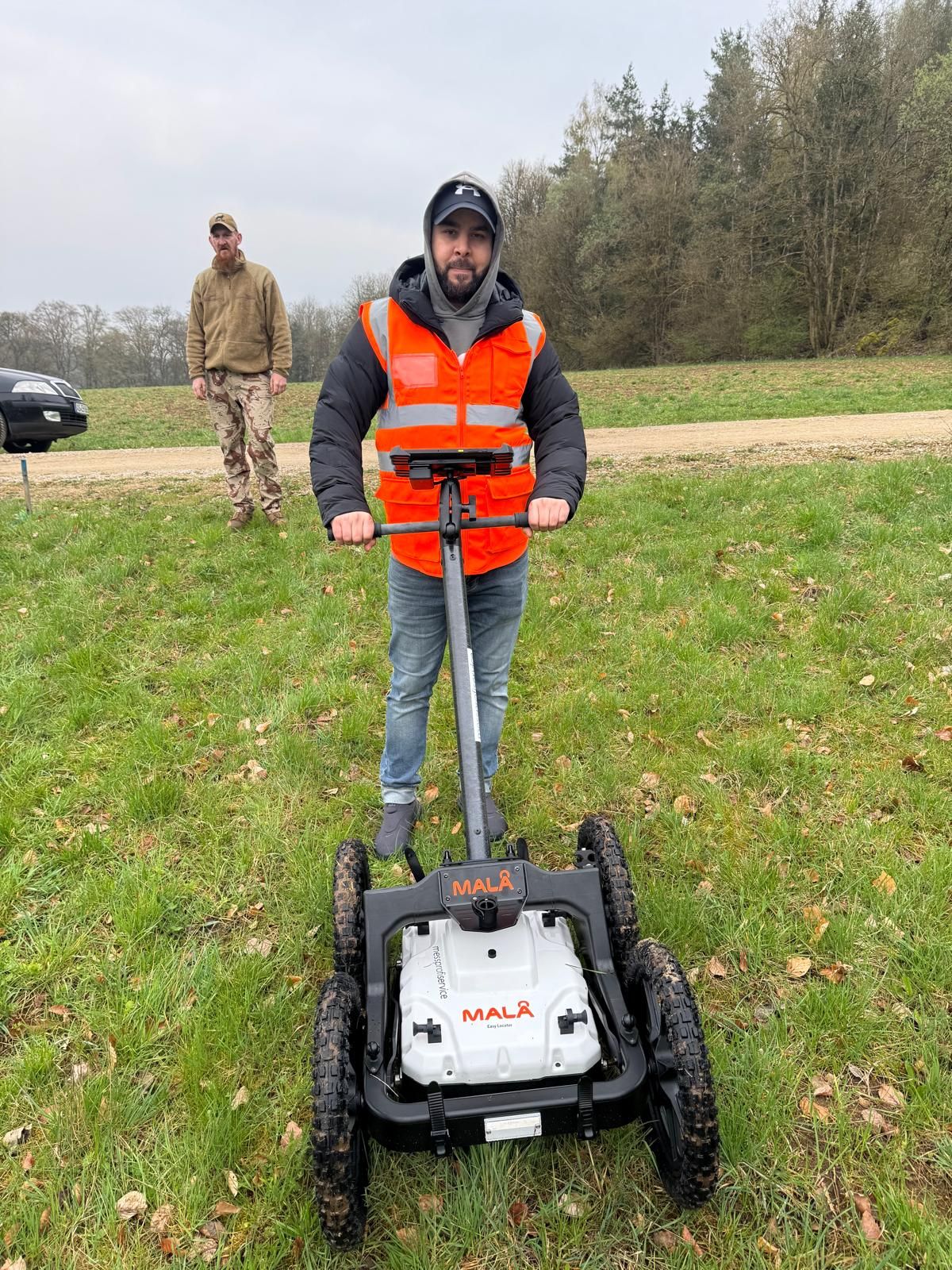
Specialist services, clearance documentation and clear technical terminology help to describe the planning result required. Agree which decision is to be prepared and which documents will then be passed on for further planning.
The service overview helps to identify investigations and other specialist contributions. The concept brings the tasks suitable for the specific project together clearly.
Identify specialist servicesThe planning result feeds into subsequent execution and documentation. Required handovers and technical decisions must remain coordinated.
Fit planning into the project sequenceA precise task description makes it easier to agree the planning scope. The terms help to distinguish the individual contributions.
Read planning terminologyIf the project requires clearance planning, it should be scheduled so necessary preliminary work and coordination can be considered before the affected intervention. This does not establish a fixed general lead time. Available data, scope, responsibilities and construction sequence are decisive.
No. The purpose, suspected situation, planned use and interventions determine the task. The BFR KMR describe planning content for their defined scope. Which requirements are binding for another project and how much detail is needed must be clarified from applicable specifications and the commission.
They may provide important initial information but do not automatically cover all relevant conditions. Intervention depths, ground conditions, utilities, existing installations, earlier investigations, accessibility and construction phases may also be decisive. Initial information gathering checks whether documents are complete and usable for the specific task.
First clarify which decision depends on the missing details. Preliminary work may be needed. If significant gaps remain, uncertainties, provisional assumptions and possible consequences must be clearly presented. Missing knowledge must not be portrayed as an established basis.
No. The clearance objective must be coordinated with the specific use, interventions and knowledge available. Method selection also considers actual site conditions and their limits. Numbers or methods from another project cannot be transferred without professional assessment.
Depending on the task, they may include traceable overview and detailed plans, relevant specialist maps, technical drawings, construction and cost documents, sources and records. Content and scale must support the report's conclusions. All appendices should be clearly named and match the planning status stated.
No. It describes the intended measure and its conditions. Investigations and clearance actually carried out must subsequently be documented and assessed within their respective scope. A clearance conclusion follows those results, the relevant specifications and expressly documented limits.
The change is assessed against the plan's basis and decisions. Other areas, depths or conditions may change clearance requirements and require further coordination. Affected content and plans must be updated traceably before being used for further execution.
In your enquiry, state the current project status and the decision that needs to be prepared next. The available documents help to define the specialist work required.
State whether a concept is to be prepared for the first time or an existing version needs adjustment. Provide the project location, address, land parcel, construction area, contact person and planning decision required. For a revision, both the old and current design revisions are needed. Site plans, sections, route alignment, borehole points, intervention depths and particular foundation or working areas describe the actual construction task.
Describe how the result will be used and who will take it forward. Provide correspondence from authorities, historical assessments, aerial photograph analysis, investigation reports and previous clearance confirmations in full, including appendices. State the desired report and plan formats, recipients and requirements for checks and documentation for handover. This allows the contribution to focus on the next decision and its actual prerequisites.
Identify known gaps and the parties who can provide further information. Link utility, existing-structure and ground investigation documents and known access conditions to the current revision. Construction times, phases, specialist planners involved, conditions imposed and outstanding coordination issues describe the interfaces. Mark the specific question on the plan so that a query can be assigned to the section affected and the intended ground intervention.
Whether historical aerial photograph analysis, explosive ordnance surveying, surface surveying using GPR, magnetometry or TDEM, deep-ground surveys, downhole surveys, excavation supervision, area clearance or ordnance recovery is needed depends on the location, ground disturbance, depth, ground and existing documents. An early ordnance assessment provides clarity for tendering, programming, occupational safety and construction.
FONTANA-EOD combines its Section 7 SprengG licence, specialists holding Section 20 SprengG certificates of competence, suitable survey and clearance methods, and traceable documentation. Send the site plan, depth of ground disturbance, construction phase and existing documents for an initial technical assessment.


