Project pathway
The quickest route to the right decision.

If terms such as ‘survey depth’ or ‘section clearance’ appear in a quotation, they must fit the investigation volume and record described. For clients, planners and site management, what matters is the service agreed and which subsequent ground interventions the result covers. FONTANA-EOD discusses the wording with you using the report, plan appendices and proposed intervention.
Look up meaning and context of use.
Distinguish measurement from assessment.
Assign areas, depths and responsibilities.
For designations such as clearance, clearance depth or suitability for submission to a review body, the task description, area, depth and record required determine the meaning within the project. Ask about the specific scope, assessment system used and underlying documents. BFR KMR serve as technical guidance within their scope. To use an older result, the volume treated at that time is also compared with the current construction plan.
Go directly to the terms: A–D · E–H · I–M · N–R · S–V · W–Z. Clarify project questions about documents and processes using the frequently asked questions about explosive ordnance.
Documented assessment of a defined part of an area. Area, depth, clearance objective and limitations determine its scope. Other sections need their own assessment reference. At handover, the section identifier on the site plan should match that in the associated record; additional working areas are explicitly considered.
Historically delineated area of bomb drops. Available sources and spatial accuracy form part of assessment; the designation alone does not identify an individual unexploded bomb.
Official register of contaminated sites and sites suspected of contamination. Information on soil protection does not replace separate clarification of suspected explosive ordnance.
Number or concentration of anomalous measurement findings relative to an area. It initially describes the data available. Causes of anomalies are assessed by specialists; utilities or other interfering objects may also play a role. Comparing two areas requires the reference area and investigation conditions so that data collected differently can be understood traceably.
Coordination of protective measures and employers involved. In Germany, prerequisites under the Construction Sites Ordinance are related to the specific project. Each employer remains responsible for protective measures for its employees. Working areas, mutual hazards, contacts and reporting routes are agreed for cooperation.
Area serving railway operations. Work must consider its specific use, operational requirements and hazards from railway operations. For work near tracks, railway operational hazards and necessary protection measures are related to the specific worksite.
Structural body of the railway with track superstructure and load-bearing substructure. The specific layers and installations must be established from existing records.
The upper part of the railway, comprising rails and their supporting structure, particularly sleepers and track ballast in ballasted track.
Coordination of work steps, dates and handovers. Explosive ordnance investigations are connected with proposed interventions and results needed.
Category for systematic description or assessment of a finding. The report explains the classification system used and assignment criteria. A measurement data class and confirmed ordnance identification represent different levels of evidence; the legend must show which is meant.
Liability-law concept associated with railway operations. Actual hazards to employees during track work must be assessed separately in occupational safety.
An indication requiring specialist examination of ordnance deployed but not functioning as intended. Suspicion and confirmed identification must be distinguished.
Project-specific depth value for an investigation or clearance. Different assessment scopes may be meant; elevation reference, method and limits must be clarified explicitly. The number is read with the stage actually reached. After filling or excavation, particular attention must be paid to which ground surface an old value refers to.
Analysis of groups of similar or spatially adjacent findings. Grouping describes an analytical result. Causes are assessed using the data and technical context. A results map should allow the group, associated individual findings and assignment criteria to be traced.
Critical infrastructure is particularly important for supply and society. Its failure may have serious consequences; specific legal requirements must be checked separately.
Combining different data sources for joint analysis. Origin, spatial reference and assessment limits remain identifiable. Where sources differ in age, accuracy or coverage, these differences are considered in assessment. A historical indication and a current measurement anomaly each retain their own evidential value.
Long-term measure to limit a hazard, for example through suitable use restrictions. It must be distinguished from removing explosive ordnance and requires specialist planning.
Project-specific designation for review and decision processes envisaged within DB. The specific project documents and tasks and recipients identified in them are decisive. Internal progress is evidenced by the review note or associated decision actually available.
Probability of detecting a defined target under specified investigation conditions. Understanding a value requires the target definition, method and constraints. Ask which assumed object, depth and investigation situation the statement relates to. Transfer to other conditions requires technical justification.
German federal authority with statutory supervisory and approval tasks, including for operational infrastructure of federal railways. Explosive ordnance responsibility is additionally clarified for the site with the responsible state or municipal authorities. The project file assigns respective tasks and associated correspondence separately.
Depth of the proposed construction activity relative to a defined elevation reference. The depth actually investigated or assessed is compared as a separate value. Working volume and lateral extent also belong in the comparison. This matters, for example, when new foundation points are added to an existing area plan.
Specialist assessment of whether an ordnance item can be rendered safe. This decision rests with the responsible authorised specialists and is based on assessment of the specific find. Client and site personnel follow the responsible authorities' instructions and leave the object untouched.
Vibrations in the ground or structures caused by work. Whether and how they matter for a known or possible explosive ordnance hazard requires specialist assessment.
Bomb intended for release from an aircraft. ‘Aerial bomb’ describes the ammunition type; ‘unexploded ordnance’ describes deployed ammunition that did not function as intended. Specialist identification of a find and its further handling rest with the responsible authorised authorities.
Project-specific definition of records and decisions needed before a particular intervention. This includes spatial assessment scope and responsible decision-makers. For the construction sequence, it is recorded which record must be available, who checks it and which next work step the decision concerns.
Fuze that can still initiate. Age, rust or damage do not enable laypersons to assess reliably its function or whether the object is harmless.
In Germany, under Section 5 of the Occupational Safety and Health Act, employers assess work-related hazards and define necessary protective measures. An area-specific explosive ordnance assessment may provide specialist evidence for this. Risk assessment concerns employees' actual activities, equipment and working conditions.
Representation for systematic assessment of hazards using defined criteria. The relationship between initial data, criteria and assessment must be traceable. For the project decision, it matters which specific hazard is considered and which protective or follow-up measure was derived.
Geophysical method using transmitted electromagnetic waves and their reflections. Investigation conditions and interpretation determine the assessment. Data is interpreted in relation to measurement setup, ground conditions and investigation objective; confirmed object identification is a separate evidential step.
Signalling information on whether a track section is clear or occupied by vehicles. Authorisation for construction work and the specialist assessment of an explosive ordnance investigation volume are each issued and documented separately. During construction preparation, these different authorisations are assigned to the responsible authorities and proposed work step.
Load-bearing area beneath the track superstructure. Its actual composition is established for the site from existing records and necessary investigations. In ballasted track, ballast belongs to the superstructure; underlying layers and installations are described in the respective plan so that the volume considered for investigation remains unambiguous.
Specialist examination of historical aerial photographs for relevant traces and uses. Date, coverage and interpretation limits form part of the assessment. Alongside visible bomb craters, historical traces relevant to the specific question are considered. Transfer to today's site plan requires a traceable spatial reference.
Investigation for possible voids, for example using suitable geophysical methods. The report distinguishes an indication of a void from an assessment of explosive ordnance contamination. The cause of an anomaly and further clarification needed follow from specialist assessment.
Civil engineering along or near existing transport and utility infrastructure. Existing facilities and proposed ground interventions must be considered in investigation planning.
Term for an initiating ignition event. It describes a technical relationship. A suspicious object is assessed by the responsible authorised authorities; site personnel follow safe behaviour rules for a possible find.
Specialist assignment of identified ordnance to a type or design. Interpretation of a measurement signal and identification of an object are described as different evidential steps in the report. It must show which finding is actually supported.
Deliberate explosion as part of professionally planned measures by authorised bodies. Procedure and protective measures require assessment of the specific case.
A coordinate reference system defines the spatial basis for coordinates. Unambiguous transfer of a find location or investigation area therefore includes both the numerical pair and system used. Where horizontal and elevation information are separate, both references are identified. Before data is combined, it is checked whether the references used correspond.
Project-specific investigation of an elongated planning area, such as a route. The task must define which areas, sources and interventions are considered.
Measure of the accuracy of a location. It depends on factors including recording and reference used and forms part of data quality assessment.
Planned arrangement of measurement lines. Spacing and orientation form part of the investigation concept and are justified by objective, method and local conditions. The execution record also shows which lines were actually recorded and where work was restricted. Planned grid and achieved coverage thus remain distinguishable.
Instrument for measuring the magnetic field. Magnetic anomalies may arise from different magnetically responsive objects and local influences. Assessment considers possible causes, measurement conditions and investigation objective together. An anomalous signal is therefore initially documented as a measurement finding; further specialist clarification determines its evidential value.
Ground-penetrating radar system with several measurement channels. Suitability for the task follows from the overall system, measurement geometry and site conditions. The assessment achievable and volume investigated are described for the specific project. Channel count is an equipment specification considered together with the other investigation conditions.
Number of spatially assigned measurements relative to an area or distance. It is assessed alongside measurement geometry and investigation objective. A results map also needs the spatial distribution of values and remaining measurement gaps. A high number of measurements in one area does not establish complete coverage of the rest of the construction site.
Designation for an individual ammunition object in its recording context. Size or quantity do not permit a blanket assessment of danger.
Suitability of documented results to support a defined assessment traceably. It depends on task, data, evaluation and disclosed limits. The recipient must be able to locate the investigated volume on the plan and trace the relationship between execution and conclusion. Missing appendices or unclear depth references are clarified before further use.
Investigation without intervention in the ground considered. The project decision also needs the investigation objective, volume actually covered, assessment achievable and measurement limits. ‘Non-invasive’ describes how the investigation is performed; specialist assessment of the result remains related to the documented task and local conditions.
Assessment of a surface with an explicitly described scope. Later excavation, drilling or another deep intervention requires a separate comparison with the volume investigated and assessed. Area, depth, task and limitations of the existing record determine whether it can be used for the new construction activity.
Assignment of findings or objects to explained categories. Classification of measurement data must be distinguished from confirmed identification of an uncovered object.
Coordination of agreed project tasks, for example organisation, dates and costs. Specific authority follows from the commission and project organisation. Decisions, specialist support and information transfer are assigned traceably for cooperation. Statutory responsibilities remain with the designated authorities.
Project-specific designation for documents suitable for review. Requirements meant are clarified with the proposed recipient and review purpose. Suitability for submission and recognition already granted are different stages. A review note or decision is identified with its actual content and date.
Justified planning of the objective, methods and sequence of clearance. Clearance objective, site conditions, limitations and interfaces belong together.
Shape and arrangement of reflected signals in ground-penetrating radar data. Interpretation considers measurement setup and ground conditions. A described pattern is initially a property of measurement data. An assessment of possible cause or object type uses further specialist evidence and interpretation limits.
Distance specified within a defined protective concept. The relevant case, hazard considered and determination by responsible authorities form part of the statement. For an unknown suspicious object, keep your distance, notify the police and follow their instructions.
Depth to which an investigation assessment relates. It depends on task, method and conditions. A depth value includes reference level, spatial limits and documented restrictions. For the next ground intervention, this assessment is compared with the proposed intervention depth; general equipment range is a different technical specification.
Coordination of proposed work with operational closure periods. The time window considers necessary railway protection measures, specialist preparation of the ground intervention and handovers needed. Operational availability of a track and specialist investigation status are each documented with their actual scope.
Activity-specific personal competency under German explosives legislation. The certificate of competency under Section 20 SprengG and permit under Section 7 concern different legal requirements. Documents assign the holder, activity scope and relevant authorisations to the proposed commission. Respective statutory responsibility remains separately identifiable.
Property of an ordnance item in its specific condition requiring specialist assessment. The responsible authorised specialists make the assessment needed. Site personnel do not use photographs, size or external condition to decide for themselves whether to move or remove an item.
Spatially defined course of proposed or existing linear infrastructure. Explosive ordnance assessment rests on site-specific evidence within this volume. Alignment, working strip, crossings and additional working areas are assigned on the site plan so that the investigation scope considered remains clear.
In Germany, employers must provide sufficient and appropriate workplace- and task-specific instruction. Content and delivery follow actual hazards and activities; instruction is adapted and repeated where necessary. Employees are informed of workplace contacts and reporting routes for their task.
Compliance with accident prevention regulations applicable in Germany to the respective companies and insured persons. Such a statement relates to specific activities and requirements. For coordination, it must be clear which regulation is implemented by which measure or record.
German explosives legislation defines ‘Verbringen’ in Section 3 SprengG as relocation of substances and objects outside a place of business. This includes the activities specified there within its scope and between Germany and other EU Member States. For a specific removal, the activity, substances or objects concerned and responsible authorised authorities are clarified. ‘Beförderung’ is a separately regulated term.
Classification of a suspected hazard under an explained assessment system. The category must be read with the underlying evidence and its scope.
A further find within a context already considered. Its significance for the evidence available and further measures requires specialist assessment.
Distance specified for a particular effect considered. The type of effect and environmental influences form part of assessment for the respective case. A value for a particular effect is therefore read in its technical context. The responsible authorised authorities determine arrangements for a specific find.
Technical mechanism by which ammunition can be initiated. You must not carry out your own functional tests on a suspicious object.
Overview of roles, tasks and decision routes. Actual statutory and contractual responsibilities must be represented correctly.
The commission scope describes the specialist task, investigation volume and record required together. Project parties should use the same terms when entering historical evidence, a measurement signal or a confirmed find in plans and reports. Each designation identifies the level of evidence and the decision it is intended to support.
Suspicion describes an initial situation requiring specialist clarification. A suspected area assigns it spatially. A report must show the basis of the assessment and the area concerned. A technical anomaly and confirmed explosive ordnance find describe other levels of evidence.
Assess suspicion in relation to the projectSurveying means technical investigation, for example using suitable geophysical methods. Investigation objective, volume and conditions are added in the commission. When reading results, what matters is which parts were actually investigated and which measurement limits exist. An area identified as technically restricted is passed on with its own specialist follow-up needs.
Distinguish survey tasksClearance and recovery belong within the specialist context of explosive ordnance disposal. A tender defines each scope specifically. Investigation, handling ordnance, ordinary earth excavation and removal are assigned as different tasks to the respective authorised contractors. The construction sequence considers necessary specialist decisions and handovers.
Distinguish clearance and recovery technicallyFor a clearance statement, the described assessment scope is decisive: area, depth, task and limitations. Documentation makes this information traceable. An operational permit to work, contractual acceptance and specialist final report may concern different processes. Their designations are therefore read in the context of the respective document.
Read evidence and its limitsEOD means Explosive Ordnance Disposal and refers internationally to professional ordnance disposal. UXO stands for Unexploded Ordnance: ammunition prepared for use or already deployed that has not functioned. The IMAS terms belong to the international mine action context. In German project documents, the task, service scope and statutory authorisations are clarified using the applicable framework here. The English term in full and associated service specification should be available together.
Translate EOD requirements into specialist tasksKBD, KMBD and KRD are used regionally for explosive ordnance authorities or corresponding services. The exact designation and task depend on the location and authority identified. For a query, provide the project location, case and existing correspondence with the full sender. This allows the responsible authority, any private specialist company involved and their respective tasks to be assigned unambiguously.
Assign authority and private tasksBFR KMR stands for Baufachliche Richtlinien Kampfmittelräumung; DGUV for Deutsche Gesetzliche Unfallversicherung, the German Social Accident Insurance. A reference is read together with the specific document and its scope. DGUV information, a DGUV rule and an accident prevention regulation have different functions and legal significance. For the project, the requirement concerned is connected with the measure actually performed or record required.
Read regulatory terms in contextExcavation supervision connects the specific intervention with the suitable technical investigation required and qualified execution. Technical surveying and its specialist assessment are described in the service scope; visual observation of excavation alone must be distinguished from this. The enquiry identifies construction stage, affected ground volume, unresolved question and desired record. Areas accessible only as construction progresses need investigation aligned with that stage.
Describe the service during constructionThe meaning of a term is checked against the upcoming decision. This keeps measurement findings, assessment and construction activity distinguishable.
First check the report context: does it describe an anomalous signal or confirmed identification? Utilities, interfering objects and ground composition may matter for interpretation. The next specialist measure follows from assessment of the finding. The plan records the level of evidence actually supported.
Before additional foundations, investigation volume and planned depth are compared. An identical area outline is insufficient. The record must identify the volume concerned and its limitations. Any further investigation needed is defined before the result is used.
For a final report, site plan, limitations and unresolved zones are read together. Remaining questions form part of the decision for the next construction section. For transfer, record which assessment is evidenced and which documents or specialist clarifications are still needed.
For a query, an individual word and number are often insufficient. Include the relevant location on the plan, elevation reference and associated legend. Specialist assessment must identify the specific conclusion needed for the project.
A location needs its spatial reference. Point lists are therefore passed on with the coordinate reference system and elevation reference used. A numerical pair or depth value without this context may be understood differently by different parties.
Designations such as finding class or suspicion classification are read with the assessment system used. Colours and abbreviations are assigned using the legend of the available report. What matters is how it defines the category and what consequence it derives. If the representation differs from an earlier project file, assignment is clarified before joint use.
A clearance objective or investigation concept initially describes a task. The execution report documents the stage reached. At handover, it remains clear whether a statement describes a planned measure, actual result or outstanding follow-up need.
For an unfamiliar word, first clarify what the assessment in the document means and why it is needed for the project. Additional investigation needs follow from the specialist question about the ground and available evidence.

Where a report contains a historical assessment of suspected ordnance, the period considered, sources and spatial assignment are read alongside it. The question is what evidence this assessment provides for the project. A new construction design may also require a different boundary for the volume considered.

For a drilling or foundation point, proposed intervention depth and documented investigation volume are compared. Elevation reference and lateral limits form part of this. Terms such as survey depth or borehole clearance statement are read with their actual assessment scope before another work step is derived.

An excavation supervision quotation should show which specialist task is performed at which construction stages. Accessibility, technical conditions and the documentation objective form part of coordination. The service name alone does not answer how an area accessible only later can be investigated technically.
The same words may be used in different project settings. Construction activity and the volume considered remain decisive for specialist assessment.

A route designation is supplemented by its specific alignment and associated working areas. For a section handover, identifiers used are connected with the site plan and construction sequence. This keeps clear which part has already been considered and where an assessment is still missing.
Connect route terms with the working volumeOn sites with existing infrastructure, information about measurement limits is read together with the facilities present. Limited interpretability initially describes the investigation situation. Further specialist needs are derived for the affected zone rather than transferred without review to the whole project.
Understand existing structures and investigation conditionsAn area-specific report may address a different task from a later deep individual point. Identify each intervention and plan version. Correct terminology makes these differences visible and supports a targeted enquiry about additional work.
Distinguish area and point tasksThe query begins with the original document and ends with a specific decision for the project.
Submit the unclear wording with its paragraph and document title. State which decision depends on it and your project phase.
Commission, site plan, appendices and plan version are considered together. This clarifies whether the report already defines the term more precisely or limits it spatially.
A historical assessment is read with the sources available and volume considered. If evidence is missing, research or aerial photograph assessment needs are determined by the specific question.
An unresolved investigation need is connected with area, depth and local conditions. This informs specialist selection of suitable surveying or work during construction.
If document comparison identifies additional investigation needs, the commissioned investigation is performed in the agreed areas. Measurement data, findings and limitations are recorded with location, depth and plan references. Execution remains related to the specialist question and agreed scope.
The completed investigation is documented and assessed. Measurement findings, confirmed findings and unresolved questions receive understandable designations that correspond in report and plan.
The explanation includes the exact passage, associated plan area and specialist assessment. If a result comes from an additional investigation, its own service scope is shown; the original report is retained as the previous record. Recipients receive the appendices needed for their decision.
The clarification is passed on with its spatial scope. For a later design change, it is checked whether the previous assessment still fits the proposed intervention.
For the query, select the document containing the relevant assessment and identify the decision that depends on it.
Assign service terms to the proposed ground volume and record needed. Compare tasks described rather than treating identical headings alone as an identical scope.
Compare service terms with the commissionCheck the assessment together with appendices and the new plan version. Identify which area, depth or construction activity has changed from the original task.
Understand the scope of existing recordsState the project location, issuing authority and specific case. Abbreviations are assigned using the actual correspondence; its full content remains available for coordination.
Identify the region and existing caseFONTANA-EOD can agree with you the meaning in its project context and the specialist service needed. Send the complete passage and a description of the proposed intervention.
Clarify wording with project documentsA coherent project file connects terms with their technical basis. Commission, investigation and result show what an assessment rests on and what it can be used for. At handover, document titles, dates, associated plan appendices and unresolved work status remain available together.
Task description, historical documents and existing official information are assigned to the plot, construction site or route section. The site plan shows the volume considered. This already clarifies which question was to be addressed and which plan version was relevant.
Survey results and assessment of findings are considered together. Documentation identifies method, spatial assignment and limitations. Technical terms in a results table are read with its legend and associated report.
Final documents describe the stage actually reached. A clearance record is used in the context of the task performed. For site management and the project file, unresolved areas and implications for the next intervention remain traceable.
Do you want to understand the assessment scope of particular wording for your project? Submit the full report with appendices and the proposed intervention. State area, depth and the outstanding decision. A terminology question can thus be connected with actual records and their assessment limits.
Discuss records and the proposed interventionFor a specific activity, requirements are clarified using the task, project location and relevant framework. The Explosives Act, 1. SprengV and DGUV documents mentioned relate to Germany. For a project in Luxembourg, requirements and responsible authorities applicable there are clarified for the site.
The German Explosives Act distinguishes, among other things, the permit under Section 7, responsible persons and the certificate of competency under Section 20. The 1. SprengV contains supplementary provisions, such as specialist knowledge and state-recognised courses. In quotations, these terms are connected with the actual activity scope. It remains clear which company and responsible person are intended to undertake the task concerned.
In Germany, risk assessment considers work-related hazards and necessary protective measures. DGUV Information 201-027 concerns explosive ordnance clearance. DGUV Rule 113-003 addresses dismantling or destroying explosives or corresponding objects, including disposal of found ordnance. Its scope remains decisive when using the terms; tasks are agreed in relation to the proposed activity and those responsible for it.
BFR KMR provide a specialist approach within their scope on federal properties. Official correspondence is read according to project location, case and specific statement. Responsible authorities must be involved in find and hazard response questions. A private report and official decision are identified accordingly in the project file.
At handover, recipients receive the information needed to assign the report to the correct commission, plan version and proposed intervention.
The term is clearly connected with a described commission.
The area, section or point can be located on the associated plan.
Depth and reference level are understandable for the proposed intervention.
Suspicion, measurement findings and confirmed findings are distinguished.
Limitations are connected with the assessment concerned.
The purpose for which the result is to be used remains clear.
For project clarification, location, responsibility and existing documents matter together.

State the address, municipality and, where applicable, plot reference. Include the correspondence whose terms you wish to clarify. The question can then build on the actual status rather than inferring responsibility solely from an abbreviation.
Assign the project location and regional designations
Mark the affected area on the current site plan and submit the full text context. Describe whether you want to prepare a tender, use a report or have a changed intervention assessed.
Submit the unclear assessment with a site planA historical assessment needs the sources from that time and their spatial coverage. Use of an investigation result additionally needs the execution report and plan appendices. A new construction activity is compared with both levels of evidence.
A historical assessment is read with its source, spatial coverage and specialist evaluation. This is particularly important when a suspected area is to be transferred to a current plan.
Understand historical assessments in planning documents
Site plan and report together show which volume an assessment relates to. The term in the title is defined more specifically by the description of the task performed and its limitations.
Connect report terms with records
Selection of a specialist service begins with the question about the ground and proposed intervention. The quotation describes the specific task, affected ground volume and record needed. Existing investigations are identified with their actual scope so that additional needs can be defined precisely.
Distinguish specialist services by task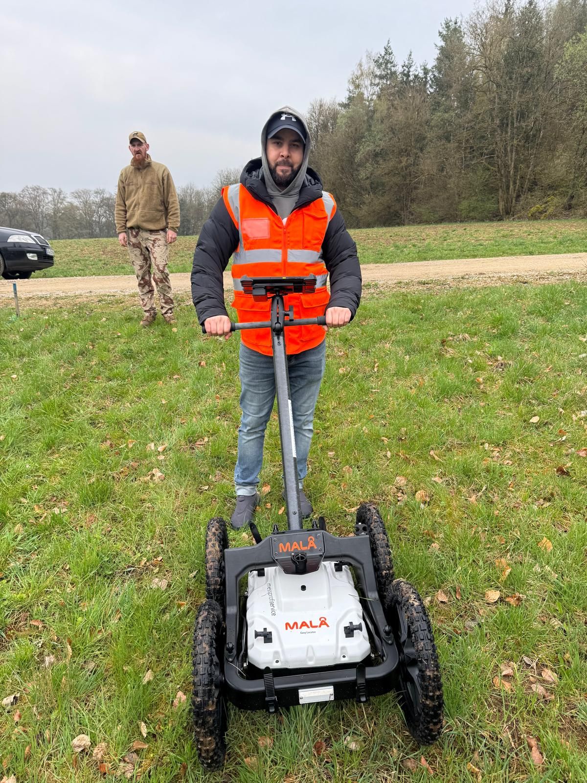

Place the assessment concerned in its technical context and compare the record with the proposed construction activity. Identify the passage and outstanding decision for specialist coordination.
Technical terms are connected with their meaning in planning, investigation and use of results. For a query, check whether it concerns historical evidence, technical measurement or an assessment for a further ground intervention. Include the full text context and associated plan.
Explore further technical backgroundCommission, completed investigation and result are considered together with the proposed intervention. Identify the record needed, responsibilities and desired handover. For a changed design, the affected areas and depths are compared with the previous work status.
Read assessment and documentation togetherSend the passage concerned with appendices and the current plan version. Describe the next intervention. A specific question enables targeted specialist coordination.
Discuss the specialist question with documentsFor a sound query, the wording, proposed intervention and full document context are considered together.
As soon as commissioning, a planning decision or ground intervention depends on it. Submit the full passage with the commission and site plan. Its meaning in the specific document can then be clarified before it becomes the basis for further work.
An anomaly initially describes an unusual measurement. Specialist assessment considers investigation method, conditions and possible causes. A confirmed find is a different level of evidence. What the available report actually established is decisive.
The two values are compared with elevation reference, investigation volume and assessment limits. A depth number alone is insufficient. Describe the proposed intervention and have the volume actually covered by the existing record checked.
The full report with appendices, original commission and current intervention plan help. Identify the assessment needed and known changes. Area, depth, task and limitations determine the meaning of the wording.
The abbreviation belongs in its regional administrative context. The specific task is clarified using project location, case and existing correspondence. A private specialist service and an official decision are considered separately.
It depends on document scope, condition of appendices and unresolved project question. An understandable passage may be assessed directly; a question about reuse of results may require more extensive comparison of plans and reports.
Stop work, do not touch or move the object and keep your distance. Notify the police on 110 in Germany, 113 in Luxembourg, and follow their instructions. The object is assessed by the responsible authorised authorities. Do not attempt your own identification or handling based on a definition or photograph.
The enquiry should identify both the passage and its significance for the project.
Submit the document title, date, full paragraph and associated appendices. Include existing aerial photograph assessment, survey reports and known authority conditions. State explicitly if parts of the documents are missing.
State the address or region, plot and construction site. Mark the route, borehole points and additional working areas on the site plan. Describe intervention depth, construction method, existing utilities and known limitations insofar as defined.
Describe whether the question concerns tendering, an upcoming intervention or use of older results. State construction dates and current changes. Specialist clarification can then be aligned with the assessment actually needed.
Whether historical aerial photograph analysis, explosive ordnance surveying, surface surveying using GPR, magnetometry or TDEM, deep-ground surveys, downhole surveys, excavation supervision, area clearance or ordnance recovery is needed depends on the location, ground disturbance, depth, ground and existing documents. An early ordnance assessment provides clarity for tendering, programming, occupational safety and construction.
FONTANA-EOD combines its Section 7 SprengG licence, specialists holding Section 20 SprengG certificates of competence, suitable survey and clearance methods, and traceable documentation. Send the site plan, depth of ground disturbance, construction phase and existing documents for an initial technical assessment.


