Project pathway
The quickest route to the right decision.
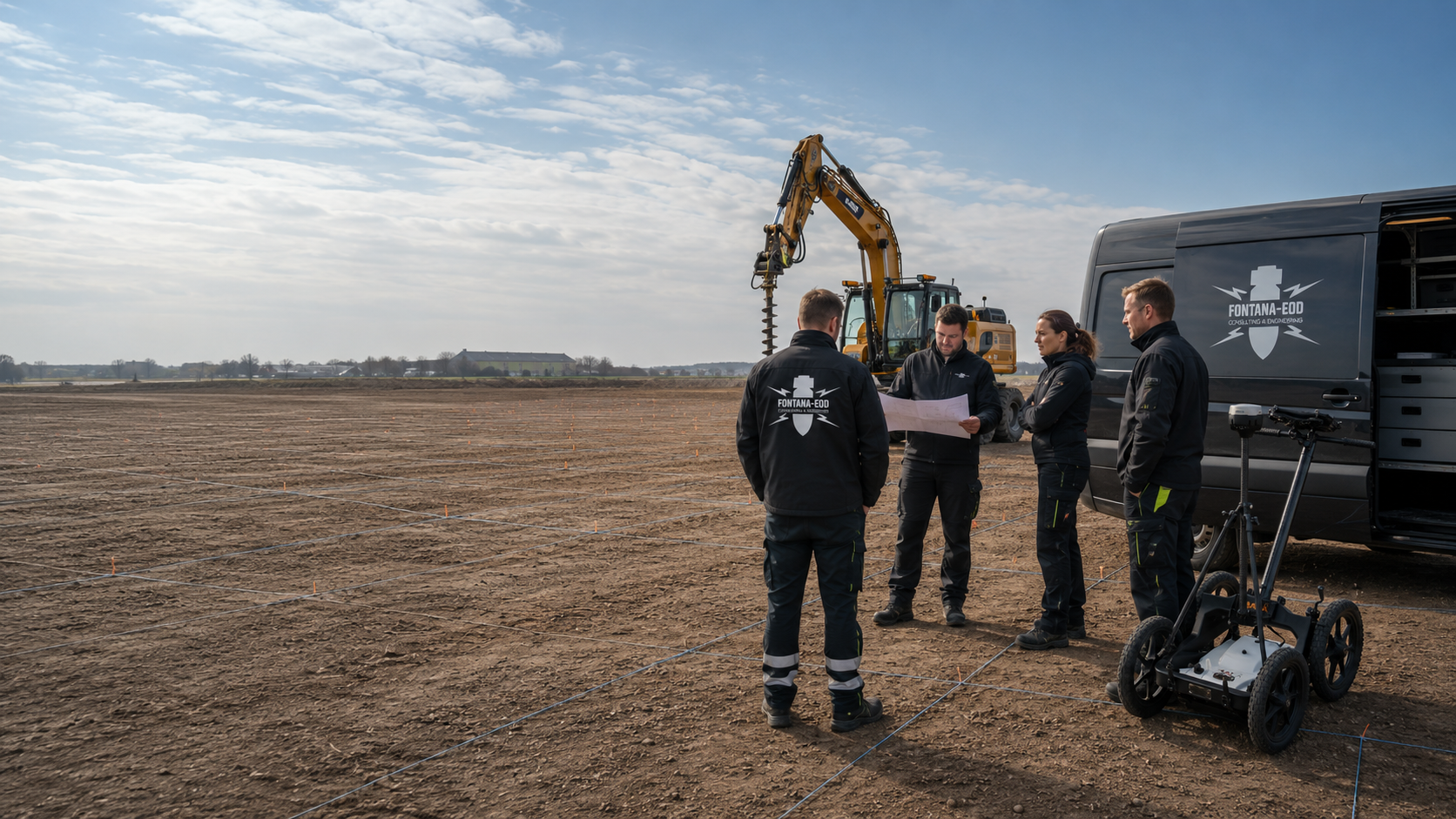
Suspected ordnance calls for technical responsibility and clear decisions. FONTANA-EOD Consulting & Engineering GmbH brings together qualified personnel, suitable survey technology and traceable documentation. We help clients, design offices and contractors check existing indications before groundworks and establish the required survey scope.
Company licence and individual competence.
Clarify tasks and responsibilities.
Document results and limitations.
FONTANA-EOD specialises in explosive ordnance surveys, clearance and specialist support for ground interventions. From our offices in Gersheim in Saarland and Wesseling in North Rhine-Westphalia, we handle enquiries across Germany. Our focus is on building, civil engineering and infrastructure projects where the survey scope, execution and supporting records must fit together reliably.
The company licence, individual competence and knowledge of the methods must be appropriate to the commissioned activities. The following documents address these different requirements.
For Oliver Fontana, company management and project management, the available training records include:
These records relate to the individual concerned and the training content described. They are not a blanket authorisation for every method or construction project. We provide documents relevant to the specific assignment on request.
FONTANA-EOD holds a licence under § 7 of the German Explosives Act for the ordnance clearance activities specified in it. Individual certificates of competence under § 20 of the German Explosives Act demonstrate the corresponding authorisation of responsible specialists. The specific scope of activity, restrictions and validity of the documents remain decisive.
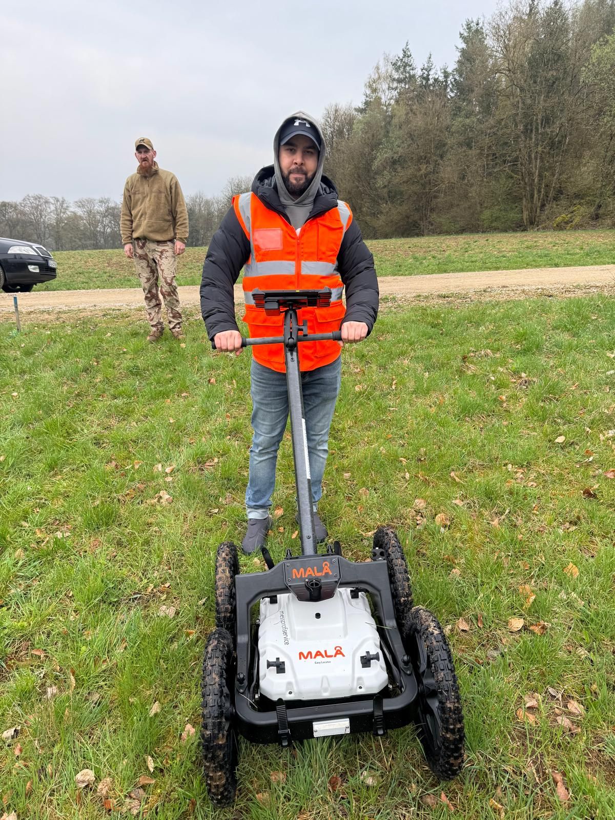
Our qualifications also include documented training in Ground-penetrating radar, including MALÅ and IDS systems. This covers use of the technology and work with survey data. These individual training records supplement specialist competence; they do not replace a project-specific check of a method’s suitability.
During procurement and project preparation, we provide the documents required for the assignment in a targeted way. This allows qualifications, the proposed task and the area of responsibility to be checked against one another before work begins.
The task, qualifications and required authorisations are brought together for the project.
The area, depth and planned interventions provide the reference for the work.
Ground conditions, objectives, interference sources and accessibility determine the choice of method.
Contacts, reporting channels and coordination arrangements are established before work begins.
Measurements and findings are assigned to the area actually surveyed.
The limits of the work and matters still requiring clarification form part of the documentation.
An agreed assignment connects the technical question with the conditions on site.
Before the first field survey, we review the available documents, planned ground interventions and conditions on site. With the client, we establish which services are needed and who undertakes each task. If the plans or survey conditions change, we record this in the documents and identify outstanding questions.
Reports and information are compared with the spaces affected by the planned works. This may show that a record covers only part of an area or certain depths. These differences are made explicit in the task definition. Further work is guided by the conclusion still required.
The ground structure, services, reinforcement, foundations and other interference sources can influence the choice of method. Indicate which areas are accessible and when the construction conditions are expected to change. A technical suitability check takes these conditions into account rather than defining the service solely by an instrument’s name.
Before work is carried out, it should be clear who needs the report and which decision it is intended to support. References to the area, depth and plans are documented traceably. Unresolved areas receive a specific description. This allows people who were not present during the survey to understand the state of knowledge too.
The technical choice depends on the knowledge required, the intervention and the actual conditions.
If the basis for suspicion is not yet available in a comprehensible form, available historical documents and information are assigned to the project. Any necessary aerial photograph assessment is given a defined survey area. Its result supports further decisions and remains distinct from a technical field survey.
Drilling points, piles and other deep interventions are described by location and design depth. Existing surveys are checked against them. Accessibility and obstacles form part of preparation. This gives a suitable deep-ground survey a traceable space to examine and a defined result objective.
Mixed interventions or changing construction conditions may require a combination of services. Describe the accessible areas and the planned sequence. The technical choice takes existing structures and the methods’ limitations into account. A later work step is not fixed prematurely.
The individual steps depend on the project and the documents available for it.
State the location, intervention and next decision. The reason for the enquiry determines which technical question needs to be clarified first.
Existing reports, plans and information are assigned to the current project. Missing information remains identifiable as specific outstanding points.
The survey space, method and expected result are defined. Access, construction conditions and interfaces are included in preparation.
Tasks, contacts and document handovers are coordinated. The required qualifications relate to the activities actually assigned.
The measures carried out and their results are assigned to the space affected by the works. Changed conditions and technical limitations remain traceable.
The report and annexes form the basis for further coordination. Outstanding questions are specifically identified for the next design or construction phase.
Different starting situations require different priorities in preparation.
Describe the intended use and foreseeable interventions. Existing documents help define the technical matters to clarify before a particular method is selected.
The survey objective and spatial scope should be clear to bidders. Identify the required results, constraints and planned handovers.
An existing report is checked against the current construction plans. Its limitations and unresolved areas are related to the next decision.
Send the site plan, details of the intervention and the timeframe. Identify the parties involved and the question that requires technical coordination.
The documentation connects the agreed assignment with the work actually performed.
The site plan, construction geometry and existing information provide the survey reference. The state of the work and known limitations are documented so that they can be understood later. Changes to the plans remain identifiable.
Survey data, detection results and assessments of findings are assigned to the spaces examined. Where clearance is part of the assignment, the relevant reports and clearance records are included. Each result is handed over with its specific scope of conclusions.
Unsurveyed areas, technical limitations and necessary follow-up measures are identified. The next decision can therefore build on the actual state of knowledge. The report and annexes remain available together.
No particular instrument needs to have been selected for the initial discussion. What matters is the conclusion your project needs and the documents on which further work can be based.
Describe the decision ahead: does the basis for suspicion need to be assessed, an area surveyed or an existing report understood for the next intervention? This question connects planning with the result that will be needed later. It helps define the technical scope of an assignment more precisely.
A land parcel, a service route and an individual drilling point have different geometries. State the area, depth and reference level where known. Working strips, retaining structures and ancillary areas may also be relevant. A clear spatial representation helps relate existing knowledge and unresolved survey questions to the right place.
Existing information and reports are needed together with their plans and annexes. Identify the version of the construction plans and known changes. This makes it clear whether an earlier survey covered the same space. Incomplete documents are identified as an outstanding task rather than silently assumed to be complete.
The project location, site plan, nature and depth of the proposed interventions, existing ordnance documents and your timeframe help us make an initial assessment. We agree with you what information is still needed and how the work can be prepared.
FONTANA-EOD Consulting & Engineering GmbH
Am Kaninchenberg 5
66453 Gersheim
Our registered office in Saarland is a starting point for coordinating our projects. We agree the specific work location and the required capacity for each assignment.
FONTANA-EOD
Bonner Straße 72
50389 Wesseling
The office in the Rhineland complements our presence for projects in North Rhine-Westphalia and beyond. Use our central contact for your enquiry; we assign it to the appropriate project area. For local preparation, you will find further information on projects in North Rhine-Westphalia.
Would you like to check qualifications, agree a service or understand existing documents? Contact us with your specific project question.
Those involved need a clear connection between their task, the information available and the next decision.
As a private specialist company, we work within our licences and the agreed assignment. Responsibilities for managing danger and decisions by the competent authorities are considered for each project. Neither an instrument’s name nor an individual measurement can provide a blanket assurance that an area is free of ordnance.
FONTANA-EOD carries out the agreed specialist assignment within the applicable conditions. The survey space, method and result objective are agreed. The documentation describes the work actually carried out and clearly records technical limitations and further matters requiring clarification.
Project managers assemble the reason for the works, the intended use and the available land documents. Necessary access and collaboration with other parties are prepared. A clear task description helps place the specialist assignment within the overall plans.
Designers connect the construction geometry with the technical requirements. They need traceable information for tendering, scheduling and further coordination. Changes to alignments, depths or construction methods are identified in the documents and communicated to the affected parties.
The works require an up-to-date understanding of the spaces they will affect. Contacts, handovers and the handling of changed conditions are agreed. Survey results must be compared with the actual groundworks ahead so that unresolved areas remain identifiable.
The responsible KBD or regional specialist authority is identified according to the location and case. Existing information and requirements are read in their specific context. The private technical work and the duties of the responsible authorities are coordinated for each project.
A project may involve different public authorities. Existing letters and decisions form part of the project’s basis. A specialist survey answers the subject of its assignment; further decisions are obtained from the bodies responsible for them.
Requirements are matched to the activities actually assigned and the intended responsibility.
The German Explosives Act distinguishes between the company licence, individual competence and responsibility. The First Ordinance to the Explosives Act (1. SprengV) includes requirements for specialist knowledge and recognised courses. The specific scope of activity and the supporting documents appropriate to it are decisive in project preparation.
A risk assessment relates to the specific work and its conditions. DGUV Information 201-027 supports occupational safety in ordnance clearance. DGUV Regel 113-003 concerns dismantling or destroying explosives or corresponding objects, including disposal of discovered munitions. Its relevance to the activity is taken into account accordingly.
The BFR KMR are treated as technical guidance within their scope of application. Authority requirements and interfaces with the KBD are assigned to the individual project. If possible ordnance is found, notify the police immediately on 110; further action to manage the danger is taken by the responsible authorities.
Information about our existing offices is provided in the contact section of this page. The specific location of your project matters for technical preparation.
Existing information and official letters are connected with the project location. State the parcel, site plan and existing contacts. The specialist assignment relates to this case; local requirements remain identifiable.
For distributed sites or route sections, documents and interventions are assigned to the relevant area. Common coordination can be combined while differences in progress remain visible. Dates and specific working conditions are discussed for each assignment.
The specific survey remains tied to the individual intervention. A clear description of the project setting helps when making an enquiry.

Buildings, excavations, retaining structures and foundations are considered with the spaces actually affected by their works. Existing results must be checked against the planned depths and ancillary areas.
Define the construction and foundation taskEarthworks can affect different areas and construction stages. State the intervention depth, planned sequence and existing surveys so that outstanding tasks become clear.
Describe the civil engineering task technicallyRoutes, shafts and crossings need a clear reference to location and depth. Changing existing conditions are described by section and taken into account when selecting the method.
Locate service corridors and crossingsInterventions near tracks are described with the construction conditions, access and spaces affected by the planned works. The technical survey is coordinated with the project-specific organisational requirements.
Define railway-related survey tasksTechnical installations and ongoing operations can affect access and survey conditions. Describe existing structures, dismantling and planned groundworks as a connected task.
Prepare industrial and commercial projectsRoads, public buildings and utility facilities often combine several construction sections. Existing documents and responsibilities are assigned to the individual interventions.
Structure municipal interventions technicallySurvey points and planned exploratory works need their own spatial reference. Describe the proposed activities and existing knowledge so that the ordnance question can be coordinated with the other specialist tasks.
Locate exploratory works and environmental projectsFor technically and organisationally demanding installations, the spaces affected by the works, operating conditions and handovers are described precisely. The survey task remains connected to the planned construction activity.
Prepare infrastructure tasks traceablyThe further sections explain what information is needed to work together.

Historical knowledge and existing information are related to the space affected by the planned works. A clear starting basis makes it easier to choose the next technical measure.
Understand the historical starting information
The choice of service depends on the knowledge sought and conditions on site. The instrument’s designation, measurability and spatial scope of the assignment are considered together from a technical perspective.
Compare the task with the appropriate service
The report, plan and assessment should describe the space examined clearly. Unresolved areas remain identifiable so that other parties can build on the documented state of knowledge.
Understand results and handovers
These sections lead from company information to a specific project question.
Compare the technical tasks with your planned intervention. The services overview helps with the initial assessment of a specific enquiry.
Choose the service appropriate to the projectDocuments, work and reporting are related to one another. The process section explains the key handovers for planning and construction.
Agree the collaboration and supporting records
Send the location, planned intervention and existing documents. The specific question and next decision provide the starting point for coordination.
Discuss your project with FONTANA-EODThe answers help you prepare a specific project enquiry.
As soon as planned ground interventions and an unresolved ordnance question can be identified, the available documents can be assembled for technical coordination. An early enquiry helps relate the survey requirements, the space affected by the works and the project programme.
The project location, site plan, nature and depth of the interventions, existing ordnance documents and timeframe are helpful. Also identify the next decision and the contacts already involved.
The choice of method depends on the survey objective, ground conditions, existing structures and services, and accessibility. Different spaces affected by the works or construction stages may require an adapted approach or work in separate sections.
The company licence, individual competence and required knowledge of the methods are considered for the commissioned activity. The specific scope, any restrictions and the validity of the documents provided are decisive.
FONTANA-EOD carries out the agreed private specialist assignment. Authority requirements and responsibilities are considered for each project. Decisions on managing the danger are made by the responsible authorities.
The documentation describes the assignment, the space examined, the work performed and the result. Technical limitations and matters still requiring clarification remain identifiable. The precise scope is agreed in relation to the task.
The survey space, intervention depth, available documents, accessibility and technical conditions influence preparation. The specific scope and working conditions are agreed for each assignment; this does not amount to a general commitment on time or cost.
Stop work, keep your distance and notify the police immediately on 110. Do not touch, move or examine the object. Further action to manage the danger is taken by the responsible authorities.
A precise enquiry makes it easier to clarify the information needed and the possible service scope.
State the address, parcel or route and attach a site plan. The nature and depth of the planned interventions give the enquiry its spatial reference.
Send available information, reports and utility plans. Identify known survey limitations, technical obstacles and missing annexes.
State the construction phase, timeframe and contacts. Explain what conclusion is needed for the next step and what coordination has already taken place.
Designers need information for the tender, while site management needs instructions for the next ground intervention. We tailor the documents to these tasks.
Municipalities, developers, engineering practices and geotechnical consultancies need a clearly defined service scope. We clarify which documents are available, which ground interventions are planned and what conclusion the survey should provide.
This makes it easier to incorporate the work into tendering, scheduling and coordination with other parties. We identify missing information and additional survey requirements.
Civil engineering, earthworks and infrastructure contractors need specialist support that takes the actual work sequence into account. This includes agreed working areas, accessibility, contacts and arrangements for changed conditions.
During specialist supervision of excavation, technical observation and the required coordination are integrated into the works. The documentation remains tied to the sections examined and the agreed scope.
For magnetic surveys, our equipment includes VALLON VX1 and VS-3X. For radar surveys, MALÅ Easy Locator Core and IDS Opera Duo are available. GNSS technology from Stonex and Trimble supports the spatial positioning of measurements and findings.
Magnetic measurement, radar and positioning serve different purposes. We select the technology according to the project question and take survey conditions and limitations into account. The technology overview explains the equipment, applications and differences.
Whether you are planning, procuring services or already preparing construction, state the project responsibility, sector, project type and phase. Explain the suspected ordnance situation, intervention depth, existing documents and project region. This information is the starting point for a general project assessment and helps us discuss the unresolved technical question specifically.
Whether historical aerial photograph analysis, explosive ordnance surveying, surface surveying using GPR, magnetometry or TDEM, deep-ground surveys, downhole surveys, excavation supervision, area clearance or ordnance recovery is needed depends on the location, ground disturbance, depth, ground and existing documents. An early ordnance assessment provides clarity for tendering, programming, occupational safety and construction.
FONTANA-EOD combines its Section 7 SprengG licence, specialists holding Section 20 SprengG certificates of competence, suitable survey and clearance methods, and traceable documentation. Send the site plan, depth of ground disturbance, construction phase and existing documents for an initial technical assessment.


