Project pathway
The quickest route to the right decision.

FONTANA-EOD combines magnetic detection, ground-penetrating radar, surveying and suitable construction machinery with specialist interpretation. The equipment that fits depends on the investigation objective and site conditions. Send us a site plan, planned intervention depths and existing ordnance documents. This allows us to establish which method and investigation scope are suitable for your task.
Methods matched to the target object and ground conditions.
Assign survey data, findings and limits.
Use results for the next step.
A magnetometer records magnetic variations, ground-penetrating radar shows subsurface reflections and GNSS provides spatial referencing. None of these instruments alone reliably identifies an object's contents or hazardous condition. A survey plan, competent operation, interpretation and, where necessary, further investigation together enable a sound assessment.
At track 20 in Plattling station, GPR surveying, investigations during construction and subsequent volume clearance were combined. The report explains the sequence and spatial limits of the works.
Working phases and original measurement images from Plattling · Region: Lower Bavaria
A suitable range of equipment is a prerequisite for an investigation. The combination used follows from the specific task. Preliminary investigation, access, interference and the intended use of the results are considered together.

Existing information, historical records and earlier investigations describe the starting point. Only from this can the question to be answered by a further technical investigation be defined. An unspecified equipment requirement does not replace this assessment; missing information is identified before agreeing the service.

For interventions at specific points or at depth, the investigation must fit the actual working volume. The sensor, survey arrangement and spatial referencing are therefore selected to match the planned geometry. The service description also identifies areas for which a conclusion remains outstanding.
Magnetic and active electromagnetic methods provide different information. Their selection depends, among other things, on expected objects, survey feasibility, interference fields and the spatial resolution required.
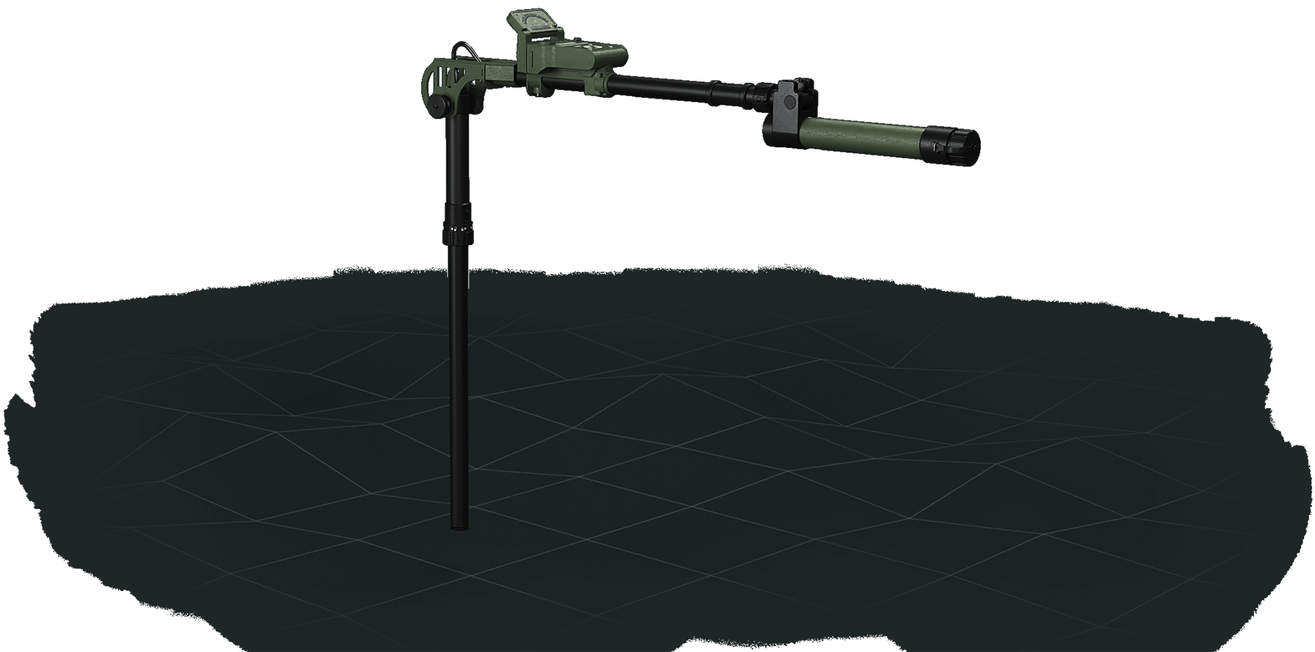
The modular single-channel system records magnetic anomalies. It supports the search for ferromagnetic objects causing anomalies and the targeted investigation of anomalous areas.
The probe and system configuration suitable for surface or borehole work is determined for each project. A magnetic signal is initially a finding, not reliable object identification.
Understand magnetometry in contextSENSYS magnetometers record variations in the Earth's magnetic field. These measurements help to investigate indications of ferromagnetic objects below ground.
Metal structures, fences or railway tracks must be considered as potential interference when assessing the data.
Plan a magnetometry investigation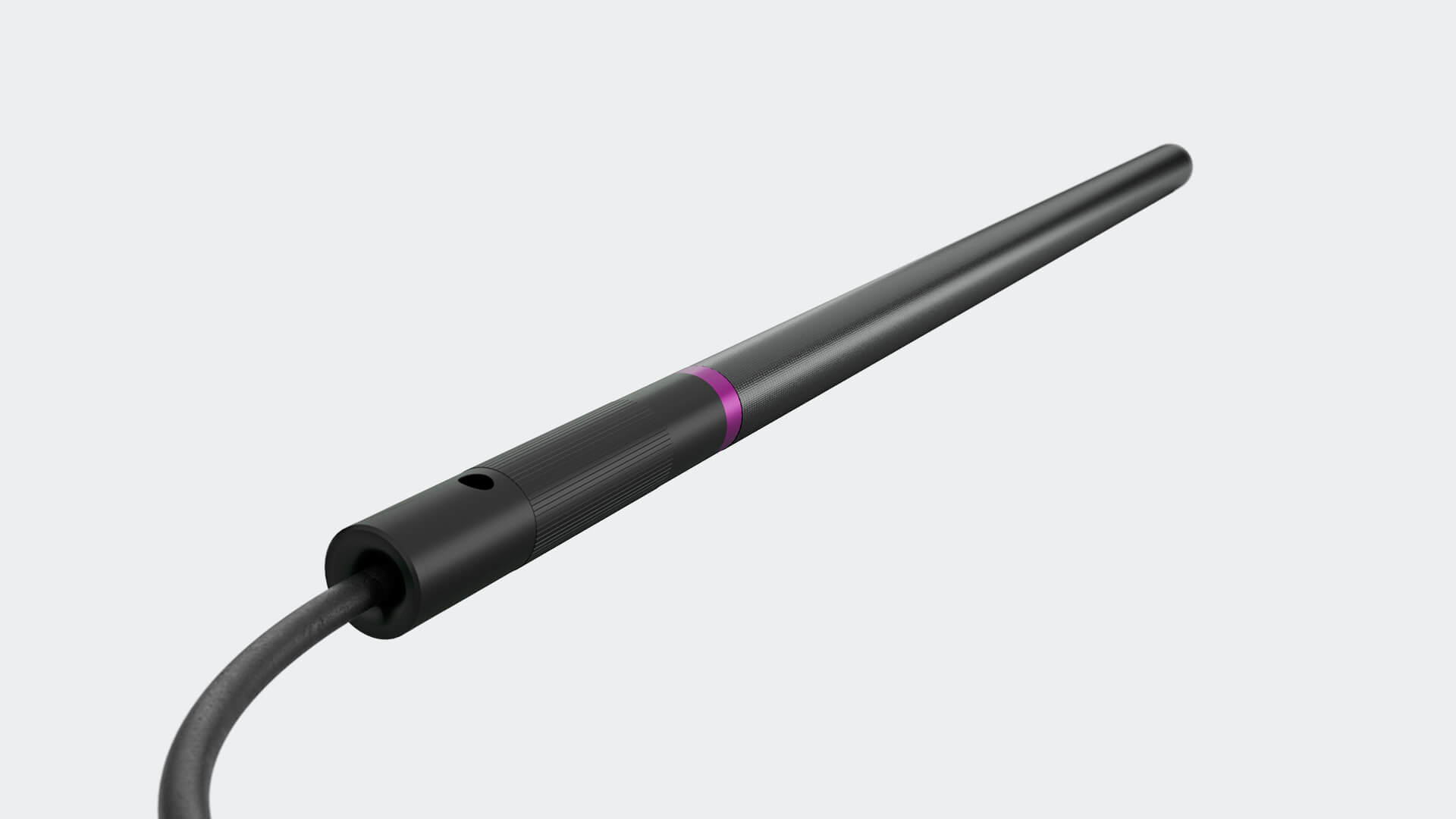
The VS-3X records the magnetic field in three spatial directions. Differential measurement provides additional directional information for borehole interpretation.
The magnetic field measurement range is ±250 µT. Which objects can be investigated at which depth also depends on conditions at the construction site.
View depth-related investigationSingle-axis magnetometers record the magnetic field component along one measurement axis. The probe arrangement suitable for an investigation depends on the survey task and site conditions.
The probe used, survey arrangement and specialist interpretation together determine the quality of the results.
Deep-ground surveys for planned interventions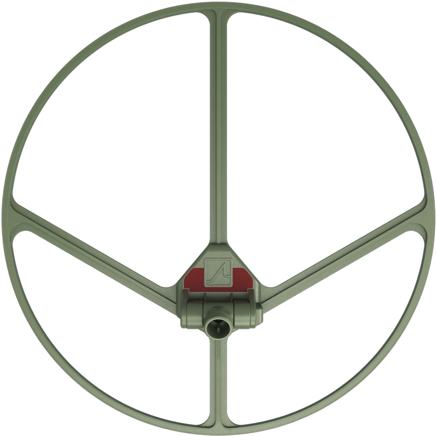
VS60 denotes a UXO search coil with a diameter of 60 cm. Used with a suitable detector, it provides an active means of searching for metallic objects.
The equipment combination, search task and settings are matched to the construction site. The investigation depth achievable also depends on the objects and ground conditions.
Surface survey methodsTDS is a digitisation unit for sensors in the SENSYS FGM3D family. It records the three sensor axes synchronously and passes on the measurements digitally.
The unit connects the sensors to digital data acquisition and interpretation. The measurement range and suitability also depend on the probe connected.
Ground-penetrating radar can provide location indications for utilities, structures and subsurface features. For ordnance questions, its potential additional contribution under local conditions is assessed.
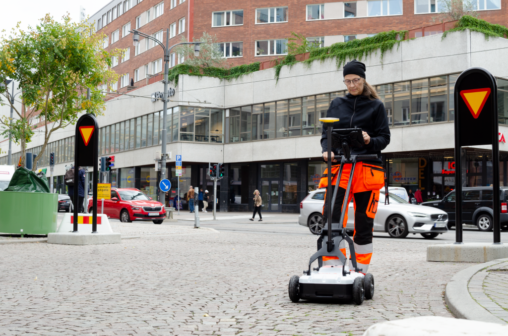
The system records and interprets radar profiles. It supports investigation of utility alignments and spatial referencing of anomalous reflections.
Digital recording and interpretation functions support the work. Survey data and automatically suggested interpretations are checked by specialists. A suitable GNSS connection supports spatial referencing of the radar profiles.
Ground-penetrating radar for your construction site
The two frequency bands support investigation of different structures and scales. The system is designed for utility location and mapping.
Radar profiles are assessed in relation to ground conditions, existing records and other survey findings. The reflections detected require technical interpretation.
Radar requires sufficient electromagnetic contrast. Conductive ground, such as clay-rich or saline areas, can strongly attenuate the signal. Moisture and structures near the surface also affect the conclusions possible.
The investigation depth and conclusions achievable in the project are assessed and documented on the basis of the actual conditions.
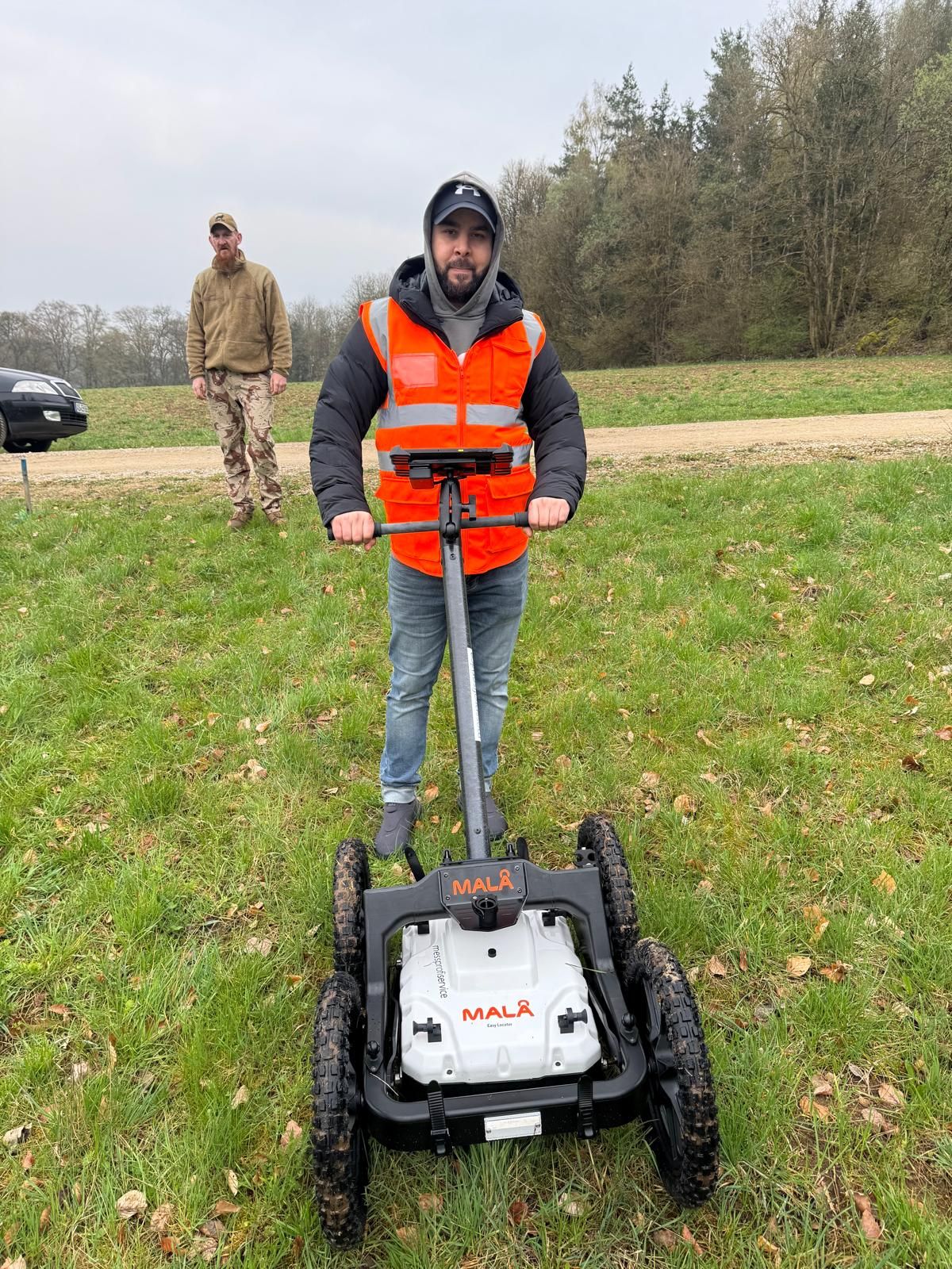
We use a MALÅ survey cart to record radar profiles. We interpret the measurements and assess what indications they provide of subsurface structures.
Whether ground-penetrating radar is suitable for your project depends on the question and ground conditions. We agree the investigation area and conclusions required with you.
Locating an anomaly and establishing its survey position are different tasks. GNSS links survey tracks, investigation points and findings to the planning data.
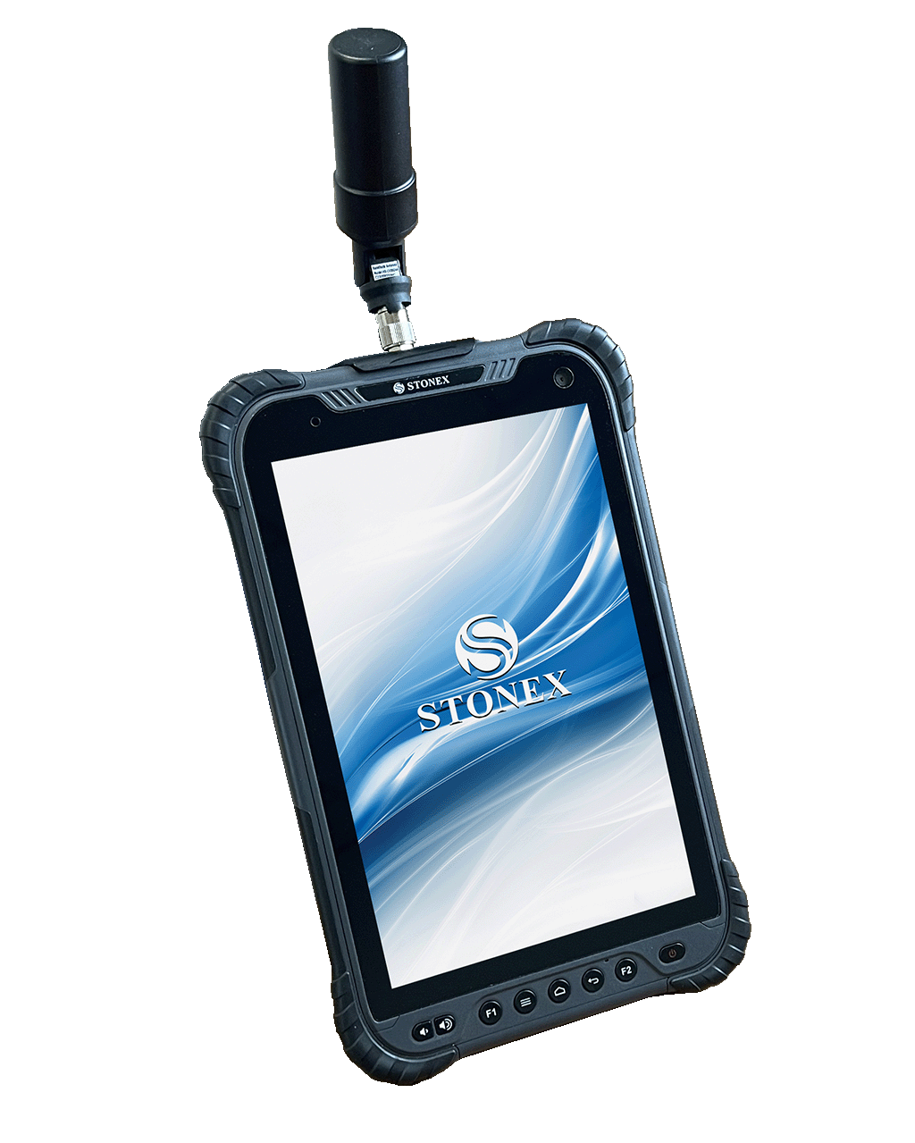
The S80G combines a rugged 8-inch tablet with multi-frequency GNSS and RTK functionality. Positions, descriptive information and photographs can thus be recorded together.
The positional quality actually achieved depends, among other things, on the antenna, correction service, obstructions and survey environment. It must be checked for each dataset.

Catalyst supports mobile capture of georeferenced data. The service provides different accuracy levels depending on the subscription and configuration.
Reception conditions, hardware used, correction data and the subscribed service are matched to the accuracy required for the project. The positional quality achieved is checked.
Coordinate and elevation references, survey date, point identifiers and limits of the work are aligned with the project documents. Existing CAD or GIS data may serve as a basis.
The handover should show which areas were investigated, where limitations applied and how findings are spatially referenced.
Documentation and the scope of resultsConstruction machinery supports the agreed earthworks and handling of soil material. Its specific equipment and the defined work and protection plan determine its use.

The comparatively compact machine with 55,4 kW engine power supports work on confined construction sites and controlled movement of soil material.
Access, standing area, load-bearing capacity and attachments determine whether it is suitable for the intended working area.
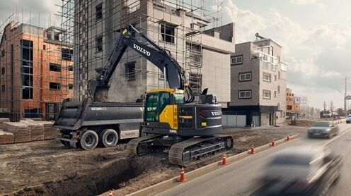
The tracked excavator with 90 kW engine power and a short tail swing radius is suitable for confined spaces. It supports earthworks and material movements where the working area has been planned accordingly.
Deployment planning considers the machine's specific equipment and condition as well as the working area, ground bearing capacity and attachments required.
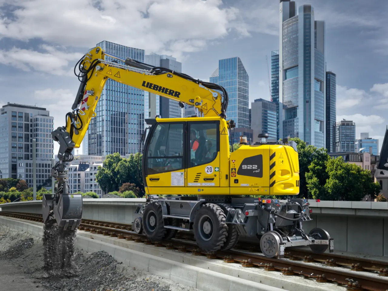
The road-rail excavator with 120 kW engine power enables work in railway environments. It is used for earthworks and material movements on rail and route projects.
Track use, the specific machine equipment and required operational permissions are agreed with those responsible for the project.
The result required determines which technical equipment is suitable for the project. Existing knowledge, the working volume actually accessible and survey conditions are checked against the investigation objective. The client, specialist company and other parties coordinate the work steps affected on this basis.
Naming a particular equipment model in the specification does not define the scope of specialist work. A surface area and a deep intervention at a specific point have different survey geometries. Provide the planned working volume with its area, depth reference and known structures. The specialist company checks which survey arrangement suits the conclusions required and which prerequisites must be met on site. Only this comparison links the equipment commitment to a specifically described investigation.
Coordinate investigation and construction sequenceMetal structures, changing ground conditions or inaccessible strips can affect the data available. The survey team records the areas affected and relevant conditions. Specialist interpretation assesses what conclusions are possible on this basis. If the investigation is insufficient for a sub-area, further work is agreed with those responsible for the project. An area shown in full on a plan must not be confused with an area actually investigated in full.
Coordinate the survey with specialistsSurvey data and findings must match the intended plan and the correct revision. Clarify coordinate and elevation references, point identifiers and the output formats required before handover. A CAD import may succeed technically while an incorrect reference shifts the data spatially. Handover checks therefore consider both assignment and technical conclusions. Reports and appendices also identify limitations that must be considered when using the data for further construction planning.
Assign result documents unambiguouslyA traceable technical investigation includes the commission, configuration used and specialist result documents. The documents link the spatially delimited working area to the data actually captured and the conclusions possible from it.
The site plan, land parcel, construction area or route and planned intervention depths describe the task. Historical documents, ordnance information and earlier investigation results are included with their revision status. The agreed commission identifies the investigation objective and documents required. The system, sensors and relevant data capture configuration used are also identified to make the technical work traceable.
The underlying information includes spatially referenced survey data, profile or point identifiers and relevant capture conditions. Survey results and findings investigated further are linked to the relevant area or position. Deviations from survey routes, interruptions and areas not covered remain identifiable. Interpretation can thus distinguish information actually captured from a spatial or methodological gap.
The report and results plan state the specialist assessment, volume covered and remaining limitations. Where clearance services were commissioned and completed, the associated clearance records form part of the documentation. Related files and revisions are identified for the project file. Site management can then see which area and ground intervention the documented conclusions concern and which question still needs coordination.
The same equipment family can perform different tasks in different projects. For planning, the conclusions achievable and local prerequisites are therefore more informative than a mere list of manufacturers and model names.

For a construction site that is still accessible, investigation areas, existing information and the sequence can be coordinated together. Specialist planning considers which areas can actually be reached and which limitations must appear in the results. This leads to a reasoned selection of the services required.
Match equipment to a specific service
Where investigation and construction interlock, working areas, contacts and handovers must fit together. Measuring equipment and construction machinery have different tasks. The intended accompanying specialist service is described in relation to the working method and agreed investigation objective.
Clarify specialist services alongside excavation
Tracks, utility installations, paved areas and existing structures shape the operating conditions. Alongside technical suitability, access, working volume and coordination with other parties must be clarified. The specific sector application determines what information is needed for technical preparation.
Identify requirements arising from the project settingBefore work begins, project documents, the investigation commission and the result documents required are coordinated. The technical execution is specified competently for each project. Data capture conditions and subsequent interpretation must concern the same task and spatial reference.
The starting point is the decision the client needs to prepare. The planned ground intervention, its spatial extent and existing conclusions are compiled for this purpose. A clear question helps distinguish information already established from additional investigation needs. State, for example, whether a utility trench is to be prepared, a borehole point investigated or an existing report related to changed foundations. Each task requires an appropriate boundary for the work and conclusions.
Site plans, intervention depths, known structures and access arrangements are considered together. Contradictions or superseded revisions are raised. Preparation must identify which information is still missing to select a suitable method. A plan must therefore also have a date. Where several revisions exist, the applicable design is identified. Elevations must show whether they describe depth below ground level or an absolute elevation reference.
The investigation area, conclusions required, intended methods and result documents are agreed. Known limitations also form part of this agreement. Technical selection and deployment planning can then refer to the same information. Also agree how initially inaccessible sub-areas will be treated. A planned later date and clear boundaries for the section initially covered help link the service to the actual construction sequence.
Contacts, access, working volume and interfaces with construction are clarified. The equipment and specialists deployed must fit the intended task. Changes on site are discussed with those responsible and taken into account in the work. For activities near tracks or operational installations, the necessary coordination with the operator takes place before deployment. A suitable machine or probe does not replace clarification of the working volume and operational interfaces.
The data collected is assessed together with spatial referencing, survey conditions and the project question. Anomalies, areas not covered and limitations remain distinguishable. A technical presentation only becomes usable for the next project decision together with this assessment. If a profile deviates from the intended line or data capture ends at an obstruction, this is assigned to the section affected. Assessment depends on the actual survey route, not only the line previously planned.
The handover identifies the area covered and the conclusions that can be drawn from it. Outstanding points are assigned spatially and by subject. Later changes to the ground intervention can be checked again against the documented limits. The client and subsequent specialist planners receive related plans and reports with clear revision status. Marked unresolved areas can then be included in further planning. An investigation still required is thus distinguished from a service already performed.
An organised project file links preparation to the services actually performed. The documents required depend on the commission and method; their relationship is as important to the recipient as each individual document.
The specification, site plan and relevant earlier documents show which task the investigation concerns. Their revision status and assignment must remain traceable. It is then possible to distinguish whether a deviation arose from changed planning or actual investigation conditions.
The documents assign data and areas covered to the agreed areas or points. Depending on the service, methods, survey conditions and identifiers required are described. The recipient must be able to locate a result in the plan and construction project.
The specialist assessment describes the conclusions arising from the investigation and their limits. Uninvestigated areas or areas that can only be assessed with limitations remain explicitly identifiable. Outstanding follow-up questions are worded so that they can be linked to a specific area and the next planned ground intervention.
Technical data describes a system's characteristics. For the commission, it is also necessary to explain which task the system is to perform under site conditions and how the result will be assessed by specialists.
For planning, tendering and construction, we therefore first define the investigation area, intervention depth and conclusions required. We agree the equipment selection and deployment date with you on this basis. The service overview explains which investigations may be suitable for your project.
A measurement initially describes a physical quantity or a change in it. The project question, however, concerns the intended ground intervention and how to address specific suspected ordnance. These two levels are linked in the survey plan. An anomalous signal and a final object assessment must therefore be documented separately.
Model name, sensor, accessories, data acquisition and interpretation environment belong together. A general product description does not confirm the specific configuration for the commission. During preparation, the relevant characteristics are checked against the requirements; different equipment must not silently appear to provide an equivalent investigation scope. If the task requires a particular probe arrangement, this is included in the agreed deployment. When changing systems, the measured quantity, capture geometry and data processing must be checked together. Comparable file formats alone do not establish a technically equivalent body of data.
A precise coordinate improves the location of a survey point but says nothing by itself about whether an object can be detected. Conversely, a signal without reliable spatial referencing is difficult to transfer to construction planning. Documentation therefore makes both the measurement conclusions and spatial assignment traceable. A point may, for example, have been surveyed correctly while an adjacent strip was not investigated because of an obstruction. These two circumstances must remain distinguishable on the plan. A finding's position does not extend the area actually covered.
Additional structures, changed access or a different construction status can affect the planned investigation. Such changes are checked against the specialist commission. If an area cannot be covered as intended under the actual conditions, the deviation remains visible in the results and is described for further coordination. If another shaft is added or an excavation relocated after data capture, the new ground interventions are compared spatially with the investigation result. The sections affected can then be reassessed specifically without transferring the earlier conclusion to a different working volume unchecked.
For an enquiry, it helps to state the current project status. Documents and technical requirements can then be discussed specifically without prejudging a particular equipment choice.
Describe the conclusions required and compile the information available. Specialist coordination can help to state the investigation scope and expected result documents clearly. Model names alone are often insufficient to describe the service required.
Specify the service requirementsProvide the proposal together with the ground intervention design and known site conditions. What matters is whether the intended investigation can answer the specific question. Reasoned limits and any further clarification required belong in the same assessment.
Relate the choice of method to the taskAlso provide the associated report and plans. A single image often does not show the conditions under which the data was captured. Assessment needs the documented relationship between the commission, area covered and interpretation.
Link survey data to its underlying informationIdentify changes from the condition investigated or planned. These include changed ground intervention areas as well as new structures or access arrangements. Only comparison with the earlier documents shows which technical questions need to be revisited.
Submit the changed project status for reviewAn investigation includes correct equipment settings, competent surveying and interpretation of the data. The specialists deployed must also recognise where a method cannot provide sufficient conclusions.
When assigning personnel to the commission, we take account of the company authorisation under § 7 SprengG, personal certificates of competence under § 20 SprengG and training for the MALÅ and IDS ground-penetrating radar systems used. Scope, validity and assignment of tasks must fit each deployment.
At FONTANA-EOD, ordnance specialists / team leaders (§ 20 SprengG), survey technicians and GIS specialists work together. Equipment training supports competent data capture and interpretation. We select personnel and equipment to suit the commissioned scope of service.
The investigation objective, area and depth form the basis of equipment selection.
Function, configuration and required checks are clarified before deployment.
Interference, gaps and anomalies are taken into account during data capture.
Survey signals are assessed in relation to location, subsurface conditions and the project question.
Areas that cannot be investigated and remaining limitations stay identifiable.
The result states the conclusions for the area covered and any further steps.
Equipment replaces neither specialist definition of the task nor cooperation within the construction project. Each party needs the information relevant to its responsibilities.
They describe the intended ground intervention, provide existing documents and identify the decision required. Changes to planning are communicated. The investigation can thus address the actual needs rather than rely on unconfirmed assumptions about depth, area or construction status.
FONTANA-EOD agrees the investigation scope, selects suitable technical equipment and assesses the data collected. Documentation makes the work and its limits traceable. Organisational prerequisites and required coordination are linked to those responsible for the project.
Construction companies, surveyors and, where applicable, operators provide information on working volumes, existing installations and the sequence of work. This information affects equipment use. Necessary official or operational decisions are made by the competent bodies through the relevant procedures and taken into account in project planning. The ordnance clearance service and public order office perform the specialist or public order tasks assigned to them. Building control is involved in relevant building-law questions. Which bodies are specifically involved depends on the location, task and applicable procedure.
Suitable equipment and appropriate specialist responsibilities both matter for the service. Personnel, organisational and occupational safety requirements are assessed according to the activities actually intended.
Authorisations and certificates of competence must be considered within their respective scopes. The company authorisation under Section 7 SprengG and the personal certificate of competence under Section 20 SprengG have different functions. When assigning tasks, the scope, personal prerequisites and relevant requirements of the 1. SprengV (First Ordinance to the Explosives Act) are checked together.
The risk assessment considers the intended work and conditions at the location. Equipment use, construction machinery movements and other activities in the working area must be considered together. The employers and responsible persons involved coordinate their tasks and necessary interfaces accordingly. For ordnance clearance work, DGUV Information 201-027 supports activity-specific assessment and the definition of protective measures.
Technical data, survey images and equipment names do not in themselves justify a general conclusion about every conceivable object. The specialist assessment relates to the commission, method and volume covered. For further ground interventions, it is checked whether this documented context still fits the current planning. The BFR KMR address planning, execution and documentation of ordnance clearance on federal properties. Their use in each project is clarified on the basis of the commission and applicable requirements.
The project location helps with organisational coordination. It does not determine technical suitability on its own; that depends on the specific areas, ground interventions and subsurface information.

Send the construction site location together with access details, accessibility and known limitations. For several construction sections, unambiguous spatial assignment is helpful. Preparation questions can then be discussed specifically for each working area.
Identify the project location and regional coordinationA railway site, utility area or urban property creates different organisational requirements. Identify known operator contacts and the coordination required. This information supplements specialist method selection without deriving a particular investigation service from site use alone.
Match equipment to the specific project settingMeasurement range, spatial reference, interference and limits of conclusions describe different properties of an investigation. The commission must clearly state the physical quantity measured and the specialist conclusions required from it.
A sensor's measurement range describes which values of the relevant measured quantity it can record. It is not equivalent to a general investigation depth. Suitability for the specific construction site must also take account of the survey arrangement, expected characteristics and environmental conditions.
Georeferencing links data or findings to a spatial reference. The coordinate system and positioning quality must fit the application. A documented spatial reference makes assignment to the plan easier but does not replace specialist assessment of the survey data concerned.
Interference may affect the recording or interpretation of survey signals. It may arise from existing structures or other surrounding conditions. Its significance is assessed for the method used and the specific question; not every anomaly has the same cause.
The limits of conclusions describe how far a specialist conclusion from the completed investigation extends. They may include spatial, methodological or other limitations. The report makes these limits clear so that results are not transferred to other areas or changed ground interventions without checking the context.
Technical selection links the information available to the investigation required and its result documents. Survey data, spatial referencing and specialist assessment are all needed for the next project decision.
Historical information and existing investigation results help define the survey task. They do not automatically describe the current construction status, however. Equipment selection considers this information together with the site plan, intended ground intervention and known obstructions.
Clarify the basis for the technical investigationThe enquiry should show which decision needs to be prepared. Only then can a suitable service be described. Method, volume covered and expected documents form a shared basis for coordination between the specialist company, planners and construction contractors.
Choose a suitable investigation for the projectDocumentation links the work completed to the specialist conclusions. Plans and reports must be usable together and identify remaining questions clearly. Those responsible for the project thus receive a basis for the next coordination steps and for assessing later changes.
Pass on technical results clearly
For rail and route projects investigation sections are coordinated with construction phases and operational interfaces. The clearance documentation must show the actual scope of work and the conclusions for the intended ground intervention.
Preliminary investigation, technical investigation and accompanying services address different questions. Selection considers suspected ordnance, the construction design and existing investigation status together. The scope of service describes which of these questions the specific commission is intended to answer.
Link the service and investigation objectiveThere are technical dependencies between document review, surveying and results handover. Missing information is clarified before the decision that depends on it. The construction sequence takes account of necessary preliminary work and clearly agreed handovers between the companies and specialist planners involved.
Understand the process and result documents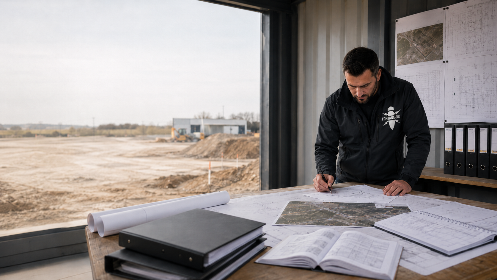
Survey signal, finding and object assessment represent different stages of work. The investigation area and limits of conclusions must also be distinguished. Clear terms help to coordinate which knowledge is already available and which question still needs to be addressed for the planned ground intervention.
Explore investigation terminology
Send a site plan, description of the ground intervention and available earlier documents. Identify outstanding questions about equipment or use of the results. Initial coordination can then focus on the conclusions required rather than assume a particular equipment model.
Agree equipment use on the basis of project documentsTo select equipment, we need information about the construction site, planned ground interventions and possible survey interference.
This cannot be determined from the area or desired depth alone. Information is needed on suspected ordnance, planned ground interventions, the subsurface, utilities, reinforcement and access.
A survey plan is developed from this information. Additional methods are provided for where they meaningfully support the specific question.
No equipment data sheet can provide a general guarantee for every object and every depth. Detection limits depend on the object, distance, survey method and surroundings.
A technical conclusion must relate to the area actually investigated, the conditions and the agreed investigation scope.
A site plan, planned intervention depths, existing ordnance information, ground and utility information and details of the construction sequence are helpful.
The coordinate system, plan format and documentation required should be agreed early for data handover.
No. Spatial referencing describes how data or findings are assigned a location. Whether an object can be detected, however, depends on the survey method and the specific conditions. Both aspects are considered in the investigation and linked clearly in the result.
A model name does not describe the intended investigation volume, survey conditions or conclusions required. For a comparable specification, the task, scope and result documents should be stated. The suitable technical configuration is selected on that basis.
The limitation is assigned to the area affected and taken into account in the technical assessment. The further clarification required for the planned ground intervention is then agreed. An insufficiently investigated area is not silently included in the conclusions for other areas.
That depends on whether the commission, area covered, conditions and conclusions of the earlier investigation fit the new planning. The associated reports and plans are needed. Changes to the ground intervention or construction status are taken into account when comparing them again.
Construction machinery performs the agreed earthworks and material movements. Measuring equipment and technical assessment have different functions. The specific use of a machine is coordinated with the working area, equipment and defined work and protection plan.
For an initial specialist assessment, FONTANA-EOD needs the task, spatial reference and available information. You can explicitly identify missing information as outstanding.
Describe the intended work and include a site plan showing the areas affected. Depth, dimensions and construction status help with assessment. If options are being considered, they should be clearly distinguishable in the documents. State the project location, land parcel or construction area and, where applicable, mark the intended borehole points, utility trenches or excavations. A specific plan extract makes the technical question easier to locate.
Identify existing utilities, structures, paved areas or access restrictions as far as they are known. Existing investigations and documents from authorities also form part of the starting information. Identify their revision status so that current and earlier conclusions can be assigned correctly. Include existing ordnance documents in full, together with their plans. An information response, survey plan and results certificate serve different purposes; the corresponding complete set of documents is needed for assessment in each case.
Tell us who will use the result, for what purpose and which documents are expected. Contacts, the planned sequence and outstanding coordination issues help with preparation. Technical selection is then linked to the conclusions actually required and the agreed scope of service.
Whether historical aerial photograph analysis, explosive ordnance surveying, surface surveying using GPR, magnetometry or TDEM, deep-ground surveys, downhole surveys, excavation supervision, area clearance or ordnance recovery is needed depends on the location, ground disturbance, depth, ground and existing documents. An early ordnance assessment provides clarity for tendering, programming, occupational safety and construction.
FONTANA-EOD combines its Section 7 SprengG licence, specialists holding Section 20 SprengG certificates of competence, suitable survey and clearance methods, and traceable documentation. Send the site plan, depth of ground disturbance, construction phase and existing documents for an initial technical assessment.


