Project pathway
The quickest route to the right decision.

 Thursday, 17 September 2026 by Oliver Fontana – Managing Director
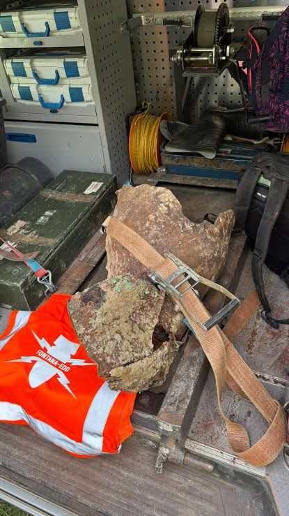
On the evening of 16 September 2026, FONTANA-EOD found an aerial bomb in the track area at Plattling station. Specialists from the explosive ordnance disposal service defused it the following afternoon.
FONTANA-EOD staff found the 250-kilogram aircraft bomb on 16 September at around 22:00 during construction work in the track area. The Federal Police initially closed off the station.
The day after FONTANA-EOD's discovery, around 400 people had to leave the affected area. According to the City of Plattling, ordnance disposal specialists defused the bomb on site on 17 September at around 14:15. The cordons and evacuation measures were then lifted.
The operation disrupted train services. BR24 also reported on the replacement transport provided.
Kathrin Hiller from Lower Bavaria Police Headquarters summarises the operation at Plattling station. The video comes from the Passauer Neue Presse news blog of 17 September 2026.
Before groundworks at a station, FONTANA-EOD needs the existing information about the affected ground in order to agree investigation requirements with the client. A cable trench, a new chamber, platform works and a foundation may be close together yet require different investigations.
For developers, preparation therefore starts with each planned ground intervention. Where will soil be moved, and to what depth? Which additional areas will be used during construction? An excavation may occupy a different working area from the completed structure. Even a temporary access route or an additional utility may raise new questions if it involves disturbing the ground.
Include this information together in the enquiry. It shows which areas can be assessed together and where separate clarification is needed. A single bomb find does not establish that every other station should be assessed in the same way. Nor does removing one item establish the condition of all neighbouring areas. What matters is the evidence for the particular work area and the works planned there.
A marked-up site plan is often more useful than a long project description with no clear geographical reference. Show the planned ground interventions and their depths. For a route, distinguish its alignment, crossings, chambers and working excavations. For foundations, show the individual positions and the working area required. The drawing need not resolve every construction detail, but its stage of preparation should be clear.
Distinguish the permanent structure from the construction phase. A plan of the completed platform, for example, may not show every earthwork needed to build it. An ordnance investigation needs to address the actual ground disturbance. Mark any additional areas explicitly rather than leaving them under a general heading such as site establishment.
Give each plan a clear reference and date or revision. Refer to it in the enquiry so that everyone uses the same drawing. If several plans are needed, a short list helps identify them. Add known work-area boundaries and inaccessible places so that outstanding areas can be identified early. An investigation can only be compared properly with the later construction works if its geographical scope is clearly documented.
The property may already have an aerial photograph assessment, a survey report or records of earlier clearance work. Include these in the project preparation. They may answer important questions, but they need to be relevant to the task now planned. First check which area the report identifies and whether all accompanying plans are available. A cover sheet bearing the right place name is not sufficient.
Next consider the investigation depth, the approach used and any stated limitations. Were some areas omitted? Which works was the investigation intended to support? Does the result cover the same section where construction is now planned? The responsible specialists should clarify these questions from the records. A brief statement in an email should not replace the complete report.
The plan revision also matters. If a utility has been installed or an excavation moved since the earlier investigation, compare the new position with the documented area. Keep the report and appendices together. Request missing pages or plans before relying on them for further work. This allows earlier work to be used without treating it as covering more than was actually investigated.
Historical aerial photographs may show earlier uses of a site and changes to it. Their assessment helps establish the work area's history and evaluate possible grounds for suspicion. It answers a different question from an on-site investigation, however. An aerial photograph alone does not reveal which object lies at which depth today.
A historical assessment may, for example, define a suspected area more closely. Whether and how it is investigated technically before a particular excavation depends on the task and site conditions. The research findings should therefore be considered alongside the planned groundworks. If areas are added later, the assessment must also cover them or be supplemented accordingly.
The same applies to other ground investigations. A geotechnical report, a utility plan and an ordnance assessment each address a different subject. A report on one subject does not answer every other question. The records can be useful together when their findings and limitations are understood. Organise them by purpose and geographical scope so that information is neither overlooked nor mistaken for evidence of something else.
An enquiry simply requesting an ordnance investigation at a station leaves many questions open. Is it intended to prepare for particular groundworks? Is the task to assess existing records, investigate the site or provide services during earthworks? Which areas, depths and construction phases are involved? Clear answers allow a quotation to describe the actual scope more precisely.
The expected result is also part of the service. Does the planning team need a written assessment of existing information or a report on an investigation carried out? Who will receive the records, and how will they be used? Clarify these points before commissioning work. They help connect the necessary work steps with the final documentation.
Outstanding information should remain clear in the quotation. If access to part of the site has not been resolved, it cannot silently be assumed to be unrestricted. The same applies to an undecided route alignment or additional depths of ground disturbance. Stating a prerequisite makes the quotation understandable; leaving an assumption unstated may lead to later misunderstandings.
Compare quotations against the same task specification. A price difference is only meaningful once it is clear which assessment, investigation and documentation each includes. Questions about scope are more useful than assuming that services with the same name must be identical.
FONTANA-EOD carried out several coordinated ordnance-related services at track 20 in Plattling station during September and October 2026. The client was ARGE GS Plattling-Obertraubling / H. F. Wiebe. The final documentation of 24 October 2026 describes FONTANA-EOD's own scope of work and the areas worked on.
The high level of contamination led to a change from the approach originally planned for work during construction. This example brings together Excavation supervision, Ground-penetrating radar and area and volume clearance. It describes this particular project, rather than a standard sequence that can be applied to other sites without assessment.
A narrow access window can determine the sequence of work on railway infrastructure. For an ordnance investigation, establish early when each area will be accessible and under what conditions work is permitted. Agree operational access conditions and protective measures with the responsible parties. Commissioning an ordnance investigation does not replace this coordination.
Plan beyond the date of the site work itself. Preparatory records need to be available in time; assessment, reporting and further decisions may follow an investigation. Ask specifically when each result is needed and when it will be provided. A survey appointment and delivery of a usable report are separate points in the programme.
Identify known dependencies. Does a section first need to be cleared or made accessible? Will other companies be working in the same area? Will some areas only become available in a later construction phase? This information helps establish a traceable sequence. Inaccessible areas remain outstanding and must not subsequently be treated as completed.
Appoint a contact for any additional matters that may arise. An actual find may trigger measures by the responsible authorities. Their sequence cannot be settled in advance through a general scheduling promise. A sound project plan identifies these dependencies without promising an uninterrupted process.
If the construction plans change, compare them with the existing investigation results as a distinct task. Place the previous and new plans side by side. Where does the ground disturbance change? Will works go deeper? Is an area being added or a section omitted? The responsible specialists can then assess which parts of the earlier information remain relevant and where further clarification is needed.
A changed route alignment is a clear example. The new alignment may be close to the old one yet fall outside the documented investigation area. Conversely, changing one section need not invalidate every other assessment of scope. The actual comparison matters, rather than simply noting that it is still the same overall project.
Record which plan revision applies to the next stage of construction. If another company takes over the works, it needs the appendices and known limitations as well as the findings report. A brief verbal summary can help with the handover but does not replace the records. Those carrying out the work should be able to identify which findings cover which area and what remains unresolved.
If excavation monitoring is planned, agree its scope before work starts. Which sections and work steps does it cover? During which periods is the service needed? Who coordinates the contractor's work with the specialist support? The term alone does not answer these questions.
Details of the planned excavation and construction sequence help prepare the enquiry. Also identify services already carried out and the records available for them. Excavation monitoring cannot automatically be equated with any earlier investigation. The combination required and suitable for the project needs to be established.
Changes during the works should reach the responsible contacts. Working in another area or changing the method may affect the agreed scope. Documentation also needs to be agreed: which work steps will be recorded, who receives the records and how will outstanding areas be identified? The answers should reflect the actual process and avoid expectations of a service not specified in the commission. Agree technical details and the response to anomalies with the responsible specialists for the particular project.
The Plattling report uses separate numbering series for the three bomb locations from the September phase and the 294 GPR anomalies. Work boundaries, survey images, clearance work actually carried out and final checks each serve a distinct purpose in the documentation.
The GPR interpretation depth of up to 0.80 m must be distinguished from excavation to 2.50 m in the specified G1/G2 subareas. Neither figure represents a blanket clearance depth for the entire station. The specialist company's statement covers the documented track-20 work area and the excavated material that was rechecked. Other tracks and areas outside the work boundaries are excluded.
For handover, the written findings, plan appendix and scope of services need to be consistent. The pages Survey report and clearance record and scope of an ordnance clearance statement explain how these elements relate. Further regional information is available under ordnance surveying in Lower Bavaria; the associated GPR service is listed in the Plattling, track 20 reference overview.
Open the Plattling report extract with a sanitised site plan (PDF, 10 pages)
The individual work phases bring together specialist ordnance support during construction, Ground-penetrating radar, volume clearance and recovery at individual points. The report assigns each method to the areas actually worked on.
The redacted site plan in the documentation example shows the separately marked work boundaries for construction-phase support and volume clearance.
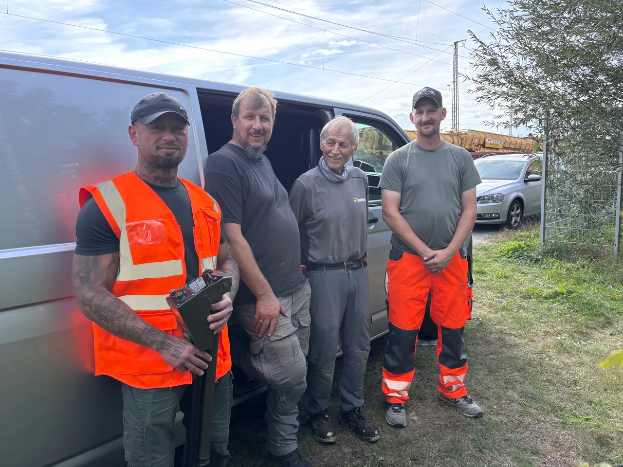
In Plattling, the FONTANA-EOD team found the aircraft bomb. The Federal Police initially closed off the station; the city's announcement identifies ordnance disposal specialists as having defused it the following day.
For construction projects, contacts and communication routes should therefore be established before work starts. Who receives a report? Who informs site management? Which responsible authorities need to be involved? These organisational questions can be prepared in advance. Assessment of an actual object and decisions at the find location remain the responsibility of the relevant specialists and authorities.
If you discover an object that might be ammunition, do not touch or move it. Leave the immediate area, warn others without putting yourself at risk and, in Germany, notify the police immediately on 110. Do not approach the object to take photographs or investigate it yourself.
A normal project enquiry does not replace reporting a find immediately. Wait for further instructions from the responsible authorities. Specialists are responsible for assessment and measures at the location.
The documented scope is what matters. A report covering a defined section cannot be extended to other areas merely because they share the same property description. Compare the area, depth and planned groundworks with the records. Stated limitations and areas not investigated still need to be considered.
The key question is whether the new groundworks fall within the documented investigation scope. Geographical proximity alone is not evidence. Show the new alignment and planned depths, and have them compared with the existing results. This establishes which questions still need to be resolved.
No. First describe the project, the planned groundworks and the information available. The specialists involved can then discuss an approach. Even where a method has already been proposed, check whether its requirements fit the work area and the findings needed.
The affected areas, access conditions and planned works should be known. This includes existing records and an agreed set of contacts. Also establish when results are needed for the next steps. The on-site investigation date is only one part of the overall process.
No. Ordnance questions and operational access conditions are separate matters. The applicable prerequisites for the work need to be agreed with those responsible. Commissioning an investigation does not grant general permission to enter railway infrastructure.
Do not rely on your own identification from a photograph. Do not touch or move a suspicious object, and do not approach it to take pictures. Report the find to the police. Assessment and the next steps belong to the responsible specialists.
FONTANA-EOD used the IDS Opera Duo system at 250 and 700 MHz for the GPR investigation. The documented survey area was approximately 1,432 m², with a profile spacing of 0.50 m and a survey point spacing of 0.04 m. The report states an interpretation depth of up to 0.80 m.
The survey recorded 294 anomalies and widespread interference signatures. This figure refers to survey anomalies, not to a number of identified items of ordnance. Signal overlap prevented reliable object identification here, and the GPR assessment alone could not support an ordnance clearance statement. The subsequent clearance work and final checks were separate work steps.
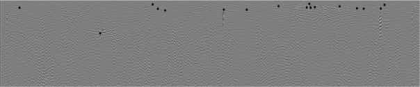
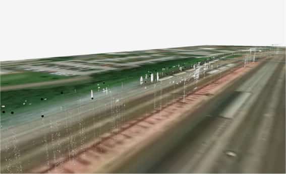
The four original radargrams and four spatial survey-data views show different representations of the same project example. The axis and reference information on the available radar profile images is not fully legible in places. These images alone therefore do not support reliable additional findings about depth, size or material.
Survey example
Two original images from the Plattling project illustrate how radar signals and spatial survey-data views are interpreted. The explanation relates the visible features to the final report's findings.
The radargram shows light and dark patterns in the recorded radar signal. Curved signal traces are visible on the left of the image, and the view also contains black point markers. The survey and assessment records for the relevant profile are needed to establish what these represent.
In the Plattling project, overlapping signals limited reliable object identification. The report therefore documents further clearance work and checks alongside the GPR investigation. A distinctive radar signature alone is not an identified item of ordnance.
The spatial view combines the survey-data display with an aerial image of the track surroundings. Bright points and point-like structures show how the displayed data is arranged from the selected viewpoint. They are not photographs of underground ordnance.
The associated axes, reference systems and assessment data are needed for a professional assessment of depth and position. The areas worked on and the limits of the subsequent services are documented separately in the report.
About the author: Oliver Fontana – Company Management and Project Management.
The original images show radar profiles and processed spatial survey data. Colours, perspectives and signal shapes do not replace professional object identification. The technical limitations and survey parameters are set out in the Plattling survey example.
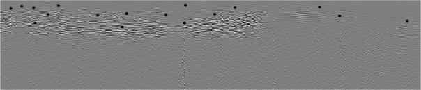
Original image from the final documentation for Plattling, track 20. Open the image at its original size
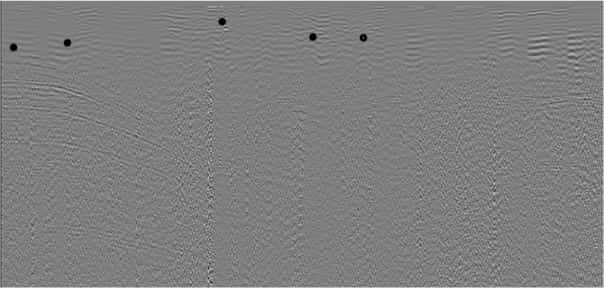
Radargram 2 from Plattling, track 20. The greyscale shows differences in the radar signal. Without legible axes and a profile reference, the image cannot independently establish depth or object identity.
Original image from the final documentation for Plattling, track 20. Open the image at its original size
Original image from the final documentation for Plattling, track 20. Open the image at its original size

Original image from the final documentation for Plattling, track 20. Open the image at its original size
Original image from the final documentation for Plattling, track 20. Open the image at its original size

Original image from the final documentation for Plattling, track 20. Open the image at its original size

Original image from the final documentation for Plattling, track 20. Open the image at its original size
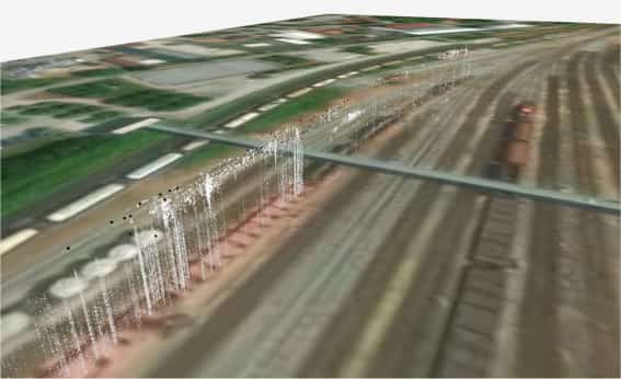
Spatial survey-data view 4 from Plattling, track 20. The aerial image and survey data provide orientation. The point display and perspective height do not independently establish the presence or depth of ordnance.
Original image from the final documentation for Plattling, track 20. Open the image at its original size
The area to be investigated must be accessible with the proposed equipment. Platform edges, structures, stored materials and ongoing construction may leave less space than a site plan initially suggests. What matters is not only the boundary of the completed structure, but also the routes and working space actually available. Preliminary groundworks that themselves affect an unresolved area cannot simply be assumed to be incidental support work.
Site arrangements may change between construction phases. If an accessible section is used for materials or closed off by other works, the investigation may no longer be possible there as planned. Conversely, removal of structures may make an area accessible for the first time. Such changes matter to scheduling just as much as the operational railway access window. Investigation and construction need a common geographical basis.
For projects with several construction sections, show each separately. Which area will be accessible next, what groundworks are planned there and what findings are available? This is particularly useful for utility trenches and individual foundations. One section may be fully prepared while records are still missing for another. Keep these differences clear in the commission and the findings so that available working windows can be used effectively.
Are you planning groundworks in a track area, at a platform or along a route? Send FONTANA-EOD a site plan, the proposed ground interventions and depths, and your programme. Include existing ordnance-related records and identify outstanding questions. We can then discuss the specific task and the scope of services required.
Details of access, available working windows and project contacts are also helpful. You do not need a completed investigation plan for the initial enquiry. What matters is that we can understand what is to be built and which information is already available.
Quotation information and project documents

Whether historical aerial photograph analysis, explosive ordnance surveying, surface surveying using GPR, magnetometry or TDEM, deep-ground surveys, downhole surveys, excavation supervision, area clearance or ordnance recovery is needed depends on the location, ground disturbance, depth, ground and existing documents. An early ordnance assessment provides clarity for tendering, programming, occupational safety and construction.
FONTANA-EOD combines its Section 7 SprengG licence, specialists holding Section 20 SprengG certificates of competence, suitable survey and clearance methods, and traceable documentation. Send the site plan, depth of ground disturbance, construction phase and existing documents for an initial technical assessment.


