Project pathway
The quickest route to the right decision.
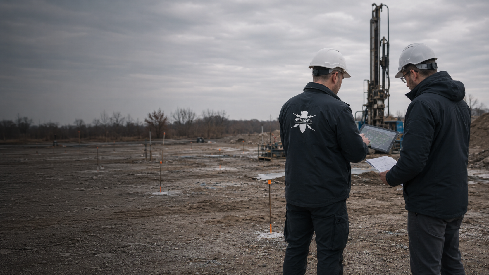
Before a geotechnical borehole or trial pit, it must be established whether existing ordnance documents cover the planned intervention. FONTANA-EOD coordinates position, depth and execution with your environmental and geotechnical specialists. Contaminant analyses and bearing-capacity assessment remain separate tasks for the appointed consultancies.
Assess ordnance, contaminants and ground conditions separately.
Show borehole locations and intervention depths on the plan.
Check the relevant reports for each intervention.
A geotechnical or contaminated-land report answers different questions from an ordnance investigation. Before drilling, trial pits or excavation, the planned interventions are therefore checked against existing ordnance documents. FONTANA-EOD agrees the appropriate investigation scope with the appointed specialists and documents the spatial and technical limits of its own conclusions.
The service scope for “A 6 AS Öhringen–AS Kupferzell – ground investigation – Bohrgesellschaft Roßla Öhringen – Kupferzell / Germany · Stuttgart administrative district” comprised downhole magnetometry.
Service period: 2026-08
Service areas:Downhole magnetometry / deep-ground survey
View project details · Deep-ground and downhole surveys · Region: Stuttgart administrative district
The service scope for “Düsseldorf – Btf Heerdt track crossover, overhead-line mast foundations – 9260398 Düsseldorf / Germany” comprised downhole magnetometry.
Service period: 2026-06
Service areas:Downhole magnetometry / deep-ground survey
View project details · Deep-ground and downhole surveys · Project location: Düsseldorf
The service scope for “Saarbrücken – Westspange, pile foundations Saarbrücken / Germany” comprised downhole magnetometry.
Service period: 2026-03
Service areas:Downhole magnetometry / deep-ground survey
View project details · Deep-ground and downhole surveys · Project location: Saarbrücken
References from project practice
For ground investigations, contaminated-land investigations and environmental projects, ordnance checks are coordinated with the planned investigation. Relevant reference examples are shown here.
Project information is loaded from the reference list.
Select a project location from the place selector or choose a point on the map.
The markers show official place centres. The associated references state the construction task, services performed and documented scope.
Map data: © GeoBasis-DE / BKG (2026), VG250 / GN250, dl-de/by-2-0; Luxembourg: ACT / data.public.lu, CC0. Geometries projected and simplified for display.

Provide the proposed boreholes and trial pits with their point numbers, positions and depths. Add the planned working areas. The number of samples commissioned alone does not describe the ground intervention. The specialist planner can use the spatial information to identify which existing ordnance documents fit the task and which questions remain open before execution.
Select services for the planned ground investigationsFill, embedded metal and existing structures can affect the investigation. Known conditions are provided together with the intervention plan. Method selection depends on the specific investigation objective and whether the results can actually be interpreted. Measuring a neighbouring unobstructed area does not replace assessing the working area that will subsequently be used.
Choose methods according to measurement conditions and investigation objectives
An investigation programme may cover individual points, while later remediation may involve larger ground volumes. At the transition, the new plan is compared with the documented investigation scope. Earlier results remain available and useful, but their conclusions apply only to the areas and conditions actually investigated and assessed.
Compare investigation and remediation scopes using the documentsA joint field campaign can use the same access routes and plans. The specialist results must nevertheless remain distinguishable. Taking a sample for chemical analysis answers neither the foundation-design question nor the question of suspected ordnance. Objectives, intervention points and required decisions are therefore set out alongside one another before scheduling.
For the transition to construction, information on demolition and site regeneration and specialist foundation engineering and foundations explains the respective ground interventions and interfaces.
Environmental investigations require sampling locations, target horizons and sampling methods. Ordnance checks also need the actual ground interventions and existing information on suspected ordnance. A small sampling point can involve a larger trial pit or equipment standing area. If an obstruction requires the sampling location to be moved, the new intervention must be included in the coordination. Chemical analysis remains the responsibility of the appointed consultancy or laboratory.
Define the investigation tasksThe geotechnical investigation programme defines the information needed on ground composition and behaviour. Boreholes and trial pits each have their own positions and depths. The ordnance specialist contractor needs this programme to define its task appropriately. Investigating the exploration points is not, however, a conclusion covering all later foundations, excavations or retaining-work locations. A further spatial comparison follows once the structural design becomes more specific.
Plan ground investigations togetherRemediation may affect different areas and depths from the preceding investigation. Material handling, additional trenches or relocated access routes can create new interventions. The transition from investigation to remediation is therefore treated as a separate planning stage. Those involved record which findings can be reused and which parts of the new measure are not yet covered by the available documents.
Coordinate the investigation stepsDescribe the decision ahead: is the aim to commission an investigation programme, prepare a tender or carry out an already planned ground intervention? This determines which documents need checking first and which outstanding questions must be resolved on site.
Provide the point list with a site plan, proposed depths and the purpose of the investigations. Identify confirmed and provisional details. The initial review establishes whether suitable historical or official information is available and what is needed to clarify the suspected ordnance further. A request for an early appointment does not replace this basis. The consultancies also identify work planned before the actual ground investigation, such as auxiliary pits, preparing a working area or moving to an alternative point. The space affected must be described for the ordnance check. Selecting a geotechnically suitable sampling point and preparing that intervention from an ordnance perspective are different decisions. Both are brought together in the current plan before the point is scheduled for execution. Unresolved options retain an identifiable processing status.
The complete report with its appendices is decisive, rather than a summary email alone. Investigated areas, depths, methods and excluded areas are compared with the new programme. The property name alone is insufficient. If a point lies outside the documented area, the gap is described and the required next step discussed. Identify the specific gap if a plan appendix is missing or an old point number cannot be matched to current plans. A map extract without a legend or a photograph of a results line is often insufficient for spatial comparison. The original report title and a contact able to obtain the full documents are useful. Further investigation is agreed using the information actually available; missing results are not inferred from a previous commission or an invoice.
Describe environmental investigation, geotechnics and ordnance work with their respective deliverables. Shared plans, access requirements and scheduling can be coordinated together. Different investigation objectives should not disappear under a vague collective heading. Quotation assessment can then identify who answers which question and which services require a separate commission. For comparable quotations, describe the results required, such as reviewing existing documents, investigating specified points or delivering a report with spatial appendices. Record who prepares the measurement area and what information other consultancies provide. Undecided alternative locations or later construction sections remain identifiable as outstanding tasks. If the commissioned scope changes, the necessary technical clarification and coordination between client and specialist contractor take place before the affected work.
Contaminated-land work investigates and assesses chemical contamination and its possible hazards. Geotechnics addresses questions relevant to ground conditions and foundations. An ordnance check concerns suspected explosive ordnance and the appropriate investigation. A laboratory result showing no abnormality therefore says nothing about possible ordnance; conversely, an ordnance report confirms neither that the soil is free from chemical contamination nor its bearing capacity.
The German Environment Agency describes separate investigation and assessment stages for contaminated land. The BFR explosive ordnance clearance guidelines also distinguish soil and groundwater contamination from their own investigation subject. Establish with the participating consultancies which documents are needed before the next investigation. FONTANA-EOD undertakes the agreed ordnance task. Laboratory analysis, contaminated-land reports and geotechnical design calculations are separate matters to be agreed with the appointed specialists.
The responsible consultancy provides the positions and depths of its proposed drilling, probing or trial-pit locations. Add the planned execution method, required working area and possible alternative locations. This establishes which existing ordnance assessment covers the intervention and where further investigation is needed.
Aerial photographic assessments, previous ordnance reports, as-built plans and environmental documents are brought together with source and date information. For each report, check the question it answers and the part of the property it covers. An anomalous measurement, a contaminant finding and confirmed ordnance contamination are different results. The responsible specialists assess them separately.
An investigation borehole is itself a planned ground intervention, so its preparation is agreed before execution. Inform the ordnance specialist planner if a point is moved or a borehole is to be drilled deeper. A previous point-specific investigation does not automatically cover an alternative point.
Measurement methods may be restricted on sites with fill, reinforcement or dense utility networks. The BFR identify ground conditions, interfering metal objects and access as essential conditions for geophysical investigation. Record the areas that cannot be adequately assessed because of these limitations. A restricted measurement demonstrates neither the absence of ordnance nor freedom from contaminants.
The environmental consultancy marks the required sampling location, the geotechnical specialist adds the depth requirement, and the ordnance specialist contractor assesses the proposed intervention space against the available findings. If the proposed method cannot investigate an area adequately, the technically appropriate next steps are established and documented. Occupational safety measures for chemical contamination and possible ordnance must be coordinated; planning accounts for both hazards.
Use unique point numbers and area identifiers, with a traceable vertical and coordinate reference. A plan register helps everyone use the current point positions. Clearly distinguish investigations already carried out from those still planned.
Reports must identify the specialist discipline, method and task associated with a finding. For ordnance checks, the investigated space, method and its limits matter. Assessment of contaminant concentrations or foundation conditions remains with the consultancy appointed for that work.
Record what information is still needed before the next borehole, sampling operation or excavation phase. Identify the point concerned, the response required and who will provide it. Compare the plan change with existing results and record the work still outstanding.
A coherent filing system helps site management. The project file links each result to the question investigated, its spatial reference and the person responsible.
Historical information, existing ordnance reports and current site plans receive an identifiable title and revision. Conflicting information is explicitly identified. An assumed former ground surface or undocumented fill is not silently treated as a verified basis. Outstanding questions remain visible for method selection. A depth value must be linked to its reference surface or elevation. After ground removal or filling, the same number can describe a different volume of ground. State whether the reference ground surface still corresponds to current conditions. Discrepancies between borehole logs, site plans and previous reports are clarified with their respective authors. The project file records which version is used for further planning and which assumptions still require checking.
Measurement areas, point numbers, reference elevations and investigation limits must be reflected in the results report. Deviations during execution are also recorded. Uninvestigated points or subareas that cannot be interpreted reliably remain identified in the conclusion as unresolved areas, with their locations and the further step required. The final report covers the work actually performed. Where point numbers are shared, each result must remain linked to its specialist activity. A sampling record initially documents that sampling; the ordnance report describes the investigation undertaken and its limits. Handover connects them through their locations without equating their specialist conclusions. If points are omitted, moved or dealt with in a different construction section, site management receives a traceable progress record. The next planned intervention can then be compared with the results actually available.
The consultancies receive the ordnance results required for their subsequent interventions, including limitations. Relevant information from borehole logs, as-built plans and environmental documents also feeds into further planning. Each technical assessment retains its responsible discipline. Waste-disposal classification and foundation recommendations are prepared by the appointed specialists. Necessary uncovering and recovery of confirmed ordnance are coordinated with the permitted activity scope, local responsibilities and documentation. After actual uncovering or clearance work, the corresponding findings and clearance records are added to the project file.
The sequence follows the knowledge available, rather than drilling-rig availability alone. A clear handover between planning, fieldwork and interpretation prevents subsequent work from starting with incomplete or outdated information.
The project owner, environmental consultancy, geotechnical specialists and ordnance contractor identify the decision each needs. This includes planned ground investigations, the next construction phase and the person who approves changes to the investigation programme. A shared communication route is agreed where several contractors are involved.
Existing historical assessments and investigation reports are reviewed for their suitability for the proposed points. Where the basis is missing or does not fit spatially, additional historical assessment or technical investigation is considered. Selection depends on the specific question, not the project name. If historical questions remain unresolved, further land-use documents are researched and suitable wartime aerial photographs analysed where available. The findings and interpretation limits are linked to the intervention now planned.
Metal installations, available working areas, ground composition and access affect the technical work. Magnetometry, electromagnetic methods, GPR and deep-ground surveys are therefore not interchangeable order items. The selected combination must be capable of meeting the required investigation objective under the actual conditions.
The commissioned investigation is carried out at the agreed ground-investigation points and working areas. Measurement data, findings and limitations are recorded with point numbers, positions, depths and plan references. Changes during fieldwork are passed to the designated technical leads.
After fieldwork, data, deviations and findings are assessed. Only the documented conclusion shows what is covered for the planned interventions and what remains unresolved. The next execution phase receives the relevant plan revision and its stated conditions. Changes are checked again before implementation.
Describe the investigation objective and interventions to identify the next technical step.
If dependable information on suspected ordnance is missing, historical aerial photograph analysis can form part of the initial assessment. Its result describes the historical assessment, documents used and limitations. It is not equivalent to technically investigating every planned borehole location.
Historical aerial photograph analysis for investigation sitesFor deeper investigations, point position, proposed depth and execution method are decisive. The deep-ground or downhole survey is coordinated with the planned intervention and the space that can be investigated. An unchanged point number alone does not show that a subsequently deeper or relocated borehole is covered. For individual borehole locations, the ground volume to be checked and achievable measurement coverage are compared before fixing the investigation grid. Necessary investigations and protective measures are established before drilling. Casing, drilling depth and documentation are adapted to the task and local conditions. The technical assessment for borehole clearance concerns the investigated intervention space.
Deep-ground surveys for planned ground investigationsCoordinated specialist work during construction may be appropriate for trial pits or phased soil replacement. It is planned in relation to existing indications of suspected ordnance, prior investigations and working conditions. The specialist’s tasks, investigation area and work sequence are agreed before work starts. Each working layer is technically surveyed and assessed before controlled removal in layers with supplementary visual inspection. These steps are repeated down to the agreed excavation formation level. Excavation layers, stop signal, authority to issue instructions, reporting routes and documentation are agreed with site management and specialist personnel before the start.
Excavation supervision for trial pits and ground interventionsWhere several reports are available, provide them with the current investigation programme. Areas, depths, conditions and unresolved zones must be comparable. The new enquiry can then address specific interventions, while clearly identifying which technical assessments the appointed specialists still need to perform.
Project process and documentsCollaboration starts with clearly described tasks. FONTANA-EOD undertakes the agreed ordnance scope and coordinates the necessary interfaces with the appointed consultancies. Results are assigned so that later plan changes can be checked against them. Unclear details and interpretation limitations are documented in relation to the intervention concerned.
A changed borehole depth, relocated trial pit or additional working area is entered in the shared plan before execution. The technical leads can then establish whether the previous investigation scope remains appropriate.
A metal-related measurement finding, a chemical laboratory value and a geotechnical layer description are different types of information. The relevant specialists assess the results and derive the follow-up decisions belonging to their tasks.
Inaccessible points and subareas that cannot be interpreted are described by location. For the next phase, it must be clear what additional work is needed and who will provide the documents or access required.
A joint field campaign needs a clear allocation of tasks. Particularly when changes occur during fieldwork, it must be clear who makes technical decisions, who adjusts the commission and who informs those affected. Participants identify the specialist organisations and authorities responsible for their respective tasks.
They identify the project, provide existing documents and commission the services needed. For new interventions or changed objectives, they ensure that the consultancies concerned receive the same plan revision. Scheduling and commercial decisions are distinguished from the technical conclusions of investigations.
Environmental specialists define the chemical investigation questions and sampling; geotechnical specialists determine the investigation programme suitable for their task. Both communicate relevant interventions, methods and changes. Their analyses and expert conclusions remain separate services alongside ordnance work.
FONTANA-EOD reviews and undertakes the commissioned ordnance scope. Responsibilities for official information, conditions, find procedures and emergency hazard response are clarified at the project location. Necessary official decisions are made by the competent authorities. Reporting routes and contacts should be known before ground interventions begin.
In Germany, state ordnance disposal services and locally competent authorities carry out hazard response and find management. Their involvement and public-order or building-control tasks are established for the project location. Outside Germany, local responsibilities apply. Contacts, requirements and reporting are assigned to the specific works.
Joint investigations must properly account for chemical hazards, ground conditions and suspected ordnance. Project organisation coordinates the individual investigation and protection tasks. Soil and groundwater findings are assigned to the relevant specialist investigations.
For ordnance work in environmental and geotechnical projects in Germany, the required authorisation and competence framework follows the Explosives Act, particularly §§ 7 and 20 where applicable to the specific activity. Before execution, client and specialist contractor establish the tasks, responsibilities and corresponding evidence within the agreed service scope. § 7 SprengG concerns commercial authorisation for activities requiring it; § 20 SprengG concerns responsible persons’ certificates of competence. Under § 1b SprengG, searching for found munitions also constitutes handling.
The authorisations and competence required for an activity in Germany depend on the specific commission. A general label such as “ground testing” therefore does not replace the explosives-law framework and the requirements of the 1. SprengV. Service scope, responsible specialists and planned work steps form part of defining the commission. Official decisions are taken by the competent authorities.
Understand authorisation and competence requirementsRisk assessment must consider the activity and its surroundings. Ordnance hazards exist alongside drilling, excavation, traffic and operational risks. DGUV Information 201-027 supports activity-specific preparation. DGUV Rule 113-003 addresses dismantling or destroying explosives or corresponding objects and disposing of found munitions, and is considered where applicable. Requirements and occupational safety measures relevant to the project must be coordinated with those responsible.
Project process and documentsThe BFR KMR describe a structured approach on federal properties. Their method and documentation principles can assist technical planning. Their application to the specific investigation programme, local procedures and responsibilities is established for the project. For an actual find or concrete suspicion, the prescribed reporting and safety procedures remain decisive.
Reports and investigation limitsIn Germany, employers assess work-related hazards under § 5 ArbSchG. Where employees of several employers work at the same workplace, the employers coordinate the necessary protective measures under § 8 ArbSchG. The BFR KMR contain requirements for their defined federal remit; application to the specific investigation programme and local procedures is clarified for the project.
The investigation programme includes the point list and a site plan showing proposed investigation depths.
For contaminated sites and landfill and backfilled areas the specialist pages explain how to compare site documents with the planned intervention. Further guidance covers measurement conditions on deposition sites and addressing ground-level changes during earthworks.
An investigation programme links point positions, depths and the geotechnical question. Ordnance work is coordinated with the actual interventions.
Plan ground investigations togetherA shared point list helps compare planning, investigation and later execution. Relocated or changed points remain identifiable.
Coordinate point lists and plan revisions

Choose the route according to the unresolved question. Assessing a site, planning technical investigations and documenting completed measures serve different purposes. Before commissioning, establish the result the next construction decision actually requires.

Assess historical information for the planned construction area and identify the limitations of the available evidence.
Historical aerial photograph analysis
Coordinate the timing and technical requirements of ground interventions and any necessary specialist work during construction.
Excavation supervision
Plan any necessary investigation of findings separately, including its prerequisites, responsibilities and results.
Ordnance recoveryA point list gives the identifier used and refers to the corresponding site plan. Proposed depth is stated with its elevation reference. Discrepancies between the list and drawing are resolved before execution. A point moved during planning remains identifiable as a change, so that older documents are not inadvertently applied to its new position. Necessary investigations and protective measures are also planned before ground interventions for vegetation clearance, demolition, breaking ground or creating access routes and working areas. Areas becoming accessible later are investigated before the respective subsequent interventions.
The area actually investigated is documented with its executed position and depth. Deviations from the original programme are assigned traceably. The project file can therefore distinguish planning from the technical status achieved. An uninvestigated alternative point is not included in the conclusion merely because the overall commission retains the same name.
Laboratory reports, borehole logs and ordnance reports are each assigned to their own specialist question. Shared point identifiers make comparison easier but do not make the results interchangeable. Later construction planning uses each conclusion within its documented scope. Unresolved questions are referred to the responsible specialists before further groundworks rely on them.

State the location, property and subareas concerned. For larger investigation programmes, consistent section names and a marked access route are helpful. Add the contacts for environmental planning, geotechnics and the project owner. The regional overview provides orientation; technical preparation also requires the specific intervention points and their current plan revision.
Existing information and specialist reports are submitted with their appendices. The documents retain their spatial and temporal context. A conclusion concerning a previous investigation point is compared with the present programme. Different site names or coordinates are clarified before use, so that the specialists address the same area.
The documentation must show which task was actually performed. Report and site plan are considered together. Further use depends on the space investigated and its conditions. A complete filing system helps keep unresolved areas identifiable as the project moves from investigation to construction planning.
Explore results and terminologyA relocated borehole, changed trial pit or additional excavation is compared with existing results. Project coordination sends the new plan revision to the specialists concerned. They relate the change to their respective tasks. A relevant contaminant result alone does not answer an additional ordnance question, and vice versa.
Compare plan changes with the specialist documentsTechnical information
Ordnance checks, contaminated-land investigations and ground investigations serve different purposes. The brochure describes their interfaces and shows how drilling and other ground interventions are coordinated.
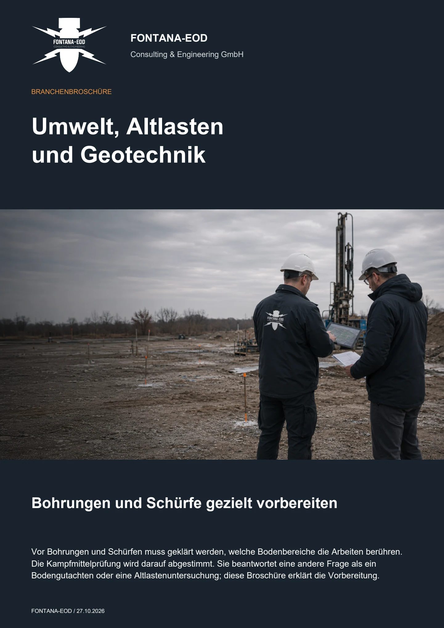
No. A contaminated-land report assesses chemical contamination; an ordnance check investigates suspected explosive ordnance. Environmental documents can provide important site information, but do not automatically establish whether an ordnance measure is needed for the planned intervention or which measure is appropriate.
Former industrial use alone does not establish either contaminated land or suspected ordnance in relation to the specific intervention. Indications of chemical contamination, historical ordnance information and the actual construction task must each be assessed using suitable documents. Investigating one question must not be used as evidence for the other.
The new position and any change in depth are checked against the previous investigation scope. This also applies to a replacement location chosen at short notice because of a utility or obstruction. The spatial limits and conditions of the documented investigation remain decisive.
FONTANA-EOD undertakes the agreed ordnance investigation and coordinates it with the appointed environmental and geotechnical specialists. Laboratory analyses, contaminated-land reports and geotechnical design calculations are separate services to be agreed independently with the specialists appointed for them.
Useful information includes a current site plan showing investigation points, planned depths and methods, existing ordnance documents, and relevant information on existing structures and environmental conditions. Also identify the specialist contacts and proposed work period. Area, intervention depths, interference and the suitable investigation method determine the effort required; interpretation and documentation form part of the service scope.
Not necessarily. What matters is a technically appropriate sequence with clear handovers. Which work must come first depends on the suspected ordnance, investigation programme and site conditions. A joint visit can make organisational sense, but does not replace clearly defined tasks and investigation limits.
Inaccessible points and subareas that cannot be interpreted are described by location and remain clearly identified as unresolved areas. For the next phase, the additional work needed and responsibility for providing the necessary documents or access are established.
If an unexpected suspicious object is found, stop work in the affected area immediately. Do not touch, move or uncover it further. Leave the immediate area, keep your distance and keep others away without putting yourself at risk. In Germany, call the police immediately on 110; outside Germany, use the local emergency procedure. The authorities determine the next steps. Inform project management, site management and the client; internal notification must not delay the emergency call. Even where laboratory results or other specialist findings are available, the specific suspicion raised by the find remains decisive.
For an initial enquiry, provide existing documents in their actual state of preparation. Identify missing information and provisional point lists. Mark methods still to be agreed as planning assumptions.
Send the address or region, site plan, point numbers and planned intervention depths. Add the proposed drilling, trial-pit or sampling method and any working areas. Where there are several options, identify which is decided and which is being examined only as an alternative.
Useful documents include complete ordnance reports with appendices, historical assessments, utility plans and relevant details of fill or installations. Environmental and geotechnical documents can provide context. Identify known gaps, unclear elevation references and conflicting plan revisions so they can be discussed before fieldwork.
State the proposed work period, participating consultancies and contact for changes. The follow-up decision required also matters: tendering the investigation, agreeing points for execution or assessing existing results for a new construction phase. The appropriate service scope is developed from this.
Send the site plan with proposed borehole or trial-pit locations, intervention depths and existing ordnance reports. Together with your consultancies, we establish which points the existing documents cover and where further investigation is needed before execution.
Deep-ground and downhole surveys Ordnance checks for industrial sites Industrial and commercial sites Coordinate borehole locations with FONTANA-EOD
Telephone: +49 6843 9994997 · Email: info@fontana-eod.de
To help assign your enquiry: Sectors and applications. Project region.

Whether historical aerial photograph analysis, explosive ordnance surveying, surface surveying using GPR, magnetometry or TDEM, deep-ground surveys, downhole surveys, excavation supervision, area clearance or ordnance recovery is needed depends on the location, ground disturbance, depth, ground and existing documents. An early ordnance assessment provides clarity for tendering, programming, occupational safety and construction.
FONTANA-EOD combines its Section 7 SprengG licence, specialists holding Section 20 SprengG certificates of competence, suitable survey and clearance methods, and traceable documentation. Send the site plan, depth of ground disturbance, construction phase and existing documents for an initial technical assessment.


