Project pathway
The quickest route to the right decision.
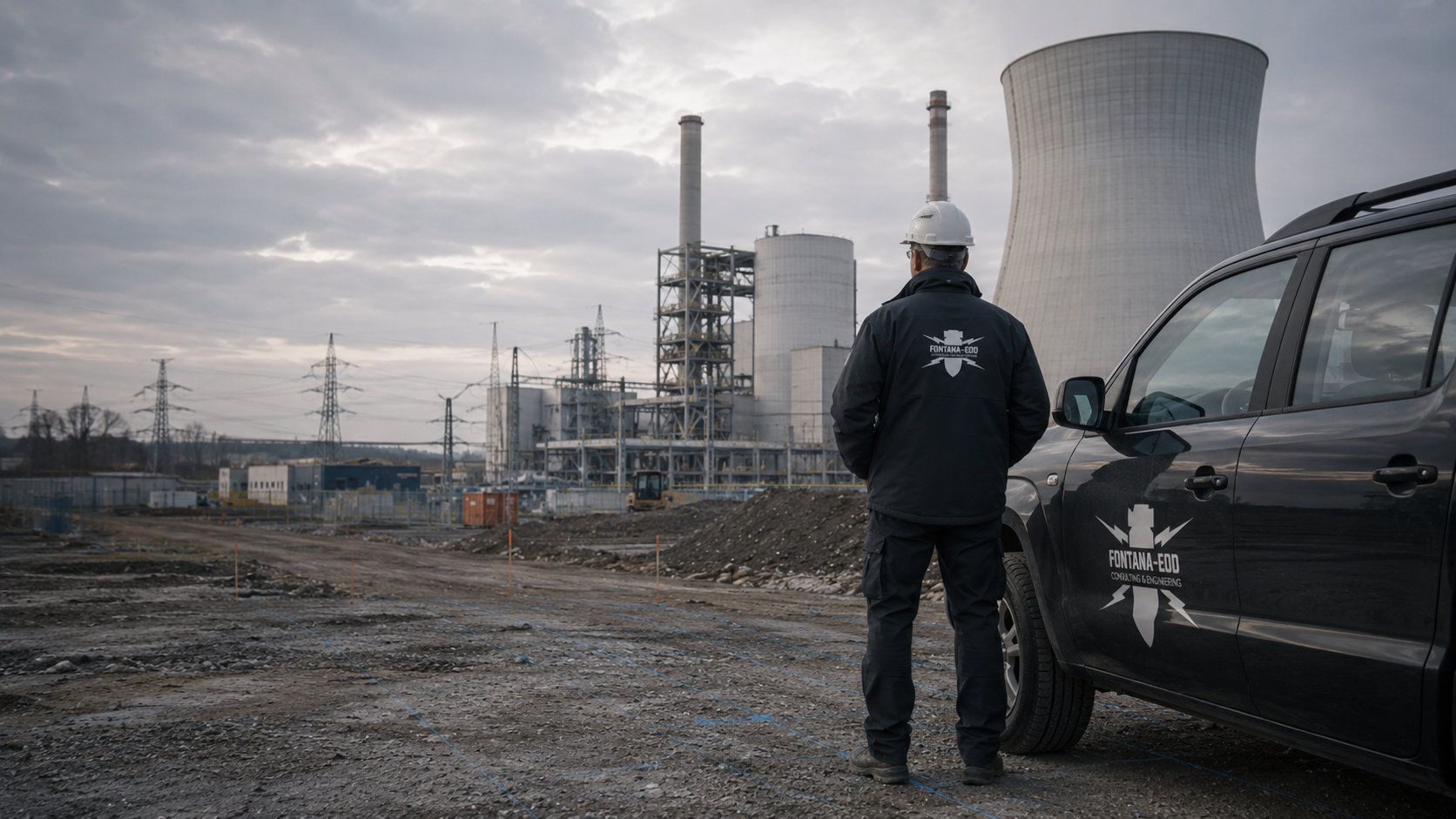
A new cable trench, pump foundation or extension at a utility installation often affects more than the construction area. FONTANA-EOD helps operators and designers connect ordnance assessment with access, operating processes and clear section handovers.
State the location and depth precisely.
Coordinate access and time windows.
Record investigation limits.
At critical infrastructure, a closed access road, interrupted utility or unavailable installation area may affect other operating processes. An enquiry should therefore describe the function of the affected installation as well as the construction area. Technical ground investigation answers the agreed ordnance question. Operational availability and operator duties are assessed separately by those responsible.
Service period: 2026-09
Service areas:Downhole magnetometry / deep-ground surveySurface surveys: GPR, TDEM and magnetometryMethod used in this project: Ground-penetrating radar
View project details · Deep-ground and downhole surveys · Region: Düsseldorf administrative district
View project details · GPR and limitations · Region: Düsseldorf administrative district
The scope of services for “Saarbrücken – DB transformer station / maintenance facility – Lot 3 Saarbrücken / Germany” included downhole magnetometry.
Service period: 2026-09
Service areas:Downhole magnetometry / deep-ground survey
View project details · Deep-ground and downhole surveys · Project location: Saarbrücken
References from project practice
Our examples include energy supply, transport routes and other operating infrastructure. Select a place for the services actually performed.
Project information is loaded from the reference list.
Select a project location from the place selector or choose a point on the map.
The markers show official place centres. The associated references state the construction task, services performed and documented scope.
Map data: © GeoBasis-DE / BKG (2026), VG250 / GN250, dl-de/by-2-0; Luxembourg: ACT / data.public.lu, CC0. Geometries projected and simplified for display.

Preparation connects the position and depth of planned work with the installation function affected. A cable trench, pump foundation or new access road may raise different questions. Describe the activity, not only the site name. The operator states which access routes and facilities must remain available. The specialist company establishes the ordnance assessment scope for the ground volume affected and identifies necessary conditions. System assessment belongs to the designated operating and specialist personnel.
Select services for the affected ground volume
Provide earlier reports together with the current plan. Mark whether new work is within the earlier area, reaches additional depths or includes lateral connections. Investigation of a main route may offer different coverage for a new foundation point. Report, plan and restrictions are therefore read together. Preparation records usable knowledge and open questions. An unchanged site name does not replace this spatial and task-specific comparison.
Compare existing evidence with the extensionFor transport and logistics projects, see information on port and terminal areas, airport and logistics areas as well as transport operators and depots. Technical utility installations are covered in information on data centres, telecommunications sites and waterworks and wastewater treatment plants. For other operating environments, information is available on hospitals and clinics, fire, rescue and security sites as well as energy parks and grid connections.
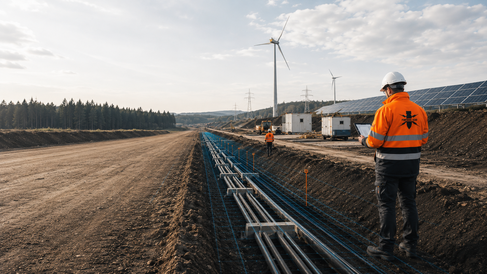
For a new connection, state the route, connection pits, crossings and work volumes separately. The operator identifies existing installations and their operating contacts. Utility information and ordnance records remain separate design inputs. Investigation is matched to the task and accessible areas. If a connection moves, coverage of the new ground volume is checked before execution. Investigation of a nearby utility is not applied indiscriminately to all new connections.
Assess connecting utilities and crossings
New components may extend deeper locally than surrounding paths or existing trenches. Show foundations, excavation and temporary work areas together. The operator describes operating constraints; designers describe interventions. These details are combined for specialist work. A small visible extension does not automatically mean a small ground intervention. Investigation therefore depends on the actual ground volume and available knowledge, not the visible size of the finished component.
Investigate foundations and individual deep areas
An extension may need new equipment areas, access roads or temporary connections. Describe their construction and groundworks. Even temporary areas may lie outside previous investigation. Operating personnel decide which routes must remain available; the specialist company states its work needs. Accessible investigation sections are developed from this information. Operational-use decisions and technical findings are documented with their respective areas and conditions.
Coordinate operational access and work areasShow the route, connection pits and affected existing installations. Add available ordnance records. The specialist company can assess the conclusion needed for the intervention; operating decisions remain with the responsible personnel.
State the date, accessible areas and outstanding prerequisites. Agree a technically suitable scope under these conditions. A desired date alone confirms neither access nor investigation of all planned areas.
Mark the unavailable area and identify who controls access. The unresolved task remains visible. Neighbouring investigation is not recorded as work on the closed section.
Identify the operator unit responsible for access, permitted work areas and routes for personnel and equipment. Add required briefings and escorts. A survey date should be tied to an actually usable work window. Sensitive plans are provided through agreed channels only to the extent needed for the task.
Mark installations, utilities and access roads that must remain in use. Operators and construction designers establish whether switching, alternative routes or special windows are required. FONTANA-EOD supplies the requirements of the commissioned ordnance task; operating decisions remain with those responsible.
Distinguish the interventions: the documented evidence for a cable trench does not automatically include the deeper foundation beside it. Before handover to the next trade, the completed area, depth and unresolved zones must be identifiable. Route or component changes are checked against documented scope.
The current intervention plan and existing knowledge provide the traceable starting point. Installation areas and construction depths are assigned. The agreement states which specific question is to be answered for the next step.
Report and plan show the area actually investigated and its limits. Unresolved areas remain distinct. This assignment is retained when handing over to other companies so the next activity can be checked against the documented area and depth. Follow-up investigations or exposures are assigned to the affected zone. Recovery of confirmed ordnance is coordinated with permitted activities, local responsibilities and documentation. After actual exposure or clearance, the corresponding records are included.
For later work, compare the new ground volume with the previous result. The operator keeps associated documents findable. Position, depth and limits are considered together before earlier knowledge is used for a new intervention.
For a new utility connection beside an existing station, planned alignment, connection pits and known utilities are shown on one plan. Existing ordnance records are assigned to these interventions. Soil, access and possible metal interference affect investigation selection; an equipment name alone does not describe a suitable service.
The operator, site management and specialist company then agree accessible sections. An operationally closed sub-area remains an unresolved task even when neighbouring areas are investigated. Where several employers are involved, hazard information and protective measures must be coordinated for the activities concerned. Risk assessment and cooperation follow §§ 5 and 8 ArbSchG. This coordination takes place before the relevant work.
Assemble location, installation function, plan revision and specific components. Mark position and depth of each activity, existing surfacing and utility information. A general address is insufficient to define the investigation spatially.
Name access requirements, available hours and the operator’s contact. Add prohibited areas and dependencies on other work. State openly which operating decisions remain outstanding.
Agree which plans and reports site management receives and who keeps the operator’s copies. Date, boundaries and restrictions should permit later comparison with maintenance or extensions. Technical documentation contributes to this file.
Utilities, installations and surfaced areas may matter for preparation. Provide known information and mark uncertainties. Method is coordinated with the investigation objective and actual conditions. A generic equipment name does not define a suitable service for every area. Preparatory steps and additional investigation are established for the task. Achievable conclusions remain tied to work actually performed.
Historical records and aerial photographs help delimit suspected areas. Depending on soil, expected objects and interference, technical investigation considers magnetic or electromagnetic methods including TDEM and, where appropriate, GPR. TDEM records time-dependent electromagnetic responses from conductive bodies. GPR shows subsurface reflections; moisture, conductive soils and installations can limit results. Methods and interpretation are matched to the required ordnance conclusion.
A signal is assessed using measurement conditions and further findings information; object identification needs appropriate specialist clarification. Records show where known utilities or metal installations affect interpretation. Such areas are distinguished from the remaining field and compared with the trench or foundation point. The next investigation follows the unresolved question.
Execution needs clear areas that can be entered or driven on and available times. Different installation parts may have different access conditions. The operator identifies them, designers describe construction and the specialist states the work area needed. Deferred sections remain visible and are not covered automatically by work elsewhere. Access or design changes trigger renewed agreement on the appropriate scope.
Necessary investigations and protection are planned before ground interventions during vegetation clearance, demolition, breaking out or creation of access and work areas. Areas accessible later are investigated before follow-on interventions.
The required conclusion is derived from the intervention. A narrow connection may involve a different ground volume from a nearby foundation. Position and depth are considered together. The report records the task performed and its conditions; later use retains that reference. A result is not transferred solely because another area is nearby or shares an installation name.
For deeper foundations or chambers, it is checked whether surface investigation covers the required ground volume. Where survey boreholes are needed, position, layout, casing, depth and documentation are coordinated with utilities and the investigation objective. Required investigations and protection are also established before creating these access points.
If necessary advance investigation cannot be completed, the suitability of construction-phase investigation is assessed. Each layer is technically surveyed and assessed before controlled removal with supplementary visual inspection. Steps repeat to the agreed excavation bottom. Layers, stop signals, instruction authority, reporting and documentation are agreed before work starts.
Assemble planned components, positions, depths and the valid plan revision. State the next decision needed. Attach existing reports with appendices for spatial checking. Mark outstanding details explicitly. Suitable sources and aerial photographs are analysed for open historical questions. Findings are related spatially to present-day installations and interventions for further investigation planning.
The operator names contacts for access and operations. Available areas, coordination needs and time conditions are supplied. The specialist then describes requirements for the activity. A proposed window is considered with actual prerequisites, not alone as confirmation of execution.
Intervention, knowledge and local conditions define the task and method. Achievable statements and unresolved sub-areas are identified. Parties establish preparation needed before execution. Design changes are communicated before the relevant step and checked against the agreed scope.
The commissioned investigation is performed in the agreed installation areas. Data, findings and restrictions are recorded with position, depth and plan references.
Data and findings receive specialist interpretation. Unresolved areas, follow-up investigation and the next decision are identified for operators, designers and site management.
After work, report and plan appendices are handed over together, showing actual scope and restrictions. The next trade checks coverage of its activity. Later additions use this documented basis rather than a generic site name as evidence.
An agreed window is usable only if required documents, access and operating decisions are available. State the date and outstanding prerequisites. The specialist describes task conditions; the operator clarifies operational questions. Feasibility during the planned outage is checked with the operator against actual prerequisites. Suitable scope is agreed from the task and local conditions.
If only some areas become accessible, the scope is divided accordingly. Boundaries are shown and updated on the plan. Each section identifies available conclusions and open areas. Handover remains tied to this status. A continuous installation site is not treated as uniformly investigated solely for organisational reasons. Further sequence is agreed with the operator and site management according to actual conditions.
Later work may affect a different ground volume. A new commission therefore begins with the activity and comparison of existing documents. An original construction report is neither discarded wholesale nor accepted without review. Position, depth and limits determine usability. Unresolved questions are assigned to the new intervention. Old documentation remains as a historical record so changes and additional work stay traceable.
FONTANA-EOD defines ordnance work from the intervention, documents and actual conditions. Operators and designers provide information from their responsibilities. Open questions are assigned so scope is understandable before work. The report records work and limits and supports decisions about investigated interventions. Operational capability and other technical requirements are assessed by designated personnel.
Discuss the investigation taskAccess, switching and construction design may have different responsible parties. Name them so preparation queries can be addressed directly. A general project address is often insufficient for time-critical changes. Coordination identifies missing information or operating decisions and who supplies them. Operating personnel make the corresponding operational decision.
An operationally inaccessible section remains an open task on the plan, not part of an investigated neighbour. Required access and intervention are stated. When conditions change, additional scope can be agreed specifically. Documentation distinguishes planned overall works from specialist work actually carried out. Operational importance does not change this technical reference.
New depths, relocated foundations or added connections are checked against the report. Changed design is supplied before the work. Coverage of the new volume and required conclusion is decisive; calling a change minor internally is insufficient. The specialist can then explain what further clarification is needed.
Report and plans remain together in the responsible project records for later repairs or extensions. Date, location and restrictions stay identifiable. A single result line should not be separated from them. This assignment is passed on when management or contractors change. New activity then receives its own comparison with the documented ground volume.

State the place, installation and affected sub-area. Connect the overview with intervention details. For several operating areas, show the commissioned areas and access routes. The address provides orientation but not spatial scope. Supply the information needed for the task; responsible parties agree the extent and distribution of operating documents according to project needs.
Project information, earlier investigations and agreed requirements are assigned to their original purpose. Record further contacts. The regional overview helps identify the site; project documents establish specifics. Investigation is prepared for the actual intervention. Legal classification and operator duties are established separately by those competent. Different decisions remain distinguishable even within a shared project organisation.
The BBK emphasises operating responsibilities, information channels and interdependencies in critical infrastructure. Planning checks these against the ground intervention: who provides access, which installation remains operating and who decides switching? Legal classification is established separately by the competent authorities.
An investigation report describes a task under documented conditions. Its use includes reading plans, depth references and restrictions. Designated personnel assess installation functionality separately. New interventions are checked for coverage of position and depth. Unclear information is returned as a specific question. This supports decisions without extending results to other areas or future changes.
Explore results and terminologyAn enquiry need not start with a method. Describe the activity and decision first. The specialist can assess existing information and suitable steps. Utilities, ground conditions and ordnance remain separate questions even within the same volume. The service overview explains this. Scope is then agreed with designers and operators against actual conditions.
Understand the service scopeOperating personnel define access and necessary operating decisions, contacts and available areas. The specialist receives information needed for its agreed task. Operator duties remain with the designated operating personnel.
Designers describe interventions and changes. Site management coordinates activities and documents. Investigation scope is compared with each activity and reassessed where requirements differ.
FONTANA-EOD performs the agreed private specialist service. Official decisions and site requirements remain with the competent bodies. Reports document the area, depth, service scope and limits. Legal classification and operator duties are handled separately by those responsible.
In Germany, state ordnance disposal services and locally competent authorities carry out hazard response and find management. Their involvement and public-order or building-control tasks are established for the project location. Outside Germany, local responsibilities apply. Contacts, requirements and reporting are assigned to the specific works.
In Germany, a possible ordnance find is reported immediately to the police on 110. Authorities arrange hazard response and involve the public ordnance disposal service under local procedures. Outside Germany, the local emergency procedure applies. Operating processes and private specialist work are assigned separately in project organisation.
Operating personnel decide which installations remain active, switch or change use temporarily. The specialist provides requirements and limits in good time for construction planning. Access and findings are documented for their respective purposes. Operating personnel determine installation status. The different decisions remain clear to companies and each phase.
Site management coordinates construction information with those responsible. Concurrent activities are compared by requirements. The specialist states its work area; changes are reported beforehand. Existing operating and safety procedures retain their responsible persons. Joint discussion resolves interfaces; technical assessments and decisions remain with the competent personnel.
Investigation answers the agreed ordnance question for a defined area. Other disciplines and operational safety remain with their designated personnel. Added work is checked against previous scope. Documents stay complete with appendices and provide a technical contribution with a traceable subject and scope.
In Germany, authorisation, competence and responsibility requirements for the intended activities under the Explosives Act and the 1. SprengV are established. § 7 SprengG concerns commercial authorisation for activities requiring it; § 20 SprengG concerns responsible persons’ certificates of competence. Under § 1b SprengG, searching for found munitions also constitutes handling. The DGUV Information 201-027 supports activity-specific risk assessment. The DGUV Regel 113-003 is considered for applicable activities according to its subject of dismantling or destroying explosives or corresponding objects and disposing of found munitions. The BFR KMR contain requirements for their defined federal remit; application to the utility-installation work and site requirements are coordinated with the authorities.
Older plans and reports are compared with current assets and work. Changes of names, access or components should be clear. Earlier documents may be valuable but need traceable links to the new intervention. Supply appendices where possible. Assessment uses their actual scope. A known address alone does not show that earlier work covers today’s connection or foundation.
Assign knowledge and appendices traceablyResults are assigned so site management and operators can identify their technical reference. Applicable versions remain clear across revisions. Restrictions and open areas belong in handover. A short status aids orientation but does not replace reports and plans. Later work compares these documents again. Technical records retain their area, depth, service scope and limits as usable project information.
Understand documentation

Different installations may share activities such as connections, foundations or access roads. The sector overview helps consider these tasks in context without equating sites or requirements. Position, depth, knowledge and operating conditions remain decisive. This supports the enquiry and scope selection; other operating tasks retain their own responsible personnel.
Assess utility and energy projectsService selection should describe the required result as well as execution. If results must refer to specific foundations or route sections, this belongs in the task. The overview distinguishes specialist work; the agreement links it to the intervention. Execution and later document use are prepared together without predicting results independently of achievable conditions.
Compare servicesTechnical information
Work at critical infrastructure requires careful coordination with operations and construction design. The brochure explains preparation, suitable investigations and traceable result documentation.
Investigation requirements depend on suspicion indicators and the specific project. Calling an installation critical determines neither a generic survey depth nor investigation of the whole site. The affected interventions and applicable requirements are decisive.
This depends on access, hazards, interference and the method selected. Conditions are agreed with the operator and site management before deployment. The operator establishes the necessary operating adjustments.
These decisions belong to the responsible operating personnel. The ordnance specialist company describes its work requirements and technical restrictions. Operational permission, ordnance assessment and contractual construction handover remain separate decisions.
Only if the documented investigation scope actually covers the connection. New lateral trenches, deeper chambers or changed foundations must be compared with the position, depth and limits of the existing result.
The commission described here concerns ordnance assessment of the agreed intervention area. Resilience assessment, IT security testing and broader critical-infrastructure certification are separate tasks under their respective responsibilities. The operator receives the agreed specialist documents for further project organisation.
If an unexpected suspicious object is found, stop work in the affected area immediately. Do not touch, move or uncover it further. Leave the immediate area, keep your distance and keep others away without putting yourself at risk. In Germany, notify the police immediately on 110; outside Germany, use the local emergency procedure. The authorities determine what happens next. Inform the operator, site management and the client; internal reporting must not delay the emergency call.
Area, intervention depth, ground, investigation objective, existing documents, local interference and accessible work areas are decisive. Operational windows may affect organisation. Method, depth and cost are determined by these conditions and the specialist services needed.
Reports, plan appendices and their plan revision are kept together in project records. For later works, the new ground volume is compared with the earlier scope. The same installation name does not replace this assignment.
Send the plan limited to the intervention with components, depths and valid revision. Add the existing ordnance assessment and reports with appendices. Mark variants where areas are undecided. The enquiry can then identify the next decision. These details turn a general site description into a specific task. Documents are coordinated with project parties to the extent actually needed.
Name the construction designer and operating contact. Provide dates, available areas and access requirements. State pending operating decisions. FONTANA-EOD can then assess service requirements. Final coordination connects scope with actual conditions, operating requirements and time windows.
The Baufachliche Richtlinien Kampfmittelräumung contain requirements for historical and technical investigation, clearance planning and documentation within their defined federal remit. Application to the work, local requirements and responsibilities are established separately.
Whether historical aerial photograph analysis, explosive ordnance surveying, surface surveying using GPR, magnetometry or TDEM, deep-ground surveys, downhole surveys, excavation supervision, area clearance or ordnance recovery is needed depends on the location, ground disturbance, depth, ground and existing documents. An early ordnance assessment provides clarity for tendering, programming, occupational safety and construction.
FONTANA-EOD combines its Section 7 SprengG licence, specialists holding Section 20 SprengG certificates of competence, suitable survey and clearance methods, and traceable documentation. Send the site plan, depth of ground disturbance, construction phase and existing documents for an initial technical assessment.


