Project pathway
The quickest route to the right decision.

Are you planning a ground intervention and wish to discuss investigation needs? First compile where construction is intended, how deep the intervention extends and what knowledge is already available. This helps you prepare a focused enquiry to FONTANA-EOD.
Mark the construction area and sub-areas clearly.
State depth and elevation reference clearly.
Include existing information with its appendices.
For the initial discussion, we need a site plan with the working area marked, a description of the planned ground interventions and existing ordnance documents. Add the design status, access details and a technical contact. Missing information is identified explicitly. This provides a basis for establishing which investigation or coordination with authorities is needed next.
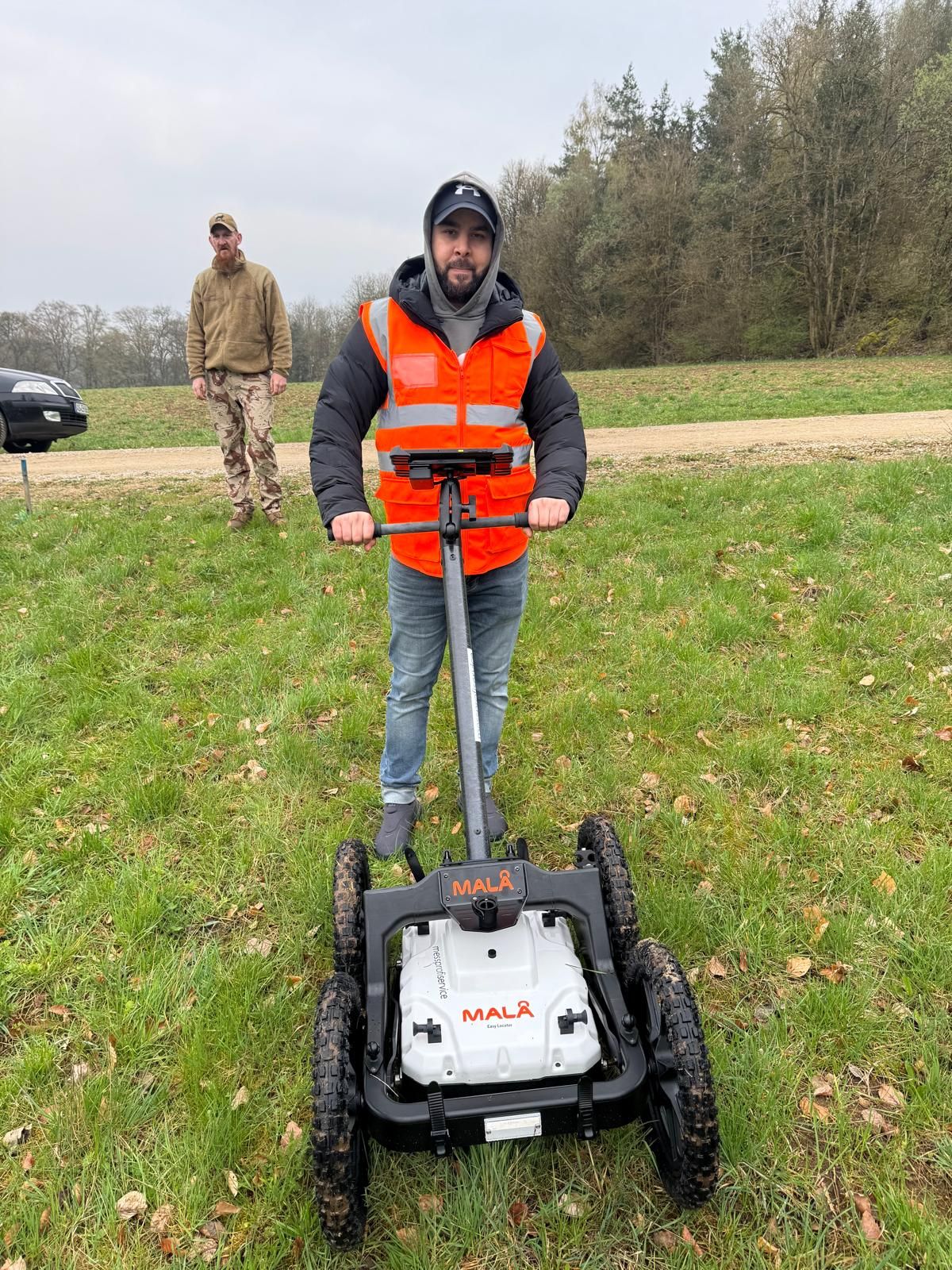
At track 20 in Plattling station, GPR surveying, investigations during construction and subsequent volume clearance were combined. The report explains the sequence and spatial limits of the works.
Working phases and original measurement images from Plattling · Region: Lower Bavaria
Available information is brought together for the initial discussion; missing data is assigned to the relevant construction section.
State the place, street and, where available, cadastral district and land parcel. Mark the actual construction area on the attached plan. Distinguish property boundaries, excavation, utility trench and other working areas so that the enquiry does not inadvertently concern the wrong area. For several parcels, also state whether work concerns a continuous area or separate sub-areas. One address may describe several buildings, yards or access routes. A single map point therefore does not unambiguously define the investigation area. Draw the boundaries of each working area and use the same identifiers in the accompanying message. If neighbouring areas are needed for access or site facilities, separately identify whether ground interventions are also intended there. Ownership boundaries and work boundaries serve different functions.
Describe the work clearly and include existing sections. Always state the reference for depths, such as existing ground level or a specified elevation. Distinguish normal excavation areas and separate deeper points. For an excavation, include intended shoring and anchor work. For utility work, launch, reception or jointing pits may have different depths and dimensions from the connecting trench. For foundations, individual starting points and the intended method are more informative than the future building footprint. Describe the actual groundworks, not only the finished structure. Identify settled methods and options still to be decided separately; they may create different investigation tasks.
Include official statements, historical assessments and earlier investigation reports in full, including maps and appendices. Identify the issuer and date. Mark documents that concern only a sub-area or an earlier construction proposal that has since changed.
Provide available utility plans and information about buildings, paved areas and usable access routes. Photographs may supplement the overview. Identify whether information is verified or still requires coordination with owners, operators or site management. For utility documents, issuer, date and spatial coverage are helpful. A plan information response for part of the area must not inadvertently appear as a complete inventory of the whole project. Also identify known decommissioned utilities and other metal structures. Photographs should show where and when they were taken. An overview of the access route and working area is often more informative than a single detail. Describe current differences from the plan in the enquiry.
State the intended start and sequence as a planning position, not an already confirmed execution date. Identify who can answer design-change questions and coordinate site access. Queries can then be directed to the right contact.
Describe the decision you wish to prepare through the enquiry. Do you need an initial specialist assessment, an already defined investigation method or a review of existing documents? Include available specifications and desired handover formats without assuming services that remain unresolved. Also identify the subsequent recipient of results. Site management may need section-specific plans while a combined report with appendices is to be agreed for the project file. Communicate special data formats or additional report versions before the cost calculation. Include any existing client requirements. Naming a service alone does not define every deliverable. For an unambiguous commission, investigation scope, result documents needed and deployment prerequisites must match.
Missing information, changed ground interventions and unknown survey conditions require different clarifications. What matters is the question still outstanding before commissioning.
In early planning, historical assessments may be missing or cover only sub-areas. Existing sources are therefore assigned to the intended construction site. The specialist company clarifies with the client what additional information is needed to choose a method. The quotation must show whether the enquiry initially concerns that research or a technical investigation based on it.
Assign files to the project fileBefore a further commission, the new design is compared with the earlier investigation scope. Mark shifted routes, additional areas and deeper foundations on the current plan. Identify the revision replaced. This allows specialist assessment of the earlier results still applicable and the additional scope that needs a quotation.
Describe changes technicallyBefore technical deployment planning, information is needed on utilities, metal structures, ground composition and access. These may affect a method's suitability and limits. Existing-structure and ground documents support this assessment but do not replace it. Unverified information is handed over as such so that the quotation shows its assumptions and remaining clarifications.
Coordinate outstanding documentsThe same documents may have different significance depending on the project. Initial area planning raises a different question from a civil engineering section already tendered. Make clear which decision the quotation is intended to prepare.

Provide the available design and identify areas where options remain open. The current design status helps define the initial scope. Areas added later or deeper foundations should be identifiable separately so that the investigation does not unknowingly use an outdated task description.
Assign project type and ground interventions
Provide the bill of quantities together with the associated plans. Items should identify the area, ground intervention and documents to be addressed. If essential information is missing or contradictory, clarify these questions before defining a sound service scope.
Check the service scope with specialistsFor a changed route or additional excavation, both the previous status and the change matter. Provide the relevant investigation reports in full. The enquiry can then address the new task while the limits of conclusions for areas already covered remain traceable.
Add the change to the project fileAn informative enquiry begins with the planned work. State the technical question even if the investigation method remains open. FONTANA-EOD can then relate the documents to the ground intervention actually intended and ask targeted follow-up questions.

If only individual information responses or older plans are available, describe their spatial coverage and provenance. Historical aerial photograph analysis requires a defined investigation area and an understanding of available sources. An assumption about former use must remain identifiable as such; an enquiry neither confirms nor excludes it.

For boreholes, piles or other deep interventions, property size and address are not enough. Provide available starting points, depths, elevation references and ground and existing-structure information. Whether and how a deep-ground survey is useful must be assessed against the specific task and constraints.

For an excavation monitoring enquiry, intended excavation sections, their depths and the planned working method matter. Also describe the investigation status already established. A service alongside construction must fit the defined technical approach; its name alone does not answer which investigations are needed beforehand.
Information, plans and earlier investigations are provided with their appendices. Their respective scopes must be relatable to the current project.
Provide historical assessments and official statements in full, with maps, issuer and date. Mark coverage limited to a sub-area. If required information is missing, coordination with authorities is clarified for the location. A missing document says nothing about the presence of ordnance.
The current plan distinguishes the property, route and actual intervention area. Sections or point lists supplement depths with elevation references. Settled planning values and open options remain distinguishable. A conclusion about an earlier construction status is not transferred to the new design without comparison.
Existing survey reports and clearance records belong in the documents with results plans, assessment of findings and identified limits. Include associated survey data with spatial referencing where available. For an older ordnance clearance confirmation the scope described matters. Comparison with today's construction task shows which results remain usable and which questions need clarification. For older documents in particular, the link between report and appendices is important. A results plan may use different section names from the current design. Show the relationship where known and raise unclear assignments as queries. Notes about inaccessible sub-areas, depths not reached or outstanding findings also belong in the complete submission. A short final conclusion should therefore not be passed on separately from the conditions under which it was reached.
Quotation documents accompany the project beyond commissioning. The technical task, execution and documentation subsequently owed must be derivable from them.
You provide the site plan, ground intervention description and existing knowledge. Initial contact clarifies the decision ahead and the scope the quotation should concern. Outstanding planning questions are distinguished from established requirements.
Existing information, historical assessments and investigation reports are assigned to their scope. If necessary historical research or aerial photograph analysis is missing, it is arranged before choosing the technical method that depends on it.
The suitable method is determined from suspected ordnance, the ground intervention and local conditions. Investigation boundaries, documentation scope and required coordination provide the basis for quotation and commission. Planned clearance takes account of the clearance concept and safety planning.
The specialist company carries out the agreed investigation or clearance within the defined area. Changed site conditions and deviations are assessed before the execution affected. Merely documenting work retrospectively does not replace the intended technical work.
Recorded data is assigned to the area covered and assessed by specialists. Anomalies, areas that cannot be interpreted and outstanding investigations remain distinguishable from the completed scope. This establishes whether further measures are needed before the next intervention.
The report, results plans and any clearance records document work actually completed. Handover identifies limits of conclusions and remaining tasks. The client and site management can compare this status with the next planned construction phase.
The project file links the current construction plan to historical information, official responses and relevant coordination. Existing survey data, assessments, reports and clearance records are assigned to their results plans. Outstanding documents and their spatial coverage also remain identifiable.
Compile the site plan, ground intervention description and existing sections under the same project name. State the plan author, date and revision where available. Preserve original documents when forwarding them so that their provenance and limitations remain traceable.
Provide investigation reports including maps, appendices and statements about uninvestigated areas. A summary cover sheet is often insufficient for specialist assessment. Identify the earlier ground intervention to which the result related and the current works extending beyond it.
Summarise later changes in a short accompanying message and identify the files affected. A visible revision makes comparison easier. Also identify who can answer technical planning questions and who can supply additional information, existing-structure records or earlier investigations. Legible PDF plans initially allow a shared review. If digital plan or point data is available, state its format; the appropriate handover is agreed for the work. Keep the original document title and visible revision. Otherwise a file with the same name but changed content may be confused with an earlier version. For several appendices, a short assignment to construction section and question helps. Identify documents still being requested even if they are unavailable at first contact.
For the quotation, the plan, actual site and intended work are considered together. Location, elevation and existing structures may describe different investigation tasks; open values remain separate from confirmed planning dimensions.
A marked area initially describes location, not automatically investigation depth. Relate depths clearly to ground level or a specified elevation. If fill is removed or terrain remodelled, describe the initial and target conditions separately. For several sections, it must remain clear which information applies to each; otherwise plan and section may describe different tasks. For point-specific work, assign location and maximum intervention depth to each point. Point lists, plans and sections should use the same identifiers. Include the coordinate system and elevation reference for coordinate lists where known. Different reference levels are not replaced with one number. Points that may still move remain identifiable as options. For the quotation, it matters whether the point arrangement is already fixed or whether investigation of a possible execution option must first be agreed.
Utilities, metal structures, reinforced surfaces or heterogeneous fill may affect the investigation possible. Provide available information without inferring survey feasibility yourself. Ground reports and existing-structure plans support assessment but do not replace method-specific evaluation. A surface appearing clear in photographs does not prove the subsurface is free of interfering structures or conductive materials. Existing information on stratigraphy, fill and groundwater is also useful. Provide the ground report with its investigation logs and locations where available. A ground profile from a distant point does not automatically describe every intervention area. For practical planning, identify paved surfaces, known voids and restricted access routes as well. This information does not establish a general commitment to a particular method; it helps assess suitability and necessary preparation for the specific place.
Separate fixed design dimensions from provisional assumptions. A final area, roughly estimated length and unresolved depth option must not be treated alike unnoticed in the quotation. State the origin of important quantities and how changes are to be handled. Desired results, such as a site plan or investigation report, should also relate to the scope actually requested. Comparable quotations require quantities and service content to be considered together. Route length alone says nothing about trench width, additional pits or the distribution of depths. A point count also needs associated location and depth information. If a quantity is estimated only from a preliminary design, identify that revision. The quotation can then state its calculation basis. Later changes and additional tasks are discussed on that basis rather than silently absorbed into an already described service.
This example information comes from the completed Track 20 documentation and shows how a task can be described. It is neither a new commission nor a price quotation.
The Plattling case study shows the actual process. A new enquiry uses its own planning data and ground interventions; the parameters in this example are not a general specification for other areas.
Equal area figures do not imply equal service scope. The documented tasks at Plattling show which details must remain separate for a clear comparison of quotations.
| Comparison point | Documented example | Check in the quotations |
|---|---|---|
| Working area | A GPR survey area of 1.432 m² is documented. | Identify areas and sections separately for surveying, interpretation and subsequent work. |
| Depth reference | GPR interpretation extended to 0,80 m. Later local excavation in G1/G2 reached 2,50 m. | Compare interpretation depth and actual ground intervention volume separately; do not equate numbers referring to different quantities. |
| Survey result | 294 anomalies and overlapping signals prevented reliable identification from GPR data alone. | Specify the specialist assessment included and how unresolved findings will be handled as follow-up services. |
| Further work phases | In the documented sequence, surveying was followed by volume clearance, individual-point recovery and checks. | Check whether the quotation includes only surveying or agreed follow-up work as well. Do not count services or quantities twice. |
| Completion documents | The report links survey presentations, work phases and spatial limits of conclusions. | Explicitly record report components, plan references, handover format, scope and any outstanding official documentation. |
The Plattling project process explains the actual sequence. The report example with original survey images shows how results and limits are documented.
The next step depends on what has already been established. An initial enquiry does not require you to complete an investigation in advance. You should, however, identify what the desired decision is to be based on.
Describe the location, intended use and foreseeable ground interventions. Mark areas or depths that remain open. Initial specialist coordination can establish which information is needed first for further planning.
Compile the basic informationProvide the documents in full and explain their relationship to the current project. Differences between the earlier and current planning should be visible. The old report's conclusions can then be assessed specifically for the new task.
Assign documents spatiallyInclude the specification, plans and technical information together. State which parts are binding and which remain to be agreed. The comparison must concern the actual construction task and stated conditions.
Distinguish specialist servicesProvide the previous and current revisions together. Mark additional areas, greater depths or changed access. A clear description helps assess the effect on service scope, sequence and documentation needed.
Submit the revised planningWe compare the requested ground interventions with the plans and earlier investigations supplied. Contradictions or missing information become specific queries. Method selection considers local survey conditions and the documentation required.
The property, construction site and individual intervention areas are distinguished. Earlier results are assigned to their documented area. It remains clear which parts of the new task are not covered by existing documents.
Elevation references and separate deeper points are compared with the planned works. A general excavation depth must not inadvertently be used for deeper boreholes or other foundations.
Reports are considered together with appendices and limitations. If results plans or essential explanations are missing, the gap is identified before drawing conclusions based on them.
The applicable design is distinguished from superseded versions. Later changes are assessed for the ground interventions and earlier conclusions affected before further services are agreed.
Queries are directed to contacts for planning, existing structures or execution. For later deployment, reporting routes for a possible ordnance find and communication with the competent authorities are also prepared.
The enquiry states whether an assessment, specific investigation or coordination of existing results is initially needed. Further work thus has a clear purpose.
Not every item of information comes from the same source. Clear assignment helps technical coordination and prevents provisional information being passed on unnoticed as confirmed planning information.
The project owner or appointed planners describe the project and compile the available documents. The applicable design revision, known changes and existing requirements are identified. If the client is not the property owner, access and intended investigations are agreed with the authorised party.
Site management and the contractor provide the current construction status and planned work sections. Operators provide information on affected installations and operational requirements. Confirmed information must be distinguishable from points still requiring clarification with the relevant party.
FONTANA-EOD reviews the information in relation to the specialist service requested and identifies further investigation needs. Official information and orders come from the competent authorities. The respective tasks of the ordnance clearance service, public order office, building control or other authorities are clarified for the location and procedure. Relevant requirements enter project coordination with their actual scope.
Quotation preparation describes the planned service. Investigation, execution and documentation follow from the task, knowledge available and relevant requirements. Sending documents is distinct from this specialist work and the decisions of the competent parties.
Execution must take account of the explosives-law requirements for authorisation, competence and responsibility appropriate to each activity. The Explosives Act and 1. SprengV form part of this framework. The enquiry should therefore describe the desired activity specifically rather than group different services under a general label.
Information on neighbouring uses, parallel trades and access supports risk assessment and protective measures. DGUV Information 201-027 is relevant guidance for ordnance clearance. For methods alongside construction, the BFR KMR also refer to the provisions for found ammunition in Appendix 5 of DGUV Rule 113-003.
Provide requirements and statements with their specific project reference. For federal properties, the BFR KMR provide a defined technical framework. For other projects, applicable or contractually agreed requirements must be clarified. Merely mentioning a set of rules does not answer that project-specific question. The BFR KMR A-4.2 address establishing the planning basis, clearance concepts and execution planning. For projects in Hesse, the ordnance clearance service at the Darmstadt Regional Council publishes information on enquiries, aerial photograph analysis and required notification documents.
If a suspicious object is encountered, stop work immediately and do not touch or move it. Leave the immediate area and keep others away without putting yourself at risk. Notify the police on 110. An ongoing enquiry or quotation discussion does not replace this immediate reporting route.
For a specialist enquiry, a clear location is more important than a general regional label. Provide existing location data and explain the operational or site conditions to be considered.

State the municipality, address and available property or location information. For larger areas, additionally mark the actual working zone. Location helps assign documents and competent contacts; a region alone does not establish specific suspected ordnance.
Assign the enquiry locationOn rail, road, utility or industrial sites, access and work windows may affect preparation. Describe installations affected and ground interventions intended. Binding operational requirements should be identified by the competent parties and included as documents where available. State existing operational windows or possession periods as requirements of the relevant operator and identify unconfirmed periods. It is equally important to state when the area will actually be ready for investigation. A desired construction start alone does not describe this prerequisite. If stored material, traffic or other trades temporarily occupy the area, include this in the sequence. Specialist services and organisational preliminary work can then be prepared together. Deployment duration is only agreed from the commissioned scope and available working conditions.
Identify conditions in the project settingClear terminology helps handover between the specialist company, planners and construction management. More detailed information on methods and records is available in specialist guidance on ordnance assessment.
It shows the project's spatial reference. For the enquiry it must identify the intended working area; a property boundary alone does not describe the planned ground intervention.
It documents a specific investigation with its basis, results and limits. Its spatial and technical scope must be checked against the current project.
It identifies the requested or planned service. Plans and technical information should match so that scope and prerequisites can be brought together clearly.
It identifies the currently applicable design revision. Provisional options can also be provided if their unresolved decision remains explicit.
Quotation preparation depends on existing knowledge and the technical question still unresolved. Sources, plans and results are related to the intended ground intervention.
Historical assessments can add to knowledge of suspected ordnance. Their actual relationship to the area affected matters for the enquiry. Provide reports with maps and explain which current construction task is to be considered.
Assess historical informationDescribe how the investigation result is needed in the subsequent construction sequence. Spatial referencing, areas covered and limits must be clear to later parties. The desired documentation therefore belongs in agreement of the scope from the outset.
Prepare result documents
Send the available information with a brief explanation of the next section. Identify missing details and a contact. Clear assignment helps discuss which technical questions need clarification first.
Send project documents for coordination
Historical assessment and technical surveying answer different questions. The construction task and existing knowledge determine the service to commission.
Identify services for the projectThe documents provide the basis for the next steps. The project process must fit the construction sections, knowledge available and handovers needed. A traceable project file supports this coordination.
Prepare the process and handoversTerms such as suspected area, anomaly or clearance are read in the context of each document. For unclear terminology, the issuer or specialist company is asked to relate it to the specific construction task.
Understand technical terms in documentsIt allows an initial location to be identified but does not describe the specific ground intervention. Add a plan with the working area marked and the planned depths. This is particularly important if only part of the property is to be covered.
No. Describe the knowledge available and identify missing documents. Further investigations needed must be established by specialists on the basis of the project and, where applicable, with the competent authority.
Photographs are a useful addition for the surface, access and existing structures. They do not replace clear spatial boundaries for the planned work, however. Include available plans and explain where the photographs were taken from.
State the planned intervention depth with its elevation reference and identify different depth zones. If values are not yet defined, identify the outstanding planning question. An estimate should not appear as a confirmed execution depth.
Sending your documents initially serves as an enquiry. Scope, execution conditions and commissioning are clarified separately. Sending project documents does not provide technical clearance for ground interventions.
If such a document appears relevant to the context, provide it with its provenance and precise spatial coverage. Its result cannot be transferred to your own construction site without specialist review. What matters for the enquiry is the knowledge concerning the area actually intended and the planned ground intervention.
Send the new design revision and describe the change from the previous basis. In particular, mark additional areas, changed depths and different access arrangements. Any adjustment to the service scope is agreed separately on the basis of that change.
Area is only one factor. The investigation objective, intervention depth, existing knowledge, survey conditions, access and desired documentation can affect scope. A sound quotation and schedule therefore need to consider the specific task and its prerequisites.
Describe the project so that working area, ground intervention and knowledge available can be understood together. Existing documents are useful even if the collection is incomplete.
State the next decision: initial needs assessment, planning a particular investigation or comparing existing results with a changed task. A clear question makes specialist work easier.
Include the current site plan, available depth information and relevant reports. Identify missing documents and distinguish confirmed details from provisional assumptions. Necessary additions can then be discussed specifically.
State who can answer planning questions and obtain additional documents. If access or operational conditions depend on other parties, add the relevant contact. Dates are agreed separately on this basis.
Whether historical aerial photograph analysis, explosive ordnance surveying, surface surveying using GPR, magnetometry or TDEM, deep-ground surveys, downhole surveys, excavation supervision, area clearance or ordnance recovery is needed depends on the location, ground disturbance, depth, ground and existing documents. An early ordnance assessment provides clarity for tendering, programming, occupational safety and construction.
FONTANA-EOD combines its Section 7 SprengG licence, specialists holding Section 20 SprengG certificates of competence, suitable survey and clearance methods, and traceable documentation. Send the site plan, depth of ground disturbance, construction phase and existing documents for an initial technical assessment.


