Project pathway
The quickest route to the right decision.

For project owners, planners and site management, ordnance checks begin with the construction proposal and existing information. FONTANA-EOD coordinates investigation needs, execution and documentation. Send a site plan, intervention depths and desired timeframe to prepare your project.
Clarify the project question and documents.
Fit measures into the construction sequence.
Record results and outstanding points.
Suspected ordnance, the type and depth of ground interventions and existing investigations determine the scope of work. Requirements of the competent authorities also apply. Historical investigation, technical surveying, clearance and any necessary method alongside construction have different tasks; the commission is limited to the scope actually required.
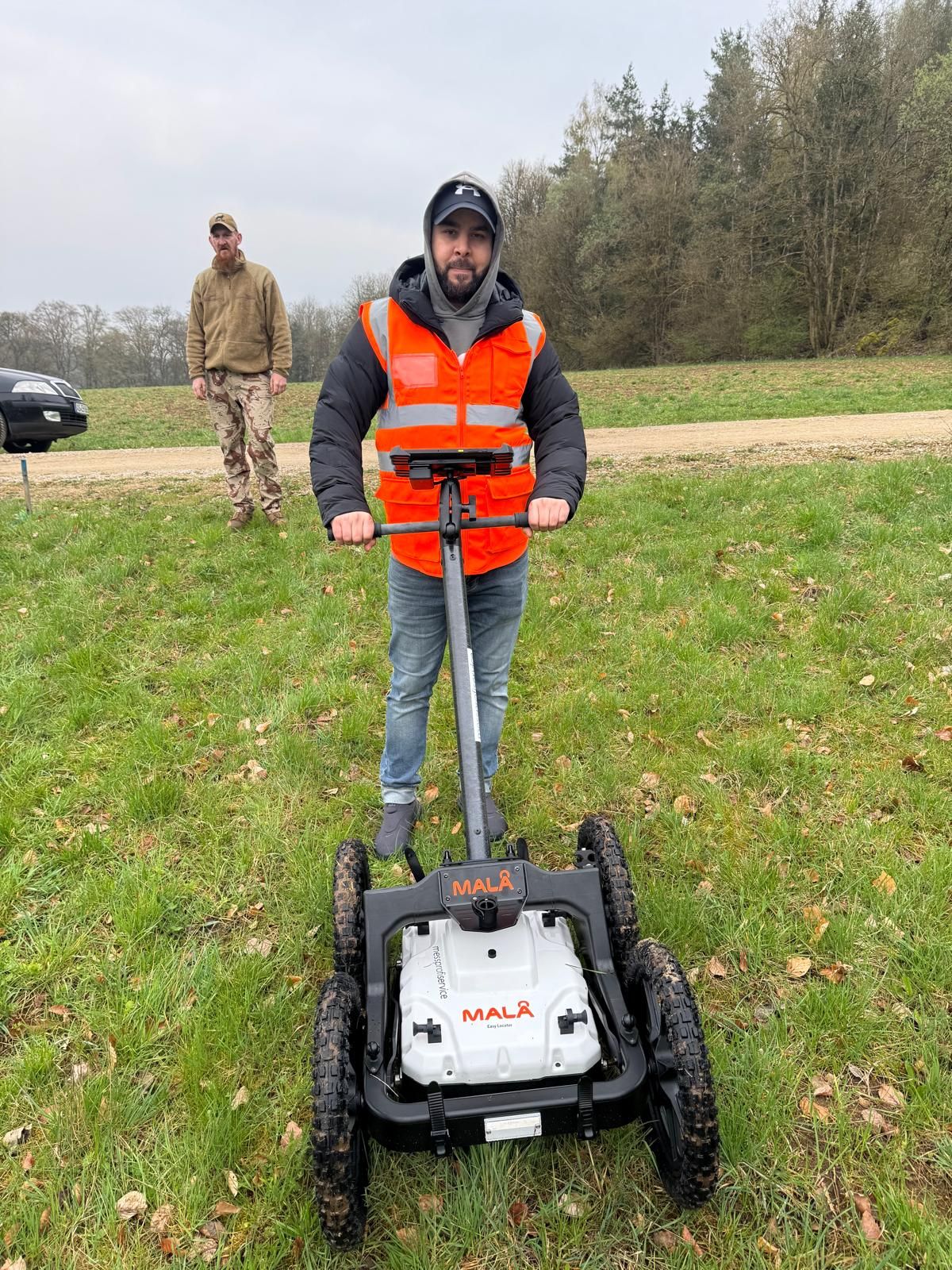
At track 20 in Plattling station, GPR surveying, investigations during construction and subsequent volume clearance were combined. The report explains the sequence and spatial limits of the works.
Working phases and original measurement images from Plattling · Region: Lower Bavaria
Missing knowledge, technical interference and design changes affect different project phases. Before each stage of execution, the investigation and handover needed are clarified.
If historical information is missing or existing information covers only part of the site, this gap is clarified before technical deployment planning. The specialist company relates the findings to the planned ground interventions and defines the investigation needs. The scope and quotation follow from this task. The client can see which document is to be produced for the next planning decision.
Prepare handovers from a technical perspectiveUtilities, metal structures, made ground or lack of access may limit the investigation. These conditions are compared with the intended search depth range and construction method. A preliminary investigation that is technically impossible is not replaced by merely observing the excavation. Whether a planned method alongside construction is suitable under the specific conditions must be established by specialists. The scope and limits are recorded before work begins.
Submit changes for coordinationNew anomalies, survey data that cannot be interpreted or changed intervention depths may require further investigations. The specialist company assesses the deviation and describes which part of the earlier work remains usable. Site management receives an identified work status with outstanding tasks. A documented sub-area does not thereby automatically cover adjacent or deeper ground interventions.
Identify the contributions of the parties involvedArea-wide development, individual foundations and work around existing structures require different handovers. A shared commission therefore does not replace section-specific execution planning.

Before development begins, construction boundaries, access routes, site facilities and planned earthworks are considered together. Areas used temporarily may also be relevant to investigation or access. Merely proceeding in plot-number order is insufficient if an area needed later will first be occupied by material storage. Work is therefore coordinated with the actual use of the area and the progress of preparatory works.
Identify the construction project's requirements
For ground interventions at specific points, the agreed point locations determine the investigation scope. The sequence must allow for setting out, specialist investigation and feedback on the intended execution. If starting points or depths change, the affected task is reviewed again. On the day of execution, the operator and site management must be able to identify the point and design revision to which the document relates.
Agree points and depths before execution
Around existing structures, other trades, utilities, traffic or changing working areas can restrict access. Planned specialist support is therefore checked against the time windows actually available. A short-notice change in excavation location is communicated before work begins so that personnel, documents and working area match. Daily progress and remaining tasks are handed over so that the next shift can understand the current status.
Provide specialist support for ongoing earthworksMethod selection follows the unresolved project question. The conclusions needed for the next ground intervention and the knowledge already reliably available are therefore established first.

If usable information on suspected ordnance is missing, the historical basis is clarified first. This work belongs early in the schedule because its result may change the later investigation. The current construction design must be linked spatially to the areas assessed. If additional parts of the property are included after the assessment, their information status must also be considered. This gives process planning a reasoned task for subsequent technical work.
Boreholes and deep foundations are prepared using the specific starting points, distances and intended depths. The foundation equipment deployment date is linked to specialist investigation needs. This requires sufficiently settled planning: an axis shifted later may fall outside the area already considered. The work plan therefore records which design revision is investigated and how changes reach the responsible specialists before execution.
For ordnance clearance alongside construction, investigation methods, work sections and excavation progress are coordinated by specialists. Site management and specialist personnel clarify handovers and prerequisites for continuing before work begins. The schedule allows for necessary investigations and technical decisions. Merely observing ongoing earthworks does not replace this service.
Different documents are needed for commissioning, site deployment and the next construction phase. Each handover records the work status reached and the basis for its assessment.
The quotation information and project documents identify the project location, property or route section, construction proposal and investigation area. The site plan and design revision delimit the service. Existing historical assessments and information from authorities are assigned to this area. Missing information must be identifiable before the quotation so that the scope does not rely on unstated assumptions.
The agreed location and depth information and technical method requirements are available for deployment. Where clearance is planned, the clearance concept and necessary safety planning form part of preparation. Known utilities, areas actually accessible and concurrent work are compared with the planned deployment. Deviations are clarified before the execution affected. Temporary works may also form part of the ground intervention volume. For an excavation, for example, shoring, intended anchor positions and the creation of a working platform for construction equipment must be checked against the planning. The future building footprint does not describe this volume in full. Point-specific foundations require the actual starting points and intended method. If such information changes only after the investigation, it must be checked whether the earlier work covers the new ground intervention at all. Details relevant to execution therefore belong in the preparation.
During work, the sections covered and locations of anomalies, access obstructions or additional questions are recorded. This feedback supports a specific decision: can the agreed next step be prepared on this basis, or are further services and coordination required? The information is handed over with a spatial reference. A general verbal statement about the entire property would be too vague for section-by-section work.
The survey report brings survey data, results and assessment of findings together with the areas covered. Completed clearance work requires the corresponding clearance records. The report and plans identify limits and remaining tasks so that site management can compare the status reached with the next works. This comparison is required again if the ground intervention changes. If interim information is needed before interpretation is complete, it is identified as such. The date, section and work still outstanding must remain clear. Site management can then distinguish provisional feedback, a completed sub-area and the combined final status. Plans and reports provided later are sent with their respective revisions. A superseded interim version must not continue to be used unnoticed alongside the later results when preparing further work. The agreed recipients therefore also receive significant updates to documents already handed over.
The sequence provides orientation. The specific scope is agreed before commissioning and reviewed when significant changes occur.
You provide the project location, site plan, intervention areas and depths, schedule and existing ordnance documents. We review the task and identify missing information. Contacts, responsibilities and the desired form of results are established early.
Submit project recordsHistorical information, aerial photograph analyses and existing statements are related to the current ground intervention area. Missing knowledge may require further research or investigation. Existing knowledge is documented and distinguished from assumptions.
View historical informationThe investigation or clearance objective, spatial boundaries and conclusions required are agreed. Where clearance is planned, suitable measures are described in the clearance concept. Requirements for checks, coordination and completion documents are included in this preparation.
Clearance concept and documentationSurvey methods, access, utility information and potential interference are checked. The process is coordinated with construction times, other trades and necessary protective measures. The responsible parties clarify when work steps may begin and which prerequisites must be met.
Checks and safetyDepending on the commission, the work includes technical surveying, area clearance, recovery within the permitted scope of activity or a professionally planned method alongside construction. Anomalies and deviations are assessed and coordinated with the responsible parties. Changed planning is checked before the ground intervention affected.
Identify suitable servicesMeasurements, areas covered, findings and limitations are brought together. The results are checked against the agreed objective. Clients receive the specified documents, clearly identified work boundaries and, where applicable, guidance on further steps needed. An anomalous survey signal is initially a finding that requires specialist assessment. Assessment considers the method used, local interference and assignment to the investigation area. Calling a metallic object or technical interference an anomaly does not identify it as ordnance. For further planning, it matters which anomaly requires more work and where survey conditions limit sound interpretation. A map of measurements alone and a professionally assessed presentation of results therefore serve different purposes in the project process.
Understand completion documentsThe project file links historical data, information from authorities and relevant coordination with the investigation results. The report, survey data, results plans and any clearance records are assigned their revision status. The client, planners and contractors thus receive the same information for the next construction phase.
Areas, borehole points or excavation sections have unambiguous identifiers. The report refers to the same site plan as the execution planning. If different partial revisions are handed over, their chronological order must be clear. A later query can then establish which document applied to a particular section and what additional work subsequently took place.
An unresolved area is assigned a location and a clear reason. This may be lack of access, a technical limitation or a finding not yet assessed. Further work is described as a specific task. For process planning, what matters is which planned ground intervention is affected and what clarification is needed before it is carried out.
The handover identifies who needs the results for the remaining project. For changed planning, the documents to be returned to the specialist company are specified. If technical results are needed for coordination with an authority, their scope is related to that requirement. A shared handover prevents planners and contractors from continuing with different assumptions about the scope of work completed.
An agreed date is not enough for technical preparation. The service must be assignable to the actual ground intervention area and its condition at the intended time of execution.
We begin by clarifying the work status: which sub-areas have been investigated, which conclusions apply only to particular depths and where are usable documents missing? This information leads to an agreed work plan. Investigation, assessment, necessary follow-up measures and subsequent handover remain clearly distinguishable within it.
The construction property's boundary and planned investigation boundary need not be identical. Therefore mark the construction areas, working volumes and intended ground interventions actually affected. Where several design versions exist, a common revision is agreed. Changes are identified and handed over specifically so that areas already covered and newly added areas are not confused. The comparison also includes ancillary areas where ground interventions are planned. A stated coordinate system and unambiguous point labels help when handing over location information. A borehole point list, associated plan and subsequent results should identify the same points. Different numbering systems are reconciled before deployment. Along routes, section boundaries and chainages can provide the reference. Reference points identifiable on site make assignment easier but do not replace the surveying technically required. The agreed form of data handover depends on the planning actually available and intended for further use.
Depths need an unambiguous reference. A depth stated from today's ground surface cannot simply be compared with the same number after soil has been removed. The work plan therefore considers the reference level, intended ground intervention and relevant construction status together. If work has already progressed, communicate changes to the surface and provide existing survey documents. No general assumptions about achievable investigation depth are derived from this.
Vehicle access, vegetation, paving, utilities and other interference sources affect practical work. These conditions form part of preparation and are checked on site where needed. Stored materials or ongoing work may temporarily make a previously planned area inaccessible. The specialist decision on how to proceed then considers the actual condition. A schedule should make such dependencies visible rather than reveal them only on the deployment day. Preparation therefore also includes access-route and intended working-area information. Known bottlenecks, gradients, overhead lines or adjacent excavations are identified so that the intended deployment can be assessed for suitability. Site management and the specialist company agree who organises necessary preliminary work and when the area will be available. Planned site clearance may itself involve ground interventions and must then be included in the task description. An area shown as open on a plan is not automatically accessible in its actual construction condition or workable with the intended equipment.
A design change need not automatically invalidate all earlier work. It is reviewed to establish which areas, points, depths or conclusions are affected. The old and new revisions are compared clearly for this purpose. Usable results remain assigned to their scope; additional needs are delimited specifically. This provides a sound basis for agreeing further services and avoids treating an earlier report as universally sufficient without change. For a laterally shifted route, spatial overlap with the area investigated earlier must be compared in particular. Added depth concerns a different investigation horizon even if the line on the site plan remains the same. Both changes may occur together. Therefore provide the new geometry, not merely a notification that something has changed. Site management must be able to identify which earlier conclusions can still be used and which additional area remains unresolved until specialist clarification.
An enquiry may arise at different project phases. The next steps start from the status actually reached.
You are planning a ground intervention but do not yet have an assessment of suspected ordnance. Existing documents and the intended construction area are brought together first. The next step clarifies which historical or technical information is missing for the project decision. The planned ground intervention is therefore as important to the enquiry as any existing assessment report.
Clarify the information needed for planningThe construction task is already described and an execution period envisaged. Investigation scope, technical prerequisites and handovers needed are now coordinated with it. The planning must show which points, areas and depths are actually affected. Missing information is identified before deployment planning and clarified with the responsible project parties.
Prepare execution with specialist inputLocation, depth or working method changes during the project. Provide the previous revision together with the clearly amended planning. Specialist review establishes which earlier results still fit the project and where additional needs arise. Further services are agreed specifically in relation to this deviation.
Submit the design change for reviewThe approach makes the work status traceable. Tasks, technical prerequisites and specialist feedback throughout the project are related to the same investigation scope.
Plan reference, section and execution objective are used consistently in coordination. A changed reference is communicated. Feedback from specialist work can then be assigned to the correct sub-area even where several trades work in parallel.
An inaccessible area or unresolved anomaly is made visible in the work status. The technically required follow-up decision is agreed with the client. A preferred date does not replace assessment of the actual prerequisites.
Before handover, it is checked whether work completed and documented scope match. The presentation also identifies work boundaries and outstanding points. Recipients can see which information is already available for the next planning stage and where further clarification is needed. In particular, areas and points named in the report are compared with the associated plans. A sub-area described as covered must be assignable to the documented scope; excluded locations must not disappear from the combined presentation. Different point numbers, unclear section boundaries or contradictory depth references are clarified before further use. The recipient also needs to know whether a work step concerns investigation, interpretation or subsequent work on anomalies.
Technical questions and changes go through the agreed contacts. Reporting routes for a possible ordnance find are made known before work begins. The companies involved then know who is informed if work stops and which competent authority initiates further protective action.
A clear division of tasks makes preparation easier. The parties provide different information and make decisions within their respective responsibilities.
The client describes the construction proposal, provides existing documents and commissions the specialist service required. If the client does not own the property, access and intended ground interventions are agreed with the authorised party. Changes and additionally commissioned investigations must be communicated to the other parties in good time.
Planners specify locations, depths and construction methods. Site management coordinates working volumes, access and handovers. The construction contractor takes the defined investigation boundaries and protective measures into account. Changed ground interventions or additional areas are submitted for specialist assessment before execution.
FONTANA-EOD carries out the commissioned specialist work and describes the prerequisites and documents needed. Technical methods are related to the task. Results, limitations and further investigation needs are handed over clearly. Specialist input supports the project decisions of the responsible parties.
During coordination with authorities information, conditions imposed and decisions are assigned to their actual scope. The tasks of the ordnance clearance service, public order office, building control or other bodies depend on the location and procedure. Project communication links technical documents and official requirements to the respective contacts responsible. Existing correspondence is provided in full with appendices and reference numbers. A verbal summary may omit parts of the area affected or a specific condition. Queries are considered using the correspondence together with the current plan. The project parties clarify who contacts the competent authority and which technical document is needed. General information about the property and a requirement relating to the intended ground intervention may serve different functions; they are not treated as equivalent without checking.
The regulatory framework is assessed according to the intended activities and project location. Coordination begins before deployment and remains part of preparation when significant changes occur.
The Explosives Act and 1. SprengV provide a framework for the activities, authorisations and responsibilities they cover. Preparation therefore clarifies the service actually to be performed and the responsible persons required. Naming a survey instrument alone does not describe this scope of activity.
Risk assessment and protective measures form part of deployment preparation, taking concurrent construction work into account. DGUV Information 201-027 supports assessment in ordnance clearance. For methods alongside construction, the BFR KMR also refer to the safety provisions for found ammunition in Appendix 5 of DGUV Rule 113-003.
The BFR KMR describe a methodical approach in the context of federal properties. For a specific project, local requirements and existing instructions are also considered. The general process model therefore does not imply an identical sequence for every property. Planning follows sound underlying information and the decision actually needed.
A shared project name does not mean that every location has the same information and responsibilities. The regional assignment therefore belongs in the enquiry from the outset.

For an extensive construction site, local access, existing information and the next ground interventions are described for each section. Project name and postal address alone are often insufficient for the enquiry. A site plan showing the areas affected helps assign investigation needs to the correct location and prepare subsequent coordination.
Identify the project location and local context
If several locations are commissioned together, the information for each is provided separately. Differences in suspected ordnance, contacts, construction progress and access thus remain visible. The sequence of work can then be agreed with the client. Results are not transferred between geographically separate locations merely because they share a commission.
Submit several locations for coordinationClear terminology helps handover between the specialist company, planners and construction management. More detailed information on methods and records is available in specialist guidance on ordnance assessment.
The investigation objective describes the technical question to be resolved for a particular ground intervention or planning decision. It is considered together with area, depth and existing knowledge. A general order without this context makes it harder to choose a suitable investigation and later check the result.
The work boundary shows which spatial and technical scope the service actually covered. It may concern a sub-area, a point, a depth range or a particular construction status. Subsequent work is checked against this boundary; adjacent or deeper works are not automatically included.
The follow-up decision establishes which technically or organisationally necessary step follows from the available status. This may be an additional investigation, a targeted query, preparation of a sub-area or handover of agreed documents. The decision is based on the results and the next construction task.
The report, plan and project file must show the same work status. At handover, completed work, findings and unresolved investigation areas are compared with the next construction phase.
The site plan and construction proposal are compared before execution. The area to be investigated and information still missing for the next decision are defined.
Prepare the enquiry using the current statusHistorical images and maps supplement the basis for investigation planning. Their spatial coverage is linked to the current ground intervention area before further technical services are specified.
View historical preparationThe documentation during construction records investigation results and construction progress section by section for a planned method. The document must show which area was investigated and assessed. Feedback solely on excavation output is not sufficient.
Plan work alongside construction
Before commissioning further work, outstanding questions are assigned to the relevant specialist field. Existing results are provided as well so that the next service can refer to them.

Surveying and clearance are selected according to suspected ordnance, the ground intervention and survey conditions. If the suitable method is not yet established, this question is clarified first using the available documents.
Choose a service for the next ground interventionReports and plans document work completed and its results. The scope reached, specialist assessment and outstanding tasks matter for the next construction phase.
Bring the process and documentation togetherSend the current planning revision and describe the next construction task. Identify the desired deployment period and the people with whom technical and organisational questions will be clarified.
Send project documents for coordinationAs soon as the construction area and type of planned ground intervention are identifiable, the information available can be assessed. Early coordination helps identify missing information or investigations before the intended deployment. The specific lead time depends on documents, location, service required and coordination needs; no general fixed turnaround time can be inferred.
No. Existing investigations may already cover individual tasks. New findings or changed ground interventions may require a fresh review. What matters is whether the existing information fits the specific construction task.
The project location, site plan, construction boundary, intervention depths, intended construction methods and current schedule are helpful. Existing ordnance documents, aerial photograph analyses, utility information and specific conditions imposed are also needed. State which decision comes next and whether you initially need a specialist assessment, quotation or specific deployment planning.
The new design revision is compared with the earlier investigation. The points, areas, depths and technical conclusions affected by the change are identified. Usable results remain assigned to their scope; additional needs are delimited specifically. The changed works should therefore be submitted for specialist coordination before they begin.
Section-by-section handovers may form part of the agreed process. Areas, investigation depths, work status and remaining tasks must be identified clearly for this purpose. Subsequent execution is related to the scope actually handed over. Whether such a division is technically and organisationally suitable is agreed with the parties on the basis of the project.
The client and planners bring together existing information, conditions imposed and project requirements. Within the agreed specialist service, FONTANA-EOD provides technical documents and specialist input. The competent authorities and necessary procedures depend on the project location and the subject of the decision. Contacts and handovers are identified before execution.
Relevant factors include scope, suspected ordnance, intervention depths, access, survey conditions, methods required and desired documentation. Coordination with other trades and possible changes to the construction sequence also matter. A specific service and schedule can only be discussed on the basis of this information. Property size alone is not sufficient.
Work in the area affected is stopped immediately. Do not touch, move or expose the object further; keep your distance, leave the area and keep others away without putting yourself at risk. Notify the police on 110 and inform site management. Further securing and handling are coordinated by the competent authorities and responsible specialists.
The enquiry should show the project's current status and what is to happen next. Existing documents are provided together with the intended ground intervention.
State the project location, property or route section, construction boundary and intended construction method. Include depths, foundation points and the relevant design revision. For several construction sections, identify which area is needed first. For ongoing projects, it is also important to know which earthworks have already been completed and where the current ground surface has changed.
Provide available aerial photograph analyses, ordnance information, earlier investigations, site and utility plans and specific conditions imposed. File name, date and section affected should allow clear assignment. State if documents cover only part of the project or are still being requested. A visible gap can be clarified specifically; an unclear reference may unnecessarily delay planning.
Describe the intended sequence and the next technically relevant date. Identify contacts for planning and the site, together with known access conditions. If other trades use the same area, this is considered during preparation. Also state which document you need after the service and to whom it should be handed over. In addition to the desired investigation date, state the planned start of the ground intervention that depends on it. Interpretation, clarification of findings and handover of the agreed documents may be needed in between. If only fieldwork dates are considered, this part of the process can easily be overlooked. Established dates for plan handover, site availability and subsequent trades are therefore helpful. For phased execution, identify which section is needed first and when further areas become available. Binding timing assumptions can only be agreed on the basis of the specific scope.
Whether historical aerial photograph analysis, explosive ordnance surveying, surface surveying using GPR, magnetometry or TDEM, deep-ground surveys, downhole surveys, excavation supervision, area clearance or ordnance recovery is needed depends on the location, ground disturbance, depth, ground and existing documents. An early ordnance assessment provides clarity for tendering, programming, occupational safety and construction.
FONTANA-EOD combines its Section 7 SprengG licence, specialists holding Section 20 SprengG certificates of competence, suitable survey and clearance methods, and traceable documentation. Send the site plan, depth of ground disturbance, construction phase and existing documents for an initial technical assessment.


