Project pathway
The quickest route to the right decision.

Process, records and documentation
The construction area, intervention depths and investigation objective must be defined before surveying. After execution, construction management needs documents on results and unresolved areas. Submit a site plan, construction intentions and existing information for FONTANA-EOD's project assessment.
A short answer for clients
An ordnance survey is reliably usable for a construction project only if the area, depth, method, period and findings underlying its conclusion remain identifiable. Documentation therefore begins with assessment of project documents, not only with the completion report.
FONTANA-EOD is a private specialist company supporting clients with technical project assessment, surveying, documentation, assessment during construction and preparation for specialist coordination. Official decisions, public-authority orders and duties of the ordnance disposal service remain with the competent bodies.
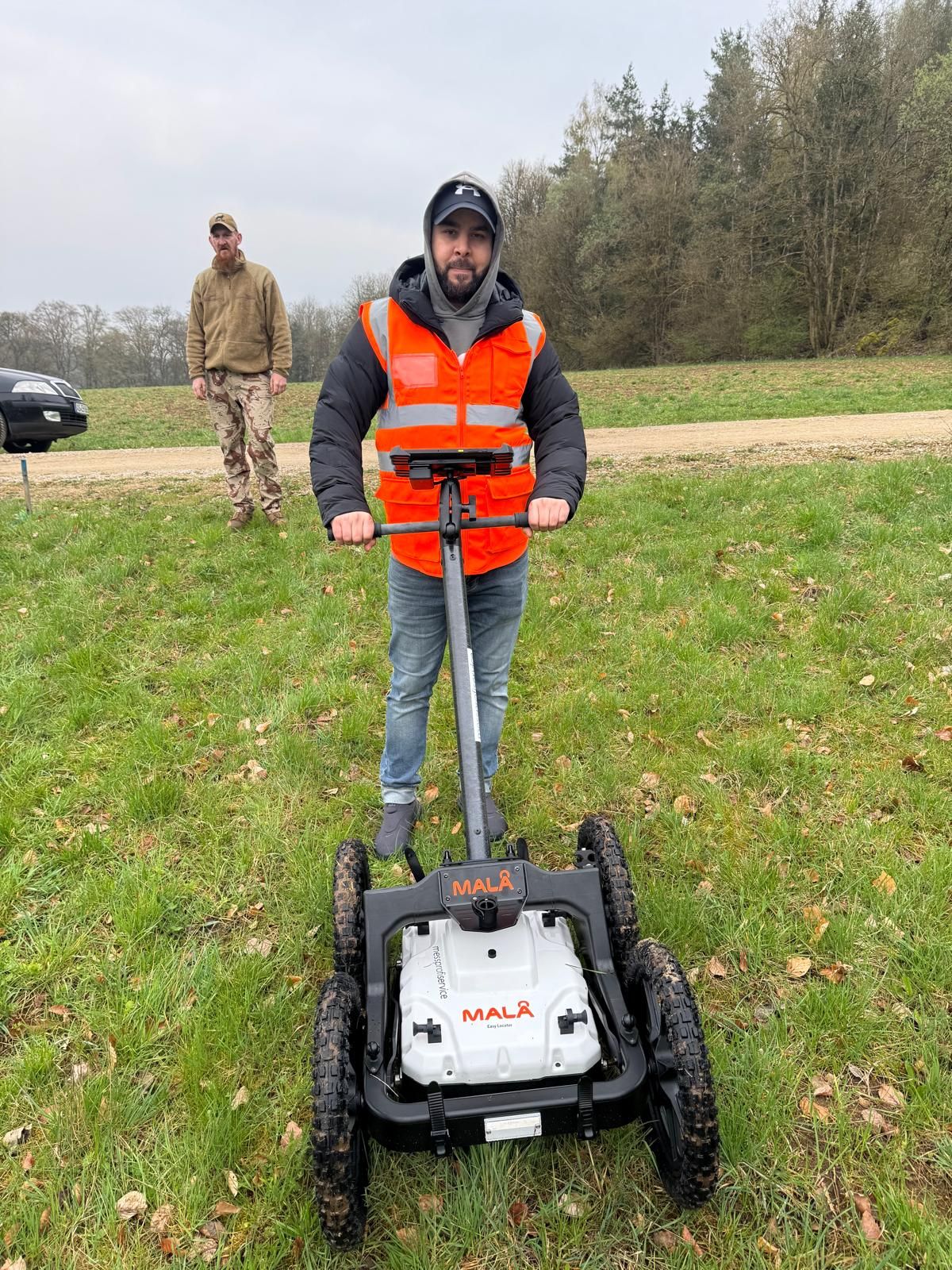
At track 20 in Plattling station, GPR surveying, investigations during construction and subsequent volume clearance were combined. The report explains the sequence and spatial limits of the works.
Working phases and original measurement images from Plattling · Region: Lower Bavaria
FONTANA-EOD helps developers, planning consultancies, project managers, civil engineering contractors, infrastructure operators, local authorities and companies connect ordnance surveying, documentation and construction in a professionally sound way.
Project basis
Before commissioning, clarify which areas are to be investigated, when results are needed and who receives them. This information belongs together in the enquiry so that the specialist company, planners and construction management work from the same commission.
An investigation must suit your planned earthworks. On a large property, only individual subareas may be affected; small foundation areas may need more extensive investigation because of their depth. Utilities, tracks, reinforcement, former buildings or made ground can restrict measurements. Position, depth and local conditions are therefore assessed together.
Before selecting a method, we clarify the objective: an initial assessment of suspicion, tendering or a specific ground intervention? If advance measurement is restricted, specialist planning must define an appropriate procedure. Documentation alone does not replace investigation.
The report required follows from the construction task. Before commissioning, define which section will be worked on next and which documents the participants need for it.

Before property development, division of areas or tendering, existing information on suspicion must match the current plan. Historical sources, later terrain changes and planned use are therefore considered together. The resulting investigation can only be planned once the affected areas are clearly marked on the site plan.
Clarify the historical basis for planning
For deep interventions, the record must clearly identify borehole points, alignments, laterally affected areas and depths. If foundation points are moved, the existing investigation is compared with the new plan. The result for the old point does not automatically apply to the new one.
Agree investigation of foundation points
If investigation is tied to excavation progress, every handover needs an unambiguous status. Daily work, excavation layer, local limitations and unresolved areas are documented so that subsequent construction management can identify the same area. The conditions for continuing are clarified between the responsible specialists involved.
Coordinate excavation monitoring and documentationFurther specialist information
Choose the next work step: complete missing information, prepare a technical investigation or hand results over to construction management. The following specialist pages lead to the documents required for each step.
For the Project process, state the next ground intervention and its date. This allows documents, necessary investigations and handovers to planning and construction management to be coordinated and missing information scheduled in good time.
Bring together the Quotation information and project documents for your enquiry: site plans, depths, information on suspicion and intended construction phases.
For coordination with authorities, arrange existing information by date, file reference and construction section. Identify contacts for technical contributions, applications and decisions by the competent bodies.
For clearance and documentation during construction, investigations carried out are connected to the respective construction condition. Defined subareas, depth references and remaining tasks must be traceable before work continues. Merely observing excavation does not replace a professionally planned ordnance investigation.
Hand over the Clearance documentation with its plans. The developer, construction management and planners assess whether the geographical and technical conclusions match the next intervention. Further agreed documents may be needed for procurement or insurance.
For an Ordnance clearance confirmation, it must be clear who made which statement for which area. A technical work status and an authority decision serve different purposes. Therefore provide the complete documents with their respective issuers and scope.
An ordnance clearance plan connects the suspected situation, construction objective and suitable methods with the necessary protective measures. For several sections, surveying, coordination and handovers are planned so that successive work uses the same investigation scope.
Keep the Survey report and clearance record with the site plan and work status. Before further execution, compare the investigation area, depth reference, methods and findings with current planning; clarify unclear assignments with the specialist company.
Quality and safety are considered from the preparation stage. The agreed service requires suitable methods, responsible persons, protective measures and a traceable location reference. At handover, checks establish whether documents represent the work actually carried out and its limits.
For Expertise and equipment, suitability for the specific investigation and the responsible specialists are what matter. Equipment properties alone do not demonstrate usable conclusions under any conditions. Methods, local requirements and the necessary records are considered together for commissioning.
Method selection
Target object, intervention depth and measurement conditions determine method selection. Historical research, surface surveying, borehole surveying and clearance during construction each need suitable initial data and a defined investigation task.
Where suspicion is unclear or a developer faces an early property, planning or investment decision, Historical aerial photograph analysis can provide an important basis. It assesses historical indications, possible bombing, military use, suspected areas, terrain changes and relevant risk contexts. This does not grant permission to build but provides a professional basis for the next project decision.

The Surface survey is suitable for accessible areas where the relevant search horizon can reasonably be reached with a near-surface method. Whether Magnetometry, TDEM or Ground-penetrating radar is suitable depends on the target object, interference environment, ground, utilities, metal installations and investigation objective.
For boreholes, piled foundations, excavations, sheet piling, anchor levels, masts, specialist foundation work or other deeper ground interventions, a near-surface assessment may be insufficient. It must then be assessed whether deep or borehole surveying is required. The target horizon, drilling method, grid, safety requirements, interfering-object positions and documentation objective are decisive.
If advance investigation is technically impossible, planned ordnance surveying during construction may be considered under defined conditions. Merely observing excavation is not an equivalent substitute. Methods, protective measures and authority to issue instructions must be clarified before work begins. The DGUV expressly distinguishes this observation alone from a professionally defined procedure during construction.
For larger construction sites, clearance areas or sections with a clearly defined scope, Area clearance can enable structured work. Clearance depth, area, grid, surveying, anomaly investigation and documentation must be clearly defined. Only then does it remain traceable which area was worked on to what extent.
If an object suspected of being ordnance is identified, specific safety and responsibility requirements apply. Ordnance recovery must be distinguished from general project assessment. If ordnance may have been found, stop work immediately. Do not touch or move the object. Leave the danger area, warn others without putting yourself at risk and contact the police immediately on 110. The documentation must clearly describe the event, find situation and measures taken.
The report also identifies inaccessible areas or areas with limited investigation potential. Metal installations, tracks, utilities, reinforcement, rubble, water, surfacing or former buildings can restrict evaluation. Such limitations must be spatially assigned so that they can be considered during later ground interventions.
Responsibilities
Ordnance matters regularly involve public order law, occupational safety, explosives law, technical rules, authority requirements and site organisation. It must therefore remain clear which tasks a private specialist company can undertake and which decisions lie with the competent authorities or ordnance disposal service.
Project phase
Trigger: Unclear suspected ordnance, missing documents or an impending project decision
FONTANA-EOD's contribution: Assessment of project documents and available information, identification of missing details and preparation of a reliable decision on the approach
Documentation objective: A traceable basis for the quotation, budget, scheduling and further coordination
Project phase
Trigger: Suspected points, authority information, applications, requirements, questions of responsibility or coordination needs before construction
FONTANA-EOD's contribution: Professional preparation of technical documents, support for project communication and clear separation of technical services from authority decisions
Documentation objective: project-specific information with unambiguous location and plan references for the competent body
Project phase
Trigger: surveying, borehole surveying, opening anomalies, area clearance or professionally planned ordnance surveying during construction
FONTANA-EOD's contribution: Project-specific execution of suitable methods, surveyed positioning, documentation of findings and coordination with construction and safety requirements
Documentation objective: traceable assignment of areas worked on, methods used and anomalies identified
Project phase
Trigger: The developer, construction management, planners, insurer or other participants need usable completion documents
FONTANA-EOD's contribution: Preparation of a survey report, clearance record, photographic documentation, positional references and notes on limitations or remaining areas
Documentation objective: A traceable project status for further planning, execution, handover or documentation
Document types
Clarify which documents you need: a costing basis, clearance plan, measurement data, findings records or a completion report. These documents answer different questions. The appropriate documents must be complete for the next project decision.
The site plan defines the service requested. Existing authority information and historical evaluations are included with their dates; planned interventions must remain distinguishable from work already carried out. Missing information is clarified before costing.
A clearance plan describes the professional connections between suspected situation, target horizon, methods, investigation scope, safety aspects, coordination and documentation. It is particularly relevant where several construction phases, larger areas, infrastructure routes or complex interventions must be coordinated.
Survey reports and clearance records state which areas and depths were worked on, which methods were used, which anomalies were found and which measures followed. They must allow a third party to understand the project status without having experienced the site situation.
A planned procedure during construction produces records for individual construction conditions. The documented section must be distinguished from areas and depths not yet worked on. An entry in a record alone does not permit further excavation; the professional assessment and conditions of the defined procedure are decisive.
The term ordnance clearance confirmation must be used precisely. In practice, a distinction is needed between completed technical work, a documented section, an authority procedure and whether construction can professionally proceed. FONTANA-EOD describes the technical records and distinguishes them from official responsibilities.
Records are only as reliable as the professional basis of execution. This includes qualified persons, suitable equipment, clear work procedures, safe site organisation, verifiable surveying and documentation that reveals technical limits. These requirements are considered during deployment planning.
Process model
The process depends on the suspected situation, local procedure, interventions and technical feasibility. Existing information and completed investigations are considered; missing investigations must be scheduled before execution.
Location, use, construction objective, construction limits, intervention depths, existing expert reports, aerial photograph information, authority indications and known grounds for suspicion are brought together.
Existing information and historical sources are checked for their relationship to the construction area. If required historical research or aerial photograph analysis is missing, it is arranged before the method decision based on it. Contradictions between plans, depths and existing information are clarified before the method is defined.
The suitable technical method is determined from suspicion, construction horizon and interference. Advance investigations and any necessary procedure during construction receive a defined scope.
Authority requirements, applications, construction schedules, site access, responsibilities, occupational safety and technical execution limits are incorporated into the project process.
Technical work follows the agreed project parameters with references to area, depth, method, measurement profiles, construction section and findings.
Anomalies, unevaluable areas, interfering objects, remaining areas, finds and further action required are professionally assessed and clearly documented.
The report and accompanying plans record the status reached. For the next construction phase, they must show which results are available and which unresolved matters require professional clarification before further interventions.
The project file connects existing historical evaluations, authority information and project-specific coordination with the report and results plans. Clearance work carried out includes its corresponding clearance records. Together with measurement data and assessment of findings, this makes it traceable how the status reached was established.
Project name, section, date and work status belong together. Changes to site plans or construction limits are identified so that an older version is not accidentally used for the next execution stage. The agreed handover list specifies which documents form part of the delivery.
Measurement data, field observations and professional assessment fulfil different functions. References between report and plan should unambiguously connect the respective areas and findings. If raw data or additional plan files are needed, their scope is agreed before execution.
Outstanding investigations and areas not yet conclusively assessed are identified in the handover status. Further work is assigned to a section and a specialist clarification requirement. The client can thus recognise which information must be added or coordinated before the next planned intervention.
Documents and quotation basis
Area size alone is insufficient to plan an ordnance investigation. The construction interventions actually intended are decisive. Topsoil removal, utility trenches, excavations, foundations, boreholes, piling, sheet piling, cable routes, joint bays or individual civil engineering works create different investigation requirements.
Identify utilities, former buildings, sealed surfaces, rubble, ballast, reinforcement and difficult-to-access areas early. They can impede measurements and execution. If such conditions only become known during work, they may require additional investigations, other methods or schedule changes.
The site plan and results plan must use the same coordinate system. Depth information must state the ground or reference elevation from which it was measured. If the surface changes, the original investigation elevation reference is retained. Only then can the result be compared with the planned intervention depth.
For clients, this means that clearer documents make it possible to determine more precisely whether Historical aerial photograph analysis, a Surface survey, deep or borehole surveying, Excavation supervision, Area clearance or a combination of several measures is appropriate as the first step.
The cadastral record, site plan, route, construction area, site facilities area and actual intervention area must be identifiable separately.
A utility trench, excavation, foundation, borehole, piling or specialist foundation work determines which investigation horizon is relevant.
Aerial photograph analysis, authority information, a suspected ordnance area, suspected point or former military use determine assessment requirements.
Vegetation, surfacing, utilities, railway installations, ballast, reinforcement, former buildings or made ground can restrict measurability. Overhead lines are also considered a possible source of interference.
Possession windows, division into sections, site preparation, vegetation clearance, excavation sequence and other trades influence practical execution.
Developers, construction management, insurers, buyers or clients may have different requirements for reports, records and location references.
Quality and safety
The report must also be understandable to participants who were not present during execution. In addition to the result, it includes spatial assignment, the time of work and investigation conditions.
Documentation must show which area, section, route, construction area or excavation area was worked on. Purely textual statements without a location reference provide only a limited basis for later decisions.
In multi-phase projects, it is essential to know when each measure was carried out. Particularly for ordnance assessment during construction, the timing in relation to the section, excavation depth and construction progress must remain traceable.
The spatial assignment of measurement points, profiles, boreholes or areas worked on forms the basis of every later assessment. Without traceable surveying, the location to which a technical conclusion applies remains unclear.
Measurement methods and equipment belong in the report with their operating conditions. Additional visual observation must be distinguished from a measurement-based investigation. During construction, it must be clear which planned investigation method was actually carried out.
Documentation must distinguish areas without anomalies, anomalies, opened suspected objects, recovered finds, interfering objects, unevaluable areas and further action required.
Investigation limits are particularly important for safety. Inaccessible areas, concealed areas, interference fields, technical limitations or unworked depth horizons must be clearly identified. Chance finds remain possible even after a documented investigation.
Records must match the actual construction sections. If a project is divided into subareas, construction phases, possession windows or excavation stages, documentation must reflect this structure.
A report must be understandable to people who were not on site. Site plans, clear terminology, traceable conclusions and unambiguous limits are therefore essential.
Practical value
The client decides on further commissions on the basis of results. Planning and construction management need the same documented status so that new designs or the next execution stage do not rely on outdated documents.
The developer arranges the necessary clarification of suspected ordnance and presents the intended construction and interventions. If not the property owner, access and planned investigations must be coordinated with the person entitled to authorise them. At handover, the developer must be able to recognise which further investigation remains outstanding for the project.
Construction management assigns the investigation results handed over to forthcoming work. The contractor must observe the defined spatial limits and protective measures. Changing the excavation plan does not enlarge a documented subarea; additional interventions need a new professional assessment.
Planners provide current position and elevation information for the intended interventions. Moved foundation points, altered routes or deeper excavations are submitted to the specialist company for assessment. Project management includes necessary investigations and coordination in the schedule.
The service specification identifies investigation scope and documents due. Surveying, anomaly investigation, additional evaluations and handovers must be defined so that quotations cover the same service level.
For a sale, change of operator or insurance enquiry, existing documents are passed on with their original investigation scope. An earlier investigation may not suit later planned use involving different ground disturbance. The original report is therefore retained together with its plans and limitations.
Technical results support authority procedures but do not replace the authority's decision. File references and associated information remain linked to the relevant plans in the project file. Later enquiries can identify which requirement applied to which construction section.
The specialist company describes technical work within the commissioned scope. It assigns measurement data, findings and limitations to the investigated areas and identifies unresolved professional questions. If the project changes, an assessment establishes whether the previous investigation scope still suits the intended execution.
The ordnance disposal service and competent bodies act under local rules. If ordnance may have been found, the police must be informed; the competent bodies arrange further measures to avert danger. Their information is added to the project documents with date and spatial reference.
The body to involve depends on project location, procedure and the subject of the decision. The developer and planners bring together existing requirements and relate them to the intended construction. Technical reports are handed over with the necessary area and depth references.
Technical services and responsible roles are defined together for project planning. The applicable requirements depend on the activity, location and commissioned scope.
The German Explosives Act regulates matters including authorisations, certification and responsibilities. The 1. SprengV supplements this framework. Commissioning must therefore clarify the specific activities intended and the responsible persons and authorisations required. A description of equipment does not replace this assignment.
Risk assessment and protective measures are prepared before execution. DGUV Information 201-027 is a relevant practical guide. For the procedure during construction, the BFR KMR also refer to the safety provisions for found ordnance in Appendix 5 of DGUV Rule 113-003.
The BFR KMR describe investigation, assessment and clearance in the stated context of federal properties. Their use considers scope, project specifications and local requirements. Traceable initial data, location references and documented work steps are particularly relevant to document handover.
Clients and planners bring existing information and requirements into coordination. The specialist company describes investigation scope, technical limits and results. The documents needed by a competent body are clarified in relation to the actual location and specific procedure.
For several construction locations, regional assignment belongs in document handover from the outset. A jointly commissioned service may involve different contacts, authority information and local conditions.

State the municipality, position and affected properties or route. Existing authority information is handed over with its date, file reference and actual geographical scope. This makes it clear which information belongs to the specific construction section and which documents are still needed for other areas.
Assign the region and project location
For projects organised in sections or across borders, the work scope, contacts and handover status are maintained separately for each part. In the enquiry, identify which information applies jointly and where responsibilities or construction dates differ. Detailed local coordination is prepared on this basis.
Enquire about several project sectionsClear terminology helps handover between the specialist company, planners and construction management. More detailed information on methods and records is available in specialist guidance on ordnance assessment.
Work status describes which activities are completed, started or outstanding at a given time. It must be assigned to a plan version and section. Progress alone does not mean all intended investigations have been completed.
A remaining area is a geographically definable area that, at the work status considered, could not yet be investigated or could be investigated only to a limited extent. The reason and position are stated traceably. Further planning must show which additional step requires clarification before the intended intervention there.
A depth value needs a traceable reference level. If the ground surface changes, information from different construction conditions must not be compared without assessment. Plans, measurement data and the report should therefore show the condition to which each investigation relates.
Evaluability describes whether measurement data permit the intended professional assessment under local conditions. An area covered by measurements and an area reliably evaluated must therefore be considered separately. Interference, inaccessible areas and technical limits form part of the described investigation result.
The report, plan and project file must show the same work status. At handover, completed work, findings and unresolved investigation areas are compared with the next construction phase.
Historical images and maps are related to the present investigation area. Further planning must show which suspicion concerns which part of the project and what the assessment is based on.
Assess the historical source basisAt handover, areas worked on, findings and unresolved questions are reviewed together. The site plan and report should use the same section names so that results can be carried into the next construction phase.
View document types for handoverDuring professionally planned ordnance clearance accompanying construction, investigations carried out are assigned to the respective construction section. Date, position and investigated depth range must match the construction condition reached so that construction management can relate subsequent execution to it.
Plan documentation during construction
Use the project status as the starting point: Which investigation is needed, what conditions apply and who will subsequently use the results?
Historical assessment, technical surveying and assessment during construction fulfil different tasks. Select the requested service according to the information available and the forthcoming intervention.
Select specialist services for the investigation objective
Track construction, utility installation, foundations and site development have different requirements for positional references, access and construction sequence. Assign your project to the appropriate application.
View requirements for the project typeExisting information and local coordination arrangements are related to the specific project location. Regional assignment supports preparation of the next coordination step.
Place the project location in its regionProvide the site plan, intervention depths, preliminary information and intended decision. State whether an initial assessment, quotation or specific execution is needed first.
Send documents for your projectCosts and quotation
Depending on the commission, the quotation also allows for surveying, assignment of findings, plans, the report and interim handovers to construction management. State whether you need one completion report or several documented construction sections. Measurement profiles, borehole points and areas that cannot be surveyed in advance also influence the effort.
A shared completion documentation package and repeated handovers during ongoing earthworks require different work. It also matters whether existing plans can be used or whether results must first be presented from measurement and surveying data.
The quotation should show which reports and plans are included and which assumptions underpin the costing. Additional file formats, raw data, further report versions or separate handover dates are agreed before execution where needed.
State particular requirements of the later recipient in the enquiry. If documentation scope is extended only after completion, additional evaluations or repeat measurements may be necessary. A brief execution note and a surveyed results plan serve different purposes.
FAQ
Before commissioning, construction intentions and existing documents must be consistent. For further execution, what matters is the conclusion the later report actually provides for the intended intervention.
The suspected situation and construction plans determine the investigation. The record must show why the method was selected, which intervention it covers and which questions remain unresolved before further work.
The main requirements are a site plan, construction limits, intervention depths and construction methods. Include existing aerial photograph analyses, authority information, utility and as-built plans. State accessibility, construction phases and the desired scope of completion documents.
No. As a private specialist company, FONTANA-EOD documents the services carried out and their technical results. Official decisions and public-authority duties remain with the competent authorities or ordnance disposal service.
The survey report describes the investigation and its results. The clearance record records the clearance carried out or work at suspected locations. Clearance documentation relates the work status achieved to the project; the scope and limits of the specific conclusion remain decisive.
A planned procedure during construction may be required where advance investigation is technically impossible. Specialists assess the conditions and incorporate them into the work and safety plan. Merely observing excavation or documenting it afterwards does not replace this procedure.
The record applies to the described investigation scope and its conditions. It does not establish an unrestricted conclusion for the entire property. Unworked, unevaluable or unreached areas must be identified separately.
The report and plans must reflect the same work status. Position and elevation references, methods used, results and unresolved questions are important. Additional files or representations required by each recipient are agreed before execution.
Clarify the approach before the tendering and construction scheduling based on it. Existing authority information may require further investigations. Their execution and coordination time must be allowed for before the intended ground disturbance.
Starting the commissioning process
State whether you need an initial assessment, quotation or specific execution. Identify the investigations already available and the next intervention. This distinguishes the commission from completed work and work still required.
Identify recipients and existing requirements for the Clearance documentation. If construction management needs interim status reports, state construction sections and handover dates. Desired raw data or additional plan formats also belong in the enquiry.
Submit construction limits and depths together with the current plan version. Identify planned changes compared with earlier investigations. FONTANA-EOD assesses the information in conjunction with existing grounds for suspicion and clarifies the requirements for the requested service with you.
Whether historical aerial photograph analysis, explosive ordnance surveying, surface surveying using GPR, magnetometry or TDEM, deep-ground surveys, downhole surveys, excavation supervision, area clearance or ordnance recovery is needed depends on the location, ground disturbance, depth, ground and existing documents. An early ordnance assessment provides clarity for tendering, programming, occupational safety and construction.
FONTANA-EOD combines its Section 7 SprengG licence, specialists holding Section 20 SprengG certificates of competence, suitable survey and clearance methods, and traceable documentation. Send the site plan, depth of ground disturbance, construction phase and existing documents for an initial technical assessment.


