Project pathway
The quickest route to the right decision.

Before the next ground intervention, developers, planners and construction management must know whether the existing clearance confirmation covers that work. Clearance objective, area, depth and limitations are compared with current planning. Send FONTANA-EOD the complete certificate with plan appendices and mark the intended intervention so that we can agree the specific professional question with you.
Compare the plan and property boundary.
Relate the conclusion to the planned intervention.
Carry limitations into planning.
The specific content is decisive. In the BFR KMR, the clearance certificate describes completed and accepted clearance work and states limitations for further use. It must not be used to derive blanket conclusions for arbitrary neighbouring areas, greater depths or different interventions. Always assess the complete document with its appendices and relation to the present project.
To use a clearance confirmation, the documented scope and planned intervention must agree. Area limits, depth reference, clearance objective and limitations are professionally compared using the complete documents.
Compare the accompanying site plan with your intervention plan. Are subareas, exclusions and boundaries clearly shown? The property may be larger than the investigated or cleared area. A postal address alone does not answer this question.
Read depth information with the stated elevation reference. Check whether different areas are described separately. Have missing or ambiguous details professionally explained rather than deriving working depth from equipment or area size. The technology overview explains why an equipment name alone does not demonstrate a particular investigation depth.
Establish the task agreed and documented as achieved. An objective may relate to a particular area and intended use. The BFR KMR A-4.1 distinguish clearance objectives and methods; the name of a measure alone does not describe its full scope of conclusions. A restriction to a particular use or depth must remain visible during later use. The investigation objective required and result actually documented are considered separately for the specific intervention.
Look for unworked areas, remaining investigation shortfalls and information on further use. These details belong to the result. When passed to construction management, they must not be separated from the certificate itself or concealed by an abbreviated summary.
Check that report, plan appendices and certificate belong unambiguously together. Project name, date and version should be assignable. A cover alone cannot show whether the professional basis and limitations for the planned project are complete.
Compare the documented scope with the present construction task. If work goes outside the covered area, deeper or under other conditions, applicability must be clarified. Even an unchanged property may receive a different construction use.
Read a document according to its task and content. Different documents may be needed within the same project.
Historical evaluation or authority information about suspicion must be distinguished from documentation of technical measures actually carried out. Read the conclusions and conditions stated. The existence of information alone does not demonstrate comprehensive clearance work.
Assess the historical conclusion professionallyMeasurements and work carried out are described in their respective documents. Whether they demonstrate the conclusion needed for the next intervention depends on content and scope. The survey report and clearance record must therefore be assessed together with their plan appendices.
Compare the spatial scope of conclusionsA clearance confirmation must not be extended through the verbal shorthand “everything is clear”. Retain the original wording and its limitations. For staged handover, also record which further areas are not yet covered by the respective status.
Bring the complete documents togetherThe planned excavation lies partly outside the documented area or goes deeper. Planners and the specialist company compare the complete certificate with the site plan and section. Historical findings are kept separate from surveys or clearance actually carried out. The professional step required is identified for the unresolved area. The record should support a specific decision before the affected ground intervention; an earlier positive brief notification does not enlarge its scope.
Determine outstanding investigation needsA new route or foundation may affect areas with utilities, different ground structure or metal installations causing interference. Existing documents are related to this part. Responsible specialists clarify whether previous results are usable and which measurement limits apply. Any required further investigation is prepared with its objective. The project file records the reasoned conclusion with remaining limitations and uncertainties.
Connect the changed intervention with the project processConstruction management and the following trade need the section status actually clarified. Survey results, assessment of findings and any clearance records are assigned to the relevant area. Unresolved questions do not disappear by combining plans. Further decisions consider the existing conclusion, its limits and residual risks. Required subsequent measures are identified specifically so the next step uses the appropriate documented status.
Assess the record and handover statusThe professional question changes with the intended use of a document. Make clear whether the documents should support specific construction, later replanning or property assessment.

Compare current execution planning with the documented scope. Include further planned interventions belonging to the construction task as well as the structure itself. Preparation must establish which question the existing documents answer and which professional clarification remains before the affected work step.
Define the construction task and affected interventions
Request complete documentation with appendices. A summary in sales documents may reduce the original scope of conclusions. What was documented for which areas and use remains decisive. Describe the intended future use so that the existing conclusion can be related to it.
Have existing documents professionally assessedShow differences from the earlier project. New structures, additional utility areas or changed depths may raise different questions from the original task. Comparison should address the actual intended work, not merely an unchanged project name.
Compare plan changes with document statusAn existing clearance confirmation must suit the intervention for which it is used. FONTANA-EOD therefore considers the complete documents and current construction task together. Any outstanding professional question leads to a specific statement of further service needs.

First check the type of document. Historical evaluation can indicate the knowledge available for an area. It does not automatically describe technical investigation or clearance subsequently carried out. Compile existing documents with appendices so the origin, task and chronology of conclusions remain traceable.

For foundations or other deep ground interventions, the precise spatial reference matters. Earlier work at neighbouring points does not itself describe the present location. The depth reference must also match the plan. Mark the proposed intervention and documented investigation areas before agreeing additional specialist services.

As excavation progresses, different work statuses may coexist. Handover documents must show which section and work each covers. A conclusion for an already worked part is not transferable to the next construction phase without further comparison. Therefore identify the next intended intervention precisely.
Additional areas, deeper interventions and previously excluded areas may exceed the existing scope. For the next construction task, the actual documented status is compared with the change.
A new building is to be placed beside an area worked on earlier. First check whether it lies within the documented limits. Earlier clearance confirmation for the existing building does not by itself provide a record for the added area. Use the earlier location and results plans. Historical analyses may explain suspicion, while survey reports and clearance records demonstrate work actually carried out. It remains to clarify which of these bases exist for the additional area and which professional step is still needed.
The present foundation goes deeper than the intervention previously described. Compare depth values with the same reference and have the difference professionally clarified. A positive upper-level result does not automatically answer the new depth question. The enquiry needs the current section and corresponding results. Measurement data, investigated points and assessment of findings are assigned to the affected depth range. If the record is insufficient, the specific further investigation need is identified and coordinated with the foundation task.
A documented remaining area becomes accessible later. It must remain marked as unresolved until an appropriate professional conclusion is available. Removing an obstacle does not itself remove the earlier limitation. Report and plan show the reason for the exception and its geographical scope. Additional work documents the new execution, findings and resulting conclusion separately. The project file brings together the earlier status and later results documents with their respective functions.
Comparison begins with complete documents and ends with the specific next decision needed. A simplified status statement does not replace this assignment.
Describe which work is planned at which location and why the existing clearance confirmation is intended to be used. The professional question should concern a specific intervention or intended use. Identify, for example, the new excavation section, relocated utility route or individual foundation points. The enquiry should show which conclusion is needed before the next step. A general property status is narrowed to the actual geometry affected.
Hand over the certificate, report and all appendices. Identify visible gaps. The original version matters because a later summary may shorten limitations or plan references. Historical aerial photograph analysis, survey report and any clearance record remain distinguishable. Dates and plan references show the findings available first and technical work performed later. Missing appendices are obtained to complete the document status rather than filling gaps with assumptions.
Establish who prepared the documents for which task. Information, an investigation report and a certificate must be read differently and retain their function even when filed together. A completed survey is read within its documented scope. For new investigation needs, utilities, ground structure, interference and possible measurement limits are compared with the construction task. Method selection and new technical execution are addressed under an agreed commission.
Compare the documented scope with today's planning. Mark deviations and unclear areas so professional assessment addresses traceable differences rather than general assumptions. Borehole points need position and reference elevation; a measurement grid needs actual area coverage and remaining gaps. Professional assessment requires these differences; a shared property name does not turn different investigation geometries into a uniform conclusion.
Describe which conclusion is missing or unclear. Identify the responsible contact from the task and existing documents. Any further investigation need is connected with the specific construction task. The response records whether an existing conclusion can be explained or additional technical work is needed. An explanation does not change the earlier investigation scope. New services receive their own records and are connected with continuing limitations.
Provide the authoritative documents and limitations to the affected planners and construction management. Later changes require a new comparison. A question clarified for a particular intervention remains bound to that scope. Identify the version to be used for the next phase. Unresolved matters and uncertainties are assigned to the affected section. An abbreviated construction overview remains traceable to the complete professional basis.
The project file should show the connection between documents. This makes it traceable which status was used for a specific professional or construction decision.
Keep the complete version with the plans and appendices it names. Project and version information help assignment but do not replace the content relationship. Identify missing appendices and request them from the competent body. A cover alone cannot compensate for missing professional details. Execution records and conclusions must relate to the same area. Measurements and assessment may be in separate appendices and are connected with the report's conclusion. Also identify adopted information and newly added findings.
Mark the location requiring explanation and describe the current construction task. The enquiry should identify the unclear passage or appendix. Keep additional answers connected with the original version so their purpose is not lost during forwarding. Conflicting information can be compared using the report passage, appendix name and current intervention plan. The contact receives a verifiable question. The explanation is filed with date and version reference so later construction management can trace the same context.
Add relevant new documents to the file and identify planning changes. A document can supplement an earlier status without replacing it completely. Further use must show which conclusions belong together and which questions remain outstanding. Each next task is prepared from this traceable status. A new investigation can address a previously unresolved area or a changed depth. Its results and necessary subsequent measures are specifically identified. Remaining limitations and residual risks stay part of the project decision even after an addition.
Professional assessment needs more than the word clearance. Plans and references must show the actual area to which the conclusion extends.
Adjacent sections may have been worked on at different times and to different extents. Check that their boundaries fit clearly and whether intermediate areas remain unresolved. Similar colouring on two plans does not prove a shared conclusion. Unclear assignments require complete documents and their plan versions. Compare the adjoining margins of both investigations with the intended intervention. Check excluded zones or different working levels. For a route through that space, the specialist company needs unambiguous positioning; visual proximity alone does not answer the gap question.
Read depth with its elevation or surface reference. If the terrain has changed, the same number may describe a different spatial range. The planned intervention must be compared with the earlier reference. Missing information should be professionally explained using original documents; an assumed standard depth does not help. Compare the current section, excavation base or foundation depth with the documented investigation using the same elevation reference. A lowered working level or fill is explicitly considered before applying the existing conclusion.
A legend explains colours, lines and symbols. Their professional meaning also comes from the report and limitations; this information belongs together. An extract without a legend or isolated screenshot may be incomplete. Mark the area concerned but provide the complete context. Include notes on inaccessible or technically unevaluable zones. Around utilities or metal interference, an outline alone may misrepresent investigation coverage. The assigned professional results and expressly stated limits remain decisive.
A specific starting position facilitates professional support. State the documents available and the conclusion still needed for your project.
Ask for the complete document and appendices. Identify who supplied the confirmation and what it is intended to concern. Without its actual scope, reliable assignment to construction planning may remain unresolved.
Identify missing documents for the enquiryCompare the existing site plan with current intervention planning. Mark the affected area or depth and identify the unclear detail to focus the professional enquiry.
Assess plan references and depthsDescribe the difference from the earlier project, additional areas and changed depths. The question is whether the existing conclusion covers the change or further professional work is needed.
Assess planning changesProvide the clarified starting position with the unresolved task. FONTANA-EOD can agree the appropriate service scope. A new service addresses the specific question and is subsequently documented accordingly.
Agree further work using the documentsFONTANA-EOD supports professional assessment of existing documents against the specific project. Actual conclusions, spatial references and intended use are considered together. Further work follows the agreed commission.
Assessment starts with the document and appendices. An abbreviated verbal account is not silently treated as the complete professional basis.
Planned work is described by position and depth, relating the question to the area actually affected.
Differences between the earlier and current project are identified. A matching address does not conceal a changed task.
Spatial or professional limits remain part of the conclusion during forwarding. An overview must not extend the documented scope.
Unclear locations are connected with the document, plan and specific question, allowing the appropriate specialist or authority to be involved.
A later specific suspicion is addressed independently of an earlier simplified status. The actual new situation receives the professional attention required.
Reliable further planning requires documents and tasks to reach the appropriate participants. Professional assessment and organisational forwarding are distinguishable contributions.
Provide the complete documentation and describe its intended use. Identify who can obtain further documents or address enquiries to earlier participants. An adopted file should not consist solely of selected positive extracts. Limitations and unresolved areas also matter.
Assign the documented conclusion to the current intervention. Changes outside the previously clarified scope must be made visible and coordinated before the affected work. Other specialist matters, such as ground conditions, utilities or pollutants, retain their own documents and responsibilities.
The professional support needed follows from the specific question. Explanation, additional investigation and an authority decision fulfil different tasks. Identify existing contacts and documents. The commission defines FONTANA-EOD's contribution to further assessment or work.
Assessment of a clearance confirmation depends on the specific document, work carried out and next intended intervention. General descriptions are therefore read according to their actual professional meaning.
For the work actually to be carried out, the German Explosives Act and 1. SprengV must be considered in their relevant authorisation, certification and responsibility context. Reviewing an existing document must be distinguished from responsible execution of a further investigation or clearance operation.
Risk assessment must cover the actual intended work. The DGUV Information 201-027 provides guidance on ordnance clearance. For planned clearance during construction, the BFR KMR A-9.4.3 refer to the provisions on found ordnance in Appendix 5 of DGUV Rule 113-003. Requirements for the current construction sequence and protective measures are assessed for the work actually intended.
The BFR KMR describe the clearance certificate in connection with completion and acceptance of clearance work. Use depends on its stated conclusions and limitations. Requirements of the specific project and competent bodies are considered in further assessment.
The BFR KMR have a defined scope for federal properties. For other projects, the applicable requirements and contractual provisions must be assessed.
Stop work immediately if an object is suspicious. Do not touch or move it, leave the immediate area and keep others away without putting yourself at risk. Contact the police on 110. An earlier conclusion must not lead to a new specific find situation being ignored.
Further coordination needs the actual project location and bodies already involved. General understanding of the term clearance does not replace reference to the specific procedure.

State existing file references and provide associated correspondence in full. The body handling an unresolved question depends on the issue and jurisdiction. A procedure from another location is not transferred solely because document names are similar.
Assess location-specific coordinationA property may contain subprojects with different interventions. Describe the affected area and intended use so the documents' professional relevance can be distinguished from other tasks.
Specify the project and useScope, limitations and plan references determine how existing documents can be used for the present project. The complete document in its specific context remains decisive.
It describes which professional question is answered for which area. Areas, depths, objectives and conditions belong to the conclusion's context.
It identifies a limit on the documented conclusion or its further use. It remains part of the documents in summaries and forwarding.
This asks whether an existing conclusion fits today's construction task. Similar location information or an earlier positive summary does not answer it alone.
It connects a professional conclusion with a particular spatial presentation and version. Without this reference, area markings or depths may remain ambiguous.
Different specialist documents may be held in the same project file. For further planning, their functions and contributions to the documented status should remain traceable.
Historical findings may explain why further investigations were undertaken. When using a later clearance confirmation, distinguish conclusions from the original evaluation from technical services actually documented afterwards.
Read historical evaluation and its conclusions
The service carried out must match the documents' content. A method name alone describes neither the whole area worked on nor the depth-related conclusions reached. Professional enquiries therefore need the report and plan appendices together.
Compare specialist services with documentsThe next construction task needs the appropriate clarified status. Changes are described in relation to existing documents, making answered questions and further coordination needs identifiable.
Place the conclusion within the project process
The service scope and complete Clearance documentation are connected with the current construction task. Use the professional terminology for ordnance assessment unambiguously so the enquiry describes the actual unresolved point.
The service overview helps assign an existing investigation or outstanding task. Enquiries should always identify the actual subject of the documents.
Assign an appropriate specialist servicePreparation, technical work and completion documents fulfil different tasks. Understanding their connection helps use an existing conclusion at the appropriate stage.
Assess process and recordsPrecise wording makes the outstanding question understandable. The terms support comparison with the complete document and current planning.
Read terminology for the professional enquiryThe term alone does not establish an unlimited assurance. The defined clearance objective, documented scope and express limitations are decisive. The conclusion must not be extended to other areas, depths or uses.
This must be clarified under the relevant specifications and agreed responsibilities. Within their scope, the BFR describe a certificate after completion and acceptance. Clarify which body issues the certificate needed for your project and which requirements apply.
The complete document and current planning must be considered together. What matters is whether the earlier scope covers today's interventions. Neither age alone nor an unchanged address answers this professional question.
A colour alone does not reliably establish meaning. You need a legend and its unambiguously associated professional conclusion, including any limitations. Also check the plan version and agreement with the actual intervention.
An ordnance-related conclusion is not a blanket statement about bearing capacity, pollutants or existing utilities. Assess these questions using the documents and responsibilities intended for each. The scope of different specialist assessments should remain separately identifiable within the project.
Identify the missing appendices and request the complete documents from the responsible contact. A cover or summary alone may leave the spatial and professional scope unclear. Provide existing documents together with your specific construction task.
Identify the passage and accompanying plan. Describe the intended intervention depth and its reference. Mark any changes to terrain or planning. The question should be professionally explained from the original documents.
A summary must not extend the original scope of conclusions. Relevant limitations must be retained or identifiable through an unambiguous reference to the complete documents. Planners and construction management need the document status authoritative for their specific work.
Initial professional coordination requires complete documents and an understandable description of the current project. State the decision you want to prepare.
Provide the certificate, report and all plan appendices. State whether appendices are missing or only a summary exists. Existing version details and senders remain identifiable.
State the location, affected area, planned depths and construction phase. Mark the question on the current plan and show changes from earlier versions. Include the land parcel, construction area, route or borehole plan where available. Construction schedules, utility plans, aerial photograph analysis and known requirements are assigned to their current status, connecting the question with conditions for the next phase.
Identify the unclear detail or area still needing assessment for the next task. Name a contact who can answer enquiries and provide further documents.
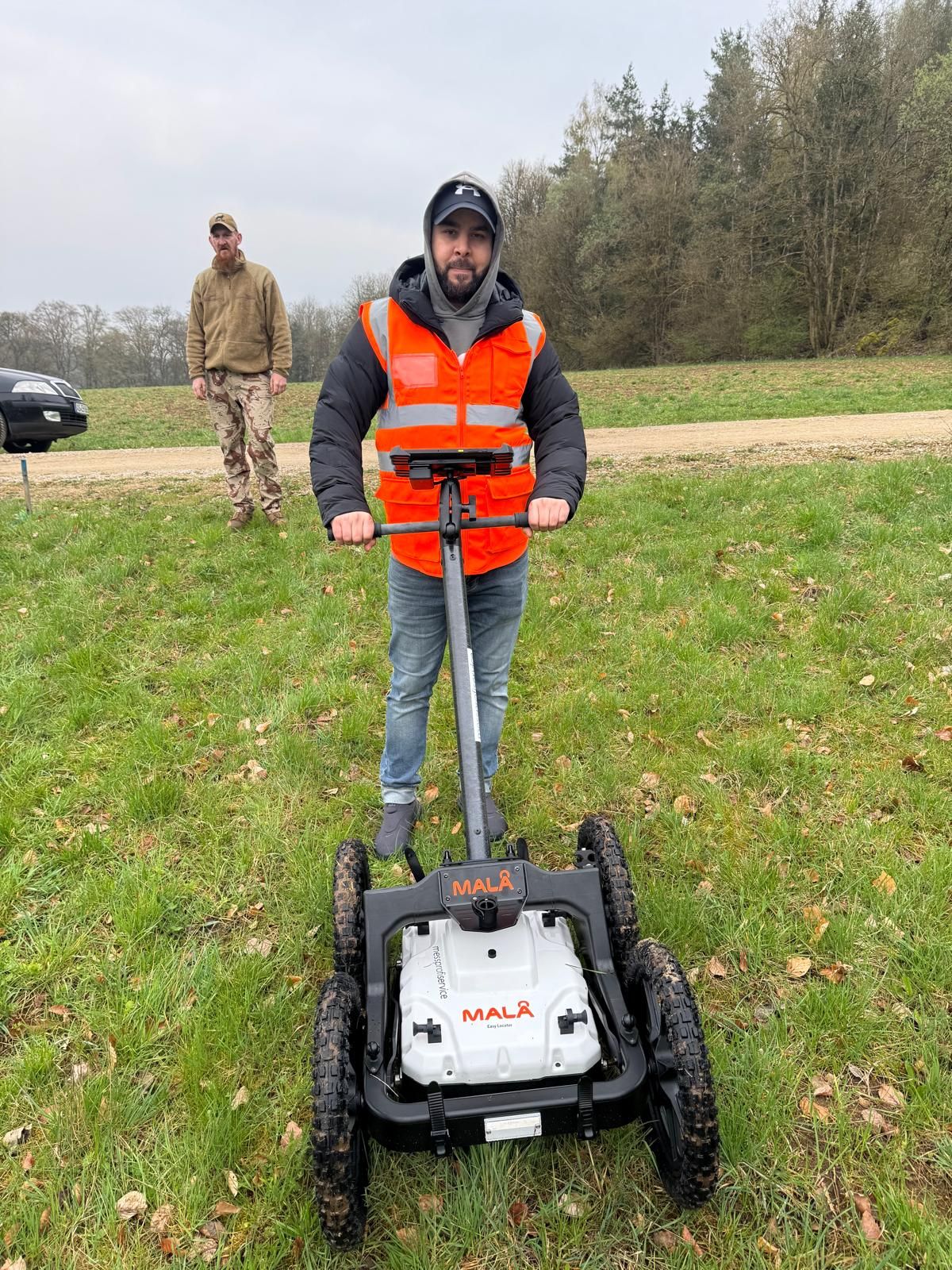
Whether historical aerial photograph analysis, explosive ordnance surveying, surface surveying using GPR, magnetometry or TDEM, deep-ground surveys, downhole surveys, excavation supervision, area clearance or ordnance recovery is needed depends on the location, ground disturbance, depth, ground and existing documents. An early ordnance assessment provides clarity for tendering, programming, occupational safety and construction.
FONTANA-EOD combines its Section 7 SprengG licence, specialists holding Section 20 SprengG certificates of competence, suitable survey and clearance methods, and traceable documentation. Send the site plan, depth of ground disturbance, construction phase and existing documents for an initial technical assessment.


