Project pathway
The quickest route to the right decision.

Railway corridors, utility trenches and industrial sites present different ordnance-assessment tasks. FONTANA-EOD considers the basis for suspicion together with working area, intervention depth and construction sequence. Select your project environment and send a site plan and existing investigations so that specialist services, operating interfaces and required documentation can be agreed.
Identify the sector and construction task.
Define the area, depth and sequence.
Use results in their project context.
The ordnance assessment a project needs depends on the construction task, intervention depth and operating conditions. Track reconstruction, utility trenches, excavations and industrial extensions need different investigation areas and sequences. Enquiries therefore bring together the basis for suspicion, working area and operating requirements before the service and scope are defined.
The scope for “Plattling — track 20, area clearance Plattling / Germany · Lower Bavaria” included surface radar surveying.
Service period: 2026-10
Service areas:Surface surveys: GPR, TDEM and magnetometryMethod used in this project: Ground-penetrating radar
View project details · GPR and limitations · Region: Lower Bavaria
The service scope for “A 6 AS Öhringen–AS Kupferzell – ground investigation – Bohrgesellschaft Roßla Öhringen – Kupferzell / Germany · Stuttgart administrative district” comprised downhole magnetometry.
Service period: 2026-08
Service areas:Downhole magnetometry / deep-ground survey
View project details · Deep-ground and downhole surveys · Region: Stuttgart administrative district
The service scope for “Xanten solar park project” comprised ordnance specialist supervision during construction / technical supervision.
Service period: 2021-11
Service areas:Ordnance specialist supervision of groundworks
View project details · Ordnance specialist supervision of groundworks
Each sector has its own working areas, time pressures, interference and documentation routes. Choose the environment closest to your project.
Sector classification serves project organisation. The technical method is then derived from suspected ordnance, target object, intervention depth, surface, ground and measurement quality actually achievable.
Larger programmes can combine several sector characteristics, such as an energy project in a railway environment or municipal development on a former industrial site. Requirements are then divided by working area and responsibility, rather than assigning the whole project to a single category.
Even within the same sector, new construction, refurbishment, maintenance and demolition differ considerably. What matters is the current construction stage, the working areas actually accessible and the status that must be evidenced before the next intervention.
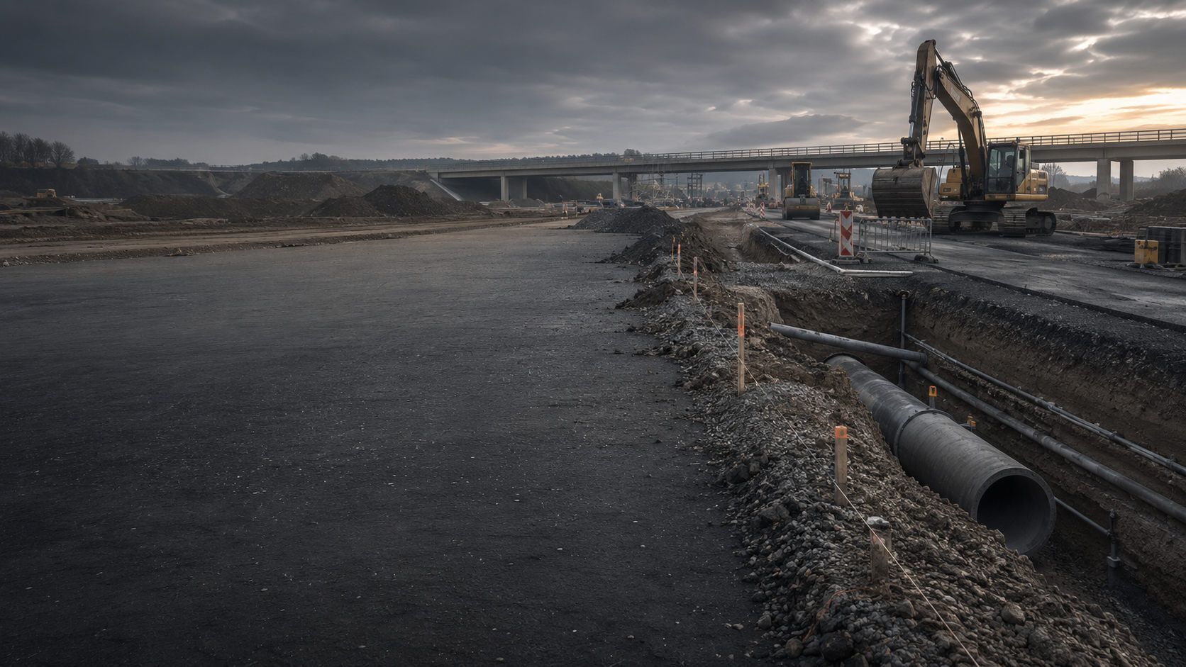
Roads, sewers, bridges, retaining walls and urban civil engineering combine changing intervention depths with traffic, utilities and constrained construction sequences. Investigation areas are divided by excavation, alignment, junction and construction section.
Depending on survey conditions, historical preliminary assessment, area surveys, downhole surveys or excavation supervision may be used. Documentation must identify the area actually investigated or treated afterwards.
Traffic management, retaining works, dewatering and phased handovers are considered in tendering and construction-phase planning. This keeps the area investigated before the next earthworks stage identifiable.
Assess road and civil engineering requirements
Track areas, railway embankments, cable routes, platforms, bridges and station areas need planning by chainage and section. Track possessions, operating installations, track superstructure and restricted access affect technical feasibility.
Survey and clearance services are coordinated with construction stage, working window and railway operations. Results remain assigned to the relevant line, chainage and intervention depth.
Cable crossings, points and switches, retaining structures and work near operational installations need particular attention. Interference and confined working areas may require additional investigation measures there.
Assess the railway project
Cables, pipelines, wind and solar parks, substations, grid connections and mast locations create linear and point interventions at the same time. Route sections, crossings, joints, boreholes and assembly areas are assessed separately.
Historical and technical assessment must match installation depth, working width and construction method. Consistent chainage references in the documentation are essential for long corridors.
Access routes, crane standing areas, cable-pulling chambers and temporary site facilities are also considered where relevant ground interventions or load transfers are planned.
Assess the energy project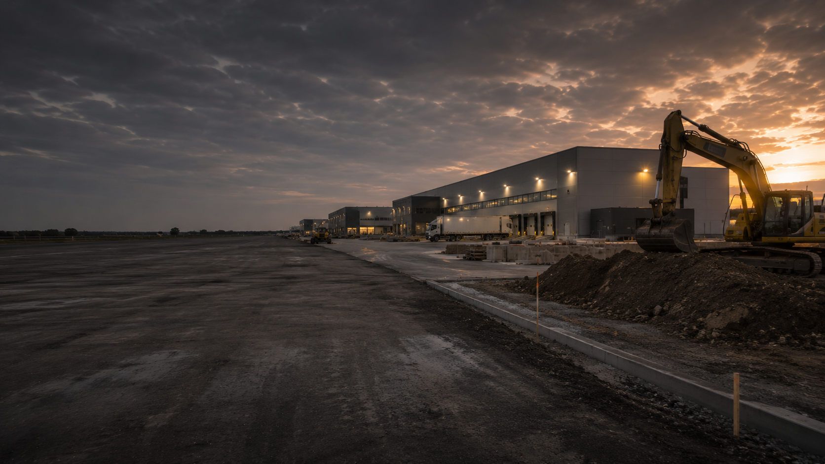
Existing foundations, utility networks, steel structures, fill, production operations and previous uses can considerably affect measurement and access. Extensions, halls, tank areas and logistics areas therefore need a phased approach.
Permissions to work, shutdowns, working areas and documentation interfaces are coordinated with the operator, designers and construction team.
During refurbishment or demolition, the current construction stage is continually considered. Newly accessible areas may need different investigations from areas previously built over or affected by installations.
Assess industrial site requirements
Schools, nurseries, administrative buildings, sports facilities, road space and urban-development sites require transparent tender documents and clear responsibilities.
Ordnance assessment is described so that the authority, design consultancy, site management and contractors use the same basis for area, depth and evidence.
Early clarification supports budgeting, scheduling and formal tendering. Later changes to the construction area are checked against the documented investigation scope.
Assess the local authority project
New developments, neighbourhoods and infill projects combine land development, roads and utility infrastructure, ground investigation and subsequent individual construction projects. Investigation status must remain understandable across several phases.
Phasing and consistent data handover help developers, local authorities, utility providers and later project owners access the same status of work.
For individual plots, it must remain clear which conclusions from the wider infrastructure development can be used and which structure-specific additions are still needed before foundations or excavation.
Assess the housing project
Energy, water, transport and communications facilities combine high availability requirements with restricted access and sensitive operating processes. Protective areas, system isolation and reporting routes must be established early.
The service is coordinated with the installation area, deep intervention, operating state and required evidence without unnecessarily disrupting ongoing operations.
Shutdown risks and safety zones are considered when choosing methods and scheduling. Deviations from the planned working window trigger renewed coordination with operational managers.
Clarify the project process and documentation
Percussion core sampling, groundwater monitoring wells, sampling, remediation and geotechnical investigations target specific ground volumes. Ordnance, contaminated-land and geotechnical questions remain technically separate but are coordinated in the work sequence.
Borehole positions, sampling areas and protective arrangements are planned so that every discipline receives reliable results that can be assigned unambiguously.
The investigation sequence and release points are agreed so that preliminary ordnance checks are complete before the respective drilling, sampling or remediation step.
Assess environmental and geotechnical requirementsProject insurers, financing partners and risk managers need traceable information on suspected ordnance, work scope, limitations and outstanding measures. General safety assurances do not replace spatially defined documentation.
The project file is structured so that investigation status, residual uncertainty, plan changes and follow-up decisions can be communicated transparently.
For risk assessment, the sources available, investigated areas and methodological limits are shown separately. Technical measures and remaining project assumptions can thereby be distinguished objectively.
Clarify the project process and documentationThe construction task, operator environment and project phase affect how suspected ordnance, technical investigation and construction sequence fit together.
Suspected ordnance initially indicates possible contamination. The resulting specialist service depends on the actual project: a long utility trench needs a different section structure from a single mast location, track reconstruction, an urban excavation or an extension during ongoing industrial operations.
Rail, road, cable and pipeline routes cross different ground conditions and historical uses. Services are therefore described by more than total length and average depth.
Chainage, crossings, structures, working widths, depth changes and inaccessible sections form the basis for surveys and later documentation.
Handover points between contract sections or construction phases are identified clearly to prevent spatial gaps between planning, surveying and execution.
Have the corridor project assessedIndustrial plants, transport areas, utility sites and urban neighbourhoods contain utilities, reinforcement, foundations and technical interference. Access and shutdowns may be available only in limited windows.
Preliminary investigation, excavation supervision and alternative measures are coordinated with the operator and construction sequence.
Documentation distinguishes permanently accessible investigation areas from areas that can be assessed only after demolition, system isolation or a new construction stage.
Assess the existing-site projectLocal authorities and public clients need comparable service descriptions, clear qualification requirements and a verifiable definition of work scope.
The clearance objective, investigation areas, depths, interfaces and documentation scope are described so that quotations remain technically comparable.
Ancillary prices and provisional items are included only where the potential follow-up service is technically justified and its trigger clearly defined.
Prepare procurementGeotechnical investigation, foundations, masts, retaining works and underpinning affect defined locations and depth volumes. A general site assessment does not automatically address these working spaces.
Coordinates, design depth, construction method, safety space and surrounding utilities are linked to the deep-ground survey.
Surveying and reports link planned and actual point positions, allowing relocations and additional boreholes to be tracked clearly.
Assess deep interventionsSeveral construction areas, infrastructure alignments and later individual projects need an updatable work status. Historical preliminary assessment, technical investigation and clearance sections are organised in phases.
Maps and reports must show which subarea was treated, when and for what objective.
Overall site assessment and section-specific evidence are kept separate, allowing later individual projects to identify their own intervention space traceably.
Make an initial assessment of suspicionTrack possessions, traffic management, shutdowns and scheduled follow-up work increase preparation and communication requirements. Unclear hold points can affect the entire construction sequence.
Ordnance assessment is linked to construction decision points and clear reporting routes.
Staff and equipment availability, data review and report delivery are coordinated with critical dates without reducing minimum methodological requirements.
Coordinate the technical sequenceEach project phase asks a different question. The technical step must therefore fit the current decision and actual intervention space.
Sector-specific planning combines historical background, working area, intervention depth, access, utilities, operating conditions, construction phases and required documentation. Only then can the need for historical aerial photograph analysis, surface or deep-ground surveying, excavation supervision, area clearance or ordnance recovery be identified.
Project question: Which historical or known indications may affect site development?
Technical step: Historical aerial photograph analysis, document review and initial spatial assessment provide the basis for options and budgeting.
Use: Unresolved site and data risks can be identified before purchase, committee decisions or further planning.
Project question: Which construction areas, routes, borehole locations and depths are actually affected?
Technical step: Areas of suspected ordnance are overlaid with the plans to define technical investigation areas and method requirements.
Use: Options can be compared by additional investigation needs, access and effect on construction sequence.
Project question: Which services, qualifications and documentation need contractual definition?
Technical step: Area, depth, method, interfaces, quality control and acceptance criteria are defined clearly.
Use: Quotations address the same scope and can be assessed transparently on technical and commercial grounds.
Project question: Which access routes, utilities, operating conditions, closures and protective areas affect execution?
Technical step: Survey and construction sequences are coordinated; plan revisions and responsible persons are assigned definitively.
Use: Permissions to work, access, closures and data handovers are clarified before the trades mobilise.
Project question: Have all working areas been adequately investigated before ground disturbance, or is specialist work during construction required?
Technical step: preliminary investigation, deep investigation, excavation supervision or clearance are carried out and documented by section. Where technically suitable surveys during construction are used, each layer is technically checked and assessed before soil removal. Additional visual inspection accompanies subsequent excavation, followed by a new survey before the next layer.
Use: Site management and specialist supervision can identify the area treated and the deviations requiring a new decision.
Project question: Which area was actually treated, and what limitations remain for later construction stages?
Technical step: Reports, site plans, findings and follow-up decisions are brought together in the project file.
Use: Operators, clients and later design phases can use the status achieved without losing its spatial reference.

A sector label is insufficient for commissioning an investigation. Existing historical assessments, statements and earlier investigations are first compared with today’s working areas. What matters is the question these documents already answer and the part of the planned intervention not yet covered. The next technical step can then be justified without deriving particular contamination from the property’s use alone.
Assess the basis for suspicion
One construction measure may involve broad working areas and individual deeper interventions. An existing area result is therefore not applied unchecked to piles, boreholes or new retaining-work alignments. Method selection considers location, dimensions, design depth, accessible surface and known interference together. The responsible design team can then identify the tasks requiring separate enquiries.
Clarify area and depth referencesAn energy connection beside a railway or infrastructure development on an industrial site combines several project environments. Investigation areas receive clear identifiers in the shared site plan. Overlaps and adjoining areas are explicitly identified. This keeps clear which documents apply to the cable trench, foundation or site access.
An investigation may use a different ground-surface or design status from later execution. After demolition, additional fill or changed intervention geometry, the team checks which conclusions remain usable. The change and affected areas are described together so that any necessary addition can be scoped technically.
Where several contractors are involved, the status handed over must support the next work instruction understandably. It includes investigated limits, plan revisions used, unresolved questions and agreed follow-up services. A combined project status does not replace spatial assignment of this information. Design and site management thereby receive a shared basis for further coordination.
Documentation is adapted to project geometry and organisation. A corridor needs different references from an industrial site or single municipal measure, but the technical core remains comparable.
Report recipients may need different information. Site management needs clear section and hold-point details, operators need installation and operational references, while clients and insurers particularly need to understand work scope, limitations and outstanding measures. All outputs nevertheless use the same technical data basis.
Tendering and site management must also know how subareas, route chainage, borehole locations, closure periods, concurrent trades and handovers are documented. A general ordnance-survey item is insufficient when several construction stages or operator requirements interact.
Measurement data, survey results and assessment of findings remain linked to their working spaces. Subsequent uncovering or clearance adds the relevant finding and clearance records. Reports and maps show which evidence belongs to which completed service and construction stage.
Construction areas, routes, chainage, structures, borehole locations and installation areas provide the spatial reference. Treated and untreated zones are clearly separated.
Updates identify plan revision, date and change. The geometry underlying an earlier assessment therefore remains identifiable.
Historical assessments, official information, known finds and project requirements are documented with their scope.
Conflicting conclusions or missing appendices are not combined without explaining their origin. Outstanding points receive a specific clarification task.
Methods, measurement coverage, depths, working layers, access, interference, operating requirements and construction-sequence changes are described traceably.
The report also identifies quality controls performed and the data actually available for technical assessment.
Anomalies, uncovering, finds, areas that cannot be surveyed and methodological limits remain tied to location and visible for later decisions.
For unresolved suspected targets, the records state whether further interpretation, target investigation, clearance or adjustment of the construction method is planned.
Clients, designers, site management, operators, specialist contractors and competent authorities receive the information needed for their respective responsibilities.
Handovers are documented with plan revision, appendix register and contact, keeping decisions traceable through personnel or contract-section changes.
The report identifies the status achieved and the further investigation, clearance, recovery or plan adjustment needed for the next step.
Conclusions remain tied to the construction stage described. Additional depths, new areas and changed methods are reassessed before execution.
The work is integrated into the existing project organisation. Decisions follow design status, intervention space and the conclusions actually achievable.
Contract-section changes, operator handovers and construction phases separated in time explicitly transfer data status and responsibility. The technical chain is retained even when several companies work successively in the same area.
In multiphase projects, documentation retains earlier investigations without applying them unchecked to changed routes, additional structures or greater depths.
Sector, operator structure, construction task, project phase, schedule and participants are clarified at the start.
Site plans, historical assessments, authority correspondence, utilities and earlier findings are assigned spatially.
Construction areas, routes, chainage, borehole locations, excavations, assembly areas and intervention depths are defined.
Historical assessment, surface or deep-ground surveys, excavation supervision, clearance and recovery are combined according to suitability.
Access, closures, operator requirements, concurrent trades, channels for issuing instructions and hold points are agreed before execution.
The agreed investigation or clearance is performed by section and location; deviations are recorded immediately.
Measurement data, findings, limitations and construction stage are assessed against the investigation or clearance objective.
The project file, site plans and conclusion form the basis for the next design or execution step.
Choose the current project need. The linked specialist pages lead to sector-specific requirements or the appropriate service.
Combined projects may need more than one starting point. What matters is the working area next to be designed, tendered or constructed.
For rail, roads, cables and pipelines with changing sections, crossings and intervention depths.
Chainage and construction phases provide the shared reference for investigation and documentation.
For earthworks, transport areas, bridges, retaining walls and municipal civil engineering.
Excavations, utility spaces and later deeper interventions are considered separately.
For point-specific deep interventions in geotechnics, foundations, energy and infrastructure projects.
Coordinates, design depth and construction method determine the investigation area required.
For industry, commercial sites and critical infrastructure with utilities, steel, foundations or ongoing operations.
Access, system isolation and technical interference are clarified before method selection.
For infrastructure development, housing, local authorities or conversion projects with several construction areas and phased work.
Overall assessment and subarea documentation are organised for continuing updates.
For reports, specifications or official documents that do not yet identify the actual specialist service.
The unresolved requirement is expressed in terms of area, depth, method, interface and documentation objective.
Permissions to work, working areas and investigation results must fit the construction sequence. FONTANA-EOD agrees with the client, designers and operator which areas and depths are investigated, what access is available and which documents are needed before the next intervention.
FONTANA-EOD first considers the decision the project needs: defining suspected ordnance, technically investigating areas, assessing deep interventions, supervising excavation, investigating anomalies or preparing completion documentation. The sector provides the organisational framework but does not replace technical assessment of the individual case.
Survey methods are selected by target object, ground conditions, interference and intervention depth. For rail, industry and critical infrastructure, metal installations and restricted access may shape interpretation; corridors and developments place particular emphasis on sectioning, chainage and data consistency.
All design or construction-stage changes are checked against the previous scope. This keeps clear which conclusions remain usable and where additions are needed.
Large programmes standardise data structures and naming conventions across the project. This helps compare subprojects without erasing the technical differences between individual areas or construction stages.
Technical review is also linked to project decision dates. Early information needs take priority; later sections receive detailed assessment once their geometry and execution are sufficiently defined. Work thereby stays targeted and capable of being updated.
Clients, designers, operators, site management, specialist contractors and competent authorities receive defined tasks and reporting routes.
Track possessions, operating states, construction phases, concurrent trades and decision dates are included in service planning.
Methods and combinations follow measurement objectives, depth, ground conditions and interference.
Construction areas, sections, chainage, borehole positions and inaccessible zones remain spatially traceable.
Technical limitations and residual uncertainty are identified early and linked to appropriate follow-up measures.
Reports and maps are structured for continued use in procurement, site management, operations and later updates.
Complex infrastructure projects often involve several client, operator and contractor levels. Ordnance assessment therefore needs clear information flows and decision points.
Defines the project objective, investigation area, required documentation and contractual interfaces. Provides known information on suspected ordnance and existing structures.
Translate the project into areas, routes, depths, borehole locations and phases, and incorporate ordnance services into design and tendering.
Arrange access, system isolation, closures, protective areas and operational reporting routes. Changes in operating state are considered in work preparation.
Coordinate equipment, personnel, sections and concurrent trades, and implement agreed hold points and communication routes.
Assesses suspected ordnance and service needs, performs the commissioned specialist service and documents results, deviations and scope limitations.
Undertake hazard-response, find-handling and further decision tasks according to project location. Names and specific responsibilities differ regionally.
Public-order authorities and building control may be involved depending on local procedures and the construction task. Existing requirements are assigned to the actual site and working area. Commercial specialist services, operational work authorisation and authority decisions on finds each have their own contact and reporting arrangements.
Qualification, occupational safety, documentation and authority interfaces depend on activity, location and construction stage. Sector-specific operator rules apply in addition.
The client needs a clear description of the basis for suspicion, area and depth, service, quality control and documentation objective. In public or complex private procurement, this clarity prevents technically different services being offered under the same item.
In Germany, § 7 SprengG concerns commercial authorisation for applicable activities requiring it; § 20 SprengG concerns responsible persons’ certificates of competence. Project requirements follow the actual activities and organisation planned. Searching for found munitions is also expressly covered by § 1b Abs. 1 Nr. 3 Buchstabe d SprengG. The search purpose is therefore linked to the required qualification and responsibility framework.
Risk assessment links working methods, personnel, equipment, protective areas, emergency and reporting routes, and sector-specific operating conditions. DGUV Information 201-027, applicable rules and the BFR KMR support the technical structure of investigation, planning, execution and documentation.
For an actual find, work in the affected area stops immediately. The object is not touched, the immediate area is vacated and the local reporting procedure is initiated. Private specialist services, site responsibilities and state hazard response are coordinated according to the actual circumstances.
Contractual acceptance, return to operational service and official decisions on finds are separate processes. Their prerequisites are shown separately in scheduling and communication plans, so that no participant infers a broader conclusion from a partial decision.
For cross-border or international projects, service terms and documentation requirements are also expressed in the technical and responsibility terminology used locally. Project location, actual activities and the competent local bodies remain decisive.
The First Ordinance to the German Explosives Act (1. SprengV) includes requirements for specialist competence and officially recognised courses. Across different sectors, the qualification required remains linked to the actual activities; operator rules do not replace this assessment.
DGUV Rule 113-003 addresses dismantling or destroying explosives or corresponding objects and includes disposing of found munitions. Applicability depends on the activities actually planned and is coordinated with the project’s operating conditions.
Project type, working areas, depth, method, interfaces, qualifications and documentation due are clearly described before quotations.
Risk assessment, briefings, protective areas, system isolation and operating rules relate to the actual workplace.
Authority procedures and handling of finds differ by federal state or country. Local responsibilities are established before relevant work starts.
Work areas, findings, quality controls, limitations and follow-up decisions are combined in a verifiable form.
Historical background, intervention geometry, project phase and required conclusion are defined as a shared task.
Access, utilities, operator requirements, working areas, hold points, communication and documentation are agreed with everyone involved.
The previous scope is reassessed against the changed situation; further steps are agreed technically and with the relevant regional bodies.
Investigations must fit the planned ground interventions and site conditions.
The location and depth of works, existing installations and ongoing operations determine which methods can be used.
In linear projects, measurement areas, borehole locations and findings are referenced by chainage and section, keeping documentation consistent over long corridors.
Open rail and track corridorsCivil engineering needs clear distinctions between preliminary area surveys, deep interventions and areas accessible only during excavation.
Open road construction and civil engineeringFor existing installations, technical interference, permissions to work and possible alternative measures are considered during work preparation.
Open industry and commerceLocal authority projects need a clear evidence chain so that tendering, grant procedures and later construction stages use the same status of work.
Open local authority projectsGeotechnical and contaminated-land investigations need ordnance-related checks without mixing their own assessments with ordnance assessment.
Open environment and geotechnicsThe specialist service is adapted to installation status and the planned intervention. Inaccessible areas and operating restrictions remain part of the conclusion.
Clarify the project process and documentation
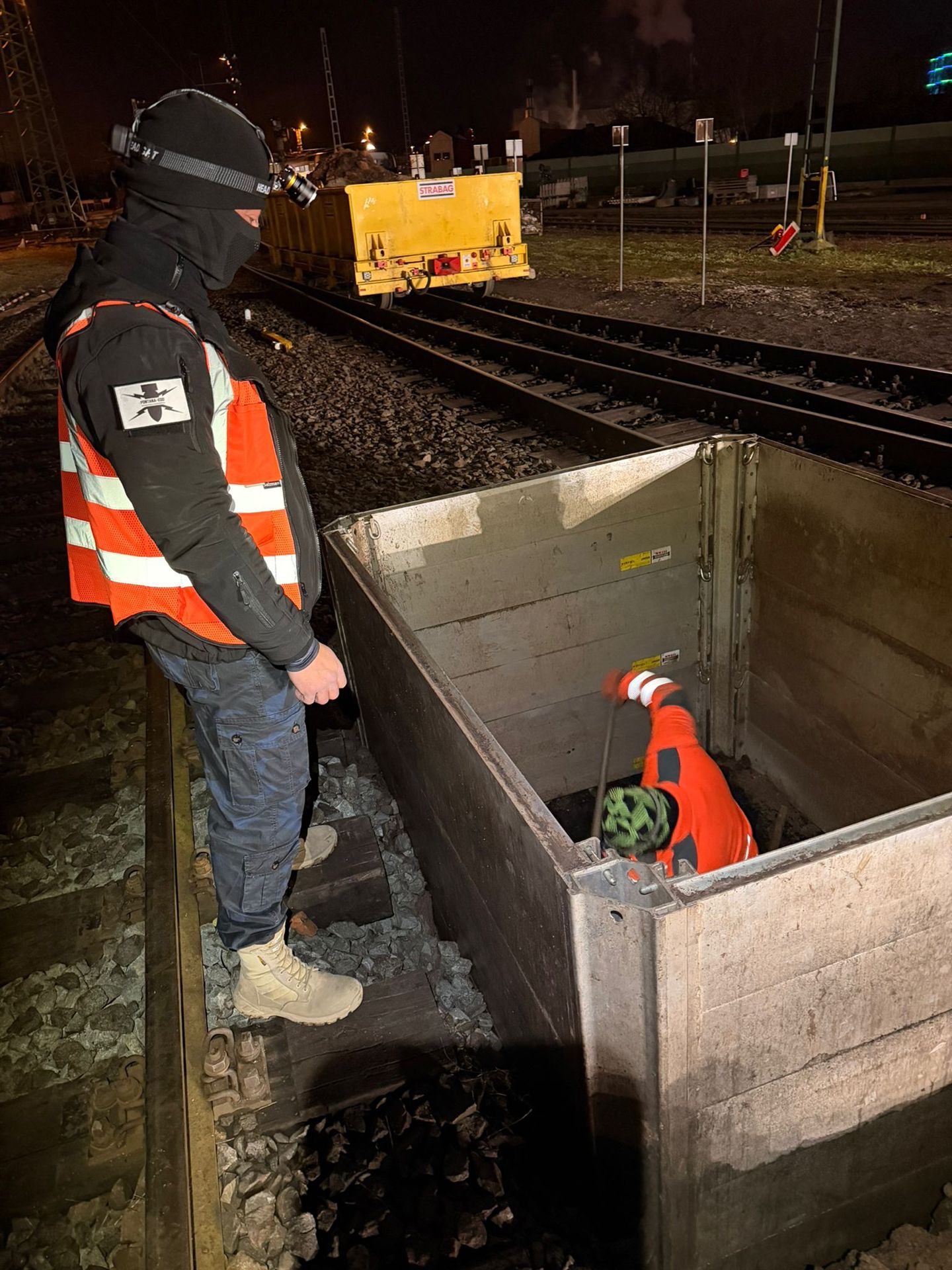
The next commission depends on current status: historical information, technical investigation, unresolved anomalies and intervention areas not yet assessed. Select the service according to that outstanding task.
Existing reports or requirements can be submitted directly. This helps avoid investigating a question already answered or applying an existing conclusion unchecked to a different working space.

Select historical assessment, surface and deep-ground surveys, excavation supervision, clearance and recovery according to project circumstances.
Open servicesRelate historical sources to the construction area, route, installation area or development site.
Assess suspected ordnance initially
Compare area-survey methods by target object, surface, ground conditions and interference.
Survey the surfaceAssess locations and depth volumes for foundations, masts, retaining works, geotechnical and infrastructure projects.
Survey at depth
Provide specialist supervision of areas not fully investigated beforehand or affected by severe interference within the actual construction sequence.
Supervise excavationStructure the clearance concept, specification, quality assurance, report and completion documentation.
Open documentation guidance
Assess project location, federal state or country and the relevant local interfaces.
Select a region
Submit project type, location, intervention, depth, date and existing documents directly.
Have your project assessedFor projects with several locations, maintain site plans, existing information and responsible contacts for each site. A common sector task does not mean that previous conclusions or local procedures transfer unchecked to another location. Alongside the sector, give the actual address, affected properties and existing project requirements. For longer routes, a clear section structure helps assign documents and further coordination to the correct territory.
Operating windows, traffic management and coordination with installation owners shape service organisation. Alone, they do not establish a suitable method or achievable conclusion. An understandable enquiry therefore presents organisational conditions together with the technical question. Access, investigation scope and documentation needs can then be coordinated.
Explore results and terminologyPreliminary assessment, surveys, work during construction and investigation of findings need different specialist services. Where a report already exists, its spatial and depth references and stated limitations are decisive. This information identifies the appropriate service for the outstanding question and defines the required scope.
Understand the service scopeCommissioning depends on location, basis for suspicion, planned intervention and operating conditions. Required documentation is agreed with the client, designers and operator.
Project types differ in intervention geometry, depth, access, existing utilities, operating conditions, closure periods and required documentation. A railway corridor is organised by chainage and track possessions, an industrial site by plant areas and operator work permissions, and housing development by construction areas and infrastructure phases. Suspected ordnance remains important, but is always related to the actual construction and operating sequence.
If historical ordnance contamination remains unresolved, work often starts with aerial photograph analysis and document review. Where a reliable basis for suspicion already exists, the team assesses whether surface surveys, deep-ground or downhole surveys, excavation supervision or clearance fit the intervention. The first step therefore depends on project phase, available information and the decision required.
Clarification starts once the working area and likely interventions are known. Before tendering and execution, the investigation objective, scope, interfaces and documentation are defined.
Corridors are described by chainage, working width, intervention depth, crossings, structures and construction sections. Historical information, survey areas, borehole positions, findings and inaccessible zones share the same spatial reference. For each section, this identifies the status achieved and the further measure required.
Steel structures, reinforcement, utilities, foundations, technical installations and ongoing operations can restrict measurement and access. Operator requirements, system isolation, protective areas and reporting routes must also be considered. The service is therefore planned against operating status, intervention space and possible alternative measures; restricted areas are spatially identified in the report and conclusion.
The specification describes the basis for suspicion, investigation or clearance area, depth, service objective, permitted methods or methods to be assessed, qualification requirements, interfaces, quality control and documentation to be delivered. Sector-specific details such as track possessions, operating requirements, access, concurrent trades and section handovers also form part of the task.
In Germany, KBD, KMBD and KRD are regional names for public bodies or tasks in ordnance disposal. Their specific responsibilities depend on the federal state and circumstances. Private specialist services such as historical assessment, surveys, excavation supervision, clearance and documentation are commissioned separately and coordinated with local procedures.
If an unexpected suspicious item is found, work stops. Do not touch or move it. Leave the immediate area, warn others without putting yourself at risk and call the police in Germany on 110. Outside Germany, use the local emergency procedure. The competent authorities decide on further handling.
Key factors include site area or route length, number and depth of boreholes, project phase, basis for suspicion, access, surface, ground, utilities, interference, closure periods, operating conditions, required methods, data formats and documentation scope. A reliable cost estimate therefore needs clear references to location, intervention and sequence.
A well-defined enquiry links project type and location to the actual ground intervention. Early designs are suitable too if the construction area, route or borehole locations can be defined traceably.
For multiple contract sections or subprojects, identify plan revisions and priorities clearly. Initial assessment can then distinguish investigations needed immediately, later construction sections and areas considered only as a precaution.
A brief account of the intended procurement and execution structure is helpful. It identifies whether project organisation needs shared overall documentation, separate contract-section reports or both.
Project management and controlling identify unresolved areas, necessary follow-up measures and critical decision dates separately. Ordnance-work status can thereby inform scheduling and cost planning without concealing technical uncertainty.
Identify the sector, client, operator, designers, site management and other relevant bodies. For industry, rail and critical infrastructure, involve those responsible for access and operations early.
Also state whether the project involves new construction, extension, refurbishment, demolition, maintenance or preparatory investigation.
Site plans, construction areas, routes, chainage, borehole locations, excavations, assembly areas, intervention depths, phases and time windows form the technical basis.
Track possessions, traffic management, system isolation, concurrent trades, machinery and planned changes help integrate the service realistically into the sequence.
Include aerial photograph assessments, authority correspondence, survey reports, anomaly maps, utility and existing-structure documents, geotechnical data and known finds.
State whether the result is needed for design, tendering, operator permission, site management, the project file, insurance or regional coordination.
An initial assessment usually needs the project address, site plan, project type, planned ground intervention, maximum depth, schedule and available information on suspected ordnance. FONTANA-EOD identifies the appropriate service area and documents still needed.
Large or multiphase projects can be divided by priority and construction section, enabling early decisions without making general assumptions about later areas.
A reliable quotation basis also defines required data formats, coordinate system, report recipients and handover dates. These details affect interpretation and documentation as well as fieldwork.
Rail, roads, utilities, energy, industry, local authorities, housing, environment or critical infrastructure.
Construction area, route, chainage, borehole locations, excavations, working widths and depths.
Utilities, operations, closures, access, interference, phases and concurrent trades.
Basis for design, procurement, site management, operators, insurance or the project file.
Whether historical aerial photograph analysis, explosive ordnance surveying, surface surveying using GPR, magnetometry or TDEM, deep-ground surveys, downhole surveys, excavation supervision, area clearance or ordnance recovery is needed depends on the location, ground disturbance, depth, ground and existing documents. An early ordnance assessment provides clarity for tendering, programming, occupational safety and construction.
FONTANA-EOD combines its Section 7 SprengG licence, specialists holding Section 20 SprengG certificates of competence, suitable survey and clearance methods, and traceable documentation. Send the site plan, depth of ground disturbance, construction phase and existing documents for an initial technical assessment.


