Project pathway
The quickest route to the right decision.
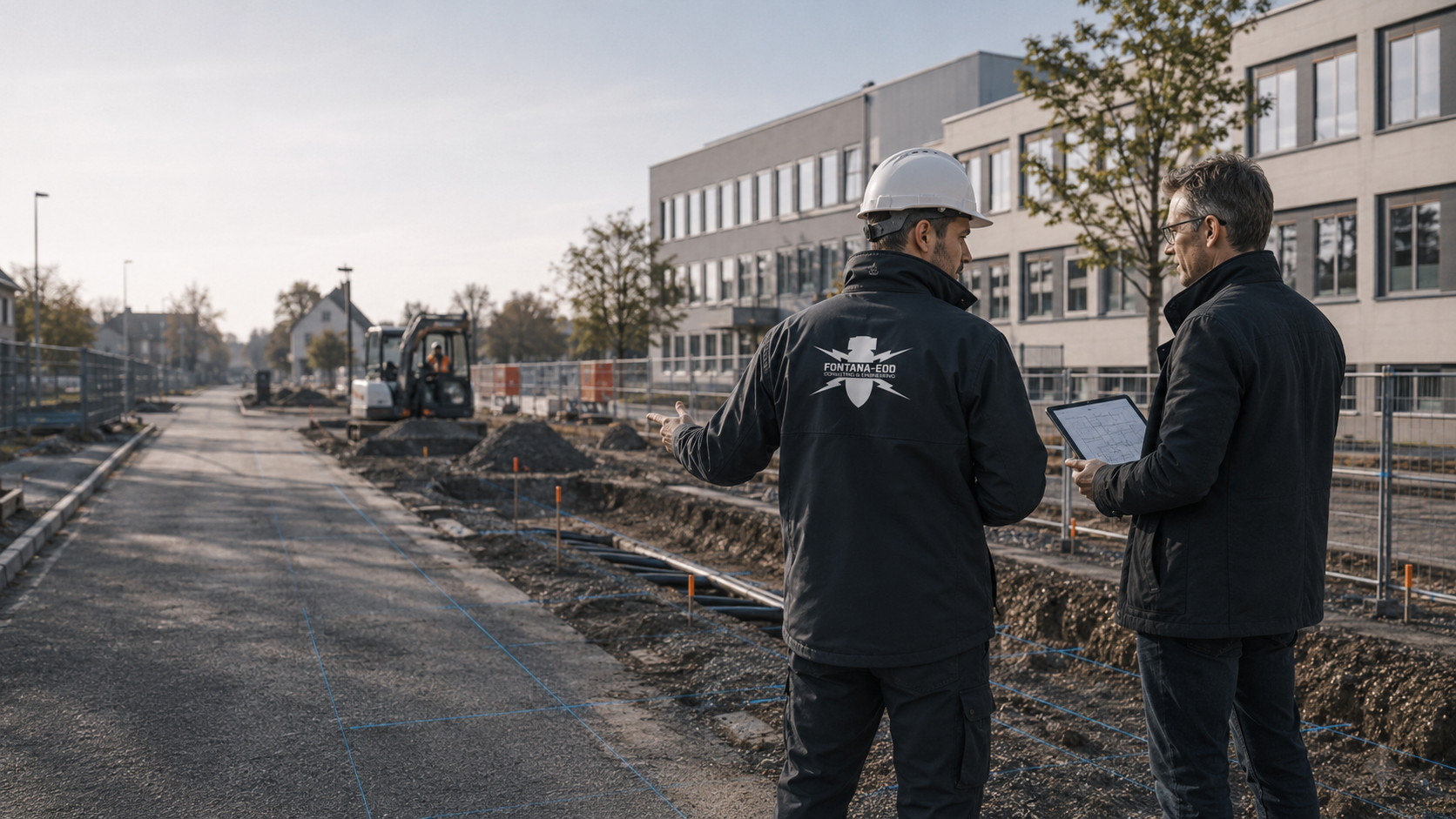
A procurement body needs a clear technical task: what must be clarified, on which area, what findings are available and what result is needed? FONTANA-EOD supports project-specific assessment of this information. Selection of the procurement procedure and legal decisions remain with the public client and its competent bodies.
Identify the information needed rather than a catch-all term.
Report existing conditions and uncertainties.
Link evidence with the commission.
Technically sound procurement starts with the question of which information is needed for the next ground intervention. The site, volume of ground intervention, existing documents and constraints are then brought together into a clear technical task. FONTANA-EOD supports this technical preparation; selection of the procurement procedure, legal assessment and contract award remain with the competent bodies.

The term ordnance checks may refer to different services: document assessment, technical surveying, surveys of specific positions or documentation of areas already treated. These tasks should not be procured solely under one collective term. The starting point is the decision that planners or those carrying out construction need to make using the result.
Distinguishing survey services for procurement
The procurement body does not itself need to select a geophysical method for this. It needs a technically prepared description of the site, ground intervention, existing knowledge and constraints. Outstanding questions are identified so that they do not inadvertently enter procurement as execution prerequisites already clarified.
Documenting the site and outstanding technical questionsIf existing findings are not available in an organised form, their technical assessment may be needed first. The task then describes which documents for which project are to be assessed and which outstanding question arises from them. Such an assessment is not equated with surveying already performed. For subsequent procurement of technical work, the information underlying survey scope and information still to be obtained or specified remain identifiable.
Organising documents and evidence requirementsFor a survey task, area, depth, access and the conclusions desired are described together. An equipment name or area in square metres alone cannot replace this definition. Preceding services, measurement obstructions and the approach to unsurveyable areas belong in technical coordination. The result should clearly answer the task actually agreed. Evidence required by the specification of services relates to the conclusions technically achievable through the agreed survey.
Selecting specialist services according to the survey task
If specialist surveying is to be linked with the excavation sequence, methods, work areas and interfaces must be precisely defined. General presence on site does not describe ordnance surveying during construction. The tasks of specialist personnel, site management and the construction company are recorded separately. Necessary interruptions, information and subsequent decisions are agreed before work starts. The scope of services can then be checked against the specialist work performed rather than attendance times alone.
Defining the tasks of excavation supervisionBefore service items are formulated, it is clarified which decision the commission should support. Unknown areas, depths or documents are treated as outstanding information rather than concealed in apparently precise quantities. The technical need first identifies the question to be answered for planning or execution. Early assessment of existing findings, surveying specific areas and supervision of a particular ground intervention have different tasks and result limitations. These differences are made visible when preparing the scope of services. If position or execution is not yet fixed, dependent information remains outstanding. The specialist planners explain which decision can initially be made and which information is still needed for it. After further planning, the scope relates to the new version. Specific items thus receive a traceable relationship to the actual construction task and available information.
The information and service boundaries provided must describe the same technical starting point. The procurement body organises provision in accordance with the procedure; the specialist planners explain the technical task. The shared starting point includes spatial boundaries, intended ground interventions and available findings. It also describes which prerequisites already exist on site and which still need providing or coordination. The specialist task can thus be distinguished from access, preparatory work and later construction services. Technical questions are answered in relation to the relevant plan version. Changes to the task description remain traceable for further coordination. The specialist planners can explain which conclusions the described survey scope can achieve and which limitations apply. The project organisation can thereby identify the basis underlying a quotation.
A change is compared with the commissioned task and described technically. The competent bodies decide its contractual and procurement-law treatment. For the technical description, the old commission, new design and area actually affected are considered side by side. A larger excavation, relocated utility connection or additional construction phase may create a different survey task. The specialist contractor explains which existing findings are usable for this change and where new questions arise. The responsible project body receives the necessary information on position, depth, scope and expected conclusions. The competent bodies can use this to organise further work. The revised status is recorded with its date and plan reference. The responsible project bodies can use the technical assessment and documented change status for further commissioning and examination of results.
State the question to be clarified and link it to a plan appendix. Areas, positions, depths and construction phases must be distinguishable. A commission for early planning may need a different results scope from a specialist service immediately before earthworks.
Existing information, reports, utility and ground investigation documents are provided with their dates and scope. Unavailable information also belongs in task clarification. An apparently complete information base must not be inferred from an appendix list alone. Where historical findings are missing, a Historical aerial photograph analysis can support technical task clarification.
Clarify who provides access and survey control information and plans necessary preparatory work. Necessary surveys and protective measures are planned before ground interventions during vegetation clearance, surface removal, foundation removal or creation of access routes and work areas. Sections accessible later are surveyed before the respective subsequent interventions. Coordination with authorities and the approach to new findings also need assigned contacts.
Define which reports, plans, measurement data or findings are actually needed. The scope should match the commission and be described in a verifiable way. The content and coverage of the required documents are aligned with the agreed survey and its technical limitations. Plan references, survey scope, methods used, results and limitations are compiled according to the specific commissioned service; evidence requirements are derived from that task.
The documents show where the specialist service is to apply and which ground interventions are planned. Revision versions and missing information remain visible. A lengthy appendix list is not equated with a fully clarified information base. The list links appendices to actual survey areas. For each relevant report or plan, it is clear which part of the task it describes and which version it represents. Missing detailed plans or unclear depths are explicitly identified. For multiple construction stages, an overview assigning the respective detailed documents helps. The specialist planners check whether conclusions from older reports can relate to the proposed ground interventions. Outstanding spatial or technical gaps enter further coordination. This shows which information for a specific commission is already available and which still needs obtaining. After a change, the connection between the task description and appendices used remains traceable.
Access, survey control information, preparatory work and coordination are assigned. Whether preparatory work itself affects ground is considered. Task clarification describes not only the specialist method but also its necessary prerequisites. For each prerequisite, responsibility for clarification and the part of the survey dependent on it are recorded. Work still outstanding is distinguished in planning from conditions already present. Where preparatory measures affect ground, necessary surveys and protective measures are considered before those interventions. The specialist contractor receives the actual status of access and work areas for coordination. If additional tasks arise, their spatial extent and interfaces are identified. The client can thus connect the technical survey scope with site organisation. Assignment remains clear even with different preparatory and construction companies and is reconsidered if the sequence changes.
The report, plan appendices and other agreed information are assigned to the commission. The content required must match the conclusions technically achievable. Outstanding areas and limitations form part of a traceable result rather than being obscured by blanket completion wording. Examination of the service relates to the agreed scope and information actually available. It identifies the areas or positions treated and the plan appendices referenced by the assessment. Limitations and outstanding areas are shown with their spatial references. A further technical question can thus be distinguished from a task already answered. At handover, the report and associated appendices are provided together. An addition remains identifiable by the previously outstanding issue it addresses. The client thereby receives a basis for further technical examination and project decisions. Contractual consequences remain a matter for the competent bodies.
The client and planners first describe the next ground intervention and the decision the result should enable. Existing findings, missing information and survey conditions are then brought together. Only this provides a basis for defining an appropriate scope. The procurement body receives a technically explained task with a plan reference, preceding services and expected result. Quantities and items are linked to this basis so that subsequent services do not depend on an unclarified initial assumption.
A changed foundation, additional utility section or different construction method may alter the specialist task. The new plan is therefore compared with the previous description. Unchanged areas remain distinguishable. The specialist planners explain which parts of the survey scope or constraints are affected. The responsible procurement body decides how to handle this in accordance with the procedure. Technical explanation and procurement-law communication are coordinated without combining their different responsibilities.
Examination of the service compares the commission with the work actually performed. This includes the plan versions used, surveyed areas, methods, results and limitations. Clear documentation facilitates this comparison. The client assesses the service on this basis within the contractual framework. Tasks or areas not yet treated remain identifiable in the results. Site management can thus use the information obtained without deriving unsupported conclusions about further groundworks from formal completion.
If the project plan changes during preparation, the technical task description must be updated with it. Quotations and later execution should rest on the same information. The procurement body organises procedurally correct communication of these changes; the specialist planners provide the necessary technical explanation.
During subsequent examination of the service, the commission, plan reference, work performed and documented limitations are considered together. The information is brought together in the project file. The client decides contractual acceptance; the respective competent authority decides authority clearances. Following actual exposure or clearance work, the associated findings and clearance records are included.
Describe which next project decision the result should support and which ground interventions are approaching.
Compare available plans and reports with the described commission; identify outstanding prerequisites. Where historical questions remain open, the necessary sources are researched and aerial photographs of the affected areas assessed. Findings are spatially assigned to the present construction task and considered in further survey planning.
Distinguish preparatory work, specialist services, documentation and interfaces and assign responsibilities. The suitable survey method is technically defined according to the ground interventions and site conditions.
Define which documents will allow the commissioned scope and work performed to be traced.
After commissioning, the agreed survey is carried out in the defined area. Measurement data, findings and limitations are recorded with position, depth and plan references.
Measurement data and findings are technically assessed and compared with the agreed information objective. The client and site management receive results, limitations and areas still outstanding for the next decision. The assessed results and their limitations are documented in the agreed report with the associated plan appendices.
The site, expected task and interference determine technical suitability. Premature selection of particular equipment may miss the technical need. If a method is specified, the basis and limitations of that specification should be clear.
Where the VgV applies, § 31 requires a sufficiently precise description of the subject of the contract that enables comparable quotations. The responsible procurement body clarifies which rules apply to the specific municipal procedure. The technical service description must be coordinated with this procurement-law classification.
The specialist service should provide a traceable set of findings. The commission describes the conclusions technically achievable for the agreed areas, depths and methods. The competent bodies make legal assessments. Limitations and outstanding areas must remain identifiable in the results.
Historical aerial photograph assessment and other old records help place the basis for suspicion in its spatial context. The available images, their evidential value and the limits of the area considered matter. The absence of an identifiable indication must be distinguished from a technically surveyed ground area. The assessment is considered together with the planned intervention and other available findings. It can support the choice of a survey, but is not a measurement of the present-day subsurface or confirmation for all future works.
Understand aerial photograph assessmentMagnetometric methods detect magnetic anomalies. Whether they can address the specific survey task depends, among other things, on the expected objects, ground conditions, interference and required survey area. Fences, utilities or existing structures may affect interpretation. A measurement signal is therefore not described as ordnance solely because of its strength. Method, interpretation and any further investigation are planned as a connected specialist task.
Understand the scope of magnetometryElectromagnetic surveys may be suitable for particular metallic targets and site conditions. TDEM detects the time-dependent electromagnetic responses of electrically conductive bodies. Suitability is justified for the particular task, not inferred merely from the availability of equipment. Interfering installations, accessible areas and the required conclusion must also be considered. Results are documented with location and survey conditions. Whether a complementary method is needed follows from the specialist assessment and remains a specific project decision.
Understand electromagnetic surveyingUnder suitable conditions, ground-penetrating radar can provide information about subsurface structures and reflections. Ground conditions, moisture, installations and the particular survey task affect interpretability. An anomaly is not automatically ordnance, and an area with no apparent anomalies is not general evidence for arbitrary depths. The specialist interpretation and its limits are documented with the instruction. A survey for another purpose is not adopted without checking as ordnance evidence.
GPR and limitationsFor deeper interventions, it may be necessary to check whether a surface survey can provide the required conclusion or whether another approach is needed. Location, depth, borehole layout and existing utilities then form part of preparation. Access for the survey must also be planned appropriately from a technical perspective. A general depth figure or standard grid does not replace this task. Results remain tied to the areas actually treated and the method applied. For surveys from investigation boreholes, casing, drilling depth and documentation are also coordinated with the task and local conditions.
Prepare deep interventionsIf a necessary preliminary survey cannot be completed in full, the suitability of a technically planned approach during construction is assessed. Each working layer is technically surveyed and evaluated before controlled removal in layers with supplementary visual inspection follows. The steps are repeated to the agreed excavation formation. Excavation layers, stop signal, authority to give instructions, reporting channels and documentation are agreed with site management and specialists before work starts. Pure visual observation of the excavation cannot simply replace a necessary instrumental survey. Site management needs a clear description of when specialist works take place, how new findings are handled and which areas remain outstanding.
Agree the approach during constructionFONTANA-EOD relates the survey to a described intervention and a traceable set of records. Before work starts, the technical task, accessible areas and required results are agreed. If the design or local conditions change, it is checked whether the agreed scope still fits. The report records the work actually performed and its limits. Further construction planning can thus identify what conclusion is available and where additional clarification remains necessary.
Discuss the investigation taskA survey begins with the required information objective. The method selected is technically justified in relation to it. A particular instrument or a similar neighbouring construction site is not, by itself, sufficient grounds for selecting a method.
Inaccessible areas and limited conclusions are identified. They do not disappear into a total area figure. Designers and site management can then decide specifically which areas still need attention and when a suitable survey becomes possible.
A new location, additional depth or different construction method is compared with previous results. A familiar project name does not replace this comparison. Feedback is provided before the affected work so that an outstanding question can be included in the sequence.
The technical conclusion remains connected to its location references and appendices. A brief summary helps orientation but does not replace the documented survey scope. This basis is retained even if site management or contractors change.
The client describes the project and provides the available project records. The operator adds requirements for use, access and timing. A coordinating contact brings the parties together; individual tasks remain assigned to the named parties. Before commissioning, it is clearly recorded what information is missing, who will obtain it and what decision the result is intended to prepare.
The specialist designers describe areas, depths, construction methods and changes. Site management coordinates the planned sequence with the construction contractors and agreed specialist works. Results are assigned to the respective intervention. A technical plan change is communicated early enough for its effect on the survey task to be assessed before construction. Organisational construction stage boundaries remain distinguishable from technical survey boundaries.
The private ordnance specialist contractor carries out the agreed survey and documentation scope. Authority requirements and decisions are clarified with the respective competent bodies. The records needed for a particular procedure depend on the site and project. The technical report documents the specialist service performed, including its area, depth and service scope and the limits of its conclusions. Applicability to further groundworks is checked against the specific intervention. Administrative decisions are made by the competent authorities.
In Germany, the Länder ordnance disposal services and locally competent authorities perform hazard prevention and find-handling tasks. Their involvement and the tasks of the public order authority and, where applicable, building control are clarified for the project location. Outside Germany, local responsibilities apply. Contacts, conditions and reporting channels are assigned to the construction project concerned.
In Germany, § 7 SprengG concerns the commercial authorisation for activities requiring authorisation; § 20 SprengG concerns the certificate of competence of responsible persons. Under § 1b SprengG, searching for found munitions also counts as handling them. The requirements applicable to the project depend on the activity actually commissioned and the allocation of responsibilities.
The First Ordinance to the German Explosives Act (1. SprengV) includes requirements for specialist knowledge and state-recognised courses. Procurement takes into account the evidence and responsible persons required for the specific relevant activity tendered.
DGUV Information 201-027 concerns protective measures during ordnance clearance work. DGUV Rule 113-003 concerns the dismantling or destruction of explosives or corresponding objects and also includes the disposal of found munitions. It applies according to this field of activity; it does not replace a risk assessment specific to the planned ground intervention.
For the commissioned activities, the relevant technical requirements and questions of permits, competence certification and responsibility are clarified. The actual planned service scope is decisive. A general company designation does not replace checking that the tasks and interfaces are described appropriately for the specific project.
Risk assessment, work areas and communication must suit the proposed activities. Ordnance specialist works are coordinated with the other construction activities. Operational organisation, traffic safety and other specialist technical inspections retain their own responsible parties. Joint coordination brings the information together without equating the different tasks.
A measurement anomaly first requires specialist assessment; its depiction alone does not identify it as ordnance. If an object is suspicious, work in the affected area is stopped; the competent authorities determine further measures. Survey reports identify the scope treated and its limits so that results are not extended to unchecked areas or later plan changes. Necessary follow-up surveys or exposure works are assigned to the area concerned. Recovery of confirmed ordnance is coordinated with the permitted activities, local responsibilities and documentation.
Planning and documentation: BFR KMR: clearance planning, principles · BFR KMR: geophysics · BFR KMR: documentation · §31 VgV: service description
The federal construction guidelines on ordnance clearance contain requirements for historical and technical investigation, clearance concepts, procurement and documentation within their defined area of federal responsibility. Their application to the specific construction project being procured, together with local requirements and responsibilities, is clarified separately.

Specify the actual project site with a location plan and the affected plots. Available information, conditions and reports are assigned to this area. Applicable requirements, competent bodies and the actual survey status for the project location are clarified using local information and project records. The regional overview helps orientation, while the location plan and project records determine the technical task.
A statement is understandable only with its investigation task. Check the area and depth described, methods used and restrictions. A report title or single result line is insufficient. For new work, these details are compared with the current plan to establish which knowledge remains usable and which question is unresolved.
Explore results and terminologyDocument review, surveying, construction-phase specialist work and recovery are different tasks. An enquiry need not identify the correct method in advance. An accurate description of the intervention and required decision is more useful. This establishes the appropriate technical scope and prevents a general term from meaning different things in design, procurement and execution.
Understand the service scope
For preparation, the location plan and available findings are considered together. Assessment of historical records addresses a different task from a technical survey of the present-day subsurface.
Explore the historical basisSurvey scope, plan references and limitations are documented together. Site management can identify the specific conclusion available for the next intervention.
Understand documentation

Other municipal projects may include additional interventions and interfaces. The overview helps classify them without anticipating the survey of a specific site.
Understand municipal projectsDocument assessment, instrumental surveying, supervision during works and recovery are distinguished by their respective purposes. A technically justified selection connects the information sought with the actual conditions.
Compare servicesNot solely on the basis of the term ordnance surveying. First, the task, site conditions and conclusions required must be clear. A technical specification needs a technical justification and must also be assessed within the applicable procurement framework.
The statement of need clarifies which problem the project must solve. The specification of services translates the agreed scope into the specific tender structure. Without a clarified need, items that appear precise may nevertheless miss the actual task.
They should be identified as outstanding information. Specialists then clarify whether more information is needed before procurement or how uncertainty should be considered in the task. Missing information does not confirm an unproblematic condition.
If an unexpected suspicious object is found, stop work in the affected area immediately. Do not touch, move or uncover it further. Leave the immediate area, keep your distance and keep others away without putting yourself at risk. In Germany, call the police immediately on 110; outside Germany, use the local emergency procedure. The competent authorities determine the next steps. Inform site management and the client; internal notification must not delay the emergency call.
Factors affecting effort include the area, position and depth of ground interventions, ground composition, interference, utilities, access, necessary preceding services and construction stages. The quality of existing documents, suitable survey methods and required documentation scope also matter. Quantities and service items relate to the technically defined survey volume and services actually required.
The conclusions needed and planned depths of ground intervention must be described technically. The resulting technical specification is derived from the task, existing knowledge and survey conditions. A general depth figure without this context may prescribe an inappropriate scope of services.
Describe the prerequisites needed for access and surveying and who provides them. Preparatory work affecting the ground is included in technical consideration. These prerequisites remain distinguishable in the commission from surveying, interpretation and documentation so that responsibilities and scope of work are traceable.
The specialist planners and contractor involved explain the technical change. Contractual and procurement-law treatment lies with the client and its competent bodies. Documentation links the new plan version with the technical task without pre-empting that decision.
Specify whether the project is at an early planning stage, being prepared for procurement or already approaching an intervention in the ground. The date by which a technical conclusion is required helps coordination. Outstanding information is communicated expressly rather than replaced with assumed values.
Send the technical need, existing plan appendices and intended procurement status. Identify outstanding preceding services and the result needed for planners or site management. State whether an initial technical assessment is needed or an already defined survey commission is to be prepared.
Identify a contact for the technical plan appendices and a contact for the organisational procurement status. Spatial extent, intended depths, access and available working windows help assess effort. Outstanding preceding services or alternatives are described separately from tasks already fixed. Technical coordination can thus relate to the information actually needed. A desired quotation date is distinguished from the required handover date for results and the first affected ground intervention.
Send the site plan and available reports with their associated appendices. For multiple construction stages, indicate which document relates to which area. Photographs supplement descriptions of access and existing conditions; they do not replace information on underground structures or planned depths. Associated plans and appendices are also supplied with older reports. For several individual commissions, explain their spatial relationship. The task description also identifies adjoining areas or early work insofar as these matter for defining the scope. Unclear plan versions and missing information are already identified in the enquiry. The specialist contractor can then specifically explain which information is still needed for the intended survey scope. This clarification supports a technically traceable service description and facilitates later assignment of the commission, area treated and result.

Whether historical aerial photograph analysis, explosive ordnance surveying, surface surveying using GPR, magnetometry or TDEM, deep-ground surveys, downhole surveys, excavation supervision, area clearance or ordnance recovery is needed depends on the location, ground disturbance, depth, ground and existing documents. An early ordnance assessment provides clarity for tendering, programming, occupational safety and construction.
FONTANA-EOD combines its Section 7 SprengG licence, specialists holding Section 20 SprengG certificates of competence, suitable survey and clearance methods, and traceable documentation. Send the site plan, depth of ground disturbance, construction phase and existing documents for an initial technical assessment.


