Project pathway
The quickest route to the right decision.
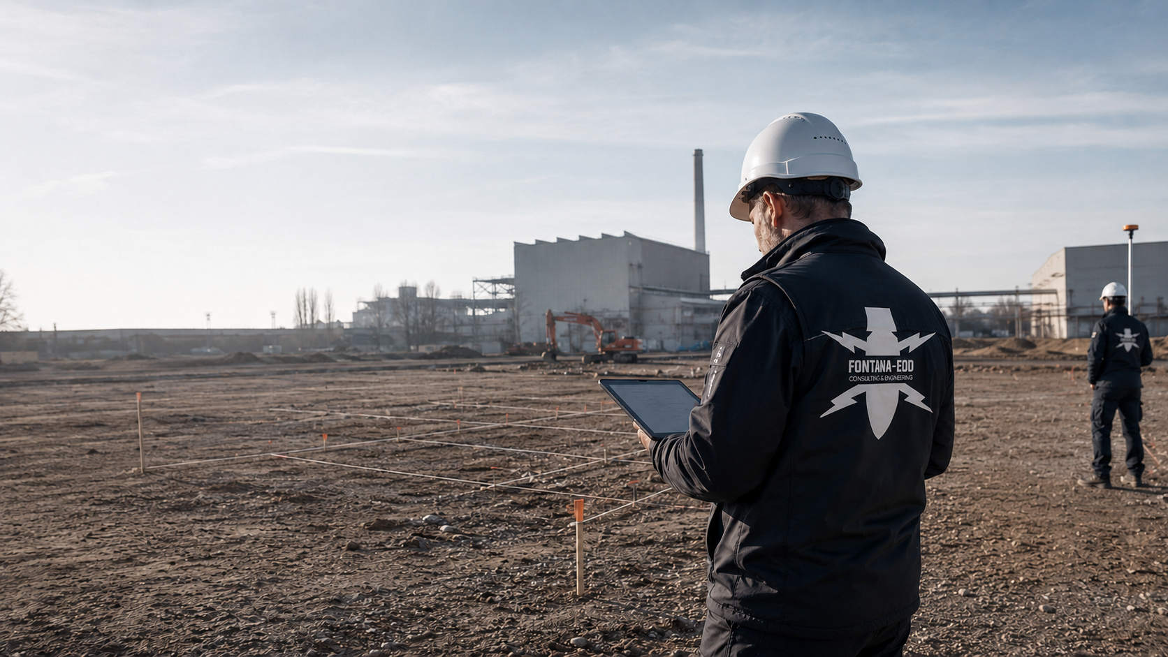
For a new industrial building, we consider the ground slab, foundations, piles and external works with their respective areas and depths. FONTANA-EOD checks the structural grid, foundations and particular deep points against existing information and survey conditions. Send the building and foundation plans with axes, design depths, utilities and construction phases so that the necessary investigations and documentation can be coordinated before procurement or excavation.
Assess column axes early.
Define the area and depth.
Plan the investigation before excavation.
Before a new industrial building is constructed, existing indications of a suspected hazard are used to determine which explosive ordnance investigations are needed for foundations and other groundworks. Column axes, foundations, piles, utilities, drainage and external works are recorded by position and depth in the current plan. Existing results are checked to establish whether they adequately cover these volumes of ground. The documentation remains tied to the building elements and depths investigated; changes to the grid or foundations are checked separately.
For a new industrial building, project development, structural design, civil engineering, site management and HSE must use the same area and depth references.
The structural grid defines the column axes. Foundation and pile positions are incorporated into the investigation plan with their axis designations.
Coordinate the structural gridThe ground slab is often prepared over a large area, but work does not always extend as deep as piles, chambers or utilities. These differences require separate technical consideration.
Define the ground slab areaThe foundation depth indicates how far the individual foundation or foundation element extends into the ground. It is considered with an unambiguous level reference when selecting the method.
Clarify the foundation depthExternal works include traffic areas, ramps, drainage, retention facilities, fire appliance access and utilities. They often require separate investigation sections.
Assess external worksSurvey feasibility depends on the surface, vegetation, demolition condition, utilities, interfering objects, ground conditions and site access.
Assess survey feasibilityThe purpose of the documentation defines whether records are needed for procurement, site management, the project file, HSE, the operator or a specific subsequent decision.
Define the purpose of the documentationThe investigation plan distinguishes between excavation over an area, individual foundation elements and groundworks for utilities and external works.
The building footprint is the main visible area, but is not automatically the only area requiring investigation. Excavations, working spaces, site roads, drainage and external works may also be relevant and should be described separately by location, depth and purpose of the documentation.
Column axes, piled foundations and deep foundation points involve localised ground interventions. Their positions, design depths, drilling methods and subsequent documentation must be known before the work is carried out.
The ground slab, formation level, frost protection, crushed-stone sub-base and fill influence the surface, access and survey conditions. The assessment must distinguish between near-surface earthworks and deeper foundations. Necessary investigations and protective measures are planned before ground interventions during site preparation, breaking out, demolition or the construction of site roads and working areas.
Electricity, water, drainage, fire-fighting water, data services, chambers, infiltration trenches and rainwater retention often extend outside the building footprint and involve different depths. These areas require their own location and depth references.
Ramps, access roads, fire appliance routes, loading yards and parking areas are often surfaced over large areas. For explosive ordnance assessment, the construction section, excavation depth, interfering objects, existing utilities and subsequent use matter.
Boreholes, trial pits or sampling for ground investigation and environmental assessment often take place before construction of the building. These interventions should be coordinated with the suspected hazard, design depth and survey feasibility before the investigation team enters the ground.
The investigation is included in the construction programme. Survey work, assessment of findings, excavation supervision and documentation should be incorporated into the sequence before procurement and work preparation.
For a later extension or new utility, existing investigation results are checked for relevance to the planned intervention. The documentation records the investigated areas, depths and limitations for this purpose.
The technical investigation needs arise from the structural grid, foundation type, utilities, external works, ground investigation and purpose of the documentation.

Column axes, foundations, piles and ground improvement are checked against their positions, design depths and drilling methods. Together with the suspected hazard and survey conditions, this allows the required investigation scope to be defined.
Coordinate foundation points
Large-area earthworks for the formation level, sub-base and ground slab are considered alongside the suspected hazard, interference and survey feasibility.
Select a suitable investigation for the building footprint and formation levelUtility routes, chambers and drainage structures may also lie outside the building footprint. Their linear, localised or area-wide volumes of ground affected are recorded separately.
Determine methods for utility corridors and chambersAccess roads, ramps, loading yards, parking areas and fire appliance routes require their own assessment of area, depth, construction phase and documentation.
Define the technical scope for external works
Survey anomalies are assessed by specialists and documented with location references. If an unexpected suspicious object is found, stopping work, keeping a safe distance and reporting it immediately take priority; in Germany, notify the police on 110, and outside Germany use the local emergency reporting procedure. The competent authorities determine the next steps.
Maintain traceable records of findings and subsequent measuresThe documents identify investigated areas and depths, methods, results and unresolved areas for procurement, site management and the operator.
Prepare evidenceNew industrial buildings should be prepared before procurement and excavation so that areas, depths, methods and documentation align.
Before acquisition, planning or a change of use, a review of documents can clarify whether a suspected explosive ordnance hazard is relevant to the building footprint, external works or deep interventions.
Have the project area assessedSpecifications need clear information on investigation areas, depth, method, limitations and documentation. Unclear investigation boundaries should be clarified before procurement.
Prepare procurement documentsPiles, pad foundations, strip foundations and drilling points must be considered with their positions, depths, drilling methods and survey feasibility.
Coordinate foundation areasChambers, infiltration trenches, drainage and utilities involve localised or linear ground interventions and must not be treated merely as ancillary areas.
Assess investigation needs for utilities and drainageAccess roads, loading ramps, parking areas and fire appliance routes can combine extensive earthworks with numerous installations. These areas should be assessed section by section.
Define external areasIf an unexpected suspicious object is found, stop work in the affected area immediately. Do not touch, move or further expose the object. Leave the immediate area and keep others away without putting yourself at risk. In Germany, notify the police immediately on 110; outside Germany, use the local emergency reporting procedure. The competent authorities determine the next steps. Inform site management and the client; internal reporting must not delay the emergency call. Survey anomalies are assessed by specialists using the survey data and assigned to a targeted follow-up investigation.
Document reporting routes and location references for findingsBuilding and foundation plans are compared with existing information and survey conditions. Missing depth information or unresolved building element positions are clarified before the affected ground intervention.
Column axes, foundation type and design depth define the investigation task. Whether the required assessment can be achieved from the surface or through a deep-ground investigation also depends on the suspected hazard and survey conditions.
Have the structural grid assessedPrevious use, aerial photograph assessments, historical plans and existing reports help define the building footprint and external areas for technical assessment.
Assess previous useDrainage, chambers, infiltration trenches, retention basins and traffic areas may reach different depths from the ground slab. These areas require separate assessments.
Define external areasFill, scrap metal, utilities, reinforcement and demolition remnants can obscure survey results. The method should take these factors into account before work begins.
Determine the technical methodologyWhere earthworks follow a short construction programme, survey work, assessment and possible excavation supervision should be included in scheduling early.
Place investigations and handovers within the construction programmeTendering and site management need the investigated areas, methods used and results, together with information on limitations and investigations still required.
Prepare evidence for procurementInvestigated areas and depths are related to existing conditions, operations and the required documentation. The plan version, actual execution and subsequent handover are linked. If axes, depths, construction phases or utility routes change, the previous investigation is checked to establish whether it still covers the new intervention.
For new industrial buildings, the assessment should not be framed as a blanket review of the entire site. Building areas, drilling points, utility axes, excavation areas, access roads, demolition zones and subsequent adjoining areas may have different depths, interference and documentation needs. The records identify the volumes of ground investigated and the limits of the conclusions for each.
Planned interventions and their design depths are recorded in the investigation plan. A ground slab, cable trench, pumping chamber, piled foundation and ground investigation borehole create different requirements. The construction objective, design depth and investigation method are therefore considered together before work begins.
Existing utilities, chambers, old foundations, reinforcement, steel remnants, aggregate, recycled material and earlier construction conditions can affect survey results. These factors influence both the technically viable method and the limitations stated in the report, as well as being construction constraints.
At industrial and commercial sites, access, shift windows, safety zones, works traffic, contractor coordination and HSE requirements also determine practical execution. A technical assessment must include these points while keeping the investigation area and limits of the conclusions clear.
Before excavation, drilling or demolition, it should be clear how suspected hazards are communicated, who is informed, which work is stopped and what information is documented. An unexpected suspicious object requires work to stop immediately and immediate reporting through the local emergency reporting procedure; in Germany, notify the police on 110.
The subsequent project file must also be understandable to people who were not present during execution. Location references, plans, method, conditions, assessment of findings and recommendations should therefore be structured so that site management, HSE, the operator and subsequent specialist designers can use them for further work.
Industrial and commercial projects often change between design, procurement, work preparation and execution. If axes, drilling points, utility routes, construction limits, levels or construction phases change, the explosive ordnance assessment should also be updated so that the report, plan version and actual intervention align.
Project management, site management, HSE, design and execution use the agreed plan version and the same working limits. This includes clear contacts, unambiguous location references, understandable working limits and documentation that remains traceable after personnel changes or in later construction phases.
After the technical assessment, civil engineering, drilling, demolition, utility installation and building construction teams must know which areas were considered and what conditions apply. Plans, results and limitations are handed over to subsequent trades for their work preparation.
Industrial sites are often adapted several times. An assessment carried out today may later be important for additional utilities, building alterations, machinery locations or external works. Documentation should therefore enable later project participants to understand the area, method, depth, conditions and limits of the conclusions without relying on verbal agreements.
Survey quality, occupational safety and the ability to document results depend on the specific construction work, existing conditions and access.
Column axes, piles and foundations need precise position and depth information. These data guide the technical investigation before work begins.
The ground slab may extend over a large area without always involving deep intervention. It must be assessed separately from chambers, piles, retaining structures and utilities.
Ramps, access roads, fire appliance routes and parking areas involve their own construction phases and depths. They form part of the investigation area where groundworks are planned.
Existing utilities can affect investigations and construction work. New utilities and chambers are recorded with their own volumes of ground affected and depths.
Drilling points before construction need position, design depth, drilling method and access information. They should not be executed without considering the suspected hazard.
The documents must show which areas, depths and construction sections were considered and which areas require separate investigation later.
The documentation identifies investigated areas and depths, methods, results and limitations for procurement, HSE, site management and the project file. Following actual exposure or clearance work, the corresponding findings and clearance records are included in the project file.
Documentation becomes usable only when the site plan, construction site boundaries, construction section, existing utilities, planned depths and existing documents are clearly brought together. For new industrial buildings, subareas and interventions should be clearly distinguished.
Aerial photographs, historical plans, previous uses, demolition records, contamination data and existing reports are not considered in isolation. The decisive question is whether they raise a project-specific investigation or follow-up question.
The methods used must suit the surface, interfering objects, ground conditions, access, survey feasibility and depth of intervention. Structural grids, column axes, ground slabs, piled foundations, utility trenches and external works may therefore require a combination of preliminary investigation, survey and monitoring during construction.
Anomalies, interference and findings are described with location references, method, limitations and the subsequent decision. This makes it possible to trace whether an area is to undergo further work, deeper investigation or supervision during construction.
The documentation must be understandable to clients, site management, HSE, designers and later operators. It describes the result, investigation area, method, limitations and steps still required.
Before ground intervention, site management and construction teams should know which areas were considered, what limitations apply, who is informed if a suspected hazard arises and which documents are needed during construction.
Documentation is reliable only when the area, depth, method, conditions and subsequent decision are clearly described.
The plan version, revision numbers, construction sections, coordinate reference and planned depths are recorded so that subsequent conclusions relate to the actual intervention.
The area considered is described spatially as well as in words. Subareas, drilling points, routes, excavations and unresolved adjoining areas must remain identifiable.
Historical assessment, surface survey, deep-ground investigation, borehole survey or excavation supervision are documented so that the method and limits of the conclusions are traceable.
Sealed surfaces, reinforcement, existing utilities, scrap metal, fill, operational restrictions and access are identified as influencing factors, keeping conclusions within their valid limits.
Findings are assessed by specialists and related to their location, survey context and proposed follow-up. This enables project management to arrange further steps in an orderly way.
The documents are prepared for the project file, procurement, site management and later ground interventions so that they serve as a reliable basis for decisions, rather than merely as an individual report.
The sequence follows the project circumstances: documents, suspected hazard, method, execution, assessment and documentation are brought together step by step.
At the outset, the site plan, construction objective, subareas, previous use, utility data, ground information, existing reports and planned depths for the new industrial building are brought together.
It is established whether documentation is needed for procurement, site management, HSE, the operator, drilling points, excavation or a specific subsequent decision.
Historical assessment and existing information are checked against the planned intervention. This establishes which areas should undergo more detailed technical consideration.
Surface investigation, deep-ground survey, borehole survey, excavation supervision or a combination are considered according to the surface, depth, interference and construction sequence.
Access, exclusion areas, operational windows, equipment use, utilities, contacts and safety organisation are coordinated with project participants before work begins.
The commissioned investigation is carried out with location references, survey data, recording of findings and communication during construction, as required by the project stage.
Survey data, indications of a suspected hazard, interfering objects and limitations are assessed by specialists. Where necessary, follow-up measures or further coordination are prepared.
The documentation describes the investigation area, method, conditions, result and next technical step for site management, procurement, HSE and the project file.
Technical quality depends on the surface, depth, access, existing conditions, utilities and interfering objects. These conditions determine the limits of the conclusions.
For explosive ordnance assessment, the building footprint, foundations, utility trenches and external works are considered with their planned depths of intervention.
Mark building footprints, drilling points, utility trenches, excavations and traffic areas separately on the site plan. State the construction condition, depth of intervention and known interference. Reinforcement, utilities and fill can affect surveys on a sealed surface differently from those on an open extension area.
A deep borehole at a column axis raises different questions from topsoil removal or a utility connection. The report therefore identifies the method, conditions and results that can be used for the next construction section for each subarea investigated.
Surfaced areas, asphalt, concrete, aggregate, vegetation, demolition condition and temporary storage affect whether a technical preliminary assessment for new industrial buildings can be carried out reliably.
Piled foundations, chambers, utility trenches, retention facilities, machinery foundations and excavations may extend deeper than near-surface investigations. The design depth must be known in advance.
Reinforcement, steel remnants, scrap metal, old foundations, operational installations and utilities can obscure survey signals. These factors must be included in method selection and assessment.
Earthing, electricity, water, gas, utilities, drainage and communication routes are both safety factors and influences on surveys. Utility plans should be checked before work begins.
Operations, access roads, safety zones, storage areas, machinery locations and shift windows determine when and how investigation services can be carried out in practice.
The report must show which subarea was considered, which method was used and which limitations remain for later construction phases.
Column axes, pad foundations, piles and ground improvement are described with their actual volumes of ground affected. Existing investigation results are related to this geometry. Relocated axes or altered foundations require a new spatial comparison.
Check foundation points against existing resultsA result for individual foundation points does not automatically describe all later ground interventions. Utility trenches, chambers, ramps and external works are recorded by position and depth. Sealed surfaces, technical installations and accessible working areas are also decisive for method selection.
Select suitable methods for utilities and external worksMethod selection depends on the suspected hazard, investigation objective, required depth and survey conditions. For each construction section, the assessment the investigation is intended to provide is defined.
It assesses previous use, identifiable indications of a suspected hazard, existing structures and site history. It does not replace a technical investigation, but can define the investigation area much more precisely.
It is suitable for accessible areas with adequate survey conditions. Sealed surfaces, reinforcement, utilities and scrap metal can affect the conclusions and must be taken into account.
Magnetometry detects ferromagnetic anomalies in accessible areas. Reinforcement, steel remnants, utilities, earthing networks and machinery foundations can obscure survey data in industrial surroundings. Areas that can be evaluated and survey limitations are documented separately.
TDEM detects time-dependent electromagnetic responses from conductive objects. The target object, ground conductivity, required depth and electrical infrastructure determine suitability for the particular building foundation, utility trench or external works.
GPR records reflections at material and structural boundaries and can provide supplementary investigation of utilities or installations. Soil, moisture, surface coupling and reinforcement affect data depth. A reflection does not uniquely identify ordnance.
For boreholes, piles, chambers and deeper foundations, it is assessed whether a surface survey adequately covers the required depth range or a deep-ground survey is necessary. Positions and design depths must be provided for this purpose.
It may be relevant to defined drilling points or deep interventions. Position, diameter, drilling method, spacing, casing and purpose of the documentation are decisive.
Where explosive ordnance detection during construction is technically suitable, each working layer is surveyed and evaluated using technical methods. Controlled removal in layers and supplementary visual inspection then follow; these steps are repeated down to the agreed excavation base. Excavation layers, hold points, authority to issue instructions, reporting procedures and documentation are established before work starts.
Survey anomalies undergo a targeted follow-up investigation or exposure. Recovery of confirmed explosive ordnance is coordinated with the permitted scope of activities and local responsibilities. An unexpected suspicious object must not be further exposed independently; stopping work, keeping a safe distance and immediate reporting take priority.
Depending on the project stage, the next step may be a document review, technical survey, excavation supervision or coordination of documentation.
The site plan, construction section, depth, existing conditions and existing reports are brought together before tendering. This allows the scope of services to be described more precisely in technical terms.
Have project documents assessedPrevious use, aerial photograph data and historical documents are related to the planned intervention rather than used solely for a general statement about the site.
Have previous use assessedDrilling points, piles, chambers, foundations and routes need their own depth reference. The survey should be aligned with these before work begins.
Clarify the depth of intervention and investigation areaWhere survey feasibility, existing conditions or interfering objects limit the preliminary investigation, specialist supervision of defined earthworks may be useful.
Plan excavation monitoringThe documents relate results, limitations and unresolved investigations to the relevant construction sections.
Prepare evidenceFurther information on explosive ordnance assessment for logistics projects, conversion sites and former sites can be found in the industry and commercial sector section.
Industry and commercial sitesSpecialist designers, FONTANA-EOD and site management use the same plan version and axis designations. Each result can thus be related to the intended building element.
The assessment starts with the site plan, use, construction objective, depth, interference environment and existing documents. Investigation areas and suitable methods are defined on this basis.
The surface, existing utilities, reinforcement, fill, scrap metal, construction condition and access can affect the conclusions. These limitations are taken into account in assessment and documentation.
Site management, specialist designers, HSE, the operator and contractors receive a common basis for working limits, contacts and subsequent decisions.
Reports, location references, findings and recommendations are structured to remain usable for procurement, site management, the project file and later ground interventions.
Survey work, excavation supervision, assessment of findings and documentation are adapted to time windows, access, exclusion areas and actual construction phases.
At active industrial and commercial sites, access roads, production, safety zones, shift windows and HSE requirements are incorporated into sequence planning.
Industrial and commercial projects need clear responsibilities between the client, operator, designers, HSE, site management, specialist company and competent authorities.
FONTANA-EOD carries out the project-specific technical assessment, considers documents, survey feasibility, depth of intervention and construction sequence, and produces traceable documentation for the commissioned scope of services.
The client and operator provide site data, plans, the construction objective, time windows, contacts and existing documents, and make project decisions on that basis.
Designers and project management relate construction phases, procurement, drilling points, civil engineering, the programme, existing utilities and documentation needs to the explosive ordnance assessment.
Contractors need clear working limits, agreed reporting procedures, communication about findings and information on which areas were considered before each intervention.
HSE personnel consider access, barriers, machinery use, procedures on finding a suspicious object, instruction and communication within the operational safety organisation.
In Germany, the ordnance disposal services of the federal states and the locally competent authorities carry out hazard-response and find-management duties. Their involvement is established for the project location; outside Germany, local responsibilities apply.
The local public order authority and, where applicable, building control are involved according to their project-specific responsibilities. Conditions, contacts and reporting procedures are related to the actual building axes, foundation areas and external works.
Qualifications, occupational safety, reporting procedures and the required documentation are clarified before work begins.
In Germany, § 7 SprengG concerns the commercial authorisation for activities requiring authorisation; § 20 SprengG concerns the certificate of competence of responsible persons. Under § 1b SprengG, searching for found munitions also counts as handling them. The requirements applicable to the project depend on the activity actually commissioned and the allocation of responsibilities.
The First Ordinance to the Explosives Act (1. SprengV) includes requirements concerning specialist competence and state-recognised training courses. For new industrial buildings, the required qualifications are determined by the specific investigation or clearance assignment and the planned volumes of ground affected.
DGUV Information 201-027 concerns protective measures during ordnance clearance work. DGUV Rule 113-003 concerns the dismantling or destruction of explosives or corresponding objects and also includes the disposal of found munitions. It applies according to this field of activity; it does not replace a risk assessment specific to the planned ground intervention.
For work involving explosive ordnance, requirements concerning competence certification, permits, responsibility and safe execution must be observed. Before ground intervention, clients clarify the scope of services, contacts and documentation.
Risk assessment, instruction, exclusion areas, machinery use, reporting procedures and access must suit the actual construction sequence. This applies particularly to operational sites with simultaneous construction and production processes.
DGUV Information 201-027 supports risk assessment and protective measures for explosive ordnance clearance work. The Baufachliche Richtlinien Kampfmittelräumung contain requirements for historical and technical investigation, clearance concepts, procurement and documentation within their defined scope of federal responsibilities. Their application to the specific building project is clarified separately.
If an unexpected suspicious object is found, stop work in the affected area immediately. Do not touch, move or further expose the object. Leave the danger area and keep others away without putting yourself at risk. In Germany, notify the police immediately on 110; outside Germany, use the local emergency reporting procedure. Then inform site management and the client; internal reporting must not delay the emergency call. Do not return to the object for photographs or further information.
The investigation area, depth, method, survey feasibility, limitations and purpose of the documentation should be described so that the client, bidders and site management understand the same technical starting point.
After work has stopped, those involved follow the instructions of the competent authorities. Site management and the operator are informed; permission to resume work is not inferred independently from a photograph or survey anomaly.
Reports describe the commissioned area, method used, conditions and technical decision on subsequent steps. Areas not considered are not included in a blanket conclusion.
The developer, designers, HSE, site management, specialist company and competent authorities need the same location and project data. This coordination reduces misunderstandings during construction.
The project address, site plan and existing documents enable local contacts and the required information to be clarified.

The address, land parcels, site plan, construction site boundaries and construction sections form the basis for regional assessment. Without an unambiguous location, documents, responsibilities and existing files cannot be reliably assigned.
Send the project location
Procedures, contacts and administrative routes differ between federal states. FONTANA-EOD prepares the technical project data to suit the location, construction phase and communication channel.
Check the project regionMunicipal interfaces may become relevant early in building applications, site servicing, demolition, traffic safety or public infrastructure. The explosive ordnance assessment should provide the required information in a structured form.
Prepare interfacesAccess roads, neighbouring properties, existing use, working windows and site logistics influence practical execution. These points belong in the planning of survey work, excavation and documentation.
Coordinate the construction phaseIndustrial and commercial sites often have older reports, utility data, ground information or previous assessments. These data should be checked in relation to the site before new measures are planned.
Review existing site data and documentationThe documents identify the location, construction section, investigation method, responsible contacts and steps still required.
Assign documentationThe earlier the investigation area, depth, method, conditions and purpose of the documentation are described, the better the explosive ordnance assessment can be integrated into work preparation and construction.
The specification should clearly identify investigation areas, depths, methods, conditions and documentation. Unclear lump-sum items make subsequent execution more difficult.
Access roads, exclusion areas, drilling points, utilities, equipment access, contacts and operational windows are coordinated on site and using the project documents.
Survey work, assessment, earthworks and documentation must suit the sequence of demolition, civil engineering, building construction, utility connections and production operations.
Site management needs clear limits, reporting procedures and documents. It must be able to identify which work can be carried out under which conditions.
HSE needs reliable information on working areas, procedures if a suspected hazard arises, barriers, instruction, machinery use and communication.
For the client and operator, what matters is a traceable file identifying the area, method, conditions, assessment of findings, limitations and subsequent decision.
Existing utilities, chambers, earthing systems, cable routes and drainage must be included in planning as safety factors and influences on surveys.
If construction limits, depths, drilling points or routes change, the explosive ordnance assessment should also be updated. Otherwise, the report and execution no longer reliably align.
Ground investigation, contamination, survey and demolition data can improve explosive ordnance assessment when shared early and checked against the planned interventions.
Questions on investigation depth, documentation, interference, access, working windows and follow-up services should be capable of receiving a technical answer before work begins.
Unclear investigation areas, missing depth information and unaccounted-for interference can lead to later discussions about construction time and scope of services.
Plans, investigation areas, contacts, procedures for findings and documentation requirements should be available during work preparation before work begins.
Existing documents, surveys and results reports are checked against the building footprint, foundations and external works.
Planned areas and depths for the ground slab, foundations and external works are recorded in the investigation plan.
Assess the sector context
Previous use, aerial photograph findings, historical plans and existing indications of a suspected hazard are brought together before the technical investigation.
Assess previous useDrilling points, foundations, retaining structure axes and deep utility trenches require an investigation that takes account of the design depth and construction method.
Agree borehole positions
For remaining areas, it is assessed whether explosive ordnance detection during construction is suitable. Excavation layers are technically investigated before removal.
Plan excavationReports, location references, findings and subsequent decisions are prepared for site management, HSE, the operator and procurement. Following actual exposure or clearance work, the corresponding findings and clearance records are included.
Prepare evidenceThe site plan, depths and construction phases enable the investigations and further documents required to be clarified.
Send project documents

Before demolition, drilling and excavation, suitable investigations and the documentation needed for the respective volume of ground affected are defined. Further construction tasks can be found in the Sector overview.
Information on explosive ordnance assessment for other commercial construction projects and existing sites.
Assess your industrial projectOverview of aerial photograph assessment, survey work, ordnance specialist supervision of excavation, explosive ordnance recovery and documentation.
Understand the serviceBasis for clarifying suspected hazards, assessing previous use and defining investigation areas in technical terms.
Assess the suspected hazardSpecialist page on borehole surveys, drilling points, deeper interventions and localised investigation areas.
Clarify intervention depthSpecialist page on earthworks, interference, active construction sites and monitoring during construction.
Arrange excavation supervisionProcess, documentation, project file and record keeping for clients, site management and operators.
Prepare the project fileTechnical information
Work on industrial and commercial sites combines existing installations, operational processes and new ground interventions. The brochure explains how ordnance assessment is coordinated with these conditions.
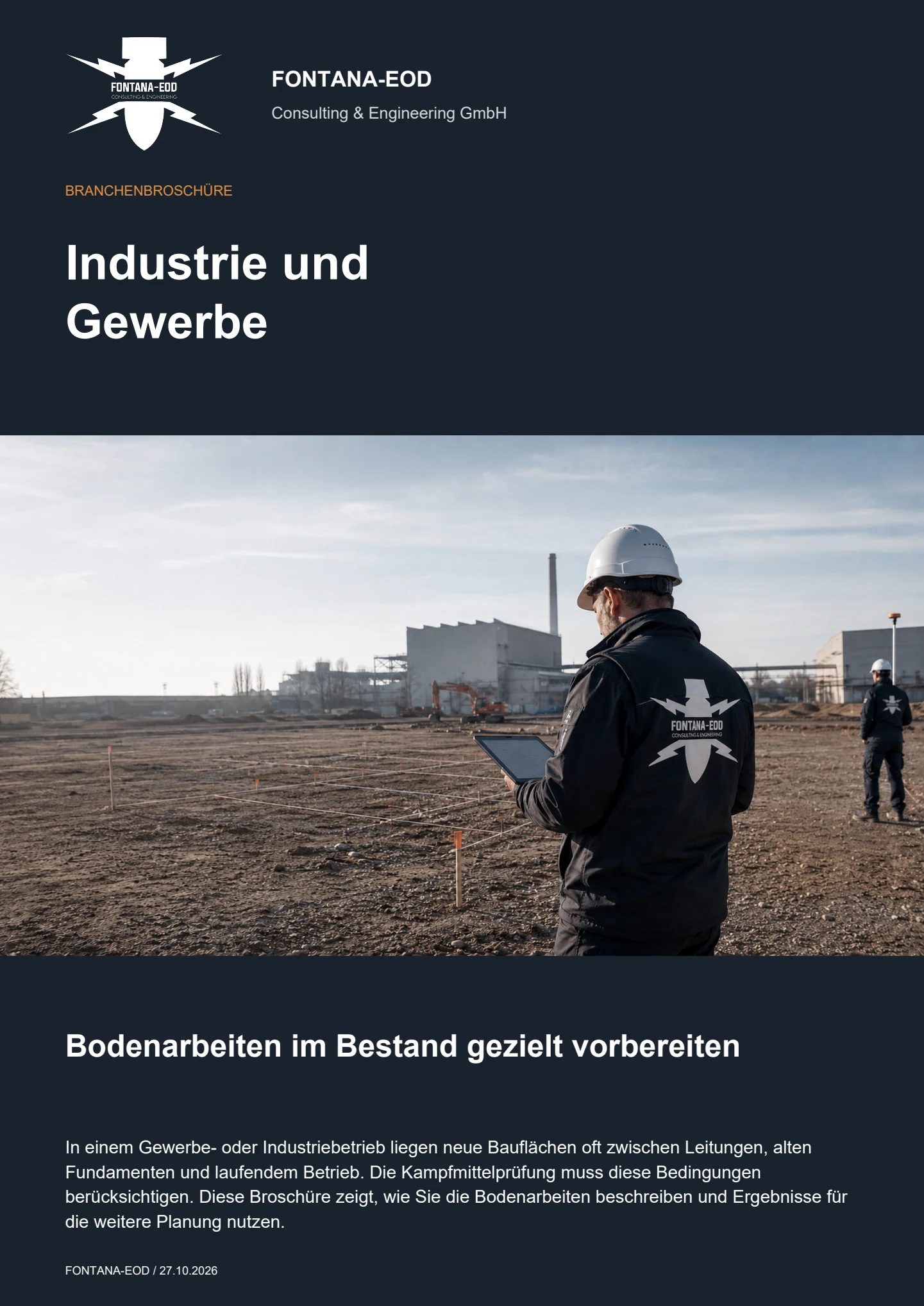
An assessment is useful as soon as the building footprint, foundations, piles, drilling points, utility trenches, chambers, drainage, retention facilities or external areas involve work in ground that has not been adequately assessed. The suspected hazard, depth of intervention, construction phase and purpose of the documentation are decisive.
Useful documents include a site plan, land parcels, structural grid, foundation type, drilling points, design depths, utility plans, drainage design, ground investigation data, existing reports, aerial photograph assessments and information on the construction programme. Authority information and conditions should be supplied with their dates, complete attachments and geographical scope.
If an unexpected suspicious object is found, stop work in the affected area immediately. Do not touch, move or further expose the object. Leave the immediate area and keep others away without putting yourself at risk. In Germany, notify the police immediately on 110; outside Germany, use the local emergency reporting procedure. The competent authorities determine the next steps. Inform site management and the client; internal reporting must not delay the emergency call.
Depending on the project, historical aerial photograph assessment, surface survey, magnetometry, TDEM, ground-penetrating radar, deep-ground survey, borehole survey, ordnance specialist supervision of excavation or explosive ordnance recovery may be relevant. Selection depends on the surface, interference, ground conditions, investigation depth and construction sequence. If the selected survey does not adequately cover the planned foundation depths, or interfering objects obscure the data, those areas remain unresolved. The appropriate supplementary approach is established before the relevant ground intervention.
Piles, drilling points and foundations are checked against their positions, design depths, drilling methods, diameters, spacing and the suspected hazard. This may lead to a depth-related investigation or borehole survey for defined points.
Utility trenches, chambers, drainage, retention facilities and traffic areas are treated as separate investigation sections where groundworks are planned. Area, depth, construction phase and existing utilities determine the next technical step.
Typical documentation includes location references, the document version used, investigation area, method applied, assessment of findings, limitations, photographic records and recommendations for the next project step. Its precise form depends on the scope of services and project phase.
Decisive factors include site size, structural grid, foundation type, access, sealed surfaces, interfering objects, ground conditions, drilling points, depths of intervention, construction phase, available documents, required methods and extent of documentation.
Mark building axes, foundations and particular deep points on the plan. Add sections, depth information and planned interventions outside the building.
Address, land parcels, site plan, construction site boundaries, subareas, existing areas and affected construction sections.
Excavation, drilling points, piles, foundations, chambers, utility trenches, demolition and planned design depths.
Utility plans, utility axes, earthing, chambers, reinforcement, existing structures, exclusion areas and access roads.
Aerial photograph assessment, historical plans, ground investigation data, contamination documents, demolition plans, previous reports and conditions.
Design stage, tendering, procurement, work preparation, construction times, shift windows and simultaneous trades.
Procurement, site management, project file, HSE, operator communication, subsequent decision or coordination with competent authorities.
Send the existing documents with the location, construction site, planned work, depth and construction phase. Distinguish the building footprint, external works, utility trenches, drilling points, demolition zones and later connections. Where documents are incomplete, identify the gaps and the decision for which you need a result.
State whether operations, delivery traffic, shift changes, demolition, civil engineering or assembly will continue during the investigation. Access, exclusion areas, machinery use and coordination depend on this. FONTANA-EOD uses this information to assess which historical assessment, survey, deep-ground investigation or excavation supervision is suitable for the next step.
Identify the recipients of the results and outstanding questions about the method, timing, access or further services. Report subsequent changes to the plan version, construction limit and design depth. This enables the report and execution to be kept at the same stage.
+49 (0) 6843 - 999 499 7
info@fontana-eod.de
Site plan, depth, construction phase, suspicion indicators
Site management, designers, HSE or project management
Whether historical aerial photograph analysis, explosive ordnance surveying, surface surveying using GPR, magnetometry or TDEM, deep-ground surveys, downhole surveys, excavation supervision, area clearance or ordnance recovery is needed depends on the location, ground disturbance, depth, ground and existing documents. An early ordnance assessment provides clarity for tendering, programming, occupational safety and construction.
FONTANA-EOD combines its Section 7 SprengG licence, specialists holding Section 20 SprengG certificates of competence, suitable survey and clearance methods, and traceable documentation. Send the site plan, depth of ground disturbance, construction phase and existing documents for an initial technical assessment.


