Project pathway
The quickest route to the right decision.
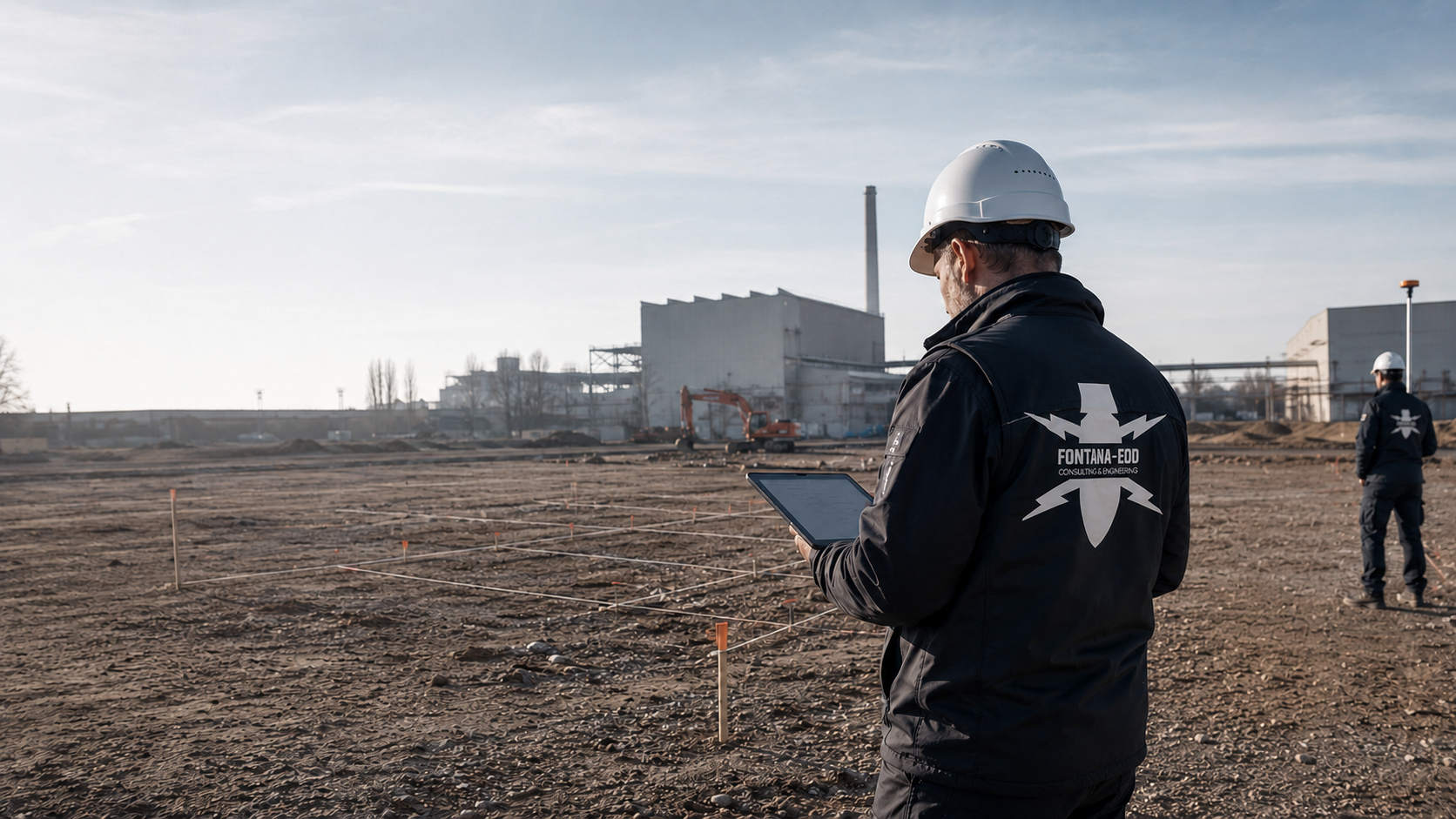
Before work in an industrial or chemical park, plant foundations, utility trenches and demolition areas are checked against existing indications of explosive ordnance. FONTANA-EOD reviews works and construction plans and plans suitable investigations according to area, depth, existing utilities and operational access. Send site and service plans, depths of intervention, construction phases and working windows so that services and documentation can be defined before drilling, excavation or demolition.
Coordinate investigation areas and closure windows.
Assess utilities and interference.
Clarify drilling points and design depth.
Before construction in an industrial or chemical park, investigation needs for plant foundations, utility trenches, demolition areas and drilling points are clarified. Existing indications of a suspected hazard are checked against the positions, depths and construction methods of planned interventions. Utilities, metal installations, operational access and working times influence investigation options. Results and inadequately investigated areas are coordinated with site management and the responsible operational contacts and documented.
For each works area, the suspected hazard, survey conditions, depth of intervention and documentation needed are recorded.
The suspected hazard describes whether historical data, aerial photographs, old installations, previous uses or circumstances of finds call for a specialist assessment of the planned intervention.
Clarify the term in the project contextSurvey feasibility depends on the surface, utilities, steel components, sealed surfaces, access, interference and planned investigation depth.
Clarify the term in the project contextThe depth of intervention describes how far drilling, foundations, chambers, utility trenches or excavation affect the ground. It guides method selection.
Clarify the term in the project contextMetal or structural objects can affect survey signals, such as reinforcement, utilities, rails, foundation remnants or scrap metal. These interfering objects are considered during evaluation.
Clarify the term in the project contextThe procedure for findings defines how unusual findings are reported and documented and who coordinates subsequent steps. For a suspicious object, the immediate emergency reporting procedure applies.
Clarify the term in the project contextThe purpose of the documentation defines whether documents are needed for site management, the operator file, HSE, procurement, the start of excavation or a further technical decision.
Clarify the term in the project contextIn industrial and chemical parks, previous use, technical alterations and the current plant structure often overlap. Old plans and use records are checked against the present construction site and intended depths.
Older foundation areas, structural grids, works roads and plant remnants can indicate earlier ground interventions and also affect survey conditions.
Rail connections, loading areas and handling areas may be relevant to historical assessment where construction or deep interventions are now planned.
Storage areas, tank areas, filling areas and former ancillary facilities are checked against the construction objective, depth and available documents rather than assessed indiscriminately.
Repeated utility replacements, chambers, duct routes and cable routes can alter ground conditions and create interfering objects.
Works areas are often levelled, filled or altered during earlier construction phases. These layers must be considered in method selection.
Historical aerial photographs, as-built plans and current planning provide a sound assessment basis only when checked against the specific intervention.
Historical assessment must be compatible with current access, ongoing operations, safety zones and the planned construction time window.
Incomplete historical documents are not overinterpreted. Unresolved points are treated as investigation needs rather than as a blanket conclusion.
For investigation planning, existing utilities, depths of intervention and survey conditions are checked against operational working and access requirements.
Areas close to production are often built over several times. For new foundations, pits or site roads, earlier construction conditions and current operational requirements must be brought together.
Assess the works area in context
Utilities, chambers, cable routes and pipe bridges influence survey conditions and the construction sequence. Investigation areas should therefore be prepared with service plans and depth information.
Select methods for pipe routes and utility corridorsDemolition areas may involve fill, steel remnants, foundations and a changing history of use. This requires differentiated method selection.
Determine a suitable investigation for demolition areas
When construction takes place within tight time windows, stopping procedures, communication procedures and findings documentation must be coordinated before execution.
Coordinate stopping procedures and findings documentation
If an unexpected suspicious object is found, stop work immediately, do not touch, move or further expose the object, leave the immediate area and keep others away without putting yourself at risk. In Germany, notify the police immediately on 110; outside Germany, the local emergency reporting procedure applies. Further work follows the instructions of the competent authorities.
Clarify the procedure for findings with specialistsIndustrial park projects need verifiable documents on the area, method, depth, survey limitations, assessment of findings and subsequent decision.
Prepare documentation for operatorsFor industrial and chemical park projects, the location determines which documents, reporting procedures and coordination need consideration before technical execution.

The federal state, municipality, works address, land parcel and position within the works complex are needed so that the suspected hazard and responsibility route align.
Have the project region assessed by specialists
The operator, HSE, works fire brigade, site management, contractor coordination and competent authorities should be included in a clear communication procedure before execution.
Coordinate interfaces within the worksFor cross-border projects or projects involving Luxembourg, responsibilities and technical documents are prepared for the specific project.
Assess the operating areaSite-specific conditions, site plans, historical reports, aerial photograph assessments and utility data help prepare the investigation reliably.
Prepare site documentsFor the next ground intervention, the area, depth, existing information and required investigation are defined. The operator and site management coordinate access and working times accordingly.
Drilling points, driven core sampling points and survey axes should be checked against the suspected hazard in advance. For plant foundations and utility crossings, the required depth, target object, ground conditions and existing sources of interference are used to assess which method is suitable.
Prepare drilling points with specialist inputDemolition areas may contain both interfering objects and indications of a suspected hazard. The investigation area, excavation depth, protective measures and procedures for findings are coordinated before work begins. Necessary investigations and protective measures are planned before ground interventions during demolition, utility exposure or preparation of access routes.
Coordinate investigation before demolition and exposureUtility diversions often involve narrow routes in plant areas that are already intensively used. The investigation must follow the actual axis, width, depth and access rather than a general works area.
Have the utility route assessedFor tendering and site management, service limits, investigation areas, anticipated methods, purpose of the documentation and communication about findings should be described as clearly as possible. This reduces technical queries and avoids overly general lump-sum items.
Prepare evidence for procurementFor areas that cannot be fully investigated in advance, the technical suitability of explosive ordnance detection during construction is assessed. Each working layer is technically surveyed and assessed before controlled removal in layers with supplementary visual inspection follows; these steps are repeated until the agreed excavation base is reached. Stopping points, authority to give instructions, communication procedures and documentation are established before work begins.
Plan excavation supervision within the construction sequenceA finding changes the construction sequence, protective arrangements, documentation and coordination. Communication procedures defined in advance help manage measures appropriately and keep all project participants working from the same information.
Maintain traceable records of findings and further measuresIn industrial and chemical parks, methods, occupational safety, operational safety and documentation are closely linked. Required investigations, access, working times and reporting procedures are coordinated before earthworks.
Ongoing operations influence access, exclusion areas, permits to work, access roads, survey windows and communication. Investigation planning considers these operational conditions and identifies resulting limitations. This applies particularly to work beside production plants, pipe bridges, tank areas, works roads or central utility axes.
Coordinate operational windowsDrilling points for plant foundations, masts, silos, pipe bridges or retaining structures must be described with coordinates, design depths, diameters and construction methods. Deep-ground surveys can then be carried out, documented traceably and later checked against the actual intervention.
Check drilling points and design depthWhere preliminary investigation is limited, the technical suitability of explosive ordnance detection during construction is assessed. Each working layer is technically surveyed and assessed before controlled removal in layers with supplementary visual inspection follows. These steps are repeated until the agreed excavation base is reached. Working areas, the stop signal, authority to give instructions, communication about findings, responsibilities and documentation are established before work begins.
Agree excavation supervisionWhen indications of a suspected hazard arise, safe communication matters alongside technical assessment. The location of the finding, work stoppage, report and instructions are documented. For a suspicious object, keeping a safe distance and immediate reporting take priority; do not approach for photographs. This keeps HSE, site management and the client able to act.
Document communication about findings and instructionsIn industrial and chemical park projects, the combination of depth of intervention, proximity to operations, existing utilities and suspected hazard determines methods, sequencing and extent of documentation.
New foundations, crane runways, machinery locations or excavations may extend deep into areas that cannot be adequately assessed by near-surface methods.
Clarify the depth of intervention with specialistsDense utility networks create interference and occupational safety requirements. Service plans and planned depths are central to method selection.
Have the utility axis assessedThese areas may have been altered several times historically. A traceable assessment of the suspected hazard is needed before construction.
Assess the suspicion indicatorsSteel, concrete, old foundations and fill can affect survey data. Known sources of interference are considered during evaluation, and anomalies that cannot be unambiguously assessed are identified.
Have the existing area assessedDuring excavation, safe stopping procedures, clear communication and documented responses to indications of a suspected hazard matter.
Clarify reporting procedures and documentation before excavationDocumentation must be structured understandably for the operator, site management, procurement, the client and responsible interfaces.
Prepare documentation for operatorsBefore work begins, the investigation objective, working windows, existing utilities, operational safety requirements and documentation needed are coordinated.
Internal permits to work, instruction, supervision and access rules influence the actual investigation sequence. Before scheduling, the requirements for access and work are therefore clarified.
Coordinate permits to workSite management must know which area has been investigated, which areas remain unresolved and how to respond to indications of a suspected hazard. At handover, the investigated areas and depths and remaining limitations are identified.
Prepare site managementIn industrial parks, several trades often work simultaneously. Explosive ordnance assessment therefore needs controlled working areas, communication procedures and a record of which company works where and when.
Coordinate working areas and handovers between tradesInvestigation and the construction sequence should be planned so that technical safety and operational organisation align. Where critical areas have limited access, the methodology must clearly reflect this limitation.
Coordinate method selection with operational conditionsIn industrial and chemical parks, the suspected hazard is not the only decisive factor. Existing utilities, surfaces, interfering objects, deep interventions, operational windows and the purpose of the documentation also matter.
Old installations, previous storage, railway and handling areas or aerial photograph findings are considered alongside the planned intervention within the works site.
Define suspected areasPipelines, cables, chambers and earthing systems can affect survey signals and the work sequence. The investigation needs current plan information.
Check service locations against the investigation areaSurfaced areas, plant remnants, safety zones and restricted access roads determine whether surface survey, deep-ground survey or supervision is appropriate.
Have access assessedDrilling points, foundations and deep excavations must be prepared with design depths, borehole diameters and location references.
Have drilling points assessed by specialistsWork stoppage, reporting procedures and informing site management and the operator are defined before work begins. For a suspicious object, internal reporting must not delay the emergency call.
Define procedures for findings with site management and the operatorThe documentation must show which areas were investigated, what limitations exist and which subsequent decision is technically justified.
Prepare documentation for operatorsDuring deployment planning, technical investigation conditions are checked against operational requirements. The investigation area, operational safety, existing utilities, old installations, construction phase and purpose of the documentation must be considered together.
Works sites are often divided into safety, production, storage or traffic areas. For explosive ordnance surveys, it must be clear which areas may be entered, which operational conditions apply and how the specialist investigation is coordinated with internal permissions, contractor coordination and site management.
Coordinate operator boundariesPipelines, cable bundles, drainage, earthing systems and process utilities influence both occupational safety and survey data. A reliable enquiry should therefore include service plans, planned crossings, depth and construction method so that survey feasibility and depth of intervention can be technically assessed.
Determine a suitable investigation for utility axesIn former plant areas, foundation remnants, chambers, pits, fill, steel components and traces of historical use may occur together. Explosive ordnance assessment must consider these sources of interference alongside the suspected hazard and derive a traceable methodology for survey work, excavation or deep-ground investigation.
Select methods for old installations and sources of interferenceInvestigation and construction work often have to take place within short time windows. This affects access, marking, survey grids, drilling points, excavation supervision and communication about findings. Investigation dates and available working areas are coordinated with upcoming construction phases; limitations remain documented.
Assign investigation status and handovers to construction phasesBefore earthworks begin, procedures for stopping work, restricting access and informing participants are defined. For a suspicious object, immediate reporting to the police on 110 applies in Germany; outside Germany, the local emergency reporting procedure applies. Internal reporting to the operator and site management must not delay the emergency call.
Prepare procedures for findingsOperators often need a traceable document for later alterations, audits and internal safety communication as well as a report for the current construction site. The investigation area, method, limitations, findings and subsequent decisions must therefore be documented clearly in spatial and technical terms.
Prepare the operator fileIndustrial and chemical parks contain many technical influences. These investigation points help plan realistic expectations for the survey's conclusions before execution.
Concrete, asphalt, steel fibres and reinforcement can affect signals and help determine whether survey work, borehole survey or excavation supervision is the more appropriate approach.
Pipelines, cables, earthing strips and chambers are technical sources of interference for evaluation as well as safety factors.
Fill, slag, scrap metal content, cohesive soils or changing moisture can alter the detectability of anomalies.
The survey grid, equipment use and excavation supervision must suit works access, exclusion areas, shift windows and internal safety requirements.
For deep foundations, the positions, diameters, design depths and deviation tolerances of drilling points are essential to the technical assessment.
Survey data are considered together with documents, sources of interference, the construction objective and procedures for findings rather than read in isolation.
After the investigation, the operator, site management and designers need results with location references, investigation depth and limits of the conclusions.
The documentation should show which plant area, utility axis, construction section or drilling point was investigated. In industrial and chemical parks, this location reference matters because seemingly similar areas can differ considerably in technical terms and later construction phases often use earlier results.
The operator and HSE must be able to trace why a particular method was selected. The justification covers the suspected hazard, access, surface, interfering objects, depth, construction objective and limits of the conclusions. The decision can thus be checked even if not all areas can be addressed with the same method.
Reinforcement, utilities, foundation remnants, steel components, earthing strips, pipe routes and sealed surfaces are documented as possible sources of interference. They determine the scope of conclusions the investigation can support. The documentation identifies these influences so that later decisions are not misread as conclusions covering the entire area.
Access rules, permits to work, safety instruction, exclusion areas, shift windows and internal communication procedures influence execution and documentation. Where these conditions are traceable in the report, site management and the operator can better identify which investigation areas were addressed under which conditions.
For indications of a suspected hazard, the procedure between the specialist company, site management, operator, client and competent authorities must be clearly described. The documentation records the location of the finding, work stoppage, report and further instructions. Documentation must not delay the emergency call or cause anyone to approach a suspicious object.
For deep interventions, relating the drilling point, design depth, surveyed interval and site plan to each other is decisive. The documents must show whether a conclusion relates to a point, an axis or an area. Deep-ground investigation and subsequent execution thus remain clearly linked.
Site management and project management need clear information for action: the investigated area, unresolved limits, supervision required, procedures for findings and follow-up measures. At handover, investigation limits and outstanding tasks are discussed with site management.
Industrial park projects often proceed in several construction phases. Results should therefore be structured so that later sections, additional drilling points, altered routes or variations can build on the existing status. The project file records which plan versions were investigated and which changes were added later.
The operator, site management and specialist designers must be able to trace the basis on which the survey was planned, carried out and assessed.
The address, land parcels, site plan, site area, routes, construction section, planned depth and project objective form the basis for specialist assessment.
Aerial photographs, archival data, historical drawings, land-use history, earlier buildings and known indications of suspected ordnance are brought into a spatial reference.
Areas, grids, borehole points, depths, accessibility, interference sources and survey limitations must be described so that data evaluators and site management can follow them.
Survey results, anomalies, findings locations, clearance or supervision measures and photographic documentation are assigned to the project stage.
The evaluation describes which areas were considered for the next step, where limitations apply and which specialist measure follows.
Reports, drawings and logs must be clearly structured for clients, site management, operators, designers and the relevant interfaces. After actual exposure or clearance work, the corresponding findings and clearance records are included.
Within the works environment, every decision must be traceable to the location reference, investigation boundary, method, assessment of findings and follow-up measure.
Assignment of the construction section, plant area, access arrangements, utility axes and closure windows to the investigated area.
Explanation of why aerial photograph assessment, surface survey, deep-ground survey or excavation supervision was used for the specific intervention.
Documentation of reinforcement, utilities, steel components, sealed surfaces, fill and areas where the scope for conclusions is limited.
Description of how indications of a suspected hazard, work stoppage areas, responsibility routes and project communication were handled.
Specialist recommendation for the drilling point, excavation, further investigation, recovery or completion of documentation within the commissioned scope.
The sequence must be technically reliable while also suiting access, exclusion areas, HSE, site management and operator communication.
The construction section, plant area, planned interventions, depths, existing utilities, access and operational windows are brought together with existing documents.
Historical data, aerial photographs, historical plans, utilities, steel components, reinforcement, fill and sealed surfaces are included in method selection. Where historical questions about the intervention area remain unresolved, the necessary sources are researched and aerial photographs evaluated spatially. Results are related to the current works areas and interventions and used for investigation planning.
Depending on the conditions, surface survey, deep-ground survey, borehole survey or excavation supervision are combined or prioritised.
Access roads, exclusion areas, working windows, HSE communication and responsibility routes are defined before ground intervention. The agreed investigation is then carried out in accessible subareas. Survey data and areas actually investigated are recorded with their location references; areas that cannot be investigated and interference identified during execution are recorded for assessment.
Survey data, indications of a suspected hazard and exposed findings are assessed by specialists, spatially assigned and documented for the project file.
The results provide a reliable basis for excavation, further survey work, recovery or the next construction phase.
The evaluation considers the surface, interfering objects, existing utilities and required investigation depth. Access to survey areas is clarified before deployment.
For investigation planning, existing indications of a suspected hazard are checked against the intended areas and depths of intervention.
The technical assessment starts with the question of which conclusion is needed for which intervention. A drilling point for a plant foundation, a utility trench along a pipe route and excavation in an old plant area require different depths, survey conditions and forms of documentation. FONTANA-EOD therefore assesses both the method and the limits of its conclusions: reinforcement, steel components, utilities, sealed surfaces, fill, foreign material and electromagnetic interference can affect survey results. Method selection is justified for each subarea. Areas that cannot be adequately investigated are explicitly identified.
Investigation points, grids, drilling points and routes are recorded so that results can later be related to construction plans and works areas.
Metal installations, rails, utilities and foundation remnants are included in the evaluation as sources of interference.
Design depth, borehole diameter, excavation depth and construction method determine whether near-surface or depth-related investigation is required.
Working windows, access roads, exclusion areas, communication and HSE processes are incorporated into execution planning.
Historical documents and existing investigations are compared with foundation points, utility trenches and demolition areas. Position, depth and construction method determine which areas are actually affected. Temporary foundations and excavations are also recorded where they involve ground intervention.
Check documents against current plant geometryMetal installations, pipe bridges and existing foundations can affect the ability to evaluate survey data. Method selection considers when areas are accessible and which installations exist before or after demolition. Inadequately investigated volumes of ground remain documented with the follow-up measure needed.
Select investigation according to survey access and operational conditionsWithin the works environment, steel, utilities and sealed surfaces can limit geophysical methods. For the required areas and depths, it is assessed whether a single method is sufficient or suitable supplementary methods are needed.
Useful for spatial assessment of areas of suspected ordnance, previous use, traces of attacks, storage areas and remodelling before technical surveying.
Suitable for accessible areas where surface, interference sources and ground structure indicate sufficient survey quality.
Magnetometry detects ferromagnetic anomalies in accessible areas. Structural steel, earthing networks, pipelines, rails, reinforcement and vehicles can strongly obscure survey data within the works environment. Areas that can be evaluated and survey limitations are documented separately.
TDEM detects time-dependent electromagnetic responses from conductive objects. The target object, ground conductivity, required depth and electrical infrastructure determine suitability within the respective works area.
GPR records reflections at material and structural boundaries and can provide supplementary investigation of utilities or installations. Soil, moisture, surface coupling and reinforcement affect data depth. A reflection does not uniquely identify ordnance.
A relevant component for piles, excavations, shoring, deep utilities and ground interventions extending beyond near-surface conclusions.
Where explosive ordnance detection during construction is technically suitable, each working layer is surveyed and evaluated using technical methods. Controlled removal in layers and supplementary visual inspection then follow; these steps are repeated down to the agreed excavation base. Excavation layers, hold points, authority to issue instructions, reporting procedures and documentation are established before work starts.
Survey anomalies receive specialist further investigation or exposure. Recovery of confirmed explosive ordnance is coordinated with the permitted scope of activities and local responsibilities. If an unexpected suspicious object is encountered, work stoppage, distance and immediate notification apply.
Industrial and chemical park projects need a clear decision on which investigation is technically and organisationally appropriate before each intervention.
Pipe routes, cable routes and chambers should be prepared with service locations, depths and survey feasibility information.
Have utility axes assessed by specialistsFor foundations and special structures, it is assessed which method can cover the intended areas and depths.
Agree drilling points and target depthWhere preliminary investigation is limited, suitable supplementary methods are assessed, including explosive ordnance detection during construction.
Plan excavation supervision within the worksDemolition areas need a technical link between history, interfering objects, findings and the construction sequence.
Distinguish specialist services for demolition areasThe operator, HSE and site management need clear reports on the investigation area, method, depth, survey limitations and result.
Prepare documentation for operatorsThe site plan, utility plans, depth of intervention, construction phase and operational windows are particularly relevant to a reliable assessment.
Make a specialist enquiry about your works projectFor industrial and chemical parks, an approach that clearly identifies technical limitations, considers operational processes and documents results verifiably matters.
FONTANA-EOD reviews works and construction documents, plans suitable surveys and records the areas and depths actually investigated. Missing information on area, depth and sources of interference is identified before execution. Coordination procedures at the project location are clarified. The assessment thus remains usable when a project is divided into sections, individual areas become accessible only later or the operator, designers and site management have different documentation needs. The decisive questions are always which conclusion is needed for the next intervention and which data technically support it.
Not every area needs the same method. The service scope is derived from suspected ordnance, ground intervention, surface, depth and documentation objective.
Interference sources, reinforcement, paving, utilities and ground structure are not disregarded but included in the assessment.
The client, operator, designers, site management, HSE and responsible authorities receive clearly distinguishable roles and communication procedures.
Assessment, surveying and excavation supervision are planned to fit construction sections, closure windows and procurement.
Reports and drawings are tailored for use in the project file, site management, operator communication and documentation procedures.
If an unexpected suspicious object is found, stop work immediately, do not touch, move or further expose the object, leave the immediate area and keep others away without putting yourself at risk. In Germany, notify the police immediately on 110; outside Germany, the local emergency reporting procedure applies.
A reliable explosive ordnance assessment clearly distinguishes specialist project services, construction responsibility and the relevant reporting or decision procedures.
FONTANA-EOD assesses documents, carries out commissioned surveying and supervision services, evaluates results by specialist assessment and prepares project-specific documentation.
The client provides project information, defines the construction objective, area, time window and documentation needs, and coordinates project decisions.
Designers and site management need clear investigation areas, service boundaries, findings procedures and documentation status for tendering and construction.
Contractors need organised working areas, stop procedures for indications of suspected ordnance and a clear interface with specialist supervision.
In Germany, the ordnance disposal services of the federal states and the locally competent authorities carry out hazard-response and find-management duties. Their involvement is established for the project location; outside Germany, local responsibilities apply.
The local public order authority and, where applicable, building control are involved according to their project-specific responsibilities. Conditions and contacts are assigned to the actual works areas and construction sections; reporting procedures are defined before work begins.
For industrial and commercial areas, operational safety requirements, exclusion zones, access and internal communication procedures are incorporated into project coordination.
The regulatory framework is considered for the specific project: qualifications, occupational safety, technical guidance, reporting procedures and documentation must match the actual ground intervention.
In Germany, § 7 SprengG concerns the commercial authorisation for activities requiring authorisation; § 20 SprengG concerns the certificate of competence of responsible persons. Under § 1b SprengG, searching for found munitions also counts as handling them. The requirements applicable to the project depend on the activity actually commissioned and the allocation of responsibilities.
The First Ordinance to the Explosives Act (1. SprengV) includes requirements concerning specialist competence and state-recognised training courses. In industrial and chemical parks, the required qualifications are determined by the activities actually commissioned and the operational conditions.
DGUV Information 201-027 concerns protective measures during ordnance clearance work. DGUV Rule 113-003 concerns the dismantling or destruction of explosives or corresponding objects and also includes the disposal of found munitions. It applies according to this field of activity; it does not replace a risk assessment specific to the planned ground intervention.
Activities involving explosive substances are subject to requirements concerning authorisation, competence and responsibility. Clients should establish qualifications and responsibilities in advance.
Risk assessment, site organisation, barriers, instructions, machinery use and conduct when suspected ordnance is encountered form part of project planning.
DGUV Information 201-027 supports risk assessment and protective measures for explosive ordnance clearance work. The Baufachlichen Richtlinien Kampfmittelräumung contain requirements for historical and technical investigation, clearance concepts, procurement and documentation within their defined scope of federal responsibilities. Their application to the specific works project is clarified separately.
If an unexpected suspicious object is found, stop work in the affected area immediately. Do not touch, move or further expose the object. Leave the danger area and keep others away without putting yourself at risk. In Germany, notify the police immediately on 110; outside Germany, use the local emergency reporting procedure. The competent authorities determine the next steps. Then inform the operator and site management.
A single finding or measurement does not replace project-specific assessment of area, depth, method and limits of conclusions.
Documents should describe precisely which areas, depths, methods and results were considered.
Responsible authorities and official procedures may be involved differently depending on location and project circumstances.
Depending on the project, historical documents, technical investigations and documentation of the results are needed.
Starting point for project-specific explosive ordnance investigation with site, operational and documentation references.
Have the project area assessed
Aerial photograph and document assessment helps delineate areas of suspected ordnance before technical work.
Assess historical documents
For foundations, chambers and service ducts, it is assessed which methods can cover the required depth volume.
Establish depth and borehole positions
Where explosive ordnance detection during construction is suitable, excavation layers are investigated using technical methods and documented before removal.
Agree excavation supervision

The next technical steps lead to deep-ground investigation, excavation supervision, documentation and a structured project enquiry. Further construction tasks can be found in the Sector overview.
Sector page for works sites, commercial areas, operational interfaces and typical investigation decisions.
Compare sector circumstancesBorehole survey and deep-ground investigation for piled foundations, retaining structures, chambers and deep utility ducts.
Clarify drilling points and design depthEstablish the suitability and sequence of construction-phase ordnance surveying for remaining excavation areas.
Agree excavation supervisionCoordinate recovery of confirmed ordnance with the permitted activities and local responsibilities.
Clarify the procedure for findingsProject file, investigation area, report, location references and documentation for the operator, designers and site management.
Prepare documentation for operatorsSend works data, utility plans, construction phase, depth of intervention and documents for a specialist assessment.
Enquire about your works projectTechnical information
Work on industrial and commercial sites combines existing installations, operational processes and new ground interventions. The brochure explains how ordnance assessment is coordinated with these conditions.
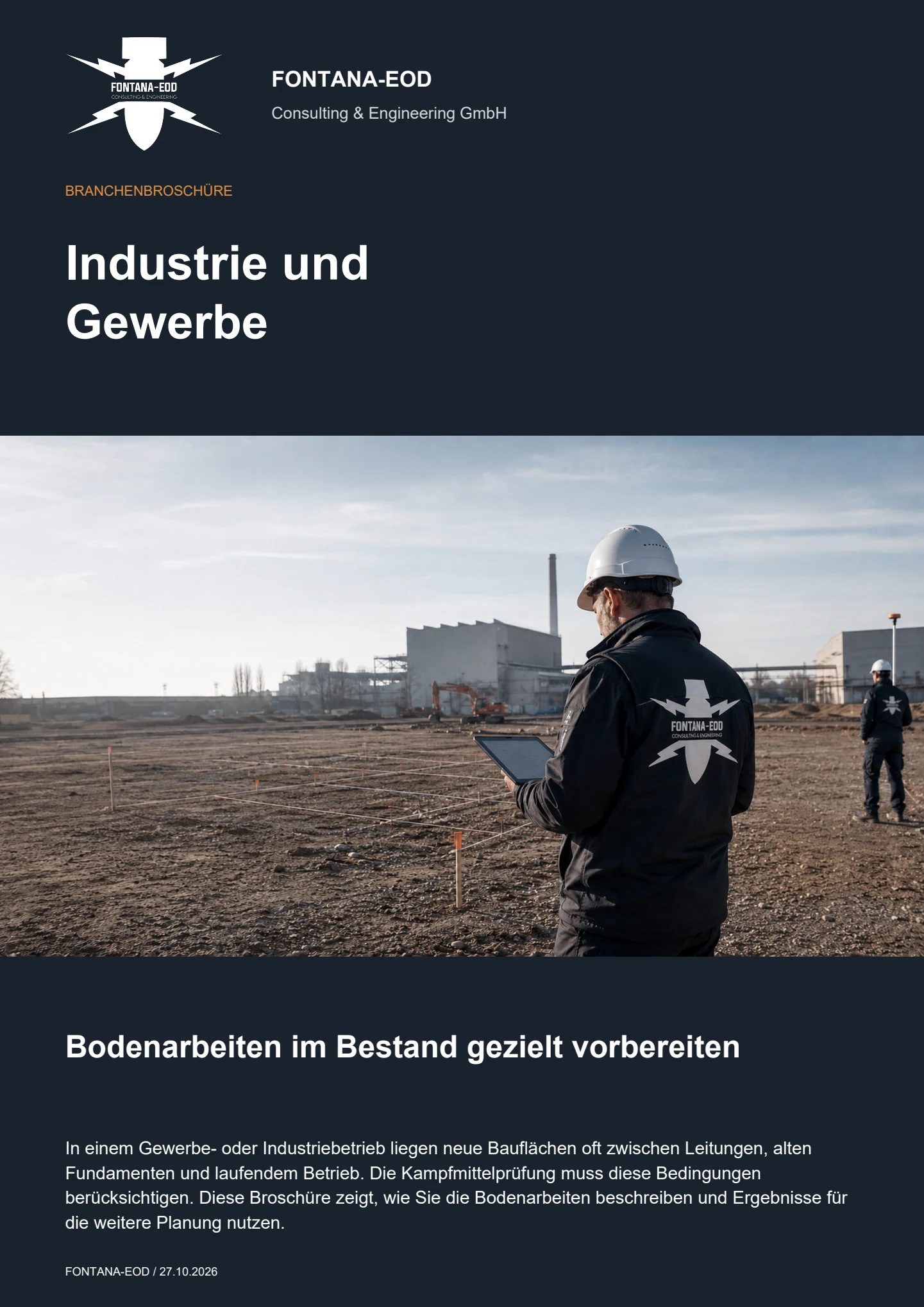
Before earthworks, drilling, utility diversions and demolition, existing indications of a suspected hazard and planned interventions are used to clarify which investigations are needed. The assessment must consider works operations, HSE requirements, utilities, interfering objects and the planned depth of intervention.
Industrial and chemical parks often have dense utility networks, metal installations, earlier construction conditions, sealed surfaces, access restrictions and tight construction time windows. These factors influence method selection, survey quality, safety organisation and documentation.
Required documents include site plans, utility and service plans, drilling-point lists, planned depths, construction site boundaries, shift or closure windows, historical documents, aerial photograph assessments, existing reports and information on sensitive operational areas. Authority information and conditions should be supplied with their dates, complete attachments and geographical scope.
This depends on the area, investigation objective and method. Asphalt, concrete, reinforcement, rails, steel components, utilities, fill and plant remnants can affect survey signals. For areas that cannot be adequately evaluated, it is assessed which supplementary method is suitable and whether a different construction condition is needed.
Investigation areas, access roads, exclusion areas, working windows, communication with HSE, site management and the operator, and procedures for indications of a suspected hazard are coordinated before execution. The technical investigation can thus be integrated into the planned construction sequence.
Relevant records include location references, the investigation area, method, survey and findings documentation, assessment of investigation depth, photographic records, interface notes and recommendations for the next construction or excavation step. The extent depends on project requirements and the commissioned service.
If an unexpected suspicious object is found, stop work in the affected area immediately. Do not touch, move or further expose the object. Leave the danger area and keep others away without putting yourself at risk. In Germany, notify the police immediately on 110; outside Germany, use the local emergency reporting procedure. The competent authorities determine the next steps. Then inform the operator and site management. FONTANA-EOD supports specialist communication and documentation within the project context.
The size and depth of the volumes of ground affected, utility density, sealed surfaces, technical sources of interference, ground conditions, access and operational working windows are decisive. Suitable methods, surveying, evaluation and the agreed extent of documentation are additional factors. Pricing requires current works and construction plans with traceable quantities.
For industrial and chemical parks, existing utilities, operational windows, HSE requirements and access restrictions are particularly relevant alongside the site plan and depth of intervention.
Address, works section, construction site, plant reference, access and contacts.
Service plans, pipe routes, cables, chambers, earthing systems and known interference.
Drilling points, excavation depth, foundations, retaining structures, utility trench and planned construction methods.
Working windows, exclusion areas, HSE requirements, construction phase and intended extent of documentation.
Send the available documents as completely as possible. Incomplete data can also be assessed if the project location, area, planned intervention and desired next step are identifiable. FONTANA-EOD checks which investigations are needed, which methods are suitable and which information is still missing.
+49 (0) 6843 - 999 499 7
info@fontana-eod.de
Site plan, depth, construction phase, suspicion indicators
Site management, designers, HSE or project management
Whether historical aerial photograph analysis, explosive ordnance surveying, surface surveying using GPR, magnetometry or TDEM, deep-ground surveys, downhole surveys, excavation supervision, area clearance or ordnance recovery is needed depends on the location, ground disturbance, depth, ground and existing documents. An early ordnance assessment provides clarity for tendering, programming, occupational safety and construction.
FONTANA-EOD combines its Section 7 SprengG licence, specialists holding Section 20 SprengG certificates of competence, suitable survey and clearance methods, and traceable documentation. Send the site plan, depth of ground disturbance, construction phase and existing documents for an initial technical assessment.


