Project pathway
The quickest route to the right decision.
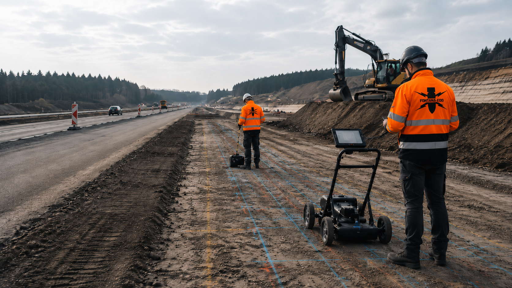
Explosive ordnance investigation for a cycle path considers crossings, drainage and lighting foundations as well as the route. FONTANA-EOD plans the investigation according to working width, depth and survey conditions. Send route drawings, typical cross-sections, depths and construction sections so that investigations and documentation can be specified for the path formation and ancillary installations.
Define sections and working widths.
Record excavation, chambers and foundations.
Document the areas investigated.
Before earthworks for a cycle path, existing indications of suspected ordnance are used to establish which explosive ordnance investigations the planned construction corridor requires. Route location, working width and excavation depth are considered together with crossings, utilities, lighting and drainage. For deep individual points and zones affected by technical interference, it is assessed which method adequately covers each intervention. Results are documented by construction section so that designers and site management can identify investigated areas and outstanding tasks.
The scope of services for “Lahnstein – new Lahnsteg, bridge and cycle path – project 3020093 Lahnstein / Germany · Rhineland-Palatinate” comprised downhole magnetometry.
Service period: 2026-09
Service areas:Downhole magnetometry / deep-ground survey
View project details · Deep-ground and downhole surveys · Region: Rhineland-Palatinate
The scope of services for “Langlingen (Hohnebostel) – new K 52 cycle path Langlingen (Hohnebostel) / Germany · Lüneburg administrative district” comprised downhole magnetometry.
Service period: 2026-07
Service areas:Downhole magnetometry / deep-ground survey
View project details · Deep-ground and downhole surveys · Region: Lüneburg administrative district
The scope of services for “Lahnstein – Oberlahnstein cycle path / harbour mole Lahnstein / Germany · Rhineland-Palatinate” comprised ground-penetrating radar.
Service period: 2026-02
Service areas:Surface surveys: GPR, TDEM and magnetometryMethod used in this project: Ground-penetrating radar
View project details · GPR and limitations · Region: Rhineland-Palatinate
Cycle path projects comprise more than the eventual paved area. Ancillary installations, crossings, drainage and individual structures may be laterally offset or lie substantially deeper.

Cycle paths beside existing roads often lie in verges, slopes, drainage zones and utility corridors. Pavement construction, safety barriers, signs and existing cables affect access and survey feasibility.
Investigation relates to the path formation, lateral working space, crossings and individual structures. Inaccessible zones receive their own follow-up measure.
At road connections, transitions to the carriageway and existing drainage systems are recorded as separate subareas because working width and ground construction change there.
Investigate a roadside section
New routes through green corridors, former railway alignments or agricultural tracks and undeveloped corridors may offer extensive access but often contain vegetation, root zones, fill or previous land uses.
The historical basis for suspicion and technical survey area are aligned with actual path width, slopes, drainage and site establishment.
For green corridors, access routes, temporary roads and material storage are also considered where they require earthworks, compaction or temporary foundations in previously unassessed ground.
Establish historical evidence of suspected ordnance along the routeAlterations to junctions, advisory cycle lanes, shared walking and cycling paths or paved public spaces affect dense utility networks and repeatedly modified surfaces. Narrow sites and live traffic restrict equipment use.
Subareas, chambers, foundations and construction phases are planned separately so that conclusions do not extend beyond the working volume actually investigated.
Urban construction phases are defined so that pedestrian and cycle traffic, access to adjoining properties and utility works do not create unclear overlaps between investigated and unresolved areas.
Assess an urban junctionRoad crossings, small underpasses, ramps and connection areas link area-based route sections with deeper excavations, shoring or boreholes.
Methods are organised by structural geometry and construction phase. Conclusions for deep points and areas accessible only after demolition are not inferred from the cycle path area.
For small structures, portal, ramp and connection areas are recorded separately from the linear route; only then can surface and deep investigations be assigned unambiguously.
Investigate the underpass and crossing
Lighting columns, signs, railings, safety installations and charging or service stations create individual foundations outside or at the edge of the paved area.
Coordinates, foundation dimensions, target depth and installation method determine whether a point-specific deep-ground survey is required.
Foundations for bollards, access barriers, railings and information displays are also recorded where their location or depth extends beyond the path formation already assessed.
Investigate equipment foundationsSwales, infiltration trenches, chambers, culverts and cable routes may run deeper than or laterally offset from the cycle path itself. Their excavations and utility alignments receive their own investigation geometry.
The investigation considers ground conditions, dewatering, existing utilities and the proposed construction section. Boundaries between the cycle path and ancillary installations are shown on the drawing.
Laterally offset swales or infiltration trenches may lie outside the paved corridor. Their actual excavation width and required working space are therefore included in the service scope.
Assess drainage areasInvestigation requirements develop as planning progresses. Early clarification of route and depth information improves tendering, method selection and scheduling.
During early planning, possible routes, connections to structures, protected areas and known areas of suspected ordnance are compared on drawings.
The comparison shows which option is expected to need additional historical clarification, technical investigation or difficult-to-access working areas.
Required access and deep interventions are considered during options appraisal. Later design changes may still require additional investigation.
Assess the options corridor using historical evidencePath width, frost-protection layer, verge, slope, drainage, cables and equipment are related to the corridor of suspected ordnance.
The cross-section establishes clearly delineated area, point-specific and depth volumes for the subsequent service specification.
When cross-sections change, it is checked whether verges, slopes and drainage remain within the historical and technical investigation boundaries.
Have the design cross-section assessed by specialistsExisting service lines, chambers, lighting, fences and earlier excavations are coordinated with survey areas and the construction sequence.
Discrepancies between as-built drawings and conditions on site remain visible as separate clarification tasks.
Coordinate and level references are standardised so that utility information, survey data and subsequent setting-out do not use different spatial bases.
Agree existing-condition and data referencesSection, working width, depth, method, qualifications, data format and documentation required under the contract are clearly described.
Provisional items receive a technical trigger so that tenders remain comparable and variations verifiable.
Procurement distinguishes plannable basic items from technically justified provisional services; blanket combined items for the entire cycle path are avoided.
Structure the tender documentsAccess, construction phases, closures, protection zones and available working widths are checked with the construction team before fieldwork.
Changes to the construction corridor or additional ancillary installations are incorporated into investigation geometry before work starts.
Before deployment, it is specified which areas must have vegetation cut back, be cleared or be protected from traffic, and which preparatory services the client provides.
Establish construction sections and accessSurveying, deep investigation and construction-stage measures are documented by chainage and construction section.
Subareas are handed over to subsequent trades only once investigation status and unresolved remaining areas have been clearly recorded.
Handover status is recorded on construction drawings and logs for each section so that subsequent trades do not inadvertently disturb laterally unresolved or uninvestigated zones.
Document results and section handoversNot every section needs the same service. Suspected ordnance, technical interference and intervention depth determine which investigation and subsequent decision are technically sound.
Aerial photographs, maps, previous land uses or information from authorities concern a clearly delineable part of the planned route.
The historical assessment establishes where technical investigation is required and which data gaps must be closed before construction.
The subsequent technical investigation is limited to the specific construction areas; neighbouring green or traffic areas receive no conclusion solely because they are nearby.
Assess the suspected section spatiallyOpen, sufficiently level subareas can be investigated using a suitable geophysical method where the target object and ground permit.
Survey coverage, depth and interference zones are related to the typical cross-section and planned ground replacement.
Test lines or reference sections can show before an extensive survey campaign whether the requested conclusions are achievable under the actual ground and surface conditions.
Specify area surveyingCables, pipes, safety barriers, fences, signs and vehicles may obscure measurements. Known installations are maintained as a basis for comparison.
Areas that cannot be evaluated are marked on the drawing. It is assessed which supplementary investigation is suitable under the relevant conditions.
Where several known utilities run in parallel, it is assessed whether another method, a different survey-line layout or a later construction stage allows more reliable data.
Assess interference conditions for method selectionLighting columns, retaining walls, railings, chambers or bridge connections create point-specific interventions at greater depth.
Each point receives coordinates, foundation geometry and target depth. Existing measurements are checked to establish whether they cover that location and depth.
Before fieldwork, point schedules are checked against the current equipment design so that relocated lighting columns or altered retaining elements do not fall outside the investigated geometry.
Investigate deep element pointsVegetation, root protection, slopes, traffic or existing structures may prevent continuous measurement.
For unresolved areas, the technical suitability of explosive ordnance detection during construction is assessed. Each working layer is surveyed and evaluated using technical methods before controlled removal with supplementary visual inspection. The steps are repeated down to the agreed excavation base.
Specialist construction supervision is tendered only for specifically identified remaining areas and receives its own quantity, time and documentation basis.
Plan investigation of remaining areasA survey anomaly, a technical interference source and an actual find are handled separately by specialists.
Survey anomalies are evaluated by specialists. If an unexpected suspicious object is encountered, work is stopped immediately and the responsible authorities are notified without delay.
The location of the find is described to the responsible authority as precisely as possible. The object remains untouched; nobody must put themselves at risk again to obtain further details.
Clarify the findings and handover processUsable documentation links the route, drawing revision, method, results and limitations. It must remain understandable to people who were not involved in fieldwork.
The cycle path alignment, construction section, chainage, working width and crossings form the spatial basis.
Changes are updated by revision so that fieldwork and construction drawings agree.
The section drawing also shows access routes, storage areas and temporary working areas where they entail ground interventions relevant to explosive ordnance.
Historical sources, information from authorities, known finds and earlier investigations are documented with their scope.
Incomplete or contradictory background information remains visible and receives a specific clarification task.
Source details and spatial conclusions remain distinguishable so that later design changes can be traced specifically to the initial data.
The survey system, survey-line layout, grid, surface, ground, weather, vegetation and interference sources are recorded for each section.
This keeps the reasons why particular zones could be reliably assessed or needed supplementary investigation traceable.
Changes of method within a construction section are explained in the report with their location, reason and effect on the conclusions achievable.
Anomalies, deep individual points and areas investigated during construction receive unique identifiers.
Status, work and subsequent decisions remain linked through the site plan, field log and report.
For deep points, it is also recorded whether design and actual locations agree and what depth was actually reached with interpretable data.
Inaccessible root zones, utility zones, slopes and technical interference are mapped.
These areas are not included in a broader conclusion but are assigned a suitable follow-up measure.
Remaining areas receive unique identifiers and must not be named differently in the site plan, status schedule and conclusion.
The report describes which area was investigated, to what depth and using which method.
Designers and site management can identify what can be used for the next construction section and what remains unresolved.
For partial handovers, the area investigated, depth, drawing revision and remaining edge zones are confirmed together.
The same section and object identifiers must be used across drawing revisions. The project file assigns sources, survey data and decisions to the relevant chainage and drawing revision.
Aerial photograph assessments, route drawings, typical cross-sections, utility documents and revisions are clearly named.
The subsequent documentation refers to the exact drawing revision underlying fieldwork.
Before a route or utility drawing is used, its revision is checked against the current construction design.
Route sections, crossings, lighting columns, chambers, retaining walls and ancillary installations receive consistent identifiers.
The identifier is used consistently in survey data, photographs, point schedules and subsequent decisions.
The object schedule also links the relevant client or work-package reference where several contractors work successively along the same route.
Raw data, survey lines, grids, drilling logs, investigation depths and evaluations are organised by section and method.
Original data and processed representations remain distinguishable.
File names and data registers follow a consistent section structure so that raw data and report attachments remain unambiguously retrievable after project completion.
Anomalies, exposures and actual findings are linked to location, investigation status and responsibility.
Unresolved items remain visible until the subsequent decision has been documented.
For exposures, location, depth, working condition and specialist evaluation are updated under the same point identifier instead of creating separate unlinked schedules.
Preparation, surveying, excavation and partial handovers are maintained in an updatable status overview.
This allows site management to identify the working volume actually investigated in each section.
The status overview identifies which sections have only been historically assessed, technically surveyed, investigated during construction or fully completed.
Reports, drawings, point status and limitations are handed over in the agreed data structure. After actual exposure or clearance work, the corresponding findings and clearance records are included.
Later route changes can be checked specifically against the existing scope of work.
For later maintenance or widening, it remains clear which conclusions relate to the construction condition at the time and which relate to unchanged ground.
The sequence is adapted to design maturity, accessibility and construction phases. Investigation, evaluation and handover of results are scheduled before each construction section.
The route, construction section, typical cross-section, ancillary installations, depth and information required are taken from the current drawings.
Historical assessment, utility drawings, earlier construction stages and existing explosive ordnance documents are related to the corridor.
The path formation, drainage, crossings, lighting columns, chambers and structures receive their own area or point geometries.
Area measurements, deep-ground surveys and explosive ordnance detection during construction are assessed for suitability for each ground intervention and planned accordingly.
Chainage, survey lines, points, exclusion zones, equipment access and communication routes are agreed before work starts.
Surveying and specialist supervision follow the agreed geometry; deviations are documented spatially without delay.
Measurements, known installations, anomalies and limitations are checked for plausibility against the planned ground intervention.
The report, site plans, point status and outstanding measures are prepared for designers, site management and subsequent trades.
The cycle path corridor combines area-based, linear and point-specific ground interventions. A general route line is therefore insufficient as a technical basis for services.
Explosive ordnance investigation relates to the entire subsequent intervention: path formation, frost-protection layer, lateral working space, crossings, drainage, lighting, retaining structures and temporary areas.
Near-surface measurements remain limited to the volume technically covered. Investigations for deep point-specific ground interventions and inaccessible zones are planned separately.
When designs change, it is checked whether the new alignment or ancillary installation still lies within the documented investigation area. Mere proximity to earlier survey lines is insufficient.
The cycle path, verge, frost-protection layer, slope and lateral working space determine the area-survey geometry.
Excavation or storage zones widened for construction purposes are recorded separately.
The cross-section is compared with the construction strip actually needed so that lateral storage or assembly areas do not inadvertently fall outside the investigation.
Ground replacement, drainage, chambers, retaining walls and lighting columns reach different depths.
Each depth is assigned to an appropriate method and documentation objective.
For local deeper excavations, the base level and possible lateral widening of slopes are documented in addition to nominal element dimensions.
Roads, access routes, watercourses, railway lines and utilities create complex transition areas.
Launch and reception areas, excavations and deep drilling paths are described separately.
Crossing areas receive their own chainage and structural references so that they remain unambiguous if the main route changes later.
Existing service lines, lighting, fences and safety barriers affect survey feasibility and excavation.
Location accuracy and the currency of documents are included in method selection.
Utility data are assessed by specialists for currency, accuracy and possible decommissioning. As-built drawings and utility-location results are compared with survey planning; known installations support plausibility checks.
Root protection, restricted vehicle access and uneven surfaces may limit survey lines.
Inaccessible zones remain recorded as separate remaining areas with specified follow-up measures.
For root zones and slopes, permissible equipment routes and investigation steps possible later are specified. Necessary investigations and protective measures are planned before ground disturbance during vegetation clearance, demolition or breaking out.
If the route, width or ancillary installation changes, the new geometry is checked against existing investigation status.
Results are carried forward only for changes whose new working volume demonstrably lies entirely within the previous investigation geometry.
The update records whether a change affects only the surface or creates new, deeper working volumes.

Compare existing documents on suspected ordnance with the planned working corridor. Slopes, drainage, temporary access and lateral excavations may extend beyond the eventual paved cycle path area. Investigation relates to these actual ground interventions.
Establish investigation requirements throughout the working corridorLighting columns, chambers and crossing structures need their own details of location, dimensions and depth. For these points, it is assessed whether investigation of the path corridor suffices or whether supplementary deep investigation is required and feasible on site.
Assess depth-related investigationThe methods have different physical and spatial ranges. Their combination follows the specific working volume rather than a blanket standard sequence.
Establishes areas of suspected ordnance and data gaps along the planned route.
It does not detect present-day objects or replace technical investigation of the ground intervention.
The historical assessment shows which route sections are affected by indications of suspected ordnance and where information for further planning is missing.
Investigates accessible areas using a suitable geophysical method.
Conclusions and range remain dependent on survey conditions, target object and the volume covered.
Area-based methods are used only where the survey area, survey-line layout and information required are compatible with local conditions.
Can show structural differences and suitable reflection features beneath paved or near-surface areas.
A reflection is not automatically explosive ordnance and requires specialist plausibility assessment.
Radar profiles are checked for plausibility against known layer and utility information; anomalous reflections remain unresolved pending further clarification.
Investigates defined lighting-column, pile, shoring or drilling points within their subsequent depth volume.
It supplements area investigation and remains limited to the documented point geometry.
Deep investigation is linked to the actual foundation or borehole point, rather than inferred from a neighbouring survey line.
In a technically suitable explosive ordnance survey alongside construction, each working layer is surveyed using technical equipment and assessed. Controlled removal in layers and supplementary visual inspection follow; these steps are repeated down to the agreed excavation base. Simply watching excavation is insufficient.
Excavation layers, hold points, authority to issue instructions, communication routes and documentation are specified in the work instruction before work starts.
Recovery of confirmed explosive ordnance is coordinated with the permitted scope of activity and local responsibilities.
Recovery is a follow-up service and not another name for the preceding survey.
Before a recovery decision, individual suspect points are exposed and assessed by specialists. Exposure and recovery are documented according to the scope actually carried out.
Magnetometry detects magnetic anomalies, particularly those caused by ferromagnetic objects. In suitable open cycle path corridors, it can provide a location-based foundation for anomaly evaluation. Fences, safety barriers, vehicles and other ferrous masses can obscure signals. Survey coverage and interference zones are documented separately; a signal does not identify an object.
TDEM records time-dependent electromagnetic responses from conductive objects. Target size, depth, survey geometry and the surrounding technical installations limit the conclusions achievable. Utilities, reinforcement and metal installations can affect evaluation. Results are compared with existing information and the basis for suspicion; a survey signal alone does not identify explosive ordnance.
Working volumes, suitable methods and required documentation are specified before work starts. If the design changes, it is checked whether previous investigations cover the new location and depth.
FONTANA-EOD plans investigation from the proposed construction corridor, including ancillary installations.
Before fieldwork, surface, ground, utility environment, vegetation, access and deep individual points are assessed. This allows technically restricted areas to be identified early.
If the drawing revision changes, the new working volume is checked against existing survey and documentation geometry. Results are reused only where coverage remains technically demonstrable.
Anomalies and actual finds are communicated with precise locations. Further action depends on the finding, construction phase and regional responsibility.
Alignment, chainage, working width, depth and ancillary installations are specified before work starts.
Methods are selected according to the target object, ground, surface and interference conditions.
Fieldwork and documentation follow the actual construction and procurement sections.
Inaccessible areas or areas affected by technical limitations are identified spatially.
Surveying, deep investigation and excavation are coordinated with traffic management and subsequent trades.
The conclusion answers the project question for the documented working volume.
Trees, utilities, entrances and existing carriageways may restrict access to individual sections. The construction sequence must show when these areas become accessible and which investigation should be completed before the next ground intervention.
The investigation report and construction drawing use the same chainage and lateral boundaries. Unrecorded crossings, additional foundations and changed drainage depths are assigned individually so that they remain identifiable at handover to the contractor.
Cycle path projects involve public-sector planning, utility operators, construction and specialist explosive ordnance investigation. Before work starts, it is specified who obtains missing documents, communicates design changes and decides on subsequent work.
Defines the project objective, route, construction sections and information required.
Provides existing design and suspected ordnance documents and decides on further services.
The client also specifies which sections are needed first and how design changes are distributed to all parties.
Translates the project into cross-sections, drainage, crossings, structures and individual foundations.
Design changes are checked against the existing investigation status.
Designers coordinate construction, environmental and traffic aspects so that working volumes relevant to explosive ordnance remain clearly identifiable.
Provide utility records, protection zones and information on earlier excavations.
Unclear or contradictory locations are clarified before fieldwork and excavation.
Utility operators identify known safety distances and planned diversions that affect subsequent access to the ground.
Implement working areas, excavation depths, hold points and reporting procedures.
Changes to the actual working volume are communicated before construction.
Before each section, the construction team confirms whether the alignment, depth and ancillary installations match the investigated drawing revision.
Assesses suspected ordnance and methods, carries out commissioned services and documents results and limitations.
The specialist service remains tied to the agreed section and actual investigation geometry.
FONTANA-EOD documents deviations promptly and links them to a clear decision for the affected section.
In Germany, the ordnance disposal services of the federal states and the locally competent authorities carry out hazard-response and find-management duties. Their involvement is established for the project location; outside Germany, local responsibilities apply.
Specific involvement follows regional procedures and the actual ordnance findings.
The local public order authority and, where applicable, building authority are involved according to their project-specific tasks. Conditions and contacts are assigned to the actual section. If ordnance is found, the responsible authorities determine the next steps.
Qualifications, risk assessment and work organisation depend on the activity, project location, ordnance findings and site environment. Requirements are related to the specific commission.
In Germany, § 7 SprengG concerns the commercial authorisation for activities requiring authorisation; § 20 SprengG concerns the certificate of competence of responsible persons. Under § 1b SprengG, searching for found munitions also counts as handling them. The requirements applicable to the project depend on the activity actually commissioned and the allocation of responsibilities.
DGUV Information 201-027 supports risk assessment and protective measures for explosive ordnance clearance work. The Baufachlichen Richtlinien Kampfmittelräumung contain requirements for historical and technical investigation, clearance concepts, procurement and documentation within their defined federal remit. Their application to the specific cycle path project is established separately.
If an unexpected suspicious object is encountered, work in the affected section must stop immediately. Do not touch, move or expose the object further. Leave the immediate area and keep others away without putting yourself at risk. In Germany, notify the police immediately on 110; outside Germany, use the local emergency contact procedure. The responsible authorities determine the next steps.
The First Ordinance to the Explosives Act (1. SprengV) includes, among other things, requirements for specialist knowledge and state-recognised training courses. For cycle paths and crossings, required qualifications are determined by the activities actually commissioned in each working section.
DGUV Rule 113-003 concerns the dismantling or destruction of explosives or corresponding objects and also includes the disposal of found munitions. It applies according to this field of activity; it does not replace a risk assessment specific to the planned ground intervention.
Route, depth, methods, qualifications and documentation required under the contract are clearly specified.
Traffic, equipment, utilities, protection zones, escape routes and communication are assessed for the specific project.
New alignments, crossings and ancillary installations are checked against existing investigation status before construction.
Site management and the project promoter agree internal reporting procedures. If a suspicious object is encountered, the responsible authorities are notified without delay; internal coordination must not delay this notification.
The route revision, construction sections, depths, qualifications and documents required under the contract are clearly described.
Accessibility, surveying, utilities, equipment and responsibilities are checked again.
Work in the affected section remains suspended until a specialist subsequent decision has been documented.
Reports, drawings and logs show which areas and depths were investigated, which limitations exist and which investigations remain outstanding.
Areas of suspected ordnance and data gaps form the starting point for technical investigation.
Clarify the suspected hazard for the route
Survey coverage, interference zones and limitations remain visible on the site plan.
Plan area investigation for the cycle path
Coordinates, target depths and survey conditions are documented for each point.
Investigate deep equipment foundations
The report distinguishes zones investigated in advance, zones investigated during construction and unresolved zones.
Prepare sections for investigation alongside construction
Anomalies and actual finds are documented separately in technical and spatial terms.
Assess the investigation of findings
Designers and site management can identify which conclusion applies to which section.
Structure section-specific records

Historical assessment of suspected ordnance, surface and deep-ground surveys, construction-stage investigations and documentation are related to the same cycle path section. For other construction tasks, use the sector overview.
Plan road, sewer and civil engineering works involving crossings, drainage and foundations according to construction section and depth.
Assess road and civil engineering requirements
Establish suspected ordnance conditions and spatial priorities before design, tendering or technical investigation.
Clarify historical suspicion indicators
Select suitable area-based methods according to surface, working width and interference conditions.
Select a suitable area survey method
Relate deep lighting-column, pile, shoring and borehole points to the subsequent intervention geometry.
Investigate deep ground disturbance
Assess whether an explosive ordnance survey alongside construction is suitable for the remaining areas.
Prepare ordnance specialist supervision of excavation
Coordinate recovery of confirmed ordnance with the permitted activities and local responsibilities.
Assess the investigation of findings
Coordinate the service specification, section status, quality assurance and project file.
Prepare tendering and documentation
Establish the project location, federal state and local interfaces for ordnance finds and procedures at an early stage.
Check regional responsibilitiesState the project location, route start and end and current chainage. Mark road crossings, junctions, drainage and temporarily used areas. Existing requirements are assigned to each section; if the route is relocated, this spatial reference must be checked again.
The finished cycle path may be narrower than the area used during construction. Compare slopes, trench edges and access routes with the documented investigation boundaries as well. Lateral extensions require their own specialist assessment.
Check evidence against the interventionA documented investigation of the path surface does not automatically describe the deeper volume of a chamber or lighting-column foundation. The report must be read together with current sections and point information before preparing the associated works.
Explore the technical principlesTechnical information
How can carriageways, bridges and deep excavations be investigated for ordnance? The brochure explains preparation, suitable survey methods and supervision of earthworks.
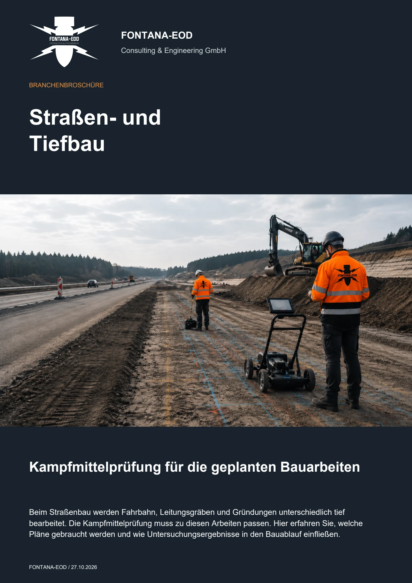
Specialist assessment should begin as soon as the route corridor, construction sections and proposed ground interventions can be identified. For roadside, independently routed and urban cycle paths, historically suspected ordnance, working width, excavation depth, crossings, drainage, lighting, retaining structures and existing utilities must be brought together before tendering. This allows early assessment of suitable investigations for areas, deep individual points and remaining zones.
The cycle path formation, verge, drainage swale, cable trench, lighting foundation, retaining wall, crossing, bridge ramp and site establishment affect different areas and depths. Measurements within the future path route do not automatically cover lateral utility alignments or deep mast and shoring points. Each working volume is therefore clearly described by location, width, depth and construction method.
If an unexpected suspicious object is found, stop work. Do not touch, move or uncover it further. Leave the immediate area and warn others without putting yourself at risk. In Germany, notify the police on 110; outside Germany, use the local emergency reporting procedure. The competent authorities determine what happens next; a project enquiry does not replace reporting the find.
Root zones, existing trees, slopes, fences and adjacent traffic areas may restrict survey lines and equipment access. Planning distinguishes accessible survey areas, deep individual points and sections accessible later. Necessary investigations and protective measures are specified before ground disturbance during vegetation clearance, demolition or breaking out. Interventions in root-protection areas are coordinated with construction and environmental planning; unrecorded areas remain unresolved.
Effort, duration and cost depend on route length, working width, intervention depth, surface, vegetation, existing utilities, deep individual points, accessibility, traffic phases and documentation scope. New crossings or relocated ancillary installations may require supplementary investigations. A site plan, typical cross-section, point schedules and construction phases are needed for costing.
A deep-ground survey becomes relevant where lighting columns, signs, retaining walls, railings, bridge connections, chambers or other elements extend deeper into the ground than the reliably investigated near-surface zone. Point location, foundation dimensions, target depth and installation method determine the investigation volume. Whether existing area measurements suffice or a deep-ground or borehole survey is needed depends on the demonstrated detection depth and actual survey conditions.
The documentation should clearly show the route, chainage, construction section, working width, intervention depth, method used, survey coverage, interference and excluded areas, anomalies, findings and subsequent decisions. With several construction sections, drawing revisions and partial handovers must remain traceable. Designers and site management can then identify the area to which the conclusion applies and where further measures are needed.
Helpful documents include site and route drawings, chainage, a typical cross-section, construction sections, maximum excavation depth, crossings, lighting and drainage points, utility drawings, existing trees, any existing aerial photograph assessments, correspondence with authorities and the requested date. Incomplete documents are also suitable if they show which working volume is to be planned or tendered next.
Information and requirements from authorities are supplied with their date, complete appendices and geographical scope. In Germany, the competent ordnance disposal service, local public-order authority and, where relevant, building-control authority are identified for the project location; outside Germany, local responsibilities apply.
An initial enquiry does not need to contain a finished schedule of services. It should, however, show the route, working width, relevant depths and current drawing revision.
Provide the site plan, chainage, typical cross-section, working width and proposed construction section.
For alternatives, it should be clear which route is to be investigated and which is merely being compared.
Describe excavation, frost-protection layer, drainage, crossings, lighting, retaining walls and maximum depths.
Point schedules and foundation dimensions support depth planning.
Include utility drawings, existing trees, historical assessment, authority documents and earlier investigations.
State when the conclusion is needed for design, procurement or construction.
A site plan, brief project description, typical cross-section, maximum depth, construction sections and existing indications of suspected ordnance are often sufficient for an initial assessment.
FONTANA-EOD then identifies the background information still required and the appropriate service scope for areas, points and remaining zones.
Alignment, chainage, working width, crossings and drawing revision.
Excavation, drainage, lighting, chambers, retaining walls and maximum depth.
Utilities, trees, structures, earlier excavations and accessibility.
Basis for design, tendering, site management or the project file.
For long municipal or wider-area cycle path programmes, it should also be specified how data formats, coordinate systems and partial reports are standardised across several work packages. This allows later extensions and maintenance measures to refer to the existing investigation status without overstating the original conclusions.
Whether historical aerial photograph analysis, explosive ordnance surveying, surface surveying using GPR, magnetometry or TDEM, deep-ground surveys, downhole surveys, excavation supervision, area clearance or ordnance recovery is needed depends on the location, ground disturbance, depth, ground and existing documents. An early ordnance assessment provides clarity for tendering, programming, occupational safety and construction.
FONTANA-EOD combines its Section 7 SprengG licence, specialists holding Section 20 SprengG certificates of competence, suitable survey and clearance methods, and traceable documentation. Send the site plan, depth of ground disturbance, construction phase and existing documents for an initial technical assessment.


