Project pathway
The quickest route to the right decision.
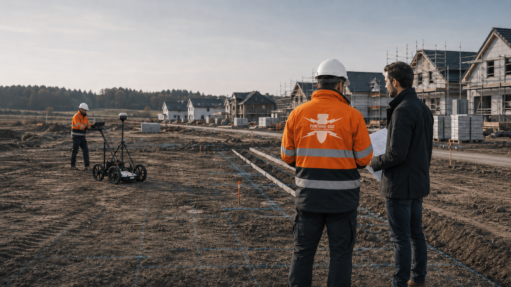
A neighbourhood development brings existing buildings, demolition, new building plots, underground parking, site-servicing works, green spaces and construction roads together across several phases. FONTANA-EOD reviews the suspected ordnance, individual areas, planned depths, construction sequence and required evidence so that planning, tendering and construction can use clearly defined investigation areas. Send us the current development and phasing plans, proposed depths and existing assessments. We will coordinate the next investigations with your project management, designers and site management.
Name each building plot clearly.
Coordinate demolition and new construction.
Assign reports to the relevant sections.
An ordnance investigation becomes relevant when a development combines several areas, construction phases and excavation depths on land with an unclear history or existing requirements. The review draws on existing site plans, demolition areas, new building plots, retaining works and excavation depths, service routes, borehole locations, historical records and the evidence needed by project management, site management and procurement. FONTANA-EOD compares this information with existing findings and identifies the investigations needed for each planned ground disturbance, section and report.
The work for “Project: Arche Noah Quartier, Lacomblet- straße 22, 40239 Düsseldorf” included ordnance supervision of construction works.
Service period: 2025-11
Service areas:Ordnance specialist supervision of groundworks
View project details · Ordnance specialist supervision of groundworks · Project location: Düsseldorf
The scope of services for “Residential neighbourhood in Köln-Deutz, North Rhine-Westphalia” included ordnance surveys.
Service period: –
Service areas:Surface surveys: GPR, TDEM and magnetometry
The work for “Housing development in Aachen, North Rhine-Westphalia” included ordnance investigation.
Service period: –
Service areas:Surface surveys: GPR, TDEM and magnetometry
New building plots, demolition, site servicing and later construction phases are investigated and documented separately. The following links help you identify the relevant task, the planned ground disturbance, who is responsible and the evidence required.
Permitted building areas, building lines, intended use, external works and actual ground disturbances are reviewed separately. This establishes whether the assessment is needed before purchase, a planning application, tendering or excavation.
Have the building plot assessedWhere several plots, road alignments, utility trenches, shafts and construction phases come together, ordnance surveying must be organised by area and timing. One result does not automatically cover sections developed later.
Prepare the infrastructure worksApartment buildings bring together basements, underground car parks, retaining works, geotechnical boreholes, foundations, utilities and confined site logistics. The assessment for the project depends on excavation depth and survey conditions.
Prepare the building works
Neighbourhood developments combine demolition, existing structures, several new construction areas, infrastructure, underground parking, green spaces and construction phases. The assessment must keep the records for different sections separate. Necessary investigations and protective measures are planned before ground disturbance during demolition, vegetation clearance, breaking up surfaces or establishing temporary roads and working areas. Areas that become accessible later receive their own investigations before the subsequent ground works.
View the process and documentationWhere prior investigation is limited, the suitability of ordnance surveying during excavation is assessed. Each working layer is surveyed and evaluated before controlled removal in stages, supported by visual checks. This sequence is repeated down to the agreed formation level. Before work begins, site management and specialist personnel agree the excavation layers, stop signal, authority to give instructions, reporting arrangements and documentation.
Assess the surveying needed during excavationDeep excavations, formation levels, shafts, retaining wall alignments and underground structures need a different assessment from shallow external works. The investigation depth must match the planned construction work.
Coordinate deep interventionsRoad alignments, drains, utility routes, shafts and service connections follow defined routes. Ordnance surveying must address their alignment, depth and construction phase as well as their area.
Prepare site access roadsFrom development and design through infrastructure works to building construction, the teams need clear investigation records. These must identify the investigation area, method, conditions and next decision.
Prepare evidenceEach construction section is described by its affected areas, proposed depths, construction phases and required documentation.
The development plan assigns demolition, new building plots, underground parking and service routes to the relevant construction phases. Existing investigations, outstanding areas and required evidence are recorded for each section. This prevents findings from being applied to other areas or depths.
Coordinate building plots and construction phasesBoreholes, trial pits, window sampling and geotechnical investigations disturb specific points in the ground. Where the evidence of suspected ordnance is unresolved, the location, depth and access should be assessed in advance.
Agree drilling points and target depthService boundaries, investigation areas, construction phases and documentation requirements should be specified before procurement. This supports comparable offers and clear handovers to site management or the civil engineering contractor.
Prepare evidence for procurementExcavations, foundation trenches, utility trenches, shafts and retaining wall alignments must be assessed against the evidence of suspected ordnance, survey conditions and construction sequence. That assessment determines the appropriate next technical step.
Select suitable specialist services before excavation and foundation workExisting requirements, older reports, aerial photograph analyses and incomplete site records should be considered together with the current design and actual ground works.
Check existing records against the current designSite management, the client and designers need clear information on the investigation area, method, conditions, result and next decision. These requirements should be agreed before work starts.
Prepare the project fileClear descriptions of the plan revision, construction work and available records help integrate ordnance assessment into housing and infrastructure projects.
At an early planning stage, a detailed technical assessment usually needs more than a general description. Provide the project location, approximate site boundary, intended use, expected depths and available records so that the suspected ordnance can be assessed in context.
Geotechnical borehole locations, probing, trial pits and laboratory programmes should be coordinated with the ordnance assessment where they involve areas with unresolved evidence of suspected ordnance. This reduces pressure to resolve arrangements just before drilling starts.
Slopes, retaining works, formation levels, excavation sections and access routes determine how an excavation can be assessed. A general statement about the plot is insufficient where the actual depths vary significantly.
Utility routes and drainage are often underestimated in housing projects. They disturb different areas from the building itself and therefore need their own location and depth references in the project assessment.
Access routes, parking spaces, play areas, retention facilities, green spaces and later extensions may involve new earthworks. Early documentation should distinguish between areas already addressed, outstanding areas and areas to be investigated later.
Where ordnance assessment, surveying or excavation supervision is included in a schedule of works, the area, depth, method, construction phase and documentation must be specified. Unclear service boundaries often lead to questions during construction.
Site management and the construction team need clear work areas, routes for queries and response procedures. Suspected objects call for orderly communication with the relevant authorities, rather than an impromptu assessment on site.
Changes to foundations, utility routes, excavations or external works can also change the relevance of the ordnance assessment. The project file should show which findings relate to which plan revision.
Housing project records often pass from the developer to site management, and later to owners, property managers or operators. Clear documentation helps avoid starting from scratch when further ground works are planned.
Regional rules, responsibilities and available records may affect the process. The project location should therefore be identified as clearly as possible, including the federal state, municipality, address, land parcel and existing information.
Before earthworks start, the documents site management will receive and the areas relevant to construction should be clear. They should identify locations, depths, completed sections, outstanding adjoining areas, contact persons and how technical queries during excavation, utility installation or ground investigation will be handled.
A reliable ordnance assessment considers the evidence of suspected ordnance, planned construction work, technical limitations and required documentation together.
First, establish whether the assessment is needed before purchase, planning, ground investigation, tendering, excavation or ongoing construction. This determines the level of detail and the form of documentation.
Agree the project phaseAn address alone is insufficient. Building plots, excavations, service trenches, borehole locations, access routes, external works and construction sections must be identified separately on the plan and linked to their proposed depths.
Choose the method for the area and proposed depthHistorical records, aerial photograph analysis, old plans, previous use, requirements and existing reports are checked against the current ground works. This establishes which areas need further assessment.
Evaluate the recordsNear-surface investigations, investigation at depth, downhole surveying and excavation supervision address different questions. The method depends on the surface, depth, surrounding interference and required records.
Agree the specialist serviceSurveying or supervision must suit the access, programme, exclusion areas, utilities, machinery and subsequent trades if the investigation is to support construction effectively.
Include results and handovers in the construction sequenceThe documentation describes the commissioned area, method, conditions, evaluation of results and next technical decision. It should remain clear to the client, designers and site management.
Prepare the documentation requirementsThe plots, construction work and depths are described in the current plan revision. Existing findings and outstanding investigations are assigned to their respective construction phases.
The address is only the starting point. The technical assessment depends on the actual work: drilling, foundations, excavation, service trenches, chambers, retaining works, external works or service routes. This determines which area, depth and investigation method need to be considered.
A housing project often contains several sections with different levels of information. Existing records may describe one area, while another needs a different investigation because of deeper ground works, new services or poor access. The documentation should make those differences clear.
Designs often change between the outline proposal, planning application, detailed design and procurement. The ordnance assessment should identify both the current plan revision and the construction phase for which the records are needed. This helps prevent an early finding being used later outside its scope.
Ground investigations provide important information on the ground profile, made ground, water, strata and planned borehole locations. Drilling itself also disturbs the ground. Coordinating the two activities early helps align borehole locations, survey depths, access and site safety arrangements.
Service connections, drainage, electricity, water, telecommunications and later external works often involve more ground disturbance than the building alone. These routes need consideration before civil engineering starts because they have their own depths, sources of interference and documentation requirements.
Neighbouring buildings, boundaries, existing services and surfaces, demolition, existing structures and site establishment can affect whether investigation is possible in advance. These conditions help determine whether surveying, downhole investigation or support during excavation is appropriate.
Where excavation is a significant part of the project, the excavation sections, formation levels, slopes, retaining works, machine access, temporary storage, working areas and reporting arrangements should be described in advance. Specialist support can then be included in the construction sequence before earthworks start.
Housing projects pass between development, design, specialist assessment, infrastructure works, building construction, civil engineering and site management. Ordnance documentation must be technically correct, clear to the different teams and useful for the decision required at each stage.
Not every area can be commissioned, accessed or investigated at every stage. Completed areas, areas not assessed, later design changes and possible follow-up questions must therefore remain distinct. This clarity avoids misunderstandings in procurement and site management.
The client, design team and site management receive the results, investigation limitations and outstanding tasks with the location and depth references for the corresponding construction phase.
Before specialist work begins, actual access to the area must be confirmed. Vegetation, fixtures, vehicles, fences, storage areas, excavation support and neighbouring land may affect the work. These conditions should be identified before the team arrives on site.
A technical assessment needs clearly defined data. If site plans, borehole lists, excavation plans or utility plans change afterwards, the records should show which revision was assessed and which subsequent decisions remain outstanding.
Work areas, contact persons, queries, reporting arrangements and handover documents are agreed before work starts. Site management and contractors use the same location and depth references.
Survey anomalies are evaluated and assigned for follow-up investigation. Do not touch, move or continue uncovering an unexpected suspicious object. Stop work immediately in the affected area, leave the immediate vicinity and keep others away without putting yourself at risk. In Germany, notify the police immediately on 110; elsewhere, use the local emergency reporting route. The relevant authorities decide what happens next. Internal project communication must not delay the report.
Civil engineering, structural construction, utility installation, external works and ground investigation teams often use different plans. A useful ordnance assessment relates its findings to the corresponding trade so that subsequent work does not rely on statements outside their scope.
Where construction proceeds in separate phases, the documentation should reflect that progress. It should identify investigated areas, inaccessible areas, adjoining areas to be addressed later and changes to the depth of work.
Technical limitations are described clearly. The surface, interfering objects, services, reinforcement, made ground, survey conditions and depth all affect what an investigation can establish.
The outcome should identify the appropriate next project step: obtain further records, carry out a survey, investigate borehole locations, support excavation, resolve a finding or hand over documentation to site management.
The documentation must reflect the commissioned area and actual construction work. General statements do not provide a useful basis for the construction sequence.
The site plan, land parcel, building-plot boundaries, construction phase, intended use and depth of ground disturbance provide the basis. They must reflect the actual planning stage.
Aerial photographs, historical plans, previous use, demolition records, contaminated land data, earlier reports and known requirements are reviewed alongside the planned ground works.
The methods used are documented so that the method, location reference, investigation area, sources of interference and limitations remain clear.
Anomalies, interference, findings and limitations are evaluated. Their location, depth and survey context must be considered together with the subsequent construction work.
The report should be clear to the client, designers, site management and contractors. It describes what was investigated and the next step arising from the results.
A useful project file distinguishes investigated areas, outstanding areas, later design changes and additional construction phases. This keeps the records clear when they are handed over. Where objects have actually been exposed or clearance work carried out, the corresponding investigation and clearance records are included.
The investigation file assigns records, investigations and findings to their respective construction phases. It contains the current plan revision, investigated areas and depths, results, limitations and further steps needed.
The plan revision, revision number, coordinate reference, construction limits and commissioned sections are recorded so that findings are not applied to other versions of the plans.
Each building plot, excavation, service trench, borehole location or route section is linked to its proposed final depth. Area and depth must be considered together.
Historical analysis, surveying, downhole investigation or excavation supervision is described with the surface conditions, access, services, interfering objects and construction phase.
Findings and anomalies are linked to their locations, technical evaluation and possible next project decision, rather than listed in isolation.
The client, designers, site management, civil engineering contractor, consultants and the people responsible for coordination need the same information base. The file identifies which information is relevant to each party.
Housing sites are often altered, developed more intensively or excavated again. Clear records help with subsequent utility works, external works and extensions.
The process follows the project stage. Records, suspected ordnance, methods, execution, evaluation and documentation are brought together step by step.
The review brings together the site plan, land parcel, construction objectives, demolition areas, new building plots, site-servicing works, excavations, underground parking, service information, construction phases, existing reports and proposed depths.
The purpose of the decision is established: purchase, design, ground investigation, tendering, excavation, site management or documentation.
Historical analysis and existing information are checked against the planned ground works. Outstanding areas are identified separately.
Surveying, downhole investigation, investigation at depth, excavation supervision or a combination are assessed according to the surface, depth, access and surrounding interference.
Access, exclusion areas, services, contact persons, construction dates, machinery, site logistics and communication arrangements are agreed before work starts.
The commissioned service is carried out with location references, survey data, records of findings and coordination during construction, as required for the project stage.
Survey data, evidence of suspected ordnance, interfering objects, limitations and findings are evaluated. Their implications for the construction sequence and documentation are prepared.
The documentation describes the investigation area, method, conditions, result and next technical step for the client, designers and site management.
The investigation area, depth, method and construction sequence are linked to the actual ground works. Demolition areas, new construction areas and infrastructure routes receive separate investigation boundaries.
A neighbourhood development rarely consists of a single building plot. Demolition, existing structures, new housing, site servicing, underground parking, external works and later construction sections overlap in both place and time.
The need to investigate ordnance depends on more than the size of the site. Demolition areas, former buildings, new permitted building areas, underground parking, drainage, service routes, access roads, construction roads, green spaces and later works may involve different investigation depths and access conditions. The investigation plan must therefore distinguish the individual areas, construction phases and depths. A report for a demolition section does not automatically cover a later underground car park. An investigation along a service route does not answer every question about permitted building areas or borehole locations. FONTANA-EOD brings together site and phasing plans, ordnance records, ground information and utility records so that project management, designers, procurement and site management can understand the next technical step.
Investigation areas are defined around the demolition works, existing buildings, new building plots, underground parking, service routes, construction roads, green spaces, utilities and construction phases. The survey grid or investigation sequence must reflect the actual planned ground disturbance.
Boreholes, piles, shafts, retaining wall alignments and deep foundations need clearly defined locations and depths. Without a specified depth, the findings remain limited.
Gas, water, electricity, drainage, telecommunications, earthing and old services present both safety considerations and sources of interference. Utility records form part of the preliminary coordination.
Asphalt, concrete, ballast, vegetation, old foundations, reinforcement and made ground affect whether useful measurements can be taken and how findings are evaluated.
Site establishment, access routes, machine positions, neighbouring structures, exclusion areas and working windows determine when an investigation can fit into the programme.
The technical findings must identify the area assessed, the conditions applying and the subsequent construction decision.
Demolition areas, new building plots, service routes and later construction phases are described with their respective depths. Existing investigations are checked against these areas and depths. Findings from an earlier demolition section are used only where they actually cover the proposed new ground disturbances.
Assign findings to the current construction sections
Foundations, utilities, paved surfaces and storage areas can restrict access and limit what an investigation can establish. Suitable methods are chosen for the suspected ordnance and the accessible ground. For areas that cannot yet be investigated, the records state when access will become possible and what investigation will then be needed.
Choose methods to suit survey conditions and accessThe available records, survey conditions, required depth and construction sequence determine the method. The investigation must cover the intended volume of ground sufficiently, with limitations documented for each construction phase.
It evaluates previous use, aerial photograph features, bomb craters, evidence of suspected ordnance and existing records. It does not replace physical investigation, but can help prepare it precisely.
Near-surface methods may be suitable in open areas or where conditions otherwise permit. The surface, interfering objects, reinforcement, scrap, services and ground profile limit the findings.
Magnetometry detects ferromagnetic anomalies in accessible areas. Utilities, reinforcement, foundation remains, fences and site equipment may mask the data. Interpretable areas and measurement limits are documented separately for each section.
TDEM detects time-dependent electromagnetic responses from conductive objects. The target object, soil conductivity, required depth and technical installations determine suitability for the excavation or development alignment.
GPR records reflections at material and structural boundaries and can provide supplementary investigation of utilities or installations. Soil, moisture, surface coupling and reinforcement affect data depth. A reflection does not uniquely identify ordnance.
For deep foundations, shafts, excavations or borehole locations, the first step is to assess whether a suitable surface method adequately covers the required ground. Where coverage is insufficient, additional investigation at depth is planned for the actual location and required depth.
Surveying from investigation boreholes may be considered where the investigation objective is suitable and other methods provide insufficient coverage. The location, grid, casing, drilling depth and documentation are agreed for the planned ground works and local survey conditions.
Where prior investigation is limited, the suitability of ordnance surveying during excavation is assessed for the specific working space. Each layer is surveyed and evaluated before controlled material removal. A tightly constrained programme alone does not determine the method; the working sequence, reporting arrangements and documentation are agreed in advance.
Measurement anomalies receive targeted follow-up investigation or exposure. Recovery of confirmed ordnance is coordinated with the permitted activities, local responsibilities and documentation. If an unexpected suspicious object is found, stopping work, keeping distance and immediate reporting take priority.
FONTANA-EOD records the commissioned investigations with their areas and depths. Project management and site management can then assign the findings to individual building plots and construction phases.
The investigation brief sets out the planned ground disturbances, depths and existing findings. Results apply within the documented scope of the investigation.
Interfering objects, services, sealed surfaces, reinforcement, made ground and restricted access are considered in both the choice of method and the report.
Reports are prepared so that the client, designers, site management, civil engineering contractor and consultants can work from the same information.
Where coordination with building control or the public ordnance disposal service is required, the responsible authorities and necessary documents are identified.
If an unexpected suspicious object is found, stop work in the affected area immediately. Do not touch, move or uncover the object further. Leave the immediate area and keep others away without putting yourself at risk. In Germany, notify the police immediately on 110; outside Germany, use the local emergency reporting procedure. The competent authorities determine what happens next. Inform site management and the client; internal reporting must not delay the emergency call.
The handover distinguishes investigated areas, outstanding follow-up questions, later design changes and subsequent trades. This reduces misunderstandings during construction.
Before the next ground disturbance, current plans and depths are compared with existing reports. The scope of work identifies any additional areas or locations that need investigating. This ties the new investigation brief to the actual construction phase.
If previously concealed areas become accessible, or new obstructions arise, the investigation sequence is adjusted. Site management and contractors receive the affected section, its current status and outstanding tasks together.
A reliable ordnance assessment requires coordination between the client, designers, site management, consultants, contractors, specialist firm and relevant project contacts.
define the construction objective, programme, required records, procurement requirements and contact persons. They decide which documents are needed for design and site management.
provide the site plan, excavation, foundations, utilities, drainage, borehole locations, construction phases and plan revisions. These details determine the scope of the technical findings.
provide borehole locations, trial pits, ground profiles, made ground information, contaminated land context and details of intrusive work. Ordnance assessment and ground investigation should be coordinated.
need clear work areas, reporting arrangements, exclusion areas, documentation and handovers so that earthworks, utility installation and excavation can proceed in an orderly sequence.
supports the project as a private specialist firm by reviewing records, surveying, supervising excavation, evaluating findings, recovering ordnance within the commissioned scope and providing traceable documentation.
In Germany, the federal states' ordnance disposal services and responsible local authorities carry out hazard response and deal with ordnance finds. Their involvement is clarified for the project location; outside Germany, the corresponding local responsibilities apply. The commissioned work is coordinated with the necessary reporting and consultation arrangements.
The local public order authority and, where relevant, building control authority are involved according to their project responsibilities. Requirements, contact persons and reporting arrangements are assigned to the affected construction areas and phases.
The commission, responsible personnel and reporting arrangements are agreed for each work area. Necessary protective measures are prepared with site management and contractors.
For housing developments, legal and organisational requirements are considered in relation to the site, planned ground disturbance, responsibilities, construction sequence and documentation. Ground investigation, excavation, utility installation and foundation works need to be considered together. Historical assessment, technical investigation, excavation supervision and the assessment of findings each have their own requirements and limitations. The scope of work, construction phase, current records and reporting procedures should therefore be agreed before work begins.
In Germany, § 7 SprengG concerns the commercial authorisation for activities requiring authorisation; § 20 SprengG concerns the certificate of competence of responsible persons. Under § 1b SprengG, searching for found munitions also counts as handling them. The requirements applicable to the project depend on the activity actually commissioned and the allocation of responsibilities.
The First Ordinance to the German Explosives Act (1. SprengV) includes requirements for technical competence and state-recognised training courses. The qualifications required for a neighbourhood development depend on the specific commissioned investigation or clearance works and the relevant construction sections.
DGUV Information 201-027 concerns protective measures during ordnance clearance work. DGUV Rule 113-003 concerns the dismantling or destruction of explosives or corresponding objects and also includes the disposal of found munitions. It applies according to this field of activity; it does not replace a risk assessment specific to the planned ground intervention.
The permits, qualifications and responsible personnel needed for work involving ordnance must be considered when planning the deployment.
Risk assessment, safety instruction, access, exclusion areas and machine use are coordinated with the investigation sequence. Everyone involved must know the reporting procedure for a suspicious object.
The German federal construction guidelines for ordnance clearance, BFR KMR, address historical and technical investigation, clearance planning, procurement and documentation within their defined federal remit. Their application to a particular development is established separately. DGUV requirements are considered for the activity concerned.
Evidence of suspected ordnance, findings, requirements and hazard response matters are discussed with the relevant authorities where the project requires it.
The findings relate to the commissioned area, method, conditions and time of investigation. Design changes, deeper ground works or additional areas may require a further assessment.
Site management needs a clear description of the investigation area, method, limitations, evaluation of results and next decision.
If an unexpected suspicious object is found, stop work in the affected area immediately. Do not touch, move or uncover the object further. Leave the immediate area and keep others away without putting yourself at risk. In Germany, notify the police immediately on 110; outside Germany, use the local emergency reporting procedure. The competent authorities determine what happens next. Inform site management and the client; internal reporting must not delay the emergency call.
The specification and commission should identify the area, depth, construction phase, method, documentation and interfaces so that the work can be checked afterwards.
Existing records, technical investigations and the handover of findings are coordinated for each construction section.

Planned ground disturbances for excavations, utilities and shared working areas are recorded in the development plan. The investigation boundaries remain clear for each area.
Send your development documents
Site plans, existing assessments and historical records are brought together before new surveys, ground investigations or tendering.
Have your documents reviewed
The methods needed to investigate borehole locations or excavations are selected according to the evidence of suspected ordnance, ground conditions, interference and planned depth of work.
Coordinate survey work
Where prior investigation is limited, the suitability of ordnance surveying during excavation is assessed. Visual observation of excavation alone does not replace a necessary ordnance survey.
Assess the surveying needed during excavation

Before new ground works, existing records are evaluated, suitable investigations are selected and their scope is agreed with site management. Results and survey limitations are assigned to the corresponding construction phases.
The overview explains the assessment tasks for building plots, buildings, excavations and infrastructure roads.
View the housing overviewBefore surveying or excavation, historical analysis can help assess the evidence of suspected ordnance and identify the records needed.
Assess the suspicion indicatorsDeep ground works, geotechnical boreholes, shafts and foundations need precise location and depth references.
Agree drilling points and target depthWhether ordnance surveying during excavation is necessary and suitable is assessed for the specific ground works. A tightly constrained construction programme alone does not determine the method.
Agree the surveying needed during excavationThe records should clearly identify the investigation area, method, conditions and next decision for the project file and site management.
Prepare investigation records for site management
The region and relevant project contacts can affect the available records, sequence and coordination. The regional project context should be identified early. Agreed information reduces queries and makes it easier to assign records later.
Check the project regionThe project location, land parcels, building plots and section identifiers link earlier records to the current development plan. Requirements, official reference numbers and contacts are added to this record. If the site is subdivided differently, it remains clear which original area a report covered.
The name of a development does not define the boundary of the commissioned work. What matters for later use is the area and depth investigated, the survey conditions and any outstanding areas. These details are compared with the next construction section.
Check evidence against the interventionMoved buildings, revised underground parking layouts and new utility routes are recorded with a date and plan revision. The client, designers and site management receive the same document version so that earlier and new findings are not mixed inadvertently.
Explore the technical principlesTechnical information
From development works to excavation: the brochure shows how to consider ordnance risks early and prepare investigations suited to the planned earthworks.
A report answers a particular question only where its actual investigation scope covers it. Individual sections can be investigated separately when the tasks, coordination and documentation are agreed. Findings are not extended to uninvestigated neighbouring areas, other depths or other works. These limits must remain clear in the development overview.
Responsibility for coordination must be assigned within the project. FONTANA-EOD supplies the commissioned technical findings with their locations. Project management and the client organise their distribution to the parties concerned.
Routes and handover points are recorded in a shared plan. Property boundaries do not replace a description of the actual working area or the proposed depth of ground disturbance.
The revised plan is compared with the boundaries of existing investigations. Further technical assessment may be needed outside or below the investigated area.
If an unexpected suspicious object is found, stop work in the affected area immediately. Do not touch, move or uncover the object further. Leave the immediate area and keep others away without putting yourself at risk. In Germany, notify the police immediately on 110; outside Germany, use the local emergency reporting procedure. The competent authorities determine what happens next. Inform site management and the client; internal reporting must not delay the emergency call.
The assessment follows the actual ground disturbance, including the excavation and deeper components. This may differ from the property boundaries above and must be shown accordingly.
The current section plan, the relevant investigation reports, their limitations, details of outstanding issues and agreed contacts. A reference to an earlier investigation alone is insufficient to establish what it covers.
The main factors are area, demolition stage, excavation geometry, route lengths, depth changes, ground conditions, sources of interference, access, construction phases, existing records, required methods and documentation. The quotation relates to the particular construction section and commissioned investigation scope.
Send the current development plan showing construction sections, proposed depths and existing investigation reports. Identify the next ground disturbance and the evidence needed for it.
Address, land parcel, site plan, construction boundaries, phase, individual sections and adjoining areas.
Excavation, borehole locations, foundations, utility trenches, shafts, retaining works, excavation depth and construction phase.
Aerial photograph analysis, historical plans, utility plans, ground investigation data, earlier reports, requirements and known findings.
Procurement, the project file, site management, ground investigation, civil engineering coordination, interface coordination or a subsequent decision.
Provide the masterplan and construction phasing plan showing demolition areas, building plots, underground parking, utility and drainage routes, borehole locations and proposed depths.
Mark the first section to be completed, later construction phases and handovers. State the dates and revision numbers of the plans. Areas shown for information only must be identified as such.
Include complete geotechnical, contaminated land and ordnance reports and aerial photograph analyses with their appendices. State the date, author and investigated area. Include official information and requirements.
Describe made ground, existing structures, foundation remains, sealed surfaces, vegetation, groundwater, services and neighbouring buildings. Mark access routes, confined working spaces, site establishment and possible exclusion areas. State whether operations will continue during the work.
Also show ancillary areas where earthworks are planned: temporary roads, crane positions, temporary services, service connections, drainage, parking spaces, gardens and paths. Distinguish immediate, later and separately commissioned ground works.
State your project role, technical contacts, report recipients and dates for individual construction phases. Explain why you need the records, for example land acquisition, design, tendering or construction. The required scope depends on the specific ground works.
Missing information is clarified before the method is selected. The results must relate to the work area of the corresponding trade and show which volume of ground was investigated and which later works need their own investigation.
+49 (0) 6843 - 999 499 7
info@fontana-eod.de
Site plan, depth, construction phase, suspicion indicators
Site management, design, project management or the client
Whether historical aerial photograph analysis, explosive ordnance surveying, surface surveying using GPR, magnetometry or TDEM, deep-ground surveys, downhole surveys, excavation supervision, area clearance or ordnance recovery is needed depends on the location, ground disturbance, depth, ground and existing documents. An early ordnance assessment provides clarity for tendering, programming, occupational safety and construction.
FONTANA-EOD combines its Section 7 SprengG licence, specialists holding Section 20 SprengG certificates of competence, suitable survey and clearance methods, and traceable documentation. Send the site plan, depth of ground disturbance, construction phase and existing documents for an initial technical assessment.


