Project pathway
The quickest route to the right decision.
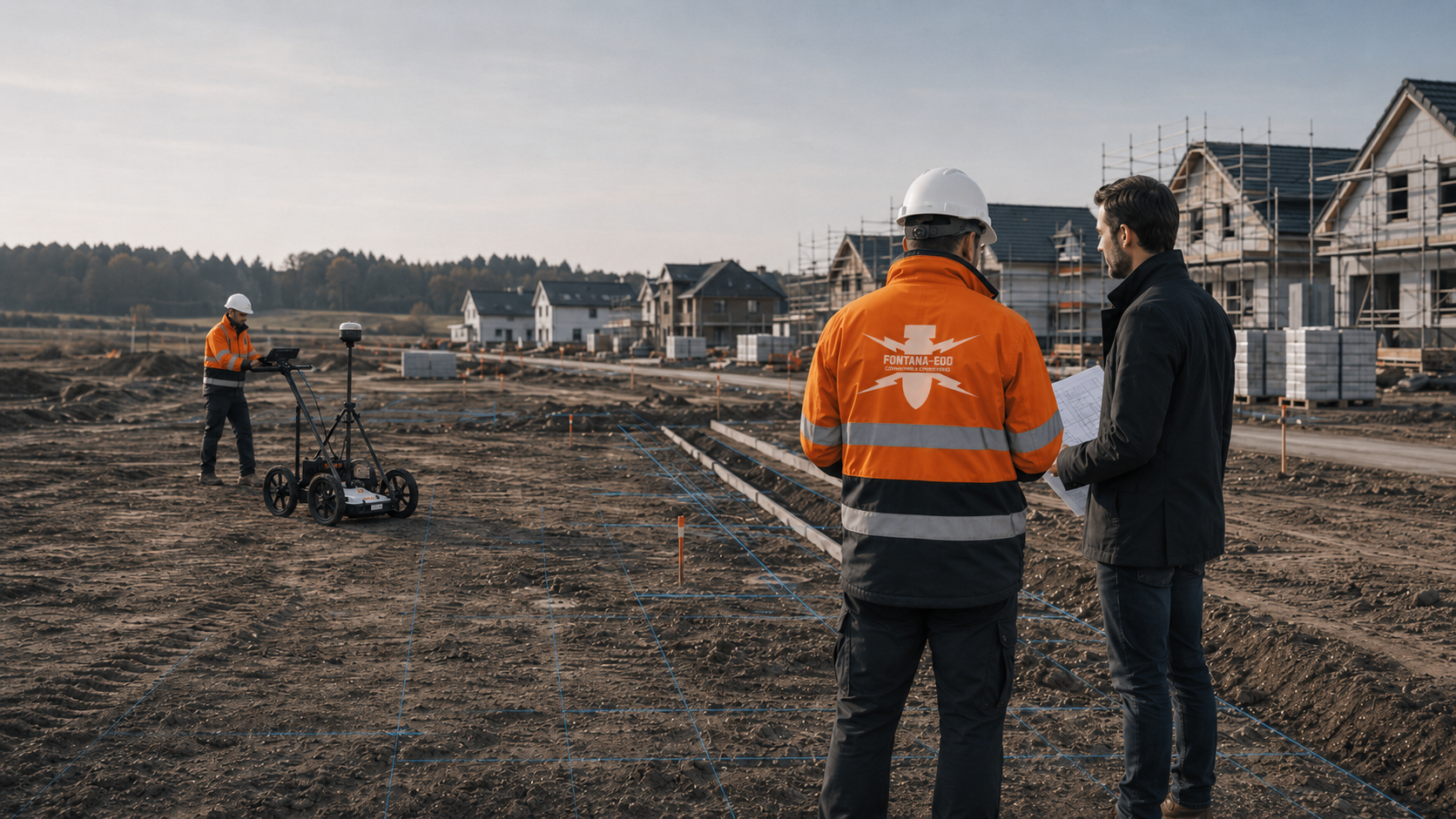
For the roads, sewers and utility services of a new residential development, the proposed areas and depths are compared with existing ordnance assessments. FONTANA-EOD agrees the investigations needed with the infrastructure developer, local authority and designers. Findings from site-servicing works and later house plots remain separate, each tied to its own plan revision. Send the infrastructure plans, proposed depths and existing reports for the next civil engineering section.
Define building plots and routes.
Define the scope and documentation.
Assign findings to the relevant areas.
Before the first ground disturbance, existing ordnance assessments are compared with the planned works. Whether an investigation is needed, and which type, depends on the suspected ordnance, available findings and local conditions. The need often arises along infrastructure routes as well as at house locations. FONTANA-EOD assigns the investigation tasks to individual construction sections and depths.
The scope of services for “Development of a building area in Bonn, North Rhine-Westphalia” included ordnance surveys.
Service period: –
Service areas:Surface surveys: GPR, TDEM and magnetometry
The scope of services for “Development of a residential area in Bochum, North Rhine-Westphalia” included ordnance surveys.
Service period: –
Service areas:Surface surveys: GPR, TDEM and magnetometry
The work for “Housing development infrastructure, Eifel, North Rhine-Westphalia · North Rhine-Westphalia” included ordnance investigation.
Service period: –
Service areas:Surface surveys: GPR, TDEM and magnetometry
Site servicing provides connections for later construction projects. For each project, it must remain clear which areas and depths have already been investigated.
The overview explains the assessment tasks for building plots, buildings, excavations and infrastructure roads.
View the housing overviewPurchasers, developers and site management need reports and plan attachments for the plots and connections that were actually investigated.
Assess building plotsWhere there are several building plots and uses, investigations and findings are assigned to the individual construction sections.
Arrange specialist assessment of a neighbourhoodFor sewer, road or drainage-storage excavations, the assessment considers whether ordnance investigation during construction is suitable. Visual observation alone does not replace a required investigation.
Plan excavation monitoringDeep structures in a new residential development may require different investigation depths from those used for the initial infrastructure works.
Clarify civil engineering sectionsRoads, grouped utilities and junctions often involve the first deep ground disturbances on the site.
Arrange an assessment of route sectionsRoads, sewer routes, grouped utilities, drainage-storage facilities and later house plots are described by their individual areas, depths and construction sections.
Evidence of suspected ordnance comes from historical sources, traces of past land use, existing reports, regional experience and the planned work. For housing projects, it matters whether that evidence concerns the whole site, particular areas or specific depths.
Depth is more than a single figure on a section drawing. The excavation formation level, service trench base, borehole, shaft, infiltration trench and deeper foundation sections may call for different investigation approaches on the same site.
The relevant area often extends beyond the future building footprint. Working space, access routes, retaining wall alignments, utility trenches, temporary roads and landscaping may each involve ground disturbance.
Survey methods respond differently to ground conditions, moisture, interfering objects, metal content, the surface and the target object. Investigation records are reliable only when these limitations are understood for the project.
Geotechnical investigation and ordnance assessment should be coordinated in both location and timing. Borehole locations, starting elevations and planned depths help determine the appropriate technical approach.
Where prior investigation is limited, the suitability of ordnance surveying during excavation is assessed. Each working layer is surveyed and evaluated before controlled removal in stages, supported by visual checks. This sequence is repeated down to the agreed formation level. Before work starts, site management, machine operators and specialist personnel agree the excavation layers, stop signal, authority to give instructions, reporting arrangements and documentation.
Survey anomalies are assigned for follow-up investigation using their location, survey conditions and technical evaluation. If an unexpected suspicious object is found, work must stop, people must keep their distance and the find must be reported immediately.
The project records should show what was investigated, which methods were used, where the limitations lie and what site management, the client and following contractors need to do next.
Tendering and subcontractor coordination need clear service boundaries, investigation depths, responsibilities, working windows and documentation requirements.
The design team, site management and civil engineering contractor receive the same current plan showing the investigated areas and depths, survey limitations and any further investigation required. The relevant authorities receive the information they need for their duties.
Technical assessment begins as soon as ground works are defined. Bringing the location, depth, construction phase and available documents together early makes it easier to include the investigation in design and procurement.
Suspected ordnance, site area, individual sections and later ground disturbances can be recorded systematically at an early planning stage.
Define the project's investigation sectionsRoad construction, manhole structures, sewer trenches and grouped utilities define deep, linear investigation sections.
Coordinate route sectionsThe later division into properties should match the investigated areas and documented construction sections.
Clarify how findings relate to individual plotsInfiltration trenches, swales, basins and pipes often lie outside the future buildings and need their own defined areas and depths.
Clarify investigation depths for drainage facilitiesOrdnance assessment, investigation and any supervision should be included in the work packages, programme and allocation of responsibilities.
Prepare evidence for procurementCivil engineering, road construction, utility installation and building construction overlap in time. The documentation must remain clear for the trades that follow.
Hand over clear findings to the trades that followOrdnance assessment is not a single appointment. It affects land acquisition, design, ground investigation, procurement, excavation, documentation and subsequent handovers. Defining the project phase clearly helps specify the specialist work accurately.
At an early stage, only the plot, outline concept and intended use may be known. An initial technical assessment can still be useful where excavation, foundation work or infrastructure works are foreseeable. This helps prevent ordnance issues emerging only after ground investigation dates, purchase decisions or procurement arrangements have been fixed.
When land is purchased, a project is taken over or a housing site is developed, the available records, previous use, existing reports and planned ground works all matter. An ordnance assessment can identify unresolved questions early and help include subsequent investigation work in the project budget and programme.
Geotechnical reports, surveys, terrain models, design levels and proposed borehole locations provide important technical information. Bringing these details together with the evidence of suspected ordnance and the depth of work helps determine whether surveying or specialist supervision is needed before drilling or excavation.
At this stage, the building footprint, infrastructure, basements, underground car parks, road alignments and utility trenches become more clearly defined. The ordnance assessment should address these actual ground works, construction phases and the records needed by the design team and site management.
Before procurement, the service boundaries, investigation depths, areas, documentation and interfaces must be described so that the client, bidders and site management understand the same requirements. Unclear wording often leads to variations, programme difficulties or uncertainty over responsibilities during construction.
Access routes, storage areas, crane positions, temporary roads and working spaces may each involve ground disturbance. Leaving them out of the investigation area creates gaps between the assessed area and the parts of the site actually used. Necessary investigations and protective measures are planned before the ground works needed to establish these areas, and before intrusive vegetation clearance, demolition or breaking up surfaces.
Excavation, drainage works, utility trenches, formation levels and foundations are critical interfaces with ordnance assessment. Investigated sections, ongoing work, reporting arrangements and documentation must be coordinated so that the project can respond consistently to unexpected findings.
If a suspected object or ordnance find is encountered, an orderly flow of information matters alongside the technical evaluation. Its location, depth and surroundings, the trades affected, contact persons and relevant authorities must be established without speculation.
Housing developments are often serviced or built in phases. The records must therefore show which areas have already been assessed to which depths and which remaining areas need to be reviewed for later phases.
Civil engineering, retaining works, structural construction, utility installation and landscaping need clear investigation records. The documentation should support both the initial decision and subsequent trades by identifying the assessed areas and unresolved follow-up questions.
For building plots, new developments and apartment buildings, information may later be passed to buyers, operators, property managers or subsequent designers. The investigated areas, depths and service boundaries must be documented clearly for this purpose.
After the assessment, it must be clear whether further records, an ordnance survey, checks during construction, follow-up investigation of findings or simply documented continuation of the project are appropriate. That next decision is the practical value of the technical assessment.
A reliable ordnance assessment brings together existing records, available survey methods, the construction sequence and documentation. The result is a traceable basis for the next project decision, rather than an isolated finding.
New residential developments often include farmland, old tracks, former buildings, made ground or boundary areas with a different history. The assessment must reflect these differences.
Assess the site's historySewers, water, electricity, heating, telecommunications and road drainage create long routes with defined design depths.
Clarify routes and depthsWhere construction sections are completed in sequence, investigated areas, outstanding areas and connection points must remain clearly documented.
Document construction sectionsBuried metal, fences, ballast, utilities, demolition rubble and temporary construction roads can affect which methods are suitable.
Agree the choice of methodsSurvey anomalies are evaluated and assigned for targeted follow-up investigation. Do not touch, move or continue uncovering an unexpected suspicious object. Stop work in the affected area, leave the immediate vicinity and keep others away without putting yourself at risk. In Germany, notify the police immediately on 110; elsewhere, use the local emergency reporting route. The relevant authorities decide what happens next. Internal reporting must not delay the emergency call.
Plan how findings will be reportedThe documentation should show which areas, depths and sections were investigated and which questions remain for later building construction.
Prepare records for handoverThe appropriate ordnance assessment depends on the available records, surface conditions, interference, depth of work and construction sequence. For housing projects, the method must suit both the programme and the required documentation, as well as being technically feasible.

Aerial photographs, historical plans and land-use records help define areas of suspected ordnance. They do not replace a physical investigation, but provide an important basis for selecting the method, depth and documentation.
Assess historical documents
Ground-penetrating radar, magnetometry or TDEM may provide suitable information, depending on the surface, interfering objects and survey targets. Their suitability depends strongly on the ground conditions and surrounding interference.
Request a technical assessment of the surface survey
For deep excavations, boreholes, shafts or foundations, we assess whether a suitable surface method can adequately investigate the intended working space. Where coverage is insufficient, additional investigation at depth is planned. The location, planned depth and starting point must be described precisely.
Agree borehole locations and depths
Where prior investigation is limited, the suitability of ordnance surveying during excavation is assessed. Each working layer is surveyed and evaluated before controlled removal in stages, supported by visual checks. This sequence is repeated down to the agreed formation level. Before work starts, site management, machine operators and specialist personnel agree the excavation layers, stop signal, authority to give instructions, reporting arrangements and documentation.
Plan excavation monitoringBefore work begins, design information, ground investigation data, civil engineering works, utilities and investigation records are assigned to the same construction phase and plan revision.
The design team and site management need to work from the same site information. The site plan, construction limits, sections, depths, construction phases and existing records are brought together so that decisions are documented, rather than agreed only verbally during a site meeting.
Civil engineering contractors and retaining works designers need clear details of working space, borehole locations, excavation sequence, exclusion areas and possible interruptions. This information should be available before work starts so that it can be included in the programme.
Utility routes often extend beyond the building footprint and are installed under separate contracts. The ordnance assessment must therefore consider service connections, public utility routes, shafts and crossings alongside the housing site.
Surveying and ground investigation provide coordinates, starting elevations and sections. These data are particularly useful for documenting investigation points, boreholes and excavation depths unambiguously.
Housing projects often need investigation records later for project files, handovers or communication with buyers. Statements about the investigated areas, depths and service boundaries must therefore be clear from the outset.
Ordnance assessment should not be scheduled as a last-minute addition just before excavation starts. A better approach is to include time for reviewing records, surveying, any necessary supervision and documentation in the construction programme.
A project may contain both investigated areas and areas that have not yet been assessed. The documentation must make that distinction clear so that later earthworks do not inadvertently rely on records that do not cover them.
If a suspected object is encountered, its location, depth and surroundings, the trades affected, contact persons and relevant authorities all matter. Clear communication arrangements agreed in advance reduce uncertainty during construction.
Reports and results should refer to plans, alignments, coordinates, construction phases or site boundaries. This allows them to be used reliably in meetings, procurement and subsequent decisions.
The assessment must establish whether further records, an ordnance survey, borehole assessment, excavation supervision or follow-up work on findings is needed. Providing that clarity is its main value to the project.
Housing project documentation must be clear, tied to specific locations and usable by subsequent teams. It should record the result and explain how the site, depths, construction sequence and interfaces are to be addressed next.
The site address, site plan, land parcel, construction area, sections, construction phase and existing requirements provide the initial working basis.
Historical records, previous land use, aerial photograph analysis and existing reports are reviewed alongside the planned ground works.
The surface, interfering objects, ground conditions, services, excavation and planned depth determine which assessment is technically appropriate.
The investigated areas, survey data, evaluation of findings, photographs and recommendations are recorded for the project. Where objects have actually been exposed or clearance work carried out, the corresponding investigation and clearance records are included.
The documentation must enable site management, procurement teams, subcontractors and subsequent trades to understand the next step.
If suspected objects or ordnance are found, the location, surroundings, contact persons and relevant interfaces are established without delay.
Housing projects need coordinated investigation work, ground data, construction planning and documentation. A well-prepared project file prevents important information being lost between design, procurement and site management.
The development plan, its geographical extent, survey data, infrastructure sections and subdivision into plots provide a reliable spatial basis for the assessment.
Road alignments, sewer sections, manholes, service trenches, drainage facilities and house connections are brought together with their design depths and construction phases.
Construction sections, restricted areas, completed investigation areas, outstanding areas and future building plots must be clearly distinguished.
The client, local authority, infrastructure developer and later project owners need clear information about investigated areas and decisions still needed for subsequent work.
The sequence is planned so that ordnance assessment, ground investigation, infrastructure works, civil engineering and documentation follow the same project requirements.
The site plan, sections, depths of work, construction phase and existing evidence of suspected ordnance are brought together.
The construction area, route, excavation, borehole locations, working space and external areas are assessed separately according to the ground disturbance involved.
Historical and technical information is assessed so that the construction sequence is not determined by a blanket assumption.
Suitable survey or supervision methods are selected according to the surface, interfering objects, ground conditions and depth.
Dates, access, site safety arrangements, site management and subcontractors are included in the programme.
The agreed surveys or investigations during construction are carried out for the specified areas and depths. Their location, conditions and completed scope are recorded.
Survey data, findings and limitations are evaluated. Working spaces that have not been investigated sufficiently, and any further investigation needed, are identified by location and depth.
The investigated areas, findings, data quality and next steps are recorded clearly for the project file.
New residential developments are rarely built in a single operation. Ordnance investigation therefore needs to fit the infrastructure design, civil engineering procurement, construction sections, later building plots and handovers to purchasers or contractors.
Housing and infrastructure projects need an assessment of the actual ground disturbance: the area, depth, construction phase and required records determine the appropriate approach.
Building plots and routes are assessed together. An area-wide survey may be appropriate for properties, whereas sewers, roads and utilities form linear investigation sections.
Each construction section needs clear boundaries so that the records show which areas were investigated, to what depth and using which method.
Open areas are often easier to investigate than a later construction site with storage areas, construction roads, retaining works, machinery and several trades working at once.
Site management, surveyors, civil engineering contractors, utility coordinators and the client need the same location references so that findings and reports remain traceable during construction.
The areas, planned depths, access, ground conditions and sources of interference are described before the method is selected. The subsequent report records the working space actually investigated and any limitations.
Vegetation, temporary roads, stored materials, old foundations, fences and confined access routes affect whether a site can be surveyed effectively before excavation or needs a different sequence of work.
Metal fixtures, reinforcement, old services, scrap, demolition rubble and boundary structures can interfere with survey data and must be considered in the evaluation.
The excavation formation level, drainage invert, pile starting level, infiltration trench, shaft and utility trench involve different depths. The records must show which ground works the assessment covers.
Information on existing services, building connections and public utility routes is needed not only for safety planning; it also informs the survey method, vehicle access and interpretation.
Necessary investigations are scheduled before the corresponding ground works. Separate investigation stages are defined for areas that become accessible later. Ordnance surveying during excavation must be technically suitable for the work; exclusion areas, reporting arrangements and the sequence are agreed with site management before material is removed.
Every investigation record needs clear details of the assessed area, depth, method and limitations. This keeps its scope clear for later construction phases.
No single method replaces every other assessment. A reliable decision for a housing project considers the records, survey conditions, depth, access, construction sequence and documentation requirements.
Historical aerial photographs help assess evidence of suspected ordnance and past land use, and prepare investigation areas. They do not show current ground conditions; their findings are therefore checked against current construction and survey data.
Surveying from the surface requires adequate access and suitable conditions. The working space, sources of interference, survey grid and achievable depth are specified for the construction area. Areas with insufficient coverage are assigned a separate investigation step.
Ground-penetrating radar records reflections at material and structural boundaries and can provide additional information on non-metallic features and layering. Its suitability depends on the ground and surface conditions. A reflection does not unambiguously identify a metal target or ordnance.
Suitable for magnetic anomalies in areas with little interference. Metal fences, reinforcement, services and scrap can limit the results.
May be suitable for electrically conductive metal objects where site conditions permit. Its limitations depend on the target size, depth, surrounding interference and survey setup.
For deeper ground works, the first step is to assess whether a suitable surface method covers the required volume of ground. Where coverage is insufficient, additional investigation at depth is planned for the actual location and required depth.
Surveying from investigation boreholes may be considered where the investigation objective is suitable and other methods provide insufficient coverage. Borehole starting points, planned depths, drilling methods and the volume of ground that can be investigated are defined in advance.
The suitability of ordnance surveying during excavation is assessed for the specific work. Each working layer is surveyed and evaluated before controlled excavation proceeds. The results are documented with their location, depth and limitations; simply watching the excavator does not replace a necessary ordnance survey.
Survey anomalies receive targeted follow-up investigation or exposure. Recovery of confirmed ordnance is coordinated within the permitted scope of work, local responsibilities and documentation requirements. If an unexpected suspicious object is encountered, stopping work, keeping a distance and reporting it immediately take priority.
For the next tender, existing reports, specific routes and outstanding questions are brought together. The investigation scope, methods and required documentation are defined for the relevant civil engineering section before the contract is awarded.
When borehole locations, window sampling or ground investigation are being prepared, the locations, depths and evidence of suspected ordnance should be considered together in advance.
Assess borehole locations in advanceThe appropriate investigation method is selected in advance for excavations, utility trenches or ground reduction. Simply watching the excavator does not replace a necessary ordnance survey.
Select the investigation method before earthworksBefore physical investigation, aerial photographs, historical plans and land-use history help define the investigation area and the priority of individual sections.
Review the evidence of suspected ordnanceTendering and site management need a clear description of the scope, investigation area, depth, documentation and subsequent decisions.
Prepare evidence for procurementRegional responsibilities, the project location, federal state and available records may affect which interfaces need early preparation.
Assess the project regionThe site plan, sections, depths, construction phase, evidence of suspected ordnance and contact details can be sent together to FONTANA-EOD.
Send project documentsFONTANA-EOD coordinates the investigation brief with the road and sewer designs. House designs that have not yet been finalised are expressly identified at handover.
Reports and plans show the infrastructure section investigated, the depths covered and remaining limitations. At property handover, it remains clear which plots were covered by the brief and which later ground disturbances still need assessment.
The assessment follows the construction objective, depth of work, available records and construction sequence, rather than blanket assumptions.
Survey methods are used so that interfering objects, the surface, ground conditions and access are taken into account in the evaluation.
Locations, methods, results and next steps are documented in a form that site management and the client can use.
Project managers, designers, civil engineering contractors, the relevant authorities and subsequent trades receive clear information about the area concerned.
Clear responsibilities reduce delays. The client, designers, site management, specialist contractor, civil engineering contractor and relevant authorities have different tasks but work from the same site information.
They define the project objective, working windows, available records and required documentation. These provide the framework for the technical assessment.
They provide site plans, sections, ground investigation data, borehole locations and technical details of the proposed ground works so that the investigation areas can be defined reliably.
They carry out earthworks, drilling, retaining works or utility trenching and need clear information on work areas, reporting arrangements and documentation.
In Germany, the ordnance disposal services of the federal states and the locally competent authorities carry out hazard-response and find-management duties. Their involvement is established for the project location; outside Germany, local responsibilities apply.
The local public order authority and, where relevant, building control are involved according to their project responsibilities. Requirements, contacts and reporting procedures are assigned to the infrastructure sections, connections and later plots.
The scope, responsibilities and reporting arrangements are established before ground works begin. The necessary conditions depend on the activity and the rules applicable at the project location.
In Germany, § 7 SprengG concerns the commercial authorisation for activities requiring authorisation; § 20 SprengG concerns the certificate of competence of responsible persons. Under § 1b SprengG, searching for found munitions also counts as handling them. The requirements applicable to the project depend on the activity actually commissioned and the allocation of responsibilities.
The First Ordinance to the German Explosives Act (1. SprengV) includes requirements for technical competence and state-recognised training courses. For a new residential development, the required qualifications are matched to the specific investigation or clearance brief and the intended working areas.
DGUV Information 201-027 concerns protective measures during ordnance clearance work. DGUV Rule 113-003 concerns the dismantling or destruction of explosives or corresponding objects and also includes the disposal of found munitions. It applies according to this field of activity; it does not replace a risk assessment specific to the planned ground intervention.
The permits, qualifications and responsible personnel needed for work involving ordnance must be considered when planning the deployment.
Risk assessment, the construction sequence, access control, reporting arrangements and coordination with site management affect how the work is carried out.
The German federal construction guidelines for ordnance clearance, BFR KMR, address historical and technical investigation, clearance planning, procurement and documentation within their defined federal remit. Their application to a particular new residential development is established separately. DGUV requirements are considered for the activity concerned.
If an unexpected suspicious object is found, stop work in the affected area immediately. Do not touch, move or uncover the object further. Leave the immediate area and keep others away without putting yourself at risk. In Germany, notify the police immediately on 110; outside Germany, use the local emergency reporting procedure. The competent authorities determine what happens next. Inform site management and the client; internal reporting must not delay the emergency call.
The service specification, investigation area, depth, documentation and interfaces should be described so that bidders and site management work from the same project information.
Assessment, surveying or specialist supervision must be coordinated with earthworks, drilling, retaining works, exclusion areas and reporting arrangements.
Reports, location records, evaluations of findings and recommendations must remain usable within the project without overstating what they establish.
The working area, planned depth and access are established for each investigation. The results remain tied to the corresponding ground works.
The construction area, building footprint, external works and utility alignments are not treated as if they cover the same ground.
Assess housing areas and infrastructure works
Excavation and civil engineering teams need clear reporting arrangements and traceable documentation.
Agree reporting arrangements and documentation before excavationBorehole locations, shafts and foundations are checked against the planned depth, starting point and evidence of suspected ordnance.
Investigate borehole locations and deep ground worksReports, site plans and evaluations are handed over together so that the client and site management can understand the investigated areas and limitations.
Bring the investigation records together

Before ground works, existing records are evaluated, suitable investigations are selected and their scope is agreed with site management. Follow-up investigations and required records are specified for survey anomalies.
Evaluate evidence of suspected ordnance, aerial photographs, historical plans and past land use before intrusive work.
Review the evidence of suspected ordnancePrepare borehole locations, foundations, shafts and deeper ground works with their planned depths and location references.
Agree borehole positionsCoordinate earthworks, excavations and utility trenches with the construction sequence.
Plan excavation monitoring
Agree the procedure for an evaluated finding and the organisations involved. If an unexpected suspicious object is discovered, follow the find safety instructions first.
Agree how findings will be handledPrepare the sequence, documentation, project file and investigation records for design, procurement and site management.
Prepare evidence
Send the site plan, depth of work, construction phase, records of suspected ordnance and assessment objective together.
Send project documents
Findings and outstanding areas are recorded on the plan.
Ordnance assessment must fit the infrastructure construction sequence. Roads, sewer routes, utilities, property areas, drainage-storage facilities and later building works are considered separately while their connections remain clear.
The municipality, land parcels and current section boundaries link the records to the new residential development. Existing requirements and contacts are assigned to the relevant civil engineering and building works.
Technical information
From development works to excavation: the brochure shows how to consider ordnance risks early and prepare investigations suited to the planned earthworks.
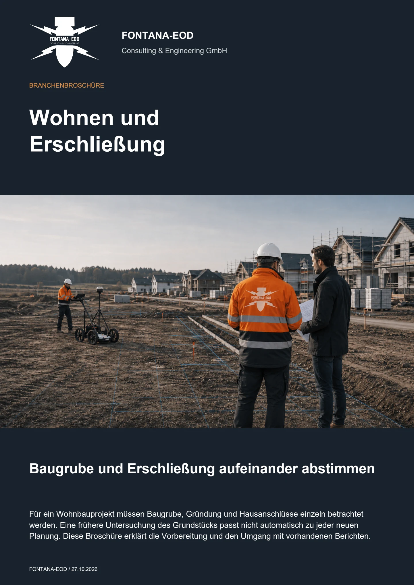
Before the first ground disturbance, existing ordnance assessments are compared with the planned infrastructure works. Whether an investigation is needed, and which type, depends on the suspected ordnance, existing findings and local conditions. This should be clarified before tendering and awarding the civil engineering contract.
Important documents include the development plan, site plan and its geographical extent, construction sections, route plans, proposed depths, sewer and utility information, survey data, ground investigation reports, existing aerial photograph assessments, historical records and requirements from procurement or site management. Official information and conditions are supplied with their dates, complete attachments and geographical extent.
Not necessarily. The first deep ground disturbances often occur in roads, sewer routes, manholes, utility services or drainage facilities. Future house plots are assessed separately according to the project objectives, planned ground disturbance and required evidence.
Depending on the area, surface, interfering objects and depth, methods may include historical aerial photograph assessment, ground-penetrating radar, magnetometry, TDEM, deep investigation, borehole investigation or excavation supervision. Methods are combined or used for separate tasks according to the project. Findings are limited to the areas and depths actually investigated and the survey data that can be evaluated. Routes and plots affected by interference or still inaccessible remain recorded as outstanding until technically assessed.
Investigation areas are coordinated with construction sections, routes, restricted areas, access points and time windows. This makes clear which sections have been investigated and which areas still need separate consideration for later phases. For service trenches and sewers, the records include route positions, design depths, manholes, excavations, crossings, existing utilities and available working widths.
If an unexpected suspicious object is found, stop work in the affected area immediately. Do not touch, move or uncover the object further. Leave the immediate area and keep others away without putting yourself at risk. In Germany, notify the police immediately on 110; outside Germany, use the local emergency reporting procedure. The competent authorities determine what happens next. Inform site management and the client; internal reporting must not delay the emergency call.
Typical documentation includes location references, investigated sections, methods used, survey or investigation results, assessment of findings, photographs and recommendations for the subsequent construction sequence. Its scope and format depend on the commissioned work and project phase.
The main factors are site size, route lengths, depth changes, ground conditions, interference, access, construction phases, existing records, required methods and documentation. A quotation needs the planned working areas and commissioned investigation scope.
Precise details of the project location, ground works, depth and construction phase help FONTANA-EOD identify the appropriate next technical step for the housing project.
Address, land parcel, site plan, construction boundary, building footprint, routes and affected sections.
Excavation, basement, foundations, borehole locations, utilities, shafts, infiltration trenches, excavation depth and construction phase.
Aerial photograph analysis, historical plans, utility plans, ground investigation data, sections, requirements and existing reports.
Procurement, site management, project records, communication with buyers, ground investigation or a follow-up decision.
Please send the available documents as fully as possible. An early design can also be assessed if the location, planned ground works, depth, construction phase and required records are clear.
+49 (0) 6843 - 999 499 7
info@fontana-eod.de
Site plan, depth, construction phase, suspicion indicators
Site management, design or project management
Send the site plan and sections showing the planned ground works, depths and corresponding construction phase. Identify existing investigations and the next scheduled date.
The address, land parcel, plan extract and coordinates help identify the investigation area without further enquiries. Larger projects should also identify construction phases, alignments or work area numbers.
Planned depths are essential for the technical assessment. Sections, excavation formation levels, drainage inverts, borehole profiles and foundation depths provide a much stronger basis than a general project description.
An enquiry before ground investigation, before tendering or shortly before excavation starts leads to different next steps. Please state the project stage clearly.
Aerial photograph analysis, geotechnical reports, utility plans, historical plans, existing site records and requirements should be sent together so that individual details are not taken out of context.
Project managers, designers, site managers, civil engineering contractors and the client hold different information. Clear contact arrangements make it easier to coordinate dates and resolve questions.
Before submitting an enquiry, state whether the records are needed for procurement, site management, ground investigation, communication with buyers or a subsequent technical decision.
Whether historical aerial photograph analysis, explosive ordnance surveying, surface surveying using GPR, magnetometry or TDEM, deep-ground surveys, downhole surveys, excavation supervision, area clearance or ordnance recovery is needed depends on the location, ground disturbance, depth, ground and existing documents. An early ordnance assessment provides clarity for tendering, programming, occupational safety and construction.
FONTANA-EOD combines its Section 7 SprengG licence, specialists holding Section 20 SprengG certificates of competence, suitable survey and clearance methods, and traceable documentation. Send the site plan, depth of ground disturbance, construction phase and existing documents for an initial technical assessment.


