Project pathway
The quickest route to the right decision.
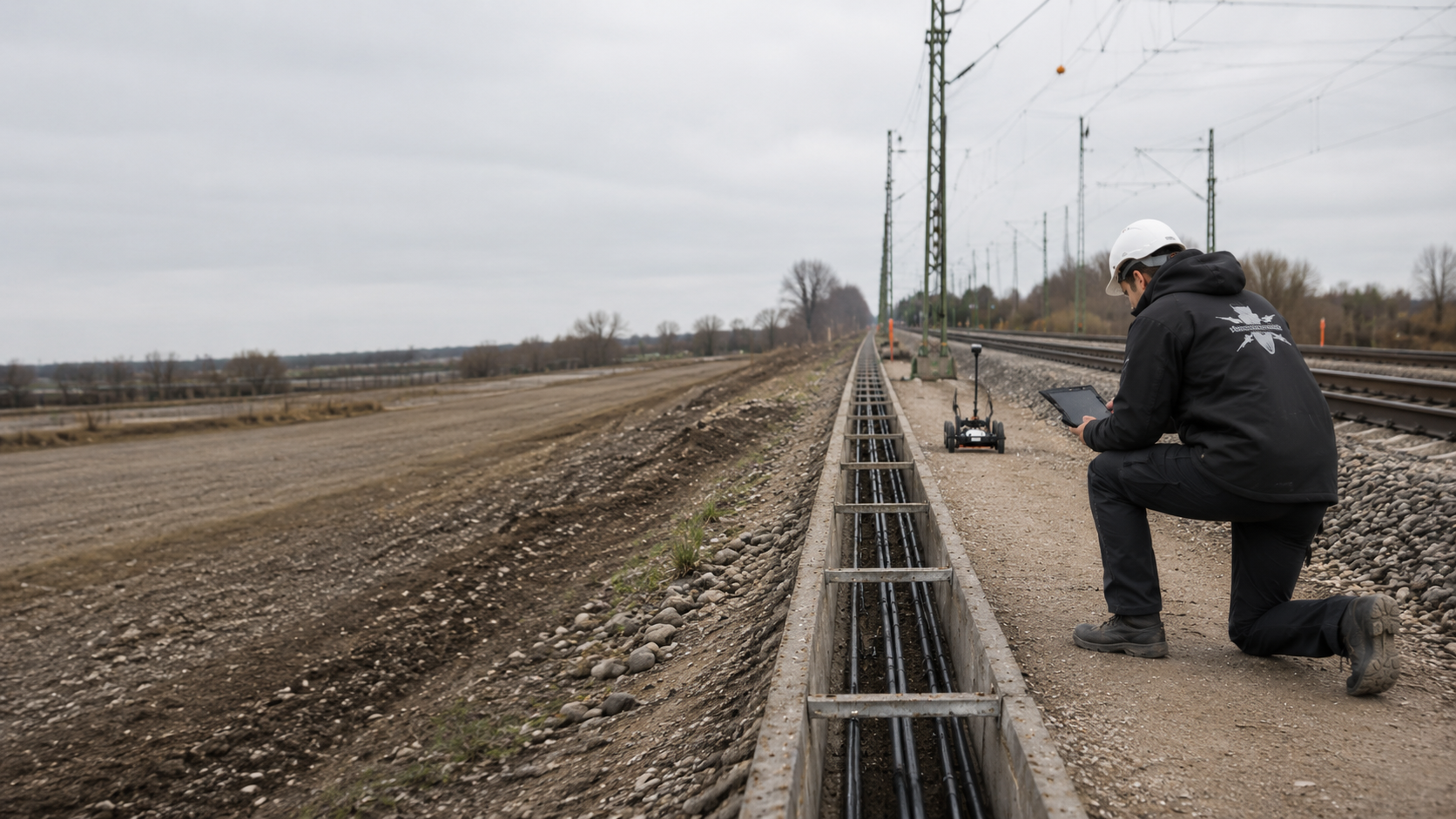
If ground suspected of containing explosive ordnance can only be investigated during demolition or excavation beside a railway line, the site management and earthworks team need an agreed procedure for work under explosive ordnance supervision. FONTANA-EOD reviews the preliminary investigations, excavation geometry and construction sequence. Send us the section plan, excavation depths and existing investigation reports so that we can define the technical survey, excavation layers, protective measures, stop-work criteria and required records.
Specify the section, width and depth.
Agree excavation layers and hold points.
Document the areas covered by supervision.
An explosive ordnance survey during construction may be appropriate where the suspected area only becomes sufficiently accessible during demolition or excavation. The procedure combines a technical survey before soil is removed, a decision by the responsible specialist and a subsequent visual check during excavation. Working layers, protective measures and stop-work criteria are agreed before work starts. The resulting record applies to the section actually investigated and the depth reached.
Work on track 20 in Plattling began with construction-stage assessments during excavation. The report explains the later change of method and distinguishes the individual work phases. View project details.
Construction supervision at Sandbach station is documented for May 2026. View project details.
Service areas:Ordnance specialist supervision of groundworks
The measures used during construction depend on the actual working area. Cable trenches, track formation, platforms, mast foundations and connections to structures have different depths, sources of interference and operational interfaces.

Cable works often take place in narrow corridors alongside the track, with existing cables, earthing systems, signalling equipment and previously disturbed ground. Before work starts, the trench alignment, width, depth and crossings are assessed against the available preliminary investigations.
Sections that cannot be surveyed adequately may be excavated under supervision in stages. The records distinguish chainage, excavation layers, known buried infrastructure and areas still outstanding.
Prepare the cable trench for investigation
Swales, ditches, pipes, chambers and drainage structures extend to different depths, often within slopes or peripheral areas. Existing utilities and changing ground conditions can limit surveys carried out in advance.
The work is divided by alignment, excavation depth, construction section and installation sequence. Connections to structures and deep chambers require their own assessment.
Have the drainage section assessedAs rails, sleepers and ballast are removed, the area of the subsequent earthworks gradually becomes accessible. Track superstructure, metal fixings and technical installations may have affected earlier surveys.
Supervision is coordinated with the removal sequence, accessible excavation base, formation width and subsequent installation works. Exposed areas do not automatically provide evidence for deeper ground or adjacent areas.
Assess formation and track worksPlatform edges, lifts, stairs, canopies, chambers and utility routes create numerous separate excavations and demolition stages. Interference from existing infrastructure and a constrained programme require arrangements for each structural element.
Each excavation section, deep foundation point and area only accessible after demolition receives an appropriate investigation or supervision scope.
Assess the station redevelopment
Masts, signals, gantries and ancillary equipment often require small but deep excavations. Supervision of near-surface excavation does not automatically address the full depth.
The coordinates, foundation dimensions, design depth and installation method are therefore assessed alongside any need for a deep or borehole survey.
Assess deep foundation locationsAreas around abutments, slopes, retaining walls, temporary diversions and utility connections have changing access conditions and numerous existing structures. Earthworks are divided by construction stage and structural area.
Deep piles, retaining works and boreholes remain separate investigation tasks. Supervised excavation covers only the ground actually opened.
Assess the connection to the structureExcavation supervision is not a fixed, unchanging service. Changes in access, drawings, depth, construction stage or findings may alter the next step required.
Rails, utilities, foundations, vehicles or lack of access prevented a complete geophysical investigation. The affected area and the limitations of the method are documented.
Before construction starts, the team defines which areas will be investigated during the earthworks and which deeper or adjacent areas need another approach.
Define a suitable alternative measureRemoving track superstructure, platforms or other structures makes previously inaccessible areas available for survey. The new conditions may allow additional detection work or investigation during construction.
Before the next excavation stage proceeds, the decision is related to the current drawings, depth and working area.
Have the new construction stage assessedA greater depth, a shifted trench alignment or an additional excavation may fall outside the existing evidence. Before work starts, the revised working area is checked against the available investigations.
Only areas actually covered by the investigations can be carried forward. Additional work requires its own scope and documentation.
Check the design change against the available evidenceDocuments, surveying, access, staff, equipment, excavation quantities and decision-making responsibilities must be coordinated before work starts. Unclear responsibilities or undefined hold points put the construction sequence at risk.
The available possession window is matched to a technically realistic plan for work sections and excavation layers.
Coordinate the possession window and work sequenceThe responsible specialist assesses any new anomaly before further soil is removed. If an item suspected of being ammunition is found, work stops immediately. The item must not be touched or exposed further, and the agreed local reporting procedure is followed.
The position, excavation depth and construction stage are documented and passed to the responsible project and specialist teams.
Clarify the findings and handover processThe handover must show which excavation layers were supervised, which areas were reached and which remain outstanding. A general daily report is insufficient.
The section plan, records, deviations and follow-up measures are brought together to provide a verifiable account of the work completed.
Prepare the handover of a subareaEvery measure carried out during construction needs a clearly defined project question. The working area is described by the suspected risk, section, depth, construction stage and required findings, rather than by machinery or daily output alone.
The conclusions apply only to the area actually supervised. They do not replace investigations outside that geometry.
Initial conditions: Historical evidence concerns the construction section, while track superstructure and technical installations limit an area-wide assessment.
Next step: Areas accessible for preliminary survey are investigated separately. A planned procedure during construction is defined for the remaining areas.
Documentation objective: The report distinguishes areas and depths surveyed in advance, covered by supervision and still outstanding.
Define the geographical extent of the suspected riskInitial conditions: The trench follows an infrastructure corridor where the available utility information varies.
Next step: Utility information, staged excavation planning and defined inspection points are coordinated.
Documentation objective: Chainage, depth, excavation layers and limitations remain traceable for each trench section.
Define the trench sections and required recordsInitial conditions: The area of the subsequent earthworks only becomes accessible after the rails, sleepers and ballast have been removed.
Next step: The exposed construction stage is assessed. Suitable surveys and supervised excavation stages are planned separately.
Documentation objective: The formation, peripheral areas, deeper ground disturbance and untreated sections each have a clearly stated status.
Assess formation investigations within the track worksInitial conditions: Near-surface excavation and deeper foundation ground overlap, while existing structures and utilities make investigation more difficult.
Next step: Supervised excavation layers and point-specific deep surveys are coordinated against the same structural geometry.
Documentation objective: For each depth, the records show which method was used to investigate the working area.
Define the foundation location and depthInitial conditions: Vehicles, materials, railway operations or an unexpected construction stage prevent the planned work.
Next step: The section is not simply omitted. Its position is recorded and the work is rescheduled or an alternative method is defined.
Documentation objective: The project records clearly identify the area that was not reached and the measures still required.
Replan the section that could not be accessedInitial conditions: An anomaly encountered during the earthworks cannot safely be classified as an ordinary object causing interference.
Next step: If an item suspected of being ammunition is found, work stops immediately. The item must not be touched. The competent authorities are involved through the local reporting procedure.
Documentation objective: The find location, work conditions, handover and decision on resuming work are recorded.
Clarify the response to a find and the next stepsThe excavation geometry, working methods, observations, stoppages and decisions on follow-up work must be documented clearly enough to support further construction planning.
The records must also be understandable to people who were not present during the fieldwork.
Each completed layer requires records of the technical survey, the responsible specialist's decision and the subsequent soil removal. Equipment, survey range, anomalies and inspection scope remain linked to the section and depth.
The railway line, track, chainage, construction section, working width and excavation depth define the area concerned. Changes during the works are recorded with their date and drawing revision.
The documentation must make clear whether the evidence applies to a cable trench, a formation area, an excavation or an area beside a structure.
Historical assessments, information from authorities, previous surveys, known finds and existing limitations are carried forward with their stated scope.
Areas surveyed in advance, areas with limited survey results and inaccessible areas remain separate. This prevents the scope of supervision from being extended beyond the circumstances that justified it.
Excavation layers, machinery, direction of work, checks at the excavation base and intermediate levels, material movements, exclusion areas, hold points and channels for issuing instructions are defined before work starts.
Where several trades are involved, the plan specifies when a section can be handed over, excavated further or reassessed because of a deviation.
The records capture the period, section, depth reached, construction stage, equipment used, observations, stoppages and status of outstanding areas.
Records are organised by location as well as date so that the project file clearly identifies the ground actually investigated.
Anomalous structures, technical objects causing interference and confirmed finds are distinguished by the specialists. Each position, depth, excavation stage and measure taken receives a unique identifier.
Handover to those responsible for the project or to the competent authorities is documented without anticipating an official decision.
The final documentation brings together the supervised sections, depths reached, deviations, outstanding areas, additional investigations and follow-up measures in a consistent set of drawings and reports.
Where clearance work has actually been carried out, the relevant clearance records are included with their locations and depths. The conclusions apply to the documented scope of work and must be checked again against any subsequent deeper excavation or design change.
The project file links the current documents, excavation planning, fieldwork, anomalies and final decision. Daily records can therefore be traced to the sections and depths actually investigated.
For long routes, the records can be organised by construction section and handover date.
Site and construction-phase plans, historical UXO records, utility and existing-structure information, previous survey reports and current excavation plans are registered with their revision status.
Conflicting information and missing attachments are identified before work starts, with responsibility assigned for resolving them.
Each working section receives an identifier linked to its chainage, width, design and actual depth, construction stage and date of work.
The register links field records, drawings, photographs and any findings without presenting outstanding areas as complete.
The excavation sequence, equipment, inspection points, stoppages, instructions and changes are recorded as work proceeds.
Changes in soil layers, existing installations or unexpected obstructions are recorded together with any resulting changes to the work sequence.
Each relevant anomaly is recorded with its position, depth, description, investigation status and a traceable decision on follow-up work.
Confirmed finds and handovers are recorded separately from survey indications or visual observations that have not been confirmed.
Inaccessible areas, design changes, depths not reached and interrupted sections remain visible in the project file.
Each outstanding item identifies whether further detection work, a deep survey, exposure or renewed supervision is planned.
Section plans, field records, status lists and the specialist conclusions are handed over to site management and the client and retained in the project file. Where clearance work has actually been carried out, the corresponding clearance records are included.
For projects with several phases, the file can be updated without overwriting earlier work records.
The sequence depends on the construction phase, access and the findings that can actually be obtained. Thorough preparation reduces the need for decisions under time pressure during a track possession.
Each step establishes a traceable status for the next operation.
The railway line, track, chainage, construction phase, working width, design depth and required findings are taken from the current drawings.
Additional excavations, crossings and deep ground disturbance are identified at this stage as separate investigation geometries.
Historical records, utility plans, previous surveys and known limitations are assessed against the current working area.
The review defines which areas can be investigated in advance and where supervision during construction is justified.
Excavation layers, machinery, material movements, inspection points, exclusion areas, channels for issuing instructions and handovers to subsequent trades are defined.
Railway operating requirements and short working windows are checked against the section of work that can realistically be completed.
Section boundaries, chainage, design depths, utilities, access routes and areas that cannot be investigated are clearly identified on site and in the documents.
Staff, equipment, communication arrangements and documentation are ready before work begins.
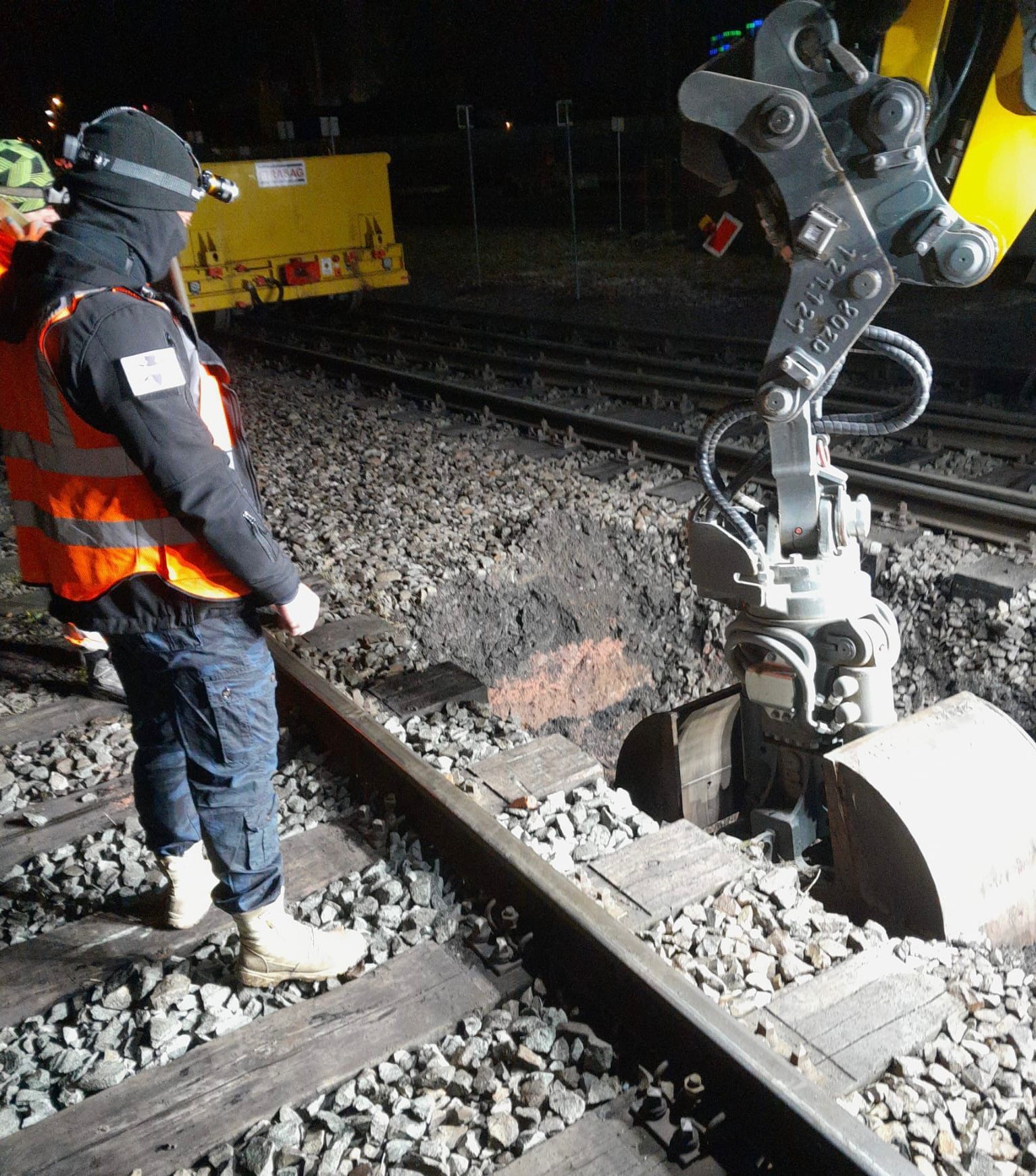
The working layer is surveyed with suitable detectors before soil is removed. Following the specialist's decision for that section, the soil is excavated in layers with additional visual checks. This sequence is repeated down to the planned excavation base. Position, depth, equipment changes, unexpected ground conditions and areas that cannot be checked adequately are documented.
Areas that could not be reached or checked adequately remain clearly marked as outstanding.
Observations are not prematurely classified as either unexploded ordnance or harmless scrap. Position, depth, construction stage and possible technical causes are recorded.
If a suspected item is found, the agreed stop-work and reporting procedure applies.
Supervised layers, outstanding areas, deviations and required follow-up measures are reviewed together before the next construction or installation stage.
The handover applies only to the specifically documented area.
Reports, drawings, records and status lists are filed with the current design and construction status.
Subsequent deeper excavation, changes in alignment and additional excavations are checked against the scope already investigated.
The quality of supervision during construction depends on describing the ground volume in three dimensions rather than simply recording daily output.
The section, width, position, depth, construction stage and connection to deeper points determine the conclusions that can be drawn on completion.
The construction drawings identify cable or drainage alignments, excavations, slopes, working areas and subsequent installations. For each area, the team defines whether a preliminary survey, investigation during construction or a separate deep investigation is required.
Excavation layers are described so that their position and depth remain traceable. The actual ground movements matter, not just the design geometry in the specification. Widened excavations, over-excavated edges and temporary working areas are included wherever the ground is disturbed.
Where existing infrastructure has limited access, the first accessible excavation base may allow another survey. This intermediate investigation is planned as a separate work and decision stage. It does not automatically replace supervision of the ground above or below it.
Deep piles, masts, sheet piles and boreholes are treated as separate point or linear investigation areas. Supervised open excavation must not be used as evidence for installation work extending deeper.
For anomalies, the stop-work area, reporting route and decision on resuming work are agreed in advance. The item must not be moved or dealt with independently. Further action follows the applicable specialist and regional responsibilities.
The sequence is followed for each layer: technical survey, a specialist decision on the next step, then layer-by-layer soil removal with additional visual checks. Newly accessible bases, slopes and excavation faces are checked against the investigation objective. If survey conditions are inadequate, the next step is defined before further soil is removed.
The route is divided into clearly identified working sections with a start, end, track or alignment reference and drawing revision.
Overlaps and interfaces between contract sections are described so that no unintended gaps remain.
Design and actual depths, intermediate and final excavation bases, and ground-level or rail-level references are recorded consistently.
No conclusions can be drawn about depths that were not reached.
Machinery, buckets or attachments, access and material movements are considered in the risk assessment and work arrangements.
The direction of work, machinery movements, material handling and inspection points are coordinated before work starts so that every planned layer can be investigated and the soil then removed under controlled conditions.
Cables, pipes, earthing systems, foundations and track components affect both excavation and any intermediate surveys.
Known installations remain visible in the drawings and are distinguished from unresolved anomalies.
After demolition or removal of an excavation layer, a previously screened area may become accessible for survey. A specialist assesses the suitability of the method and the survey objective on site.
The new information is related to the next excavation stage and the required depth.
A hold point may be triggered by a design deviation, inadequate investigation quality, an anomalous finding or a change in construction method.
Work resumes only after a documented decision on additional investigation, exposure, recovery or an adjustment to the construction sequence.

Supervision of railway excavation becomes relevant when the ground suspected of containing explosive ordnance only becomes accessible during demolition or earthworks and detection methods used in advance cannot provide reliable, complete findings there. It is not a general substitute for preliminary investigation where this is technically possible.
Assess suitable investigation methodsBefore work starts, the basis for suspicion, clearance or investigation objective, excavation section, depth, machinery, ground conditions, existing utilities and railway operating constraints are considered together. These establish a working method with defined layers, inspection points, stop-work criteria, channels for issuing instructions and records.
Agree the supervision required during constructionHistorical assessment, geophysical survey, deep investigation, investigation during construction, clearance and recovery are not interchangeable. Their combination depends on the geometry of the particular project.
Assesses whether historical evidence supports suspicion in particular route sections and identifies information that is still missing.
It does not detect objects currently in the ground and does not replace either a technical survey or investigation during construction.
Investigates accessible areas with a suitable geophysical method before earthworks begin.
Rails, utilities, reinforcement and existing structures may limit interpretation. These limitations must be documented by area.
Investigates defined locations, alignments and depths for piles, masts, retaining works or boreholes.
It addresses a different geometry from open excavation and therefore requires separate evidence.
Investigates a clearly defined earthworks area by layer and section where that area only becomes accessible during construction.
Passive observation without a planned method and quality assurance is not equivalent.
Address defined suspected targets or contaminated areas against an agreed clearance objective.
These may be needed before excavation or alongside it where the suspected risk and findings require a systematic investigation.
Concerns specialist work on confirmed finds within the permitted scope of activities and responsibilities.
The find location, protective measures, handover and subsequent decisions are recorded separately from general excavation supervision.
Magnetometry detects magnetic anomalies, particularly those caused by ferromagnetic objects. In suitable unobstructed areas, the results can be used to produce a georeferenced anomaly map.
Rails, reinforcement, foundations, vehicles and other masses of iron can mask the signals. The survey area, interference zones and limitations are documented in relation to the planned ground disturbance.
TDEM measures time-dependent electromagnetic responses from conductive objects and can provide additional investigation of selected areas or anomalies.
Existing installations, utilities, reinforcement, target size, depth and survey geometry limit interpretation. The results identify assessed anomalies; they do not establish the identity of an object.
Ground-penetrating radar records contrasts in subsurface reflections. Layers, buried installations and structural changes can provide additional information for excavations and demolition areas.
Moisture, soil conductivity and heterogeneous fill limit penetration and interpretation. Radargrams and location plans show structures and outstanding areas. A reflection does not identify unexploded ordnance.
The tasks, limits of the service and responsibilities are defined for each section. The documentation records the actual progress of the works.
Time pressure and operating constraints do not change the minimum technical requirements for work arrangements and documentation.
FONTANA-EOD first assesses which preliminary investigations are possible and necessary. Procedures during construction are developed only for areas that could not be investigated adequately in their existing condition or that only become accessible during demolition.
The commissioned scope is related to the railway line, chainage, excavation geometry, construction phases and actual ground movements. The status of each section can therefore be updated across several possession windows and changes of trade.
Changes to drawings, depth, equipment, ground conditions and access are recorded as they occur. A deviation requires a specialist decision; it does not silently extend the scope of the existing evidence.
Anomalies are reported with accurate locations and dealt with through the agreed reporting procedure. Site management coordinates the trades, the responsible specialist directs the explosive ordnance work, and the competent authorities decide on any official measures concerning finds.
The final report describes the work completed and its remaining limits. It does not provide a general statement about areas that have not been investigated or have subsequently changed.
The section, excavation depth, construction stage and required project decision are defined before work starts.
Technically feasible investigations capable of providing useful findings are carried out before the earthworks.
Everyone involved understands the layers, hold points, channels for issuing instructions and handovers.
Changes are checked against the existing evidence and reassessed by the specialists.
Anomalies are handed over through the agreed procedure rather than dealt with on an improvised basis.
The report and drawings identify the area actually supervised and the work still outstanding.
Along railway lines, rails, sleepers, cables, earthing systems, masts, foundations, ballast, demolition stages and short possession windows affect how the work can be carried out. The measures are planned for specific georeferenced working areas with a defined width, depth and construction phase.
If an anomaly arises during excavation, the affected area is taken out of the work sequence in a controlled manner. Further action follows the agreed reporting and decision-making procedure. The documentation remains limited to the section actually supervised and the depth reached.
Supervision of railway excavation brings together the developer's responsibilities, design, site management, qualified specialist services and public authorities. Clear roles prevent conflicting instructions within a short working window.
Railway operating permission to work, the specialist assessment of section status and official decisions on finds remain separate processes.
Define the construction section, project objective, required findings and programme priorities. They provide the available UXO records, drawings and existing-structure information and commission the necessary specialist services.
Where several contracts are involved, they establish consistent section identifiers and handover procedures.
Translate the proposed works into excavation geometries, depths, construction phases, utility corridors and deeper ground disturbance. They assess which areas can be surveyed in advance and which can only be investigated during construction.
Design changes are communicated in enough detail to assess their effect on the work already completed.
Manage machinery, staff, working areas, briefings, the excavation sequence and hold points. Deviations are reported to the specialists before the next stage of earthworks.
Site management remains responsible for the overall construction sequence and coordination of the trades.
Assesses the suspected risk and preliminary investigations, develops the agreed procedure during construction, supervises the commissioned sections and documents the findings and limitations.
The work is carried out within the qualifications and responsibilities required for the particular activities.
Make the decisions required for the specialist work within the scope of their competence and appointment. They direct stoppages, reporting of findings and specialist follow-up measures.
Their role is clearly communicated to site management and contractors before work starts.
In Germany, the federal states' explosive ordnance disposal services and the competent local authorities undertake hazard-response and find-handling tasks. Their involvement is clarified for the federal state, project location and circumstances of the find. Outside Germany, the relevant local responsibilities apply.
Contacts and reporting routes are established for the specific project location before work starts.
Depending on local procedures and the construction task, the public order authority and building control authority may be involved. Their requirements are assigned to the specific site, section and drawing revision. The specialist investigation, railway operating permission to work and official decisions on finds are documented separately with their respective contacts.
The requirements depend on the actual activity, suspected risk, project location, working method and site arrangements. A general description such as excavation supervision does not replace a risk assessment or specialist planning.
In Germany, § 7 SprengG concerns the commercial authorisation for activities requiring authorisation; § 20 SprengG concerns the certificate of competence of responsible persons. Under § 1b SprengG, searching for found munitions also counts as handling them. The requirements applicable to the project depend on the activity actually commissioned.
The risk assessment brings together the suspected risk, excavation method, machinery, ground movements, staff, protective areas, briefings, emergency arrangements and reporting routes. It addresses the actual railway and construction-site operations.
DGUV Information 201-027 supports risk assessment for explosive ordnance clearance work. The Baufachliche Richtlinien Kampfmittelräumung set out requirements for clearance concepts, working methods, quality and documentation within their defined federal scope. Their application to the particular railway project is clarified separately. Investigation during construction is assessed where suitable preliminary methods cannot investigate the working area adequately.
Simply watching an excavator, without a clear clearance or investigation task, a defined method or verifiable records, is not equivalent to a professionally planned measure.
If an unexpected suspected item is found, work in the affected area stops immediately. The item must not be touched or exposed further. Leave the immediate area and warn others without putting yourself at risk. In Germany, notify the police immediately on 110; outside Germany, use the local emergency reporting procedure. Site management is then informed.
The First Ordinance to the German Explosives Act (1. SprengV) includes requirements for specialist competence and officially recognised training courses. When supervision of railway excavation is commissioned, the qualifications of the responsible personnel are checked against the actual activities planned.
DGUV Rule 113-003 concerns the dismantling or destruction of explosives or corresponding objects and also includes the disposal of found munitions. It applies according to this field of activity; it does not replace a risk assessment specific to the planned ground intervention.
The basis for suspicion, excavation area, intended completion status and limitations of the methods are clearly defined before work starts.
Machinery, excavation sequence, staff, protective areas, communication and responses to deviations are defined for the particular project.
The responsible personnel, their competence, appointment and specific decision-making authority must match the scope of activities.
Supervised layers, outstanding areas, anomalies and follow-up measures remain traceable by location.
The specification distinguishes preliminary surveying, investigation during construction, possible additional services and the records to be delivered.
Provisional items have clearly defined technical triggers.
The drawing revision, access, excavation layers, equipment, briefings, hold points, reporting routes and responsibilities are coordinated with everyone involved.
Unresolved prerequisites are not left until the possession window is under way.
The affected area is secured and work is stopped in accordance with the agreed procedure.
Further action depends on the specialist assessment and the applicable regional responsibilities.
Drawings and records show which excavation areas have been investigated and the decision in place for the next stage of work.

The railway line, track, chainage, trench or formation width, design depths and construction phases share a common geographical reference.
The drawing also shows intermediate and final excavation bases, excavations, crossings and inaccessible areas.
Define section and depth references
Historical evidence, existing survey coverage, interference zones and outstanding areas are related to the current excavation area.
This makes clear why supervision during construction is planned only for certain sections.
Clarify the basis for suspicionThe excavation sequence, inspection points, stop-work criteria, channels for issuing instructions and handovers to subsequent trades are defined before work starts.
The plan provides a shared basis for site management and the responsible specialist.
Prepare the work sequence under UXO supervisionDepths reached, construction stage, equipment, observations, deviations and stoppages are recorded with their locations.
Records from several working days can therefore be combined into a complete status for each section.
Agree the record and data structureAnomalous structures, technical objects causing interference and confirmed finds receive separate identifiers and investigation statuses.
The project file therefore remains technically traceable without overstating an unconfirmed observation.
Document findings and investigation statusSupervised layers, outstanding areas, additional investigations and follow-up measures are brought together for site management and subsequent trades.
The status applies to the documented construction stage and drawing revision.
Have the project file reviewed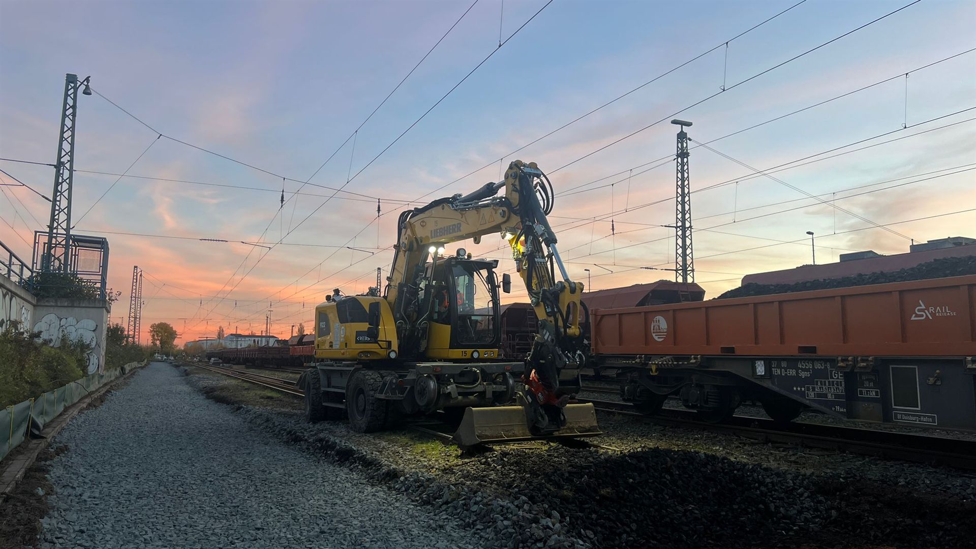
Consider the full railway project, including track works, crossings, traction power, structures and other specialist tasks.
Consider the railway project as a wholeExplore the prerequisites, work arrangements, documentation and limits of the general service.
Clarify the scope of workUse the available evidence to define suspected sections and priorities before earthworks begin.
Assess historical evidence of suspected ordnancePrepare deep mast, pile, retaining-wall and borehole locations with their own investigation geometry.
Assess deep ground disturbance
Clarify confirmed finds, specialist work and regional handover arrangements for the particular project.
Clarify reporting and recovery arrangementsExplore specifications, clearance concepts, status records, quality assurance and final documentation.
Prepare tendering and documentation
Account for the project location, federal state and regional contacts when addressing finds and procedural questions.
Understand regional responsibilitiesHave the site plan, excavation geometry, construction timings, preliminary investigations and required decision assessed.
Request an assessment of the excavation sectionProvide the project location, railway line, track and chainage together with the current site plan. Mark the planned excavation areas, design depths and temporary access routes. Existing requirements and investigation results are assigned to the relevant sections; neighbouring areas are not silently included.
Before work resumes, check that the documented location and depth actually cover the next excavation stage. The level reference must remain clear after ballast removal or demolition. Deeper or wider excavation requires a new check against the ground already investigated.
Check evidence against the interventionSite management and the next trade need a clear section plan showing investigated areas, outstanding zones and measures still required. Daily records and the final report must use the same section identifiers. Supervision of one area provides no conclusions about adjacent or deeper ground.
Explore the technical principlesTechnical information
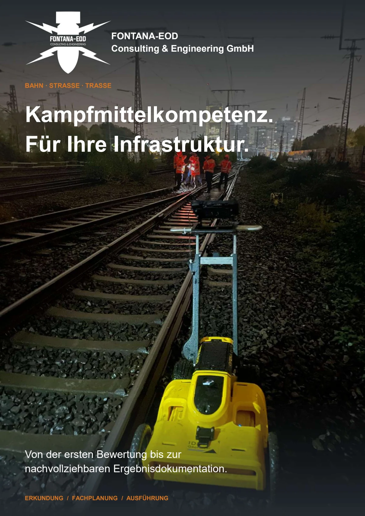
The brochure shows how FONTANA-EOD combines historical investigation, specialist planning, surveying and construction supervision in infrastructure projects. It explains trackside constraints, method selection and limitations, and result documentation.
It may be appropriate where ground suspected of containing explosive ordnance only becomes accessible during demolition or earthworks and preliminary detection was technically incomplete or could not provide adequate results. Before work starts, the basis for suspicion, excavation geometry, clearance objective, construction sequence, equipment, hold points, responsibilities and documentation must be defined. Merely observing ongoing excavation does not replace preliminary investigation where this is technically feasible.
Typical examples include cable and drainage trenches, platform or track superstructure removal, formation and slope works, excavations for signals and masts, utility crossings, connections to structures and peripheral areas affected by existing infrastructure. What matters is the ground being opened, the depth of disturbance and the areas that could be investigated reliably in advance, rather than the name of the trade.
The required information includes a current site or route plan identifying the railway line, track, chainage and construction sections; excavation geometry with depths and working widths; utility and existing-structure drawings; demolition and construction phases; historical records of suspected explosive ordnance; existing survey reports; known interference zones; machinery and logistics information; and the records required by site management and for the project file. Information and conditions issued by authorities must be provided in full, with attachments, dates and geographical scope. Competent authorities and enquiry or reporting routes are identified for the specific project location.
The available time is assessed against excavation quantity, section length, work in layers, inspection points and documentation requirements. Access, staff, equipment, surveying, communication and decisions on deviations must be prepared before work starts. A short working window must not lead to larger excavation layers, unresolved design changes or undocumented areas being accepted.
If a suspected item is found, work in the affected area stops immediately. Do not touch, move or examine the item, and do not expose it further. Leave the danger area and keep others away without putting yourself at risk. In Germany, notify the police immediately on 110 and inform site management; outside Germany, follow the local emergency reporting procedure. A survey anomaly with no visible object is assessed by a specialist under the agreed investigation and stop-work procedure. Work resumes in accordance with the necessary specialist and official decisions.
The records describe the initial conditions, sections investigated, excavation layers, period, working method, deviations, anomalies, hold points and follow-up measures. Drawings and records must show which areas were actually supervised and which areas or depths remain outstanding. They provide no further conclusions about ground that was not investigated.
Key factors include route length, the number of construction sections, excavation width and depth, ground and track conditions, utility density, possession windows, equipment and staffing, access, inspection and handover points, surveying, documentation and possible follow-up measures. Several short visits may involve a different level of work from one continuous section.
An initial enquiry does not need to include a complete clearance concept. It should show the ground to be opened, the investigations already available and why the section cannot be fully investigated in advance at its current construction stage.
Incomplete documents can also be submitted. They help identify what still needs to be resolved before tendering or mobilisation.
Provide the railway line, track, chainage, construction section, working width, excavation depth, intermediate and final excavation bases, and planned excavations and crossings.
For work in several phases, indicate which areas will be opened first and when subsequent trades will be involved.
Include historical assessments, official correspondence, previous survey reports, survey plans, known interference zones, utility and existing-structure drawings, and demolition information.
Areas where results could not be interpreted or access was not possible should also be marked on the plans.
Specify possession and working windows, planned equipment, excavation quantities, site management, parallel trades and the date by which a decision is required.
State whether you need a tender basis, work planning, supervision during construction, handover of individual areas or final documentation.
A site plan, chainage, excavation cross-section, maximum depth, construction timings, available UXO and survey records, and information about utilities and demolition stages are often sufficient for an initial assessment.
FONTANA-EOD assesses which preliminary services remain possible, which areas need investigation during construction and how each section should be documented.
Railway line, track, chainage, working width, individual areas and drawing revision.
Layers, design depths, equipment, demolition, intermediate and final excavation bases.
Aerial imagery assessment, survey reports, utilities, interference zones and known findings.
Tendering, work preparation, status of individual areas, site management or final report.
Whether historical aerial photograph analysis, explosive ordnance surveying, surface surveying using GPR, magnetometry or TDEM, deep-ground surveys, downhole surveys, excavation supervision, area clearance or ordnance recovery is needed depends on the location, ground disturbance, depth, ground and existing documents. An early ordnance assessment provides clarity for tendering, programming, occupational safety and construction.
FONTANA-EOD combines its Section 7 SprengG licence, specialists holding Section 20 SprengG certificates of competence, suitable survey and clearance methods, and traceable documentation. Send the site plan, depth of ground disturbance, construction phase and existing documents for an initial technical assessment.


