Project pathway
The quickest route to the right decision.
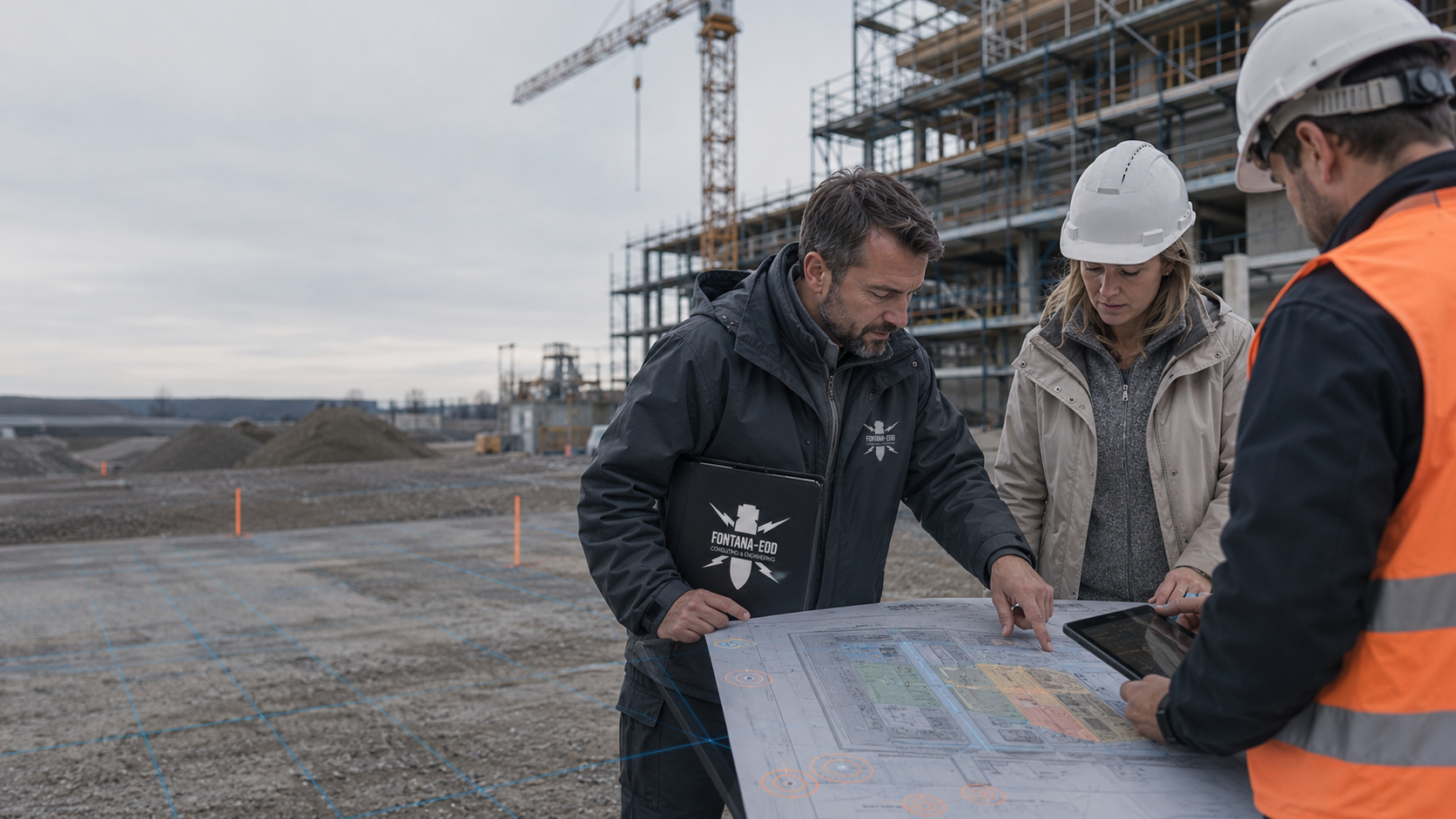
Before earthworks, FONTANA-EOD checks for clients and construction management which planned areas and depths are already covered by explosive ordnance reports. Changed routes, deeper excavation pits and outstanding areas are compared before execution, and additional survey requirements are determined. Send current plans, reference elevations, construction phases and existing reports with appendices to coordinate the next groundworks.
Identify areas and depths before commissioning.
Compare new routes and depths before execution.
Pass on current reports and outstanding areas.
Clarify survey requirements before the executing contractor begins the affected groundworks. This includes selecting the actual construction area, defining intervention depths and changes to the construction sequence. The clearer this information is, the more specifically it can be checked which explosive ordnance documents apply and which task remains outstanding.

Earlier surveys and historical information are compared with the planned ground intervention. Area, depth and current plan version are considered together. The specialist contractor assigns outstanding survey requirements to these areas and depths.
Assign existing findings to the construction area
Hard surfaces, installations and available working areas belong in preparation. Method selection is aligned with the task and conditions. Inaccessible parts remain identifiable on the plan. If site conditions change, additional requirements are clarified before the affected groundworks.
Select methods according to local conditionsAreas that can be surveyed can be coordinated with the forthcoming construction phase. The actual work status is documented and handed over to the project parties. Outstanding parts remain visible. Further construction planning uses the results within their respective spatial scopes.
Document work status and construction phasesNew trenches, deeper excavation or relocated foundations are compared with existing documents. The updated plan reaches the responsible parties before the ground intervention. Additional survey requirements are assigned specifically. Earlier results are retained as a documented work status.
Compare planning changes with existing documentationPrevention begins by asking which ground intervention will take place next. The survey relates to this actual ground volume and the findings needed for it.
Construction access roads, temporary utilities and preparatory ground investigations may already involve ground interventions. They should therefore not be considered only after the later structure has been assessed. Mark on the site plan which preparatory works are intended and the depths they require. For the site establishment date, the survey status needed and outstanding tasks are assigned to these preparatory interventions. Provide that date together with planned activities and existing findings.
The site establishment plan shows the affected working areas and intended sequence. For each preparatory activity, it is clarified whether it uses ground already surveyed or affects additional areas or depths. A temporary utility also includes its connection points; comparison with existing results considers these areas with their own depths. The client can then define the specialist service needed first and coordinate the results date with construction management. If a survey area is still occupied by a structure or use, the conditions in which it should be available by the intended date are described. Changes to these prerequisites are communicated before execution.
Select services for preparatory ground interventionsA project can be surveyed and executed in phases. A clear boundary is then important between the area already worked on and the next area. Construction management must be able to recognise which report belongs to which phase. If the sequence changes, survey assignments are also checked. A result for the first phase may provide relevant information but does not automatically replace specialist consideration of the second.
A handover overview links the phase name, site plan, report version and documented survey scope. If a working volume crosses the boundary between two phases, the corresponding evidence is compared with that volume. The elevation references used and remaining limitations also matter. Where plan versions differ, the geometry underlying each result is clarified. The executing contractor receives the complete corresponding appendices and a clear identification of outstanding areas. If several surveys are staggered, it is clear for the next work step which results are already available and which response is still needed. Surveys intended but not carried out remain identifiable by their work status. The planned scope and results actually documented are distinguished in the handover. This assignment is retained when construction management or a contractor changes.
Coordinate phases and handovers within the project sequenceA relocated route or deeper foundation may change the survey volume previously defined. The revised plan should therefore go not only to the executing contractor but also into specialist explosive ordnance coordination. Existing results are used and the actual deviations assessed. Any supplementary requirement follows from this comparison. A change neither renders all old results unusable as a general rule nor extends their findings.
For the specialist review, the old and new plan versions are provided with the change date. The comparison shows the relocated position, changed depth or newly added ancillary area. Changes to the working volume may also affect the comparison even if the later structure remains unchanged. The specialist planners assign the affected existing results and outstanding tasks to the change. An explanation identifies the area requiring a supplementary survey. The current response is passed on together with the changed plan. If the project later returns to an option discussed earlier, its survey status at that time is compared again with the execution now intended.
Compare planning changes with the survey statusFirst check whether the intended construction area and existing findings are clearly described. If site plans, survey depths or essential appendices are missing, obtaining or supplementing them is agreed. An indefinite statement such as “the site is known” is insufficient for assignment. The planning stage should show which groundworks are actually imminent. This distinguishes a merely missing document from an area not previously surveyed. The distinction avoids commissioning a new survey solely because the records are unclear.
A method is selected according to the survey objective and conditions. Planning should explain traceably which findings it can provide and which areas remain limited. Merely naming a survey describes neither its area, depth nor output format. State known installations, access and working platforms. If the survey requires particular site conditions, these must be coordinated with the construction sequence. Creating those conditions may itself require a separate preliminary specialist review.
Before execution, the report is assigned to the intended ground intervention. This requires not only the concluding assessment but also plan appendices and limitations. The executing contractor should be able to recognise which areas are covered and which task remains outstanding. A verbal statement from an earlier meeting does not replace this assignment. When construction management or the executing contractor changes, the relevant documents are handed over again. Specialist knowledge is thereby retained within the project.
Describe the specific groundworks intended and the findings already available. Have specialists assess outstanding questions before ordering a particular method or general supervision. Clarify whether the proposed method can cover the survey scope needed for the later intervention.
New utility routes, deeper structures or changed working areas may exceed the previous survey scope. Therefore do not consider only the schedule or cost implications of a change. Provide the changed plan to the responsible specialists. Before execution, they check whether the intervention is still covered by existing explosive ordnance documents.
Provide the relevant plans and reports with their applicable limitations for execution. Compare earlier meeting outcomes and overviews with current reports. Outstanding areas must be identified traceably and clarified before the works affected by them.
Show the actual location of the excavation pit, utility route or foundation on the plan. State the planned depth and corresponding elevation reference. Interventions may also be needed outside the later structure, for example for working pits or temporary facilities. If these details are not yet defined, planners should identify the open options. The specialist review can then focus on the current decision rather than assess an undefined overall site indiscriminately.
A report is used together with its corresponding plans and description of the scope executed. Check whether the appendices mentioned in the text are available and readable. For several survey phases, it must remain clear which area was worked on in which phase. A new summary map may help with orientation but does not replace the original documents. Construction management should be able to access the version actually governing the work when questions arise.
Identify changes so that they can be distinguished from the project previously surveyed. These include a new location, different depths and additional working areas. Identify the next work step affected. The specialist response can then relate to this change. An unchanged filename or new plan colour alone does not reliably explain the difference. Also record which earlier findings remain usable and which question needs new clarification.
A site that appears clear may still contain installations or made ground that affect a survey. Planning therefore describes the conditions actually intended. If an area only becomes accessible after preparatory works, their sequence and the explosive ordnance assessment are coordinated. The specific task and available findings are decisive. The handover to execution should identify the survey status reached and clearly delineate areas not yet worked on. Operational permission to use the site must be distinguished from technical findings about the ground volume.
If a utility is relocated because of an obstruction, the new route may lie partly outside the previous survey area. The old and new routes are shown together for the specialist review. Depth and possible new working pits also form part of the comparison. Existing reports remain usable within their scopes. The additional task relates to the actual deviation. Construction management must then be able to recognise which area the new findings cover. Merely updating the schedule or utility length does not answer the explosive ordnance question for the changed intervention.
Define where new plans and questions about the explosive ordnance task are sent. The current plan is needed for comparison with existing reports; the original tender may now be outdated. Also state which ground intervention is intended next. The survey still needed is clarified for that area. Existing historical findings and aerial photograph assessments are considered with their respective spatial references. If historical questions remain open, supplementary records of site use are researched and suitable wartime aerial photographs are assessed where available. The findings and limits of the assessment are assigned to the ground intervention now planned.
Distinguish documented surveyed areas from outstanding zones or those with limited interpretability. The handover must remain related to the intended intervention. Work in another phase does not allow indiscriminate transfer of findings, even where construction activities are linked in time or organisation.
Additional survey requirements are derived from comparing the intervention plan with existing results. Area, depth, ground composition, utilities and metallic interference also determine the suitability of methods. The measurement grid and borehole points where applicable are aligned with the ground volume required. Access and surveys before preparatory ground interventions are clarified before those interventions are executed.
The commissioned survey takes place in the agreed work section. Measurement data and findings receive location, elevation and depth references and are assigned to the current plan version. Restricted measurement conditions or inaccessible subareas are documented for assessment and the next construction phase.
The specialist contractor assesses measurement data and findings and documents the evidenced conclusions for the intended intervention. Outstanding areas and required follow-up measures remain assigned to the section concerned. Where explosive ordnance is recovered, the clearance record states its location, depth and the result. The report and appendices are handed to construction management before the respective subsequent works affected.
If actual conditions differ from the plan, the original findings must not be extended without checking. Arrange the necessary specialist clarification before the affected intervention. The responsible specialists check which results can continue to be used and what additions are required.
Selecting a survey depends on factors including the survey objective and local conditions. Existing installations, ground conditions and accessibility may limit the findings. These conditions are considered during method selection and areas that cannot be adequately surveyed are identified. The same measure is not automatically suitable for every construction task.
For ordnance surveying during construction each working level is technically surveyed and assessed before controlled layer-by-layer excavation. Supplementary visual inspection supports the method. Work sections, the stop signal, authority to issue instructions, reporting procedures and documentation are agreed before work begins; the steps are repeated down to the agreed excavation base. The base, walls and slopes are included in the necessary follow-up surveys.
Explosive ordnance, ground conditions, existing utilities or hazardous substances may place different requirements on the same construction activity. Coordinate results and measures with the respective responsible specialists. The responsible specialist planners carry out the further technical checks; the employer takes the required findings and measures into account in the risk assessment.
Historical information helps assess possible grounds for suspicion. It relates to the specific construction area and is considered together with existing surveys. General knowledge of local history does not determine a particular measurement method. Nor does a missing document equate to evidence of explosive ordnance contamination. For construction preparation, the findings available and the next step that follows on technical grounds are described.
An advance survey is planned where it is technically suitable for the task and feasible under local conditions. Ground, surface composition, metallic installations and accessibility belong in this check. The result must be relatable to the later intervention. A general area survey without identifiable depth and interpretive limits would be only of limited use for the specific construction decision. Magnetometry records magnetic anomalies; TDEM records time-dependent electromagnetic responses from electrically conductive bodies. Under suitable ground conditions, ground-penetrating radar can provide additional information about structures and strata boundaries. Highly conductive soils may limit its range. Measurement coverage and existing interference are recorded for evaluation.
Surveying alongside construction is selected where it is technically appropriate for the forthcoming excavation and local conditions. Planning identifies the technical surveys, excavation layers and required follow-up surveys. The sequence of execution and surveying is coordinated. Changed conditions are reported back to the responsible specialists. Visual inspection supplements the technical survey.
For a deeper ground intervention, a check is made whether a supplementary deep-ground or downhole survey is suitable. Starting elevation, structural path and final depth are compared with the survey volume required. The measurement grid, borehole points and surveys required before drilling follow the task and local conditions.
FONTANA-EOD undertakes the agreed explosive ordnance assessment and documents its actual scope. For construction preparation, what matters is that the technical findings fit the planned areas and depths. Existing findings, current plans and survey conditions are considered together for this purpose.
A clear handover should help construction management use the result correctly. It identifies the area worked on and significant limits. The handover remains assigned to this documented ground volume. If the plan changes, this assignment can be used to check specifically what addition is necessary.
A designated contact helps information flow. New plans and technical questions should not remain in separate meeting notes. Assign a response to the relevant plan version and work step. It can then be traced later which findings were available for the decision and which area was considered for the next execution step.
The question and affected area are defined before work begins.
The reports and planning versions used remain traceable.
The answer identifies its scope and the specialist questions still unresolved.
They describe the construction project and provide the available baseline information. Changes to ground interventions are passed on for specialist comparison. Where several specialist planners are involved, the information relevant to the same ground volume is brought together.
The specialist contractor checks the agreed task and carries out the commissioned surveys within the defined scope. It documents results and limits. Changes to the construction plan are compared with this survey scope and documented for the affected ground intervention.
In Germany, the federal states’ ordnance disposal services and competent local authorities undertake hazard-response and find-handling tasks. Their involvement and the roles of public order authorities and, where relevant, building control are clarified for the project location. Outside Germany, the relevant local responsibilities apply. Contacts, conditions and reporting routes are assigned to the site and construction section concerned.
They need current documents for the actual work section. If deviations arise, the agreed specialist coordination is arranged. Their own responsibilities for safe work organisation and the responsibilities of other specialist disciplines remain in place.
For the preparation and execution of explosive ordnance work in Germany, authorisation, personal qualifications and responsibility under the German Explosives Act are related to the specific activity. The 1. SprengV additionally regulates matters including specialist knowledge. Which corresponding evidence belongs to the assignment is clarified with the responsible parties before execution. § 7 SprengG concerns commercial authorisation for activities requiring a permit; § 20 SprengG concerns the certificate of competence held by responsible persons. Under § 1b SprengG, searching for ordnance also counts as handling.
When preparing actual work, DGUV Information 201-027 supports risk assessment and the selection of protective measures for ordnance clearance. DGUV Rule 113-003 addresses dismantling or destroying explosives or corresponding objects and disposing of found munitions, and is considered for applicable activities.
The BFR KMR provide technical foundations for investigation, planning and documentation. Their binding scope covers the federal properties specified there; application to other projects is agreed with the responsible parties. Site-specific authority requirements remain decisive.
If a possible ordnance item is found, stop work at the find location immediately. Do not touch, move or uncover it further. Leave the immediate area, keep your distance and keep others away without putting yourself at risk. In Germany, call the police immediately on 110; outside Germany, use the local emergency procedure. Further hazard response and involvement of the responsible ordnance disposal service follow local procedures and official instructions.
Explosive ordnance is one possible specialist question during groundworks. Utilities, ground conditions, hazardous substances and operational conditions may create additional requirements. The responsible specialists contribute their findings to planning. Further assessments remain assigned to their respective specialist tasks and are brought together with the explosive ordnance report.
The client, construction management and explosive ordnance specialist contractor agree contacts, availability and the stop signal before the affected groundworks. Workers receive the intended instructions for responding to finds. A find is reported through the local emergency reporting procedure; internal coordination must not delay it.
To compare planning and execution, the areas considered must be clearly identified. The site plan, point designation and corresponding report are brought together; a ground marking alone does not establish the survey scope.
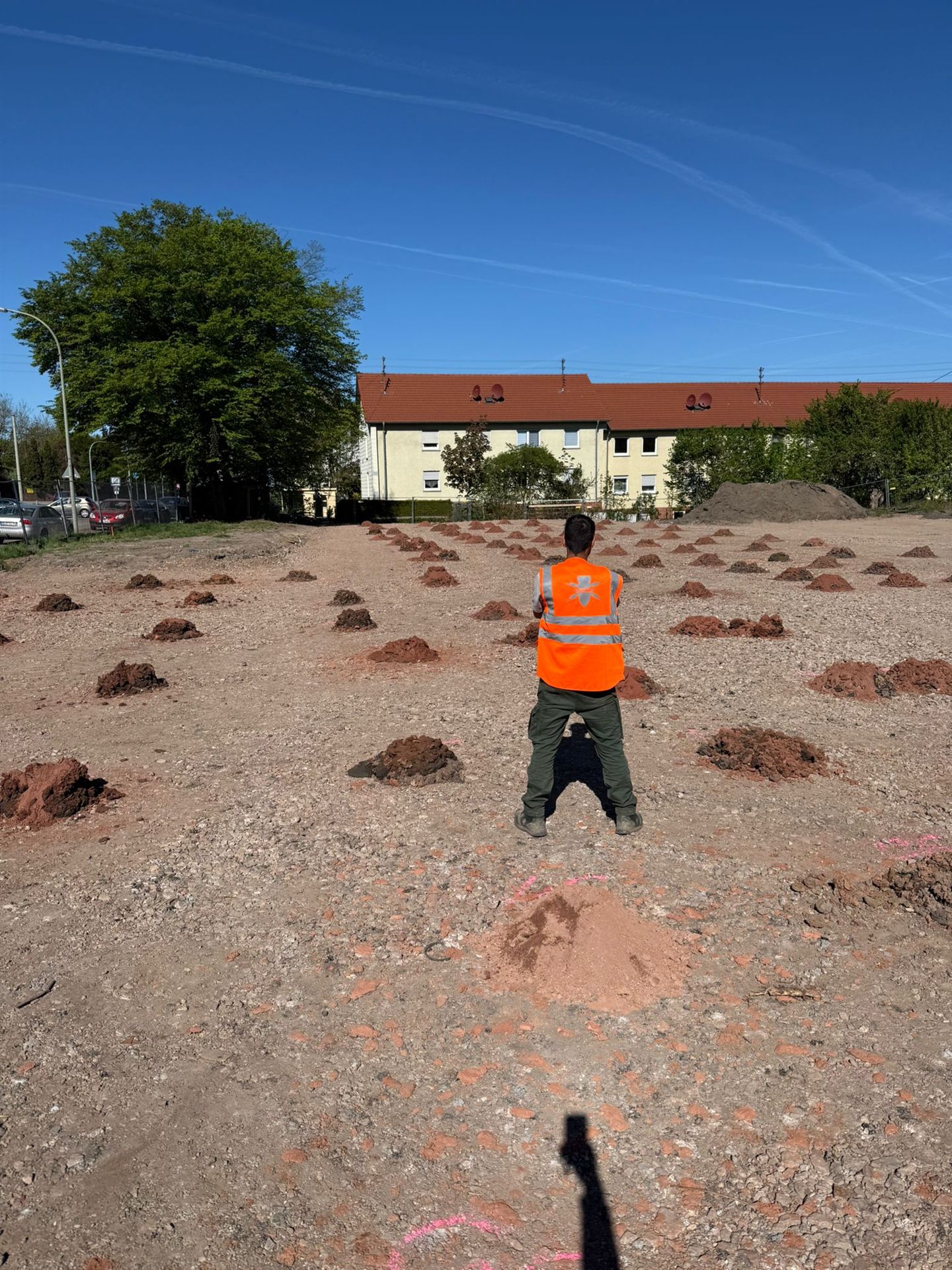
A person wearing an orange high-visibility vest on open ground with small soil heaps and pink markings; residential buildings stand in the background. For the enquiry, the location and intended intervention depths are described together.
Describe groundworks for the enquiry
Record which findings were available when a decision was made and which survey scope was agreed. A clear assignment of report, plan version and work section helps with later questions. This assignment keeps the actual survey results available with their spatial and methodological conditions.
FONTANA-EOD documents surveyed areas, results and outstanding questions for clients and those responsible for risk. Construction management and the responsible specialist planners take outstanding surveys and further protective measures into account for subsequent groundworks. Insurance questions are assessed by the parties responsible for them according to the respective contract.
Technical sources: BFR KMR: clearance planning with a clearance concept – introduction · BFR KMR: geophysics · BFR KMR: documentation · § 4 ArbSchG: general principles · § 5 ArbSchG: risk assessment · § 8 ArbSchG: cooperation between employers · BFR KMR: explosive ordnance clearance alongside construction
The Baufachliche Richtlinien Kampfmittelräumung contain requirements for investigation, assessment, planning and documentation within their defined federal remit. Their application to the specific project, together with locally applicable requirements and responsibilities, is clarified for each project.
Send the current site plan, intended depths and available explosive ordnance reports. Add construction phases and known restrictions. FONTANA-EOD can align the specialist task accordingly and identify the next coordination steps needed.
Before each section, existing results and forthcoming groundworks are brought together. Outstanding areas and conditions remain identifiable. Changes are coordinated with the responsible parties. The documentation shows the status on which further planning relies.
The report and plan appendices are handed over together to the responsible recipients. The next works are compared with them. Additional ground interventions retain their own specialist assignment. A clear handover supports preparation without extending the agreed survey scope.

State the location, affected area and contact in construction management. Add details of current access. The regional overview helps with orientation. The type and spatial scope of the groundworks remain decisive for specialist planning.
The project organisation provides existing reports and relevant plan versions. Information about other phases remains distinguishable. The responsible parties clarify outstanding requirements. The explosive ordnance task can then be placed within the specific preparation of the construction phase.
In Germany, the Occupational Safety and Health Act requires employers to assess working conditions and take account of the state of the art. Where employees of several employers work at one workplace, § 8 ArbSchG requires the employers to cooperate. Results of the explosive ordnance survey feed into the necessary risk assessment and coordination of protective measures together with other specialist information.
The explosive ordnance specialist contractor provides the agreed specialist contribution. Other planning, execution and occupational safety organisation tasks remain with the parties responsible for them. The project organisation brings the information needed together. Results are passed on within their actual scope.
Explore results and terminologyThe documented area is compared with the subsequent groundworks. Area, depth and relevant conditions remain visible. If deviations are identified, additional requirements are agreed. An earlier survey is not extended merely by a shared schedule.
Compare the next ground intervention with the survey statusNew information about existing conditions or changed access may affect specialist planning. The responsible parties receive this information in good time. The current status is kept traceable in the documents. The next coordination step can then relate specifically to it.
Explore results and terminologyTechnical information
Which documents help assess a construction project’s ordnance risks? The brochure explains investigation results, their limitations and the importance of traceable documentation.

As soon as intended ground interventions and existing findings can be described. Outstanding baseline information can then be clarified by specialists before the affected works; no fixed general lead time can be inferred from this.
It remains relevant within its documented findings. However, the changed intervention must be compared with the areas, depths and conditions considered at the time.
Each working level is technically surveyed and assessed before controlled layer-by-layer excavation. Supplementary visual inspection supports the method. The work steps are repeated down to the agreed excavation base; necessary follow-up surveys of the base, walls and slopes are considered. Suitability, work sections and responsibilities are agreed before work begins.
Planning requires the location, area, intervention depth, construction phase and existing findings. Costs and the sequence depend on ground composition, interference, access and suitable methods, together with evaluation and documentation. Identify preparatory works, necessary elevation references and unresolved findings. The quotation keeps separate services and prerequisites before the survey begins identifiable.
If an unexpected suspicious object is found, stop work in the affected area immediately. Do not touch, move or uncover it further. Leave the immediate area, keep your distance and keep others away without putting yourself at risk. In Germany, call the police immediately on 110; outside Germany, use the local emergency procedure. The competent authorities determine the next steps. Inform site management and the client; internal notification must not delay the emergency call.
Yes. Insofar as they themselves involve ground interventions, they belong in specialist coordination. Examples may include ground investigations, working pits or temporary utilities. Survey requirements are clarified before the respective works.
The relevant plans and explosive ordnance reports are assigned to the actual work section with their appendices and limitations. Outstanding areas and changes remain identifiable. A brief verbal account does not replace these documents.
Earlier elevations are compared with the current ground and planned working platform. The same depth below two different surfaces does not automatically designate the same ground volume. The corresponding plans, reference elevations and documented survey limits are provided for the specialist comparison.
Send the current intervention plan and identify the next intended works. Mark changes from areas already surveyed. If several contractors work in sequence, identify handover points and the documents needed at each. The specialist findings should also be clearly assignable to the subsequent phase. State construction windows and known authority conditions.
Include existing explosive ordnance documents with appendices. Identify the contact for planning changes and specialists already involved. Add known installations, utilities, current access and the requested survey date.
Clarify historical findings Check supplementary survey requirements Clarify investigation of findings and recovery Assess project areas
When commissioning, check which area, depth and output format the offered scope includes. Different quotations may rely on different prerequisites. If, for example, preparatory works, surveying of coordinates or further investigation of anomalies are treated separately, this should be identifiable in the decision. A comparison based only on total area or deployment duration does not explain these differences. Identify the findings needed and ask which prerequisites must be in place before work begins. Services still outstanding are listed separately in the quotation.
If terrain changes between the survey and construction, earlier elevations are compared with current conditions. A depth below the ground surface at that time does not automatically designate the same spatial position as the same figure below a later working platform. Therefore state which surface or reference elevation the planned intervention relates to. The specialist comparison can then clarify whether the existing survey scope is sufficient. A changed ground elevation alone establishes neither missing surveys nor complete coverage. The corresponding plans and documented spatial limits are decisive.

Whether historical aerial photograph analysis, explosive ordnance surveying, surface surveying using GPR, magnetometry or TDEM, deep-ground surveys, downhole surveys, excavation supervision, area clearance or ordnance recovery is needed depends on the location, ground disturbance, depth, ground and existing documents. An early ordnance assessment provides clarity for tendering, programming, occupational safety and construction.
FONTANA-EOD combines its Section 7 SprengG licence, specialists holding Section 20 SprengG certificates of competence, suitable survey and clearance methods, and traceable documentation. Send the site plan, depth of ground disturbance, construction phase and existing documents for an initial technical assessment.


