Project pathway
The quickest route to the right decision.

 Friday, 9 January 2026 by Oliver Fontana - Managing Director
The Allied bombing of the German Reich between 1939 and 1945 is one of the defining chapters of modern German history. Strategic air warfare targeted not only military facilities but increasingly industrial centres, transport infrastructure, energy supplies and densely built urban areas with high production and population densities. As a result, large parts of what is now Germany – particularly the regions that later became Lower Saxony, Bremen, North Rhine-Westphalia, Rhineland-Palatinate, Hesse, Bavaria, Saarland and Baden-Württemberg – were bombed systematically and repeatedly. Destruction in many cities reached a previously unknown scale, causing enormous loss of life and buildings and leaving a hazard from unexploded ordnance that persists today.
Aerial warfare left damaged buildings, changed urban landscapes and unexploded ordnance. These consequences are connected but distinct: a damage map describes damage; it does not count unexploded bombs still present today. Equally, surviving buildings do not prove that no explosive ordnance investigation is needed in the surrounding area.
What matters is specific evidence, its quality and its relationship to the planned construction area. A historical overview helps with research. Whether suspicion remains and what further steps are needed follow from specialist assessment of the site-specific documents.
The German Federal Archives describe the Allied air war against Germany as a campaign that changed over time. It included the Royal Air Force's night-time area bombing and American daylight attacks on targets important to the war effort. Industry, transport links and cities were attacked; the consequences also affected civilians and their residential areas.
A military target on a historical map is not the same as a precise hit. Reconstructing local events requires target documents, surviving records of actual attacks and visible damage to be considered together. Today's state boundaries alone provide no basis for defining the investigation.
Blast and incendiary effects caused different patterns of damage. The size of a destroyed area alone therefore reveals neither the number of unexploded ordnance items nor their present locations. Ground fighting, military use and destruction of ammunition are also possible causes of explosive ordnance contamination; air raids do not explain every finding.
Municipal archives and city documentation provide access to local events and surviving sources. The location, date and scope of each document remain decisive for relating it to a construction area. Today's state boundaries are neither historical boundaries of bomb impacts nor uniform explosive ordnance contamination zones.
In North Rhine-Westphalia, municipal archive records and historical maps complement one another: a contemporary damage report may concern one building, a historical map an earlier street layout, and a photograph a particular viewpoint. Their information must be related to the same area and the appropriate time. Even a documented attack does not establish the situation for every plot in a city. The article on bombing in North Rhine-Westphalia provides access to local holdings from the five present-day administrative districts.
When assembling project documents, former collieries, coking plants, steelworks or armaments factories may be relevant, as may Rhine and Ruhr ports, railway routes and later housing. A project in Cologne, Düsseldorf or Wuppertal needs its own spatial reference; for industrial sites in Essen, Dortmund, Duisburg or Bochum, documents must be related to the working areas actually affected. Road, utility and infill development projects each involve different ground disturbances.
Hanover City Archives document the loss of their reference library and destruction of building control records during the attack of 8/9 October 1943. This records not only a wartime event but also a limitation on later archival research. Missing documents must not be treated as evidence that nothing happened. Read the archive's history.
For research, this archival finding means that an unsuccessful search must be considered alongside the holdings actually available. Record what type of documents was sought and whether a documented loss limits the search. A missing answer then remains distinguishable from an expressly evidenced statement.
A project in Hanover may, for example, need records of former aviation, railway or military sites. In Wilhelmshaven and Emden, research may also cover port facilities, shipyards, dykes or coastal infrastructure, depending on the project. Construction and land-use plans help distinguish today's working area from former facilities. Known fill, changes to shorelines, and transport or energy routes built later belong in the documents with their respective dates or versions.
Bremen State Archives describe substantial damage to the Ostertorwache on the night of 18 to 19 August 1944. This evidence concerns that event and that location. It supports no conclusion about every port area, the entire city or a present-day construction site. Read the historical evidence for the location.
The local example also shows the value of identifying a property precisely. Further research can then ask specifically which plans or photographs relate to that building. This is more useful than assuming the same damage must have extended across an entire district.
Shipyard, aviation and port records answer different questions from the construction history of a residential building. For a project on the Weser, the specific port, bank, industrial or railway area affected and its changes are therefore identified. Hydraulic engineering works, infilling or known sediment movement should be described using the available project documents. For infill development, by contrast, former cellars, foundations and later building layouts may be related to today's construction area.
The City of Mainz documents the air raid of 27 February 1945 and, in a commemorative speech from 2025, explains a photographic exhibition with historical and present-day views. These comparisons make change visible. For ground disturbance, precise spatial assignment and additional investigation documents remain necessary. Open the city's documentation.
Historical and present-day views can make urban history easier to understand. For technical project preparation, however, it remains necessary to check whether the camera position, viewing direction and area shown match the planned site. Visible changes to a street do not fully describe what was retained, removed or introduced below ground.
For project preparation in Mainz, Koblenz, Ludwigshafen or Trier, Rhine and Moselle crossings, railway areas, port facilities, and former industrial or energy installations may provide important local context. Which are actually affected only becomes clear when the documents are related to the location and use. A utility crossing, bridge foundation and new commercial site each need a description of their own areas, depths and known ground changes.
Saarbrücken's city chronicle describes the attack of 5 October 1944 and names destroyed parts of the city. It offers a more precise starting point in time and place than a general description such as border or industrial region. The chronicle entry cannot be used to calculate today's probability of a find. Read the city chronicle.
In further research, retain both the event date and the place names given in the original. A modern summary may shorten these details. Particularly where several districts were affected, it should remain clear which specific statement belongs to which part of the surviving record.
A project in Saarbrücken, Neunkirchen or Völklingen may involve records of coal, steel and energy facilities or their associated railway connections. In valleys and along riverbanks, existing information on fill and earlier terrain changes is also included. Evidence of military use or ground fighting is reviewed as a separate source context. For redevelopment of former sites, post-war uses and today's plans must also be kept distinct.
The Institute for the History of Frankfurt explains the attacks of 18 and 22 March 1944 and their consequences. Distinguishing these dates is useful for research: photographs and reports must be assigned to the appropriate event and stage. This evidence would not support a conclusion about all of Hesse. Read the city's specialist article.
This gives a clear task when assembling existing images: dates should not be grouped under a general description such as the end of the war. What matters is which image was taken before or after which known event. Gaps in coverage for particular periods remain identifiable as missing information.
For Frankfurt, research may include former railway, port or airport areas as well as inner-city sites. In Kassel, relevant records may need to be related to former vehicle, mechanical engineering or armaments manufacturing; in Darmstadt and Offenbach, the affected neighbourhoods and later construction stages must be located precisely. Even a smaller project along a transport route is described through its specific ground disturbance and available records.
Nuremberg Municipal Museums discuss the air raid of 2 January 1945 in the context of the city's destruction and rebuilding. Historical events remain relevant after reconstruction, but do not replace an investigation of a construction area that has changed since then. The museum article is not a current explosive ordnance assessment. Read the historical context.
Reconstruction history and investigation documentation should be identified separately in a project file. Both may help explain an area, but they answer different questions. If an older report describes an investigation, its appendices and limitations must be assessed; a museum article does not perform that function.
For projects in Munich, Nuremberg, Augsburg, Regensburg or Würzburg, the former use of the area actually affected is related to today's plans. Relevant sources may include city-centre and reconstruction plans, railway documents, or records of aircraft, vehicle and mechanical engineering sites. Former cellars, underground railway or utility works, and later military use should be recorded with the relevant period. For redevelopment sites, it must remain clear which use is documented before, during or after the war.
The city encyclopaedia published by the City Archives describes the major air raids on Stuttgart in summer 1944. The article explains urban history; assessing a particular area today requires additional documents that match its location. The city example does not establish uniform contamination across the state. Read the city encyclopaedia.
A historical overview can prompt a search for relevant original documents. An enquiry about a construction area should therefore identify the specific site as well as the article. This makes it easier to decide whether the article provides a spatial connection at all or explains only the general historical context.
For Stuttgart, Mannheim, Heilbronn or Ulm, documents on industrial sites, railway facilities, energy supply and later reconstruction may answer different questions. For a project in the Rhine-Neckar area or along the Stuttgart–Ulm corridor, identify the specific section. Changes to ports and riverbanks, tunnelling, slopes or filled ground, and former military use are considered where local records connect them to the proposed construction task.
These help place events, intentions and reported consequences in context. Their date, provenance and spatial accuracy must be known. Contemporary reports are assessed as sources, rather than adopted unchecked as a complete description of today's ground.
Start by asking why a document was created. A target description records an intention, an operational report a reported action, and a later chronicle a historical summary. When comparing them, their respective statements should remain identifiable. A station named as a target, for example, is not a plan of all the areas actually affected.
A short provenance note is useful for your records: who wrote the text, when was it produced and which earlier source does it refer to? Keep the cover page, legend and appendices too. An isolated sentence may lose a limitation that becomes clear only in the wider context.
Images may reveal changes and traces relevant to explosive ordnance. The capture date, scale, visibility and coverage limit their interpretation. An image taken before the attack concerned cannot show its consequences.
What matters in an image series is which periods it actually covers. Two sharp images may still leave a crucial gap in time. Conversely, a sequence of images with varying readability may explain changes better than one particularly striking image. For specialist assessment, the available images should therefore include their identifiers and dates.
The Historical aerial photograph analysis relates the material to a specific investigation question. A crop from an online mapping service does not fulfil that task simply because it can be enlarged. State whether you only have an image or already have a report with an assessment and site plan.
Building damage, filled cellars and later construction help explain changes. Evidence of rebuilding does not, however, replace a report of an explosive ordnance investigation. The area, depth and result of older clearance records must be checked separately.
When reading a damage map, start with its legend. What is shown as destroyed, damaged or intact? Which buildings and date does it cover? Without this information, different maps may misleadingly appear to be directly comparable measurement results. A reconstruction plan answers questions about later changes and therefore serves a different purpose.
For a project today, it is worth considering these documents alongside existing investigation reports. The aim is not to infer a new suspicion from every change. It is to establish a clear connection between the area described earlier, known ground disturbance since then and the working area now planned.
A sound working basis connects today's site plan to the sources actually assessed. This includes their dates and spatial coverage, as well as existing investigation or clearance reports. Later fill, excavation and building work must be considered where relevant to the assessment and measurement conditions.
The next decision depends on whether the available findings already cover the planned ground disturbance sufficiently. Outstanding questions provide the reasons for further research or technical investigation. This does not establish a general requirement for deep investigation or excavation supervision at every historically bombed location.
The Baufachliche Richtlinien Kampfmittelräumung, the construction guidelines for explosive ordnance clearance, describe a staged approach for federal properties. Outside that scope, the competent authorities, state-specific requirements and agreed project basis must be taken into account. The guide to construction projects and suspected explosive ordnance leads to the documents needed.
A recorded air raid, an anomaly identified in an aerial photograph and an object actually found are different findings. They should be described accordingly. A historical source may prompt specialist assessment without itself establishing the location and type of explosive ordnance present today.
UXO means unexploded explosive ordnance. EOD stands for Explosive Ordnance Disposal; these abbreviations replace neither a specific service description nor the responsibilities of an authority. The ordnance glossary explains the terms in context. For an enquiry, it is usually enough to identify the available document and outstanding question clearly.
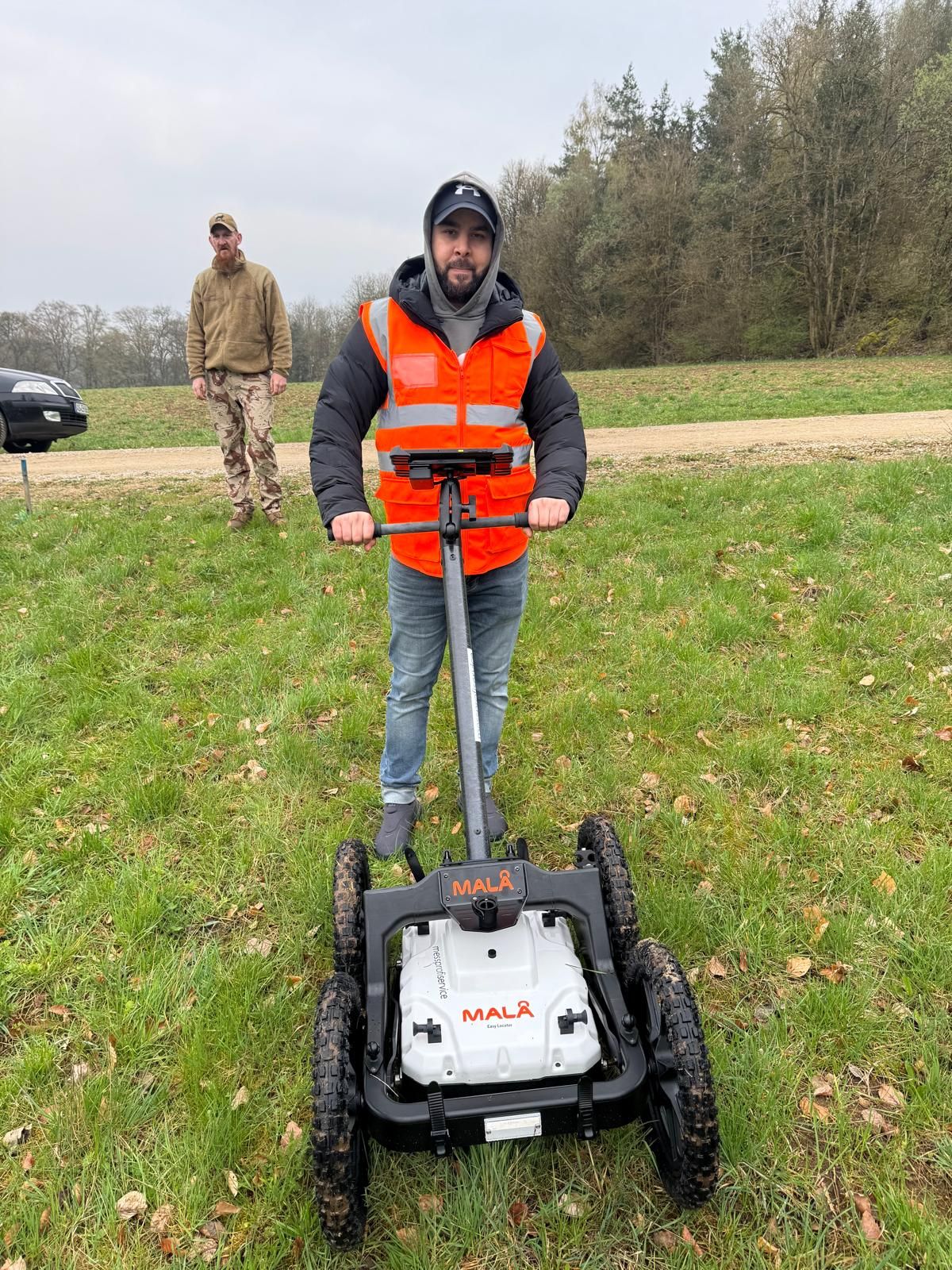
Whether technical investigation follows depends on the specialist assessment and planned ground disturbance. The choice of a Surface survey or another survey method takes account of the objects sought, ground conditions, access and interfering installed structures, among other factors. A method therefore cannot be determined solely from a historical city name or degree of destruction.
Describe known utilities, foundations and surfaces together with the intended areas and depths. This information helps plan the investigation appropriately. The survey service page explains the next step. A measurement result and its documented scope must in turn be distinguished from recovery of a find, Area clearance and later construction work.
If investigation during ongoing earthworks is being considered, it must be established whether this approach suits the specific task. The DGUV distinguishes proper explosive ordnance surveying during construction from simply watching an excavation beside an excavator. The term excavation supervision should therefore also be accompanied by a specific service description.
An area with limited measurability does not automatically have a suitable alternative method. Investigation requirements and the approach for remaining areas require specialist assessment. In an enquiry about explosive ordnance surveying during construction, describe the intended workflow and the already known limitations of the preliminary investigation. Include the associated plans so that outstanding areas remain clearly identifiable.
German Federal Archives: aerial warfare and surviving sources · BFR KMR A-2.3.4: aerial photograph assessment · BFR KMR A-2.1.4: contamination scenarios · BFR KMR 5.1: principles of assessment · BFR KMR 1: scope
BFR KMR A-3.1: geophysical methods · BFR KMR 6.2: planning contents · BFR KMR 8: documentation · DGUV: questions about explosive ordnance clearance
The competent explosive ordnance disposal service and local public safety authorities perform their duties under the applicable state procedures. A private specialist company is commissioned to provide a defined service. Each project must therefore establish which authority is to be involved and which documents it needs. Procedures cannot be inferred solely from a historical event or a neighbouring project.
The relevant authorisations must be observed for work involving explosive substances. § 7 of the German Explosives Act concerns the permit regulated there; § 20 concerns the certificate of competence for responsible persons. The specific activity commissioned determines the scope to be checked. When commissioning work, have the evidence required for that activity clearly identified. The First Ordinance to the German Explosives Act (1. SprengV) supplements this framework with provisions on specialist knowledge and state-recognised training courses, among other matters.
For employees, the employer assesses, under Section 5 of the Occupational Safety and Health Act, the hazards associated with their work and identifies the necessary measures. The DGUV Information 201-027 addresses risk assessment and protective measures in explosive ordnance clearance. Historical documents can provide important initial information, but do not replace the assessment of the actual activity.
Preparatory work must also be included in the project description if it disturbs the ground. Examples may include ground investigation boreholes or sampling. Whether an investigation is required, and what form it should take, is established for the particular position and depth. A large excavation planned for later is no reason to leave earlier work out of the discussion.
Assemble the documents concerned with their titles, dates and appendices. First check whether they cover the same area, period and question at all. A report on part of an area does not contradict a general city chronicle merely because it reaches a different conclusion.
Describe the difference as precisely as possible in your enquiry. Rather than assuming an overall solution, start by making the different statements and their spatial limits clear. The aim is a reasoned assessment for the next project decision. Documents should not be omitted simply because they make coordination more difficult.
Compare the new plan with the documented investigation scope. Additional areas or relocated points may fall outside earlier results. Conversely, an earlier investigation generally remains relevant if its evidenced scope actually covers the work now planned.
The complete report and current plan are therefore needed together for the technical enquiry. Mark what has changed. This supports a focused decision on reusing results and any additional work needed. Neither repeating all work as a blanket measure nor adopting old conclusions unchanged can be justified solely by a document's age.
First describe which information is reliably available and which question the next service is intended to answer. The service description needs a clearly defined area, the planned ground disturbance and relevant initial documents. A reference merely to the bombing of a city is too imprecise.
Also make clear which design details remain provisional. Questions about areas, depths or access can then be resolved before work begins. A quotation request should not assume both an unknown investigation scope and an already predetermined result. Guidance on suitable documents is available under Quotation information and project documents. If a Clearance plan is required, state its brief and how it relates to the intended service.
The report, site plan and result belong together. For subsequent use, the area covered and any limits or restrictions must be identifiable. A document's heading alone does not explain this. A statement described as clearance must also be read in terms of its actual scope.
The BFR KMR address clear documentation of work and results. The drawing versions used and their associated appendices should therefore remain findable in the project records. Further information on processes and evidence helps place these documents in context. Historical research, investigation and documented results remain distinguishable steps.


No. Building damage, recorded attacks, later ground disturbance and documented investigations describe different facts. An assessment today must relate to the specific area and the evidence available.
A missing file or missing set of images from a particular date limits what can be concluded. It automatically establishes neither suspected explosive ordnance nor an all-clear. The gap must be assessed alongside the other sources.
An aerial photograph assessment considers visible traces under the conditions of the available images. It does not provide a universal exclusion for any depth, period or area not covered.
Today's state boundaries help identify relevant archives and competent authorities. Historical attacks and military uses, however, must be investigated within their spatial context at the time. A state boundary marks neither a boundary of bomb impacts nor uniform explosive ordnance contamination.
The next step depends on the assessment result and the project. Remaining grounds for suspicion or unresolved areas need to be addressed specifically. A documented air raid alone does not justify the same technical investigation for every area in a town.
The precise location, planned ground disturbance and available documents with their appendices. Identify missing information and the decision for which you need a technical assessment. Where drawing versions differ, the area currently planned should be clearly marked.
The assessment result, extent of the areas affected and specific investigation conditions. For technical work, access, ground conditions, utilities and interference are relevant, for example. Historical destruction figures alone establish neither a reliable price nor a fixed investigation scope.
Stop work in the affected area, do not touch or move the object, and keep your distance. In Germany, immediately call the police on 110 and follow their instructions. An enquiry to a specialist company does not replace this immediate reporting of a find.
If you already have plans, historical assessments or earlier investigation reports for a construction area, assemble them with details of the planned ground disturbance. We can discuss which questions the documents already answer and what further investigations may be needed.
FONTANA-EOD: +49 6843 9994997 · info@fontana-eod.de
Discuss your project and documents
Understanding historical figures
Bombing campaigns and unexploded bombs
Where possible, send related reports with the maps and appendices they refer to. For the initial discussion, it also matters whether you need historical research, technical investigation or an assessment of existing results. Outstanding questions can then be discussed directly, rather than having to reconstruct the entire history of your site. The regional overview sets out the areas we serve; the knowledge section explores technical terms and methods.

Whether historical aerial photograph analysis, explosive ordnance surveying, surface surveying using GPR, magnetometry or TDEM, deep-ground surveys, downhole surveys, excavation supervision, area clearance or ordnance recovery is needed depends on the location, ground disturbance, depth, ground and existing documents. An early ordnance assessment provides clarity for tendering, programming, occupational safety and construction.
FONTANA-EOD combines its Section 7 SprengG licence, specialists holding Section 20 SprengG certificates of competence, suitable survey and clearance methods, and traceable documentation. Send the site plan, depth of ground disturbance, construction phase and existing documents for an initial technical assessment.