Project pathway
The quickest route to the right decision.
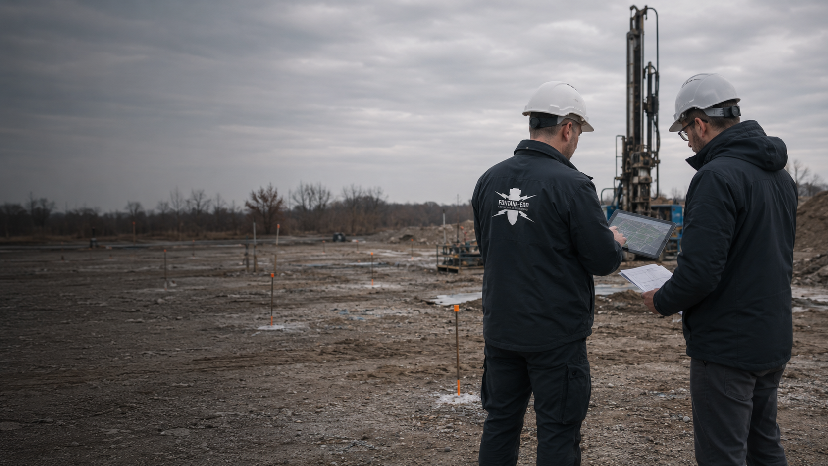
To assess a borehole location for explosive ordnance, we need more than a mark on a plan: its unique designation, actual position, starting elevation and planned depth. FONTANA-EOD compares these details with existing explosive ordnance documents and investigates the agreed area. The report records which intervention the result covers and which limitations apply.
Use the same point numbers in the plan and contract.
Include the starting elevation and borehole alignment.
Have new positions checked before the intervention.
Before drilling at a point, position, starting elevation, intended depth and execution are compared with explosive ordnance documents. An unchanged point number does not demonstrate that a relocated or deeper investigation remains covered by the previous scope. FONTANA-EOD coordinates the work for the specific intervention and documents the volume actually investigated.
The service scope for “A 6 Öhringen–Kupferzell junctions – ground investigation – Bohrgesellschaft Roßla Öhringen – Kupferzell / Germany · Stuttgart administrative region” comprised downhole magnetometry.
Service period: 2026-08
Service areas:Downhole magnetometry / deep-ground survey
View project details · Deep-ground and downhole surveys · Region: Stuttgart administrative region
The service scope for “A555 Immendorfer Straße bridge – ground investigation and explosive ordnance survey Köln-Godorf / Köln-Immendorf / Germany” comprised downhole magnetometry.
Service period: 2025-07
Service areas:Downhole magnetometry / deep-ground survey
The service scope for “Landstuhl – ESTW, geotechnical investigation boreholes Landstuhl / Germany · Rhineland-Palatinate” comprised downhole magnetometry.
Service period: 2024-12
Service areas:Downhole magnetometry / deep-ground survey
View project details · Deep-ground and downhole surveys · Region: Rhineland-Palatinate

Historical findings and earlier investigations are compared with the current ground investigation plan. Alongside position, starting elevation and planned depth form part of the description. The specialist contractor checks what the existing documents contribute to this intervention. Unresolved questions remain assigned to each point.
Assign existing reports to the ground investigation point
A surface investigation is planned in relation to local conditions and the conclusion needed. Hard surfaces, structures and known installations are noted in the documents. Method suitability follows from the specific task; general availability of an area does not yet fully describe the later investigation volume.
Surface survey for the accessible ground volume
Planned deep or inclined investigations need an appropriate spatial description. Assessment is related to that alignment and the available findings. A changed execution is coordinated technically. A report concerning a different volume is not adopted merely because the point number is the same.
Assess deep-ground surveying for the planned investigationIf an intended starting point cannot be used on site, the new position is documented and compared with the investigation status. The planning change reaches the responsible specialists before the intervention. Existing results are retained and used with their actual spatial reference.
Compare relocated starting points against the documentsA ground investigation is spatially more than a symbol on a site plan. The details needed depend on where the intervention starts, how it is to be executed and the volume affected. This information must be consistent between planning, the field team and the results report.
Coordinates and the site plan must allow clear assignment. The starting elevation helps describe planned depths spatially. Different reference systems or subsequently changed ground surfaces are clarified before execution.
Explosive ordnance assessment for ground reports and geotechnical workThe intended final depth and any differing alignment form part of the programme. A later deepening is not covered merely by the old point designation. The documented investigation volume remains decisive.
Deep-ground and downhole surveys for construction projectsEquipment position, utilities and obstacles can influence execution. A necessary replacement point is identified with its new position and execution. Proximity alone is not evidence that the earlier investigation includes it.
Ordnance checks for environmental and geotechnical consultanciesChanges at short notice can only be usefully assessed if the old and new versions are comparable. A point number communicated verbally without updated geometry is not sufficient.
Compare the surveyed position with the approved investigation programme and documented explosive ordnance scope. Deviations are clarified before the intervention. A site marking is not independent evidence of investigation. Clear assignment requires the point number, coordinates, starting elevation and valid planning version. Also identify whether a vertical or inclined investigation is planned. The position at the surface and ground volume investigated are considered together. If a marked point cannot be reliably assigned to the available documents, clarify that assignment with specialist planning before the work concerned. Those carrying out the work receive the coordinated version.
Provide the intended replacement point with depth and method. The specialist assessment addresses this new geometry. An unchecked change can break the link between investigation and execution. Record which original point is being replaced and which details change. The previous identifier must not lead to an unnoticed assignment of old results to the new position. An updated site plan and traceable point list make the change identifiable to planners, the specialist contractor and those carrying out the work. Existing results are assessed for the new intervention; investigations still needed and the subsequent response are identified specifically.
The new final depth and any changed execution are compared with the previous result. The decision concerns the additional volume. An unchanged surface position is not sufficient for transfer. For a depth change, state the reference used and mark the investigations affected. A changed drilling inclination can also affect a different ground volume. Specialist planning therefore needs the intended geometry together with the existing investigation documents. If old and new reference elevations differ, that difference is clarified. The response identifies the scope considered and prerequisites for the next intended intervention.
With several investigations, differing designations alone can cause misunderstandings: a point has a different name in the plan than in the tender, or a later relocation appears in only one file. For the explosive ordnance task, all participants must mean the same intended intervention. A current point list therefore links the designation with position, elevation reference and planned alignment.
In Germany, § 8 GeolDG identifies, among other things, the planned position and starting elevation, borehole alignment and final depth as records for drilling. The notification and data procedure regulated there is a separate task. Geological notification does not confirm that the explosive ordnance question for the investigation has been clarified. Existing explosive ordnance findings and relevant requirements must be checked separately for that purpose.
Use the same designation in the site plan, point list, contract and later assignment of results. If existing documents use different numbering, provide an unambiguous correspondence. It should remain clear whether a point was merely renamed, actually moved or replaced by another investigation.
Provide the position so that it can be located unambiguously in the project. Coordinates require the reference system used; elevations need a clear elevation reference. A mark on an unclear overview image is not sufficient. Unclear information is clarified before defining the investigation scope.
State the intervention actually intended and the starting elevation from which its depth is measured. If the ground has changed, this reference must be checked again. To define the investigation scope, provide the entire planned alignment in the ground; the surface marking alone is insufficient.
For borehole locations and ground investigations, it must remain traceable which interventions a result concerns. Documentation brings together the initial data, the investigation actually carried out and its conclusions. A property name or a short completion note is not sufficient to assess later changes to the construction project.
Existing site plans, historical assessments and earlier investigation reports are provided with dates and appendices. Position and elevation references matter for point positions, starting elevations, borehole alignments and intended depths. Undocumented assumptions are recorded as unresolved information. When selecting a method, it thus remains clear which conclusions are based on documents and which conditions still need clarification.
The areas surveyed, methods used and departures identified are assigned to the construction revision implemented. An inaccessible area or an area where data cannot be evaluated is not summarised as completed. Changes during fieldwork also belong in the result documents. This distinguishes the report's assessment from a survey originally planned but not carried out.
The handover identifies the volume investigated, applicable conditions and remaining questions. Relocating the starting point or changing depth or alignment must subsequently be compared with that scope. Those involved must be able to recognise whether existing findings still fit or additional work is needed. A conclusion about the investigated area must not be extended to other areas or greater intervention depths without checking.
The list links the planning designation, position, depth and work status. It supplements the actual investigation documents and must not abbreviate their spatial or technical limits.
The geometry and method details needed for the task are recorded for each point. Provisional values and alternatives not yet decided remain identifiable as such.
Differing positions, points not completed and changed depths are documented. An old number can be retained but must be linked clearly to the actual condition.
The conclusion is assigned to the volume actually investigated. Parts not addressed and limitations remain visible, allowing targeted planning of later additions. Necessary follow-up investigations and exposure work are assigned to the areas concerned. Recovery of confirmed explosive ordnance is coordinated with the permitted scope of activities and local responsibilities. After actual exposure or clearance work, the corresponding findings and clearance records are included.
Give the point list and associated plan an identifiable version. Identify the contact who consolidates changes. For the initial enquiry, also state the planned sequence and investigation type. Use the same current planning version for the contracts. Historical documents and existing aerial photograph assessments are also recorded at initial contact with their investigation area. Any further assessments needed are included in subsequent investigation planning. If historical questions remain open, additional records of past use are researched and suitable wartime aerial photographs assessed, where available. The findings and interpretation limits are assigned to the intervention planned today.
If an investigation is to be relocated, for example because of an obstacle, document the new position and reason. Before the ground intervention, have it checked whether the existing explosive ordnance conclusion covers the changed area. Do not transfer an investigation result to the new point yourself merely because it is close to the original.
The results handover should show which area was investigated under which point designation and which limitations remained. Points not completed, changed or still unresolved remain distinguishable. The contractor carrying out the ground investigation can thus base its preparation on the correct status.
Planning, explosive ordnance work and ground investigation need a traceable handover status. The field team receives the current point list with the assigned results and unresolved tasks.
The point list, site plan and explosive ordnance documents are read together. Missing elevation or depth information is clarified before further specifications are made.
The method is selected on the basis of suspected-hazard evidence, ground stratigraphy, intervention depth, interference and accessible areas. The starting point, reference elevation and borehole alignment determine the ground volume to which the investigation must be directed.
New positions, depths or methods are provided to those responsible before the intervention. The technical assessment addresses the changed volume, not just the point number.
The commissioned investigation is carried out at the agreed points. Measurement data, findings and limitations are recorded with an unambiguous point identifier, position, elevation and depth references.
Measurement data and findings are evaluated by specialists. Points addressed, investigation boundaries and necessary follow-up measures are documented in the results documents. The later ground investigation must relate to that actual status.
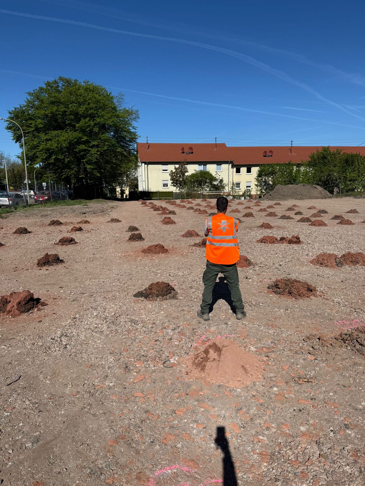
Assign the available explosive ordnance documents to each planned ground investigation. What matters is whether position, depth range and specialist conclusions fit this intervention. A neighbouring point's report can provide information but does not automatically cover the new point merely because it is nearby.
Describe actual access and known hard surfaces, utilities and metal installations nearby. These conditions can influence the geophysical investigation. The appropriate method is defined for the planned intervention and actual measurement conditions. A fixed measurement grid or investigation depth cannot be derived from a point list alone. Necessary investigations and protective measures are defined before preparatory ground interventions such as vegetation clearance, demolition, breaking out surfaces or constructing access routes and working areas. Areas becoming accessible later are investigated before each subsequent intervention.
An explosive ordnance investigation and the following geotechnical or environmental investigation are separate steps with their own tasks. Additional prerequisites may apply to carrying out the ground investigation. Provide its contractor with the report, including the actual investigation scope and remaining limitations. For further work at the site, the specific interventions and applicable prerequisites are coordinated separately.
For point-specific interventions, the methods used must be capable of covering the relevant volume. Ground stratigraphy, installations, intended depth and technical execution influence the choice. A geological investigation method is not automatically an explosive ordnance investigation.
Assessment of historical aerial photographs and other documents helps establish suspected explosive ordnance hazards. It considers previous uses and identifiable indications in the investigation area. This provides a basis for deciding on further measures. It does not replace a technical survey of the ground and cannot describe every later fill or subsequent change.
Historical aerial photograph assessment for the construction areaMagnetic and electromagnetic surveys detect different physical properties. Utilities, steel parts, reinforcement and metal-bearing made ground can affect data evaluation. A signal is initially a survey finding, not a confirmed object identification. Method selection must therefore consider expected target objects, surroundings and actual data interpretability together. Magnetometry detects magnetic anomalies; TDEM detects time-dependent electromagnetic responses from electrically conductive objects.
Magnetometry and site conditions Assess electromagnetic surveyingGround-penetrating radar adds information where the question and ground conditions are suitable. The discernible depth and distinguishability of structures depend, among other things, on ground conditions and existing installations. It is not a universal replacement for other survey methods. Whether a combination adds useful information is decided using the specific survey objective.
Ground-penetrating radar and its limitationsFor deeper interventions, an investigation from suitable borehole or survey points may be considered. The position, depth and technical execution of these points must be planned. A conclusion about one point or a limited area cannot be transferred to the next excavation merely because it is nearby. The report must identify the volume actually investigated. For individual borehole or foundation points, the volume of ground to be checked and the achievable measurement coverage are compared before defining a borehole grid. Necessary investigations and protective measures are determined before drilling. Casing, drilling depth and documentation are coordinated with the task and local conditions.
Coordinate deep-ground and borehole surveysIts use is defined in relation to the preceding investigations, the suspected hazard and the construction sequence. Unresolved areas, interfering installations and intended intervention depths must be discussed before work starts. Any necessary investigation of findings must be planned separately. Each working layer is technically surveyed and assessed before controlled removal in layers with supplementary visual inspection. The steps are repeated down to the agreed formation level. Excavation layers, stop signal, authority to give instructions, reporting routes and documentation are agreed with site management and specialist personnel before work starts.
Excavation supervision for the planned section Explosive ordnance recovery following technical clarificationFor borehole locations and ground investigations, traceable work addressing the specific interventions matters. FONTANA-EOD describes the agreed investigation scope and the limits of the methods used. Conclusions are derived from the documents and results actually available. Unresolved information and restricted measurement conditions are assigned to the investigation area concerned.
The planned ground interventions are maintained on an agreed site plan. Where changes occur, the revision replaced is recorded. This prevents the specialist contractor inadvertently working to older geometry while construction is already preparing a different ground intervention.
An anomalous signal is initially a finding requiring technical assessment. Conversely, difficult or unreliable data evaluation cannot be treated as a negative result. Useful further investigation is decided in view of the survey question and site conditions.
The responsible investigation planning team and site management receive the results and limitations needed for the next decision. For unresolved parts, the missing information or measure is clarified. Those involved thus retain an identifiable handover point between investigation, assessment and further execution.
Those involved need an unambiguous procedure for changes. It thus remains identifiable who describes the new intervention and who compares it with the previous investigation result.
It defines the points and methods needed for its question. Changes are described with position, depth and current planning version.
They compare the points to be executed with the information handed over. Unexpected obstacles or deviations are communicated before independently relocating a point.
FONTANA-EOD assesses the explosive ordnance scope for the specific intervention. Before using a result for neighbouring points or greater depths, the new intervention volume is compared with the documented scope.
In Germany, state ordnance disposal services and locally competent authorities carry out hazard response and find management. Their involvement and public-order or building-control tasks are established for the project location. Outside Germany, local responsibilities apply. Contacts, requirements and reporting are assigned to the specific works.
Notification or documentation of geological investigations does not automatically answer the explosive ordnance question. The respective procedures and responsibilities remain separate; a coordinated status must nevertheless be available for execution.
For explosive ordnance work at planned borehole locations and ground investigations in Germany, the necessary authorisation and competence requirements follow the Explosives Act, particularly §§ 7 and 20, where relevant to the specific activity. Before execution, the client and specialist contractor clarify which tasks, responsibilities and corresponding evidence belong to the agreed service scope. § 7 SprengG concerns the commercial authorisation for activities requiring permission, and § 20 SprengG the certificate of competence for responsible persons. Under § 1b SprengG, searching for found ammunition also counts as handling.
The authorisations and certificates of competence required for an activity in Germany depend on the specific contract. The relevant requirements of the 1. SprengV are considered for the work specifically commissioned. Service scope, responsible specialists and intended work steps form part of clarifying the contract. Official decisions are taken by the respective competent authorities.
Understand authorisation and competence requirementsRisk assessment must consider the activity and its surroundings. Ordnance hazards exist alongside drilling, excavation, traffic and operational risks. DGUV Information 201-027 supports activity-specific preparation. DGUV Rule 113-003 addresses dismantling or destroying explosives or corresponding objects and disposing of found munitions, and is considered where applicable. Requirements and occupational safety measures relevant to the project must be coordinated with those responsible.
Documents and constraints for preparationThe BFR KMR describe a structured approach on federal properties. Their principles for methods and documentation can assist specialist planning. For work at borehole locations and ground investigations, their application, local procedures and responsibilities are clarified for each project. In the event of an actual find or specific suspicion, the prescribed reporting and securing procedures remain decisive.
Document results and limitations traceablyA clear compilation can identify the planned construction intervention, associated report and unresolved prerequisites for each point. Retain the complete investigation report with its appendices. An isolated tick or general note without a reference to the volume investigated cannot fully represent the report's conclusions.
The specific scope is decisive for later work. Preparing an individual investigation does not create an area-wide assessment for the entire property. Deeper or differently aligned follow-up work also needs comparison with the documented conclusions. Therefore retain the associated planning versions and point lists after the ground investigation as well.
Technical sources: BFR KMR: clearance planning with a clearance concept – introduction · BFR KMR: geophysics · BFR KMR: documentation · § 8 GeolDG: geological investigations and records · German Federal Waterways Engineering and Research Institute: geotechnical field tests
The Baufachliche Richtlinien Kampfmittelräumung contain requirements for historical and technical investigation, clearance concepts, procurement and documentation within their defined federal remit. Their application to the specific construction work at borehole locations and ground investigations, and locally applicable requirements and responsibilities, are clarified separately.
Individual points form part of a larger investigation programme. Geotechnical, environmental and explosive ordnance results are linked to the same position and depth planning.
Distinguish ground investigations from later foundation questions in their specialist context.
Geotechnical investigation programmeCoordinate environmental, geotechnical and explosive ordnance questions on the same site.
Coordinate investigations
Historical assessment, technical surveys and investigation of findings have different tasks. Selection follows the specific ground intervention and the information already available.

Review the historical basis for the planned construction area and assess identifiable indications of explosive ordnance hazards with their evaluation limitations.
Historical aerial photograph analysisConsider deeper ground interventions with their location, construction details and required spatial survey.
Deep-ground and downhole surveys
Coordinate any necessary work during construction with preliminary surveys and the intended excavation sequence.
Excavation supervisionThe enquiry links point identifiers with a site plan, elevation reference, target depth and intended execution. Unresolved alternatives remain identifiable. FONTANA-EOD can define the specialist need accordingly and identify additions required for a reliable task description.
Before each ground investigation, the planning used and available investigation results are brought together. Deviations are coordinated with those technically responsible. In documentation, the current point remains distinguishable from discarded alternatives and earlier work stages.
The documents show which volume was investigated and which conditions belong to the conclusions. Geotechnical planning compares these details with the ground investigation actually intended. Other points or additional depths are assigned separately. Explosive ordnance documents remain available alongside geotechnical results.

Identify the site and mark the investigation points in the site plan. Add accessibility details and the access contact. Regional orientation replaces neither the point list nor the spatial description of the intended work.
Existing information and survey reports are provided with their dates and spatial references. The respective responsible parties clarify project-specific requirements. Statements about neighbouring areas remain distinguishable from the documents for the current investigation points.
A location point is considered together with the depth and starting elevation. This makes it easier to compare planning with the survey. If these details change, their relationship is checked again. An unchanged point designation alone does not confirm an unchanged survey scope.
Explore results and terminologyA geotechnical report describes the ground conditions covered by the agreed investigation. The explosive ordnance documentation addresses its own subject of investigation. The statements needed for the ground investigation are brought together. Sharing a location designation does not make either document a substitute for the other.
Assign geotechnical and explosive ordnance reports separatelyIf the ground investigation plan requires another point, its location, depth and intended method are submitted. The specialist contractor compares it with the existing survey findings. The additional ground intervention is assigned a traceable reference before existing results are used for it.
Explore results and terminologyTechnical information
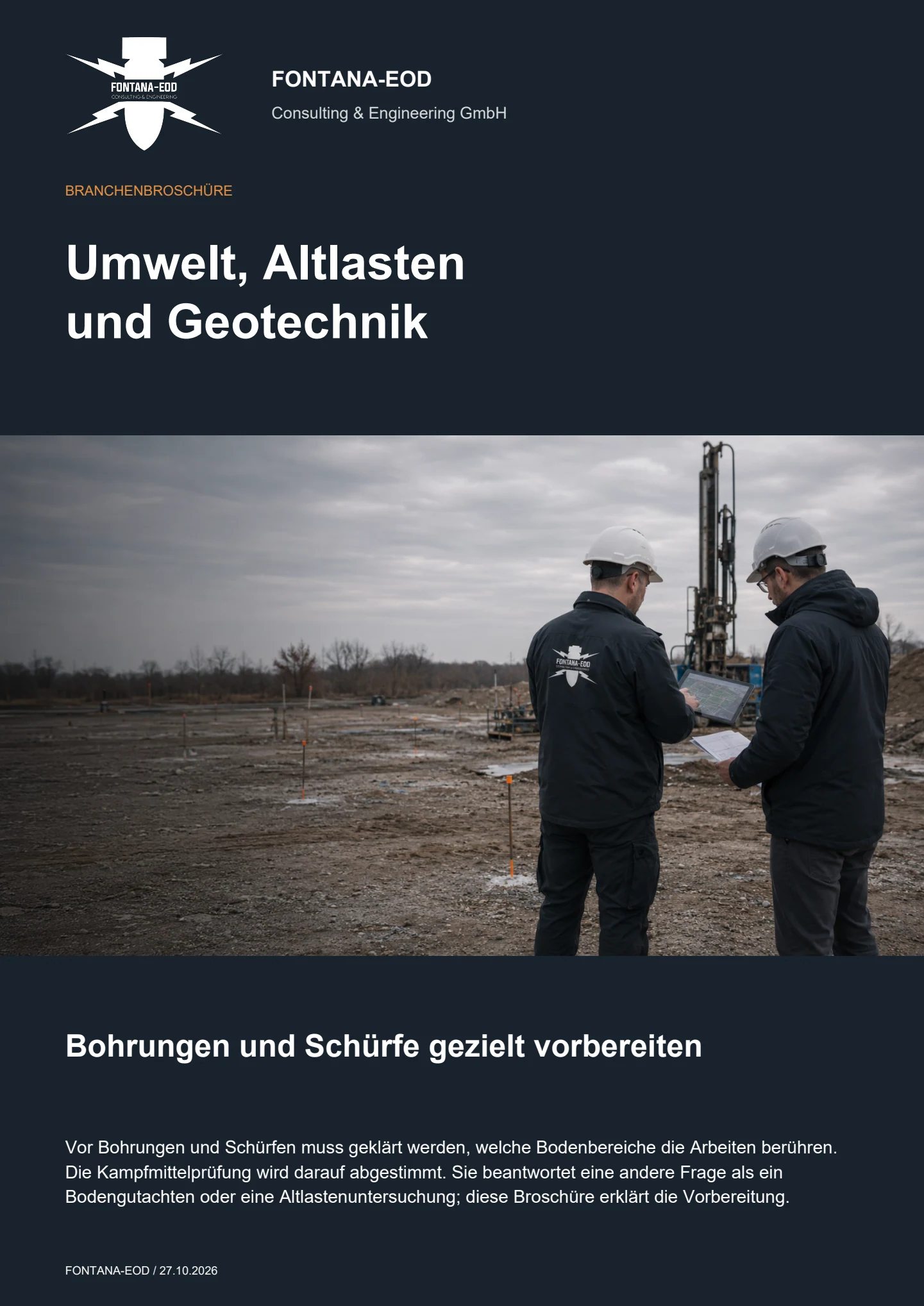
Ordnance checks, contaminated-land investigations and ground investigations serve different purposes. The brochure describes their interfaces and shows how drilling and other ground interventions are coordinated.
A change must be technically compared before the ground intervention. The new position, elevation reference and planned alignment must show whether the existing explosive ordnance conclusion still fits or an addition is needed.
It is an important reference but not sufficient by itself. The unambiguously assignable position, starting elevation, planned depth and, where applicable, alignment must also be known.
Only within the spatial scope actually documented. Investigation of a single ground investigation location does not support a general conclusion for neighbouring points or the whole property.
No. The notification and data procedure regulated in Germany under the Geological Data Act concerns a different matter. The specialist prerequisites for the ground intervention must additionally be clarified under the respective applicable requirements.
A current shared point list, an associated site plan, elevation, alignment and depth details and existing explosive ordnance reports are helpful. Changes from earlier versions should be clearly identified. Defining the explosive ordnance service scope and costs also depends on the number of points and their spatial investigation scope, working access, interference, suitable methods and documentation needs.
Difficult or unreliable interpretations remain identifiable with their limitations. They are not treated as a negative investigation finding. The specialists involved clarify, from the investigation question and local conditions, what further information or work is needed for the ground investigation concerned.
They remain identifiable in the progress record as not completed. A planned investigation must not appear as actually finished. If the point is needed later, the current intervention is compared again with the existing findings.
If an unexpected suspicious object is encountered, stop work in the affected area immediately. Do not touch, move or expose the object further. Leave the immediate area, keep your distance and keep others away without putting yourself at risk. In Germany, notify the police immediately on 110; outside Germany use the local emergency reporting route. The competent authorities determine the next steps. Inform site management, the client and the investigation planning team; internal communication must not delay the emergency call.
Initial contact is possible with provisional documents. Mark which details are confirmed and which are still planned or unclear. Describe the next project decision needed; the suitable method is agreed together according to the intervention and survey conditions.
Send the address or region and a site plan showing point locations, starting elevations, borehole paths and intended depths. Add the planned ground intervention depths, reference elevations where applicable, and the intended construction method. Working volumes and additional ground interventions outside the actual structure footprint should also be identifiable. If there are variants, it must be clear which has already been selected and which is only being considered as a possible alternative.
Send complete explosive ordnance documents with attachments and relevant existing asset and utility plans. Information on made ground, metal installations or restricted access helps the assessment. An extract without a site plan may obscure a report's spatial scope. Known gaps or conflicting details should therefore be stated in the initial enquiry.
State the planned execution period and the contacts responsible for investigation planning and construction management. Describe whether you are preparing a tender, coordinating a specific ground intervention or relating an existing report to a change. This information is used to develop the next specialist step. A firm statement about the work involved or the schedule requires a sufficiently defined task.
Send the current point list and corresponding site plan together with the intended depths and investigation methods. Include existing explosive ordnance documents and mark any location changes already known. We compare the proposed points with the existing explosive ordnance documents and clarify which areas need to be surveyed and which information is still missing.
To help us assign your enquiry: Sectors and applications. Project region.

Whether historical aerial photograph analysis, explosive ordnance surveying, surface surveying using GPR, magnetometry or TDEM, deep-ground surveys, downhole surveys, excavation supervision, area clearance or ordnance recovery is needed depends on the location, ground disturbance, depth, ground and existing documents. An early ordnance assessment provides clarity for tendering, programming, occupational safety and construction.
FONTANA-EOD combines its Section 7 SprengG licence, specialists holding Section 20 SprengG certificates of competence, suitable survey and clearance methods, and traceable documentation. Send the site plan, depth of ground disturbance, construction phase and existing documents for an initial technical assessment.


