Project pathway
The quickest route to the right decision.
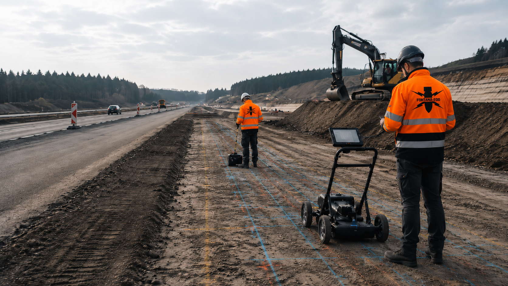
Civil engineering contractors, site management and clients need the remaining suspected ordnance areas, excavation layers and technical investigation steps to be defined before groundworks. FONTANA-EOD checks whether an explosive ordnance survey alongside construction can technically cover the planned ground volume. Send the excavation plan, depths, construction equipment and existing survey documents so that the work sequence, hold points and documentation can be defined.
Define area, depth and layers.
Check excavation bases and slopes.
Record hold points and documentation.
Excavation monitoring may be considered for defined remaining suspected ordnance areas if a technically suitable explosive ordnance survey alongside construction can sufficiently cover the planned ground volume. Technical surveying and the specialist decision precede each removal of soil; excavation proceeds in layers with additional visual inspection. The process is repeated layer by layer down to the intended excavation base and documented spatially. Separate deep interventions and areas that cannot be investigated require a separate follow-up decision.
The scope of services for ‘Sewer construction Köln -Mülheim Nordrhein-Westfalen’ included ordnance specialist supervision of groundworks.
Service period: –
Service areas:Ordnance specialist supervision of groundworks
The scope of services for ‘Sewer construction Essen Nordrhein-Westfalen’ included ordnance specialist supervision of groundworks.
Service period: –
Service areas:Ordnance specialist supervision of groundworks
The scope of services for ‘Sewer and road construction Essen / Ruhrgebiet Nordrhein-Westfalen’ included ordnance specialist supervision of groundworks.
Service period: –
Service areas:Ordnance specialist supervision of groundworks
Requirements differ between excavations, utility trenches, road excavation and demolition stages. Each section is assigned a clear geometry, work sequence and limit to the documented findings.
The service is reliable only when excavation quantity, equipment operation and the investigation step have already been coordinated during work preparation.

Narrow trenches pass through existing utilities, earlier excavations and varying fill. Prior surveys may be limited by installations or the road structure.
Excavation is divided by chainage and layer; crossings, shafts and widened areas are assigned separate work sections.
Crossings and shafts extend the linear route to include additional areas and depth volumes.
Prepare the utility trench with specialist inputRemoving the road surface, frost-protection layers, ground improvement and utility coordination progressively change access and survey conditions.
Investigation timings are coordinated with traffic phases, milling or demolition stages and the planned soil replacement.
Necessary investigations and protective measures are defined before groundworks during road excavation.
Assess the road construction section
Excavations combine bases, slopes, shoring, dewatering and localised deep interventions. Excavation supervision does not automatically cover deep piles or anchors.
Layers across the area and separate deep points are covered in coordinated but technically distinct planning.
Point and alignment investigations are completed separately before specialist foundation works begin.
Add deep foundation pointsDeep shafts, varying trench depths and densely occupied road corridors make complete preliminary investigation more difficult.
Excavation layers, shaft excavations, crossings and inaccessible edges are documented by section.
Because of their depth and shoring, shaft excavations may require a different sequence of layers from the adjoining utility trench.
Investigate sewer and shaft areasExisting foundations, reinforcement and technical installations may obstruct survey areas. The relevant ground becomes accessible only after demolition or removal in layers.
Necessary investigations and protective measures are defined before groundworks during demolition. The new construction stage is checked before the next intervention and linked to the previous stage of investigation.
After demolition, newly accessible areas are surveyed and assigned to the original remaining area.
Coordinate the demolition sequence and investigation
Utilities, scrap, reinforcement, vehicles or structures may dominate the survey data. A limited preliminary investigation is not treated as an area with no significant anomalies.
The remaining area is assigned a precise location, a documented hold point and a technically suitable follow-up measure. Whether an adapted excavation sequence can form part of that measure is assessed for the actual intervention.
Areas obscured by technical interference remain spatially closed off until a reliable follow-up measure is in place.
Assess remaining areas with specialist inputAn explosive ordnance survey alongside construction requires suitable survey conditions and coordinated work organisation. Before work begins, it is checked whether the method can adequately cover the actual planned ground volume.
Not every construction site where explosive ordnance is suspected is suitable for an approach alongside construction. Where prior clearance is technically possible and appropriate, it remains the priority.
Existing structures, utilities, reinforcement or lack of access prevent a reliable area-wide survey of the ground volume of the subsequent works.
The limitation is described spatially and linked to the construction stage at which investigation becomes possible.
The remaining area is derived by comparing the planned intervention with existing investigation coverage.
Assess survey limitations with specialist inputThe area, depth, excavation, route, layers, construction equipment and output per section can be identified.
This allows specialist supervision to focus on actual work sections rather than general attendance on site.
Working layers are selected so that each exposed surface remains technically accessible and capable of assessment.
Have the excavation geometry checkedPiles, anchors, boreholes, sheet piles or deep shafts extend beyond excavation in layers.
For these interventions, a separate assessment establishes whether existing investigations cover the location and depth involved and what supplementary depth investigation is required. Excavation supervision alone does not cover deeper interventions.
Deep points have their own execution and release planning before the relevant construction equipment is used.
Prepare deep localised groundworksThe excavation speed, equipment operation and section size must not outpace specialist investigation of the exposed surface.
The work sequence, interruptions and release points are therefore agreed with site management before work begins.
Daily output and changes between sections are adapted to the time required for investigation and documentation.
Define hold points and the work sequenceA survey signal, an interfering technical object or a suspicious item may trigger a work stoppage and further investigation.
Reporting routes, securing the area, responsibilities and resumption of work are defined before work begins.
The procedure for a find is practised or explained in advance so that instructions are clear if an incident occurs.
Clarify the findings procedure with specialist inputSupervised layers, uninvestigated areas, changed depths and additional excavations are clearly updated in the records.
Only the documented ground volume can form the basis for the next construction section.
Changes require a specialist decision before the altered intervention, rather than simply being noted in the daily report afterwards.
Structure section-specific recordsThe decision on the next excavation step is based on the ground volume that is actually accessible. Existing data, the new excavation base, survey limitations and deep interventions are assessed together.
Investigation status is documented by the areas, layers and depths actually investigated, rather than hours of attendance.
Initial situation: the planned excavation volume has already been reliably investigated using suitable methods.
Decision: the existing documentation is checked against the current plan revision.
Consequence: additional excavation supervision is required only for clearly justified remaining areas or areas affected by changes.
Existing investigation data is adopted only if the plan revision and actual excavation volume match.
Initial situation: asphalt, foundations, reinforcement or technical installations obscure the relevant ground.
Decision: define necessary investigations and protective measures before groundworks during demolition. Set additional investigation times for working layers that subsequently become accessible.
Consequence: newly accessible excavation bases and edges are assessed before the next excavation step.
The new investigation stage is determined by actual demolition progress, rather than a schedule alone.
Initial situation: historical evidence indicates suspicion in the area, without individual points being reliably located.
Decision: a project-specific clearance and excavation concept defines layers, equipment and hold points.
Consequence: the actual ground volume of the works is documented systematically by section.
The clearance concept describes the equipment used and decision-making authority as well as the layers.
Initial situation: piles, sheet piles, anchors or boreholes extend deeper than the planned excavation in layers.
Decision: compare the investigation requirements for these geometries separately with existing investigations and define the necessary depth investigations.
Consequence: excavation supervision and depth investigation receive separate documentation referring to the same plan.
Separate depth investigations are recorded on the same site plan but remain identifiable as a separate service.
Initial situation: soil, utilities, water or technical interference prevent reliable assessment.
Decision: the area is spatially closed off or further investigated using another method.
Consequence: work does not continue until the agreed follow-up decision has been documented.
An area that cannot be investigated is assigned a specific spatial exclusion instead of a general statement of limitation.
Initial situation: a relevant anomaly occurs during investigation or excavation.
Decision: the specialist investigation procedure applies to survey anomalies. If an unexpected suspicious object is encountered, work stops immediately, people leave the immediate area and the responsible authorities are notified without delay.
Consequence: findings are investigated and the responsible authorities involved in relation to the location and project.
If ordnance is found, the responsible authorities determine when and under what conditions work may resume. The basis and decision are documented.
The documentation links preliminary investigation, actual excavation geometry, layers investigated, limitations and the follow-up decision. This makes the investigation stage traceable even when construction is interrupted or plans change.
For site management, the key information is which ground volumes are released for work, subject to restrictions or closed off until a follow-up measure.
The documentation links the excavation layer, section, time window, equipment used, specialist investigation and release of the next work step. This makes it possible to trace which ground volumes were actually supervised and assessed, including across shift changes, with several excavators or during section-by-section handovers.
The excavation, route, chainage, excavation area, target depth and plan revision form the spatial basis.
Changes to location, depth or construction method are updated in the records during execution.
Section identifiers link fieldwork, daily reports and the construction timing log.
Historical assessment, official correspondence, existing survey reports and known findings are documented with their scope.
Uninvestigated remaining areas remain clearly identified as specific work areas.
Preliminary investigation is entered in the site file with its actual area and depth coverage.
Layer thickness, section size, equipment operation, sequence and planned construction progress are defined before work begins.
The documentation shows which excavation base or slope was assessed before the next excavation step.
Layer thickness and the elevation of the excavation base investigated are documented against a clear height reference.
The survey or inspection equipment used, soil, moisture, surface, existing utilities and sources of interference are described by section.
Method-related limitations are not treated as a result showing no significant anomalies.
Equipment and ground conditions explain the circumstances in which each statement was obtained.
Hold points, anomalies, exposure work, actual finds and changes to the construction sequence are recorded with their location and time.
The reporting and decision-making route remains linked to the affected section.
Interruptions are recorded with their start, end, cause and the subsequent section released for work.
Daily reports, site plans, photographs, equipment details, layers investigated and outstanding areas are combined into a traceable section file.
The conclusion applies only to the documented ground volume.
The final record distinguishes remaining areas that have been investigated from subsequent construction changes.
Work alongside construction continually generates new stages of investigation. The dossier brings this development together on a common spatial and temporal basis.
Daily reports, site plans and hold-point decisions use the same section identifiers as the construction sequence.
The basis for suspicion, site plan, construction sequence, excavation geometry and existing survey results are recorded with a clearly identified data revision.
This shows the conditions on which the assignment was based.
Before mobilisation, initial data is checked for currency and spatial coverage.
Each excavation base, slope, route or excavation receives a unique identifier with the time period and investigation status.
Outstanding, restricted and investigated areas remain separate.
The layer register establishes a reliable link between excavation quantity and the ground volume investigated.
Survey equipment, equipment deployment, ground conditions, sources of interference and quality assurance are documented by section.
Deviations from the agreed procedure remain traceable.
Investigation records identify not only the equipment, but also the survey path, conditions and quality.
Hold points, anomalies, exposure work and actual finds are linked to their location, construction stage and decision.
Work resumes only on a documented basis.
Decisions on findings remain separate from general site reports and technically traceable.
Work progress, layers investigated, people involved, instructions and handovers are recorded daily or by section.
This preserves the information chain across shift and personnel changes.
Daily reports document handovers between shifts and the companies involved.
The final report describes the stage of investigation achieved, areas that could not be investigated and measures still required. Where exposure or clearance work has actually taken place, the corresponding findings and clearance records are included.
The statement does not extend to later expansions or deeper interventions.
Remaining areas receive a clear status that is retained until their investigation is complete.
The process links construction progress and specialist investigation. No excavation step should outpace assessment of the ground volume that is accessible at that stage.
The service is costed using a realistic excavation speed so that specialist investigation and earthworks do not conflict.
Historical information and existing surveys are related to the current construction section.
The area, route, depth, layers, equipment, shoring, dewatering and expected construction output are described.
Survey equipment, section size, criteria for stopping work, instruction routes and responsibilities are agreed before work begins.
Access routes, protective zones, existing utilities, survey setting-out, equipment positions and means of communication are checked.
The accessible working surface is surveyed using suitable equipment. The responsible specialist assesses the results and limitations and decides on the next defined removal step.
Following the specialist decision, the defined layer is excavated with additional visual inspection. The process starts again for the next layer; the excavation base and slopes receive the planned final inspection.
If relevant signals or objects are encountered, work in the area is stopped, the area is secured and the agreed reporting procedure is followed.
Daily reports, site plans, layers investigated, outstanding areas and follow-up measures are compiled for site management and the project file.
The excavation base, slopes, trench walls and separate deep points form different investigation volumes. Section boundaries, the accessible survey surface and safe equipment operation determine how technical investigation and soil removal can work together.
Before work begins, it is defined which soil layer will be removed in which section and using which equipment. Layer thickness and section size depend on the suspected hazard, target object, soil, survey method and the ability to investigate an exposed excavation base reliably.
Before soil is removed, the accessible working surface is investigated using suitable technical surveying. The responsible specialist assesses the results and decides on the next removal step. Only then is the defined soil layer excavated with additional visual inspection. Surveying, assessment and removal in layers are repeated down to the intended excavation base; the base and slopes are finally checked in accordance with the investigation objective.
Utilities, shoring, water, reinforcement or technical installations may make parts of the area impossible to investigate. These zones are marked spatially and remain closed off until a suitable follow-up measure is in place.
For deep piles, anchors, sheet piles or boreholes, a separate assessment establishes whether existing investigations cover the intended location and depth. Supplementary depth investigations are defined if necessary. Work alongside construction covers only the layers actually reached and documented.
The area, excavation depth, target object, soil and survey range determine how the ground volume of the works is divided.
Section boundaries are set so that equipment operation and survey work can be coordinated safely.
Position, reach, swing area and direction of removal are organised so that investigation and protective zones are maintained.
Machine movements must not mix areas already assessed with areas still outstanding in an uncontrolled way.
Horizontal and vertical surfaces are assessed against the respective clearance or investigation objective.
Slopes and spaces between shoring elements require separate consideration from the horizontal excavation base.
Known installations and areas that cannot be surveyed are marked before excavation and assigned their own measures.
Utility areas are updated in the records using known positions and actual exposure.
Criteria for stopping work, decision-making authority and documentation of resumption are defined before work begins.
A hold point identifies its trigger, decision-making authority and conditions for resuming work.
Additional depths, lateral extensions or different equipment are checked against the commissioned scope before execution.
Every construction change is related to the spatial extent of the investigation owed under the contract and the existing risk assessment.
Excavation monitoring may be appropriate where a defined intervention is carried out in ground suspected of containing explosive ordnance and prior surveys could not technically cover the entire ground volume of the subsequent works. This requires a clear task defining the area, depth, layers, target object and achievable statement.
Clarify investigation alongside construction for the ground volume concerned
Simply watching the excavator is insufficient. Before each removal of soil, the accessible working surface is surveyed using technical equipment and the results are assessed by a specialist. Removal in layers, once released, proceeds with additional visual inspection. This process is repeated for subsequent layers; hold points, equipment position, instruction routes and communication are defined before work begins.
Prior historical investigation, surface surveying and deep-ground surveying remain part of the technical basis. Excavation supervision supplements these findings where demolition, road excavation or removal of soil in layers first provides reliable access.
Coordinate specialist services alongside construction with the excavation sequencePreliminary investigation, depth investigation, clearance alongside construction and investigation of findings perform different tasks. Reliable project planning distinguishes these roles clearly.
Assesses why suspicion exists and which areas may be affected.
It does not replace technical investigation of the ground volume actually opened.
Historical assessment describes the basis for suspicion, rather than daily release for excavation.
Investigates accessible areas before excavation and can delineate anomalies or interference areas.
Existing structures, utilities and the surface structure may limit the ability to survey.
Prior area surveys reduce remaining areas insofar as the surface and interference conditions permit reliable evaluation.
Investigates defined pile, borehole, shoring or anchor geometries at greater depth.
Its use is assessed for deep localised groundworks that are not sufficiently covered by excavation layers and existing results.
Deep localised groundworks are investigated separately before execution.
A technically suitable explosive ordnance survey alongside construction combines technical surveying before soil removal, a specialist decision and excavation in layers with additional visual inspection. The process is repeated for each accessible layer down to the intended excavation base. The ground volume, interference areas, hold points and remaining areas are documented.
Visual inspection accompanies controlled removal and can identify visible anomalies.
Technical surveying and assessment before removal remain the decisive investigation step. Simply observing excavation is insufficient for a technically suitable explosive ordnance survey alongside construction.
Individual suspected points are professionally exposed and assessed. Recovery of confirmed explosive ordnance is coordinated with the permitted scope of activity and local responsibilities.
It is based on a documented anomaly or find situation.
Exposure and recovery begin only at a specific suspected point or find location.
Magnetometry detects magnetic anomalies, particularly those caused by ferromagnetic objects. It can be used to investigate suitable unobstructed survey areas. Reinforcement, vehicles, shoring and other iron masses may obscure signals. The survey grid, interference areas and areas capable of evaluation are documented; a magnetic signal does not yet identify an object.
TDEM detects time-dependent electromagnetic responses from conductive objects. Target size, depth, survey geometry and the technical surroundings determine the achievable statement. Utilities, reinforcement and metal installations may limit evaluation. Results are checked against the basis for suspicion and further investigations; the method does not replace other methods indiscriminately.
Ground-penetrating radar records reflections of electromagnetic waves at material boundaries. The data may reveal structures, utility routes or anomalies in the ground investigated. Soil, moisture, conductive layers, reinforcement and survey geometry affect penetration and evaluation. A radar anomaly alone does not identify explosive ordnance or support a general statement for deeper interventions.
Quality comes from work organisation in which excavation, surveying, decisions and documentation all relate to the same section.
Quality assurance covers technical surveying and consistent observance of section boundaries and hold points.
Before work begins, FONTANA-EOD assesses which areas have been investigated in advance and which remaining areas need to be investigated during construction. This defines specific layers, investigation steps and hold points.
Each working layer is technically investigated and assessed before the next removal begins. Site management, the responsible person and equipment operators agree the necessary investigation periods and work stoppages.
Changes to area, depth, equipment or construction method are continually checked against the agreed scope of services. Outstanding areas remain identifiable until the follow-up decision has been documented.
The handover to site management and the client describes the actual ground volume supervised. The next construction section can therefore begin on a traceable, spatially limited basis.
Preliminary investigation and outstanding areas are brought together on the current site plan.
The section, layer thickness, equipment operation and investigation step are defined before work begins.
Site management, the responsible person and equipment operators know the hold points and decision-making authority.
Investigation is based on the target object, soil, interference conditions and accessible area.
Layers investigated, interruptions, findings and changes are recorded continuously.
The result applies exclusively to the documented section and construction stage.
The documentation describes the ground volume actually supervised and investigated. Uninvestigated depths, lateral extensions, changed construction methods or subsequently relocated routes are not automatically covered by the existing statement.
Before work begins, the basis for suspicion, achievable preliminary investigation, excavation sequence, equipment operation, layer thicknesses, intermediate investigations and stopping criteria are coordinated. The responsible people and safe instruction routes are identified before mobilisation.
Actual construction progress remains decisive. Additional utilities, unexpected fill, water ingress, changed shoring or different ground classes may alter the intended investigation geometry. Such deviations are assessed before work continues, rather than simply being noted in the daily report after excavation has finished.
A measure alongside construction requires clear authority to issue instructions. Excavation, specialist decisions and resumption of work must not operate through separate information channels.
Defines the excavation objective, remaining suspected ordnance areas, construction phases and the statement required for each civil engineering section.
Commissions a working method compatible with preliminary investigation, the construction sequence and investigation steps that can be documented.
Translates the project into excavations, routes, layers, depths, shoring, dewatering and separate localised groundworks.
Coordinates working methods and the risk assessment with the actual construction stage and known interference areas.
Organises changes between sections, equipment access, interruptions, communication and handover of investigated ground volumes.
Ensures that changes to excavation depth or construction method are not implemented without a new specialist assessment.
Carries out soil removal in accordance with the agreed layer, direction and section size.
Observes hold points and continues with the next excavation step only after the required specialist decision.
Link preliminary investigation, the accessible excavation base, suitable survey equipment and layer-specific documentation.
Anomalies and method-related limitations are immediately assigned to the affected ground volume.
In Germany, the ordnance disposal services of the federal states and the locally competent authorities carry out hazard-response and find-management duties. Their involvement is established for the project location; outside Germany, local responsibilities apply.
Securing the area, reporting and further investigation follow the responsibilities and reporting route defined for the site.
The local public order authority and building control authority may be involved depending on the procedure and construction task. Responsible contacts, conditions and reporting routes are assigned to the project location and the work sections concerned. Technical investigation, construction organisation decisions and official handling of ordnance finds retain their respective responsibilities.
Working methods, technical surveying and responsible assessment are coordinated with the suspected hazard and excavation geometry. The risk assessment must take account of the intended intervention and actual construction stage.
Construction progress must not outpace the agreed investigation steps. Hold points and resumption of work are therefore established as binding elements of the construction sequence and instruction structure.
In Germany, § 7 SprengG concerns the commercial authorisation for activities requiring authorisation; § 20 SprengG concerns the certificate of competence of responsible persons. Under § 1b SprengG, searching for found munitions also counts as handling them. The requirements applicable to the project depend on the activity actually commissioned and the allocation of responsibilities.
DGUV Information 201-027 and specialist guidance on explosive ordnance clearance support the selection of working methods and protective measures. During clearance alongside construction, each exposed horizontal and vertical surface is systematically included in the work.
Excavations, trenches, earthmoving machinery, utilities, shoring and traffic routes are considered together in the risk assessment. A change in the excavation sequence may therefore also require a change in the explosive ordnance procedure.
The First Ordinance to the Explosives Act (1. SprengV) includes requirements for specialist knowledge and state-recognised training courses. For tasks alongside construction, qualifications and responsibilities are related to the specific investigation or clearance method.
DGUV Rule 113-003 concerns the dismantling or destruction of explosives or corresponding objects and also includes the disposal of found munitions. It applies according to this field of activity; it does not replace a risk assessment specific to the planned ground intervention.
The Baufachliche Richtlinien Kampfmittelräumung (BFR KMR) describe investigation, planning, execution and documentation within their scope on federal properties. For the assignment alongside construction, the agreed requirements are related to the ground volume, method and stage of investigation to be demonstrated.
The ground volume to be investigated, the statement sought and the survey equipment to be used are defined.
Authority to issue instructions, hold points, communication and resumption of work are clearly defined before work begins.
Excavators, equipment operation, safety distances, access and escape routes are coordinated with the hazard.
Every excavation base, slope and remaining area investigated receives a documented status.
Preliminary investigation, excavation plan, equipment, layers, interference areas and contacts are reviewed together.
The next removal of soil begins only once the agreed investigation step for the accessible surface has been completed.
The agreed specialist investigation procedure applies to survey anomalies. If an unexpected suspicious object is encountered, work stops immediately, people leave the immediate area and the responsible authorities are notified without delay.
The work results link the initial situation, separate deep points, excavation layers investigated, interruptions and follow-up decisions in a site file that can be updated.
Every entry records the ground volume, investigation time and investigation status.

Previously investigated areas, outstanding areas and areas that cannot be surveyed are clearly distinguished on the current excavation plan.
Document the investigation stage and remaining areas
Piles, boreholes, shoring structures and deep shafts receive their own spatial documentation.
Investigate deep interventions separately
Excavation bases and slopes investigated, section timings, equipment conditions and outstanding areas are documented continuously.
Prepare excavation with specialist input
Anomalies, work stoppages, securing the area and further decisions remain linked to the find location.
Assess the investigation of findings
Layer status, photographs, equipment details, plans and outstanding measures are combined in a file that can be updated.
Structure the site file and layer handover
The project location determines the regional interfaces for finds and procedures during work preparation.
Assess the project region with specialist input
In civil engineering, the investigation scope, excavation sequence and handling of suspected points are coordinated before the earthworks concerned begin. Separate deep points receive their own investigation; layer records and spatially limited documentation accompany actual construction progress.
Place excavation monitoring in the wider context of road, sewer and civil engineering works.
Assess the civil engineering project as a whole
Establish the spatial basis for the suspected hazard and outstanding remaining areas before work alongside construction.
Clarify historical suspicion indicators
Investigate piles, shafts, shoring structures and borehole points independently of excavation layers.
Investigate deep localised groundworks with specialist input
Explore the scope of services, investigation steps, hold points and documentation for work alongside construction.
Plan excavation monitoring with specialist input
Coordinate recovery of confirmed ordnance with the permitted activities and local responsibilities.
Clarify the recovery and handover process
Coordinate the clearance concept, work organisation, daily reports, quality control and final documentation.
Prepare the work sequence and documentation
Assess the project location, federal state and regional interfaces for finds and procedural matters.
Check regional responsibilities
Have the excavation plan, construction phases, depths, equipment operation and existing documents relating to suspected ordnance reviewed by a specialist.
Enquire about the civil engineering section with supporting documentsState the project location and mark the excavation area, target depth and planned work sections. Add shoring, dewatering and adjoining utilities. Existing reports must correspond spatially to these details; a general site description does not adequately describe the ground volume being supervised.
A period of activity alone does not demonstrate investigation of the entire excavation. The documents must make the location, working base reached, investigation steps applied and remaining areas traceable.
Assign site documentationObserving excavation does not replace a suitable technical investigation. Whether an approach alongside construction meets the specific task is established before work begins, based on the suspected hazard and achievable investigation options.
Distinguish investigation methods with specialist inputTechnical information
How can carriageways, bridges and deep excavations be investigated for ordnance? The brochure explains preparation, suitable survey methods and supervision of earthworks.
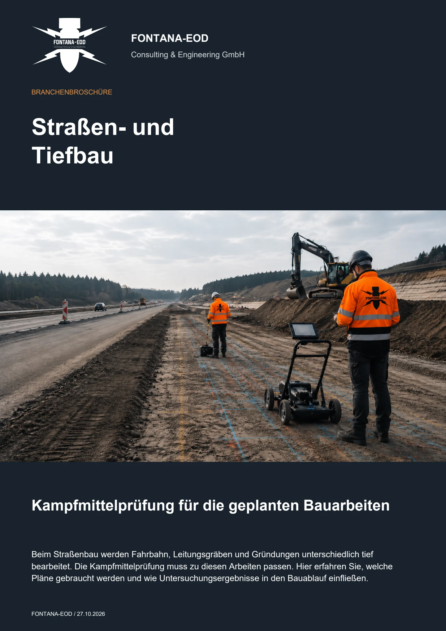
It may be considered where groundworks relevant to explosive ordnance are planned and prior methods cannot fully cover the ground volume of the subsequent works because of existing structures, utilities, fill, buildings or lack of access. Before work begins, the basis for suspicion, excavation geometry, layers, investigation methods, hold points, responsibilities and documentation objective must be defined.
No. In a technically suitable explosive ordnance survey alongside construction, each working layer is surveyed using technical equipment and assessed by a specialist before removal. Only then do controlled removal in layers and supplementary visual inspection follow. These steps are repeated down to the agreed excavation base; hold points and the ground volume investigated are documented.
A site plan, construction section, excavation area, target depth, planned layers, construction equipment, shoring, existing utilities, access, basis for suspicion and existing survey results are required. Instruction and reporting routes, work stoppages, safe equipment positions, handling of areas that cannot be investigated and the form of daily or section-specific documentation are also defined.
Existing information and conditions from authorities are supplied with their dates, complete attachments and spatial scope. In Germany, the responsible explosive ordnance disposal service, local public order authority and, where applicable, building control authority are identified for the project location. Outside Germany, coordination takes place with the authorities responsible there.
Historical assessment, surface surveying and depth investigation remain the primary foundations. Excavation monitoring does not generally replace these services. It supplements them where the actual construction stage makes new areas accessible or known interference limits preliminary investigation. Areas already investigated reliably and remaining areas are recorded separately in spatial terms.
If a suspicious object is encountered, work in the affected area stops immediately. Do not touch or move the object or expose it further. Leave the danger area and keep other people away without putting yourself at risk. In Germany, notify the police immediately on 110; outside Germany, use the local emergency reporting route. Then inform site management. For a measured anomaly without a visible object, the agreed specialist investigation and work-stoppage procedure applies. The location, construction stage, interruption and decision on resuming work are documented.
The documentation includes the project and section, basis for suspicion, layers investigated, methods used, equipment and working conditions, interruptions, interference areas, anomalies, findings and follow-up decisions. Areas that were not supervised or could not be investigated remain clearly identified. The statement applies only to the documented ground volume and construction stage.
Key factors are excavation volume, area, number of layers, trench depth, soil and fill, utility density, shoring, construction equipment, daily construction output, access, prior findings, necessary survey equipment, shift changes, dewatering, traffic phases and the scope of documentation. A reliable cost calculation therefore requires a realistic construction sequence and clearly defined limits to the services.
An initial enquiry does not yet need to contain a complete clearance concept. However, it should identify the actual excavation volume, construction sequence and existing preliminary investigation.
A reliable enquiry explicitly identifies which remaining areas were left outstanding by preliminary investigation.
Provide the site plan, excavation or route, section boundaries, target depth, planned layers and current plan revision.
Lateral extensions, slopes, shoring and inaccessible areas should be clearly marked.
Describe the excavators, direction of removal, expected daily output, dewatering, traffic phases and parallel trades.
These details determine section size, hold points and possible investigation times.
Include the historical assessment, correspondence with authorities, existing survey reports, utility plans and known interference areas.
State which areas have already been investigated and which have been assessed only with limitations.
A site plan, excavation area, maximum depth, planned layers, construction equipment, timescale and existing documents relating to suspected ordnance or surveys are often sufficient for an initial review.
FONTANA-EOD then identifies the details still needed, a technically suitable working method and the required documentation structure.
Excavation, route, chainage, area, depth and slopes.
Equipment, layers, direction of removal, shoring, dewatering and daily output.
Historical basis, survey reports, utilities, interference areas and outstanding areas.
Basis for site management, the client, project file and regional coordination.
Deployment planning requires not only the total excavation volume, but also the realistic sequence of exposed surfaces. Different soils, shoring sections or utility areas may require different layer and investigation concepts.
For shift working or several earthmoving machines, handovers, authority to issue instructions and section boundaries are expressly defined. This keeps it clear which ground volume has been investigated and who may authorise the next excavation step.
The cost calculation also includes time for setting out, surveying, assessment, documentation and possible interruptions. A sequence based solely on excavator output would be incompatible with a reliable investigation step.
If excavation depth, slopes, shoring or equipment operation change during execution, the impact on the risk assessment and investigation geometry is assessed before the changed intervention.
Details of excavation equipment, planned changes between open slopes and shoring, and areas where intermediate investigations can be carried out safely are also helpful. These allow a reliable work sequence to be developed for the civil engineering section concerned.
Whether historical aerial photograph analysis, explosive ordnance surveying, surface surveying using GPR, magnetometry or TDEM, deep-ground surveys, downhole surveys, excavation supervision, area clearance or ordnance recovery is needed depends on the location, ground disturbance, depth, ground and existing documents. An early ordnance assessment provides clarity for tendering, programming, occupational safety and construction.
FONTANA-EOD combines its Section 7 SprengG licence, specialists holding Section 20 SprengG certificates of competence, suitable survey and clearance methods, and traceable documentation. Send the site plan, depth of ground disturbance, construction phase and existing documents for an initial technical assessment.


