Project pathway
The quickest route to the right decision.
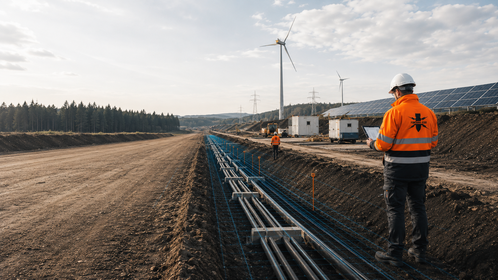
For battery storage projects, storage foundations, transformer stations, cable routes and assembly areas form part of explosive ordnance assessment planning. FONTANA-EOD plans suitable surveys according to the storage layout, ground intervention depth, site conditions and construction phase. Send the layout, foundation and cable plans, depths, construction programme and delivery dates so that services and documentation can be defined before civil engineering work and container installation.
Identify storage blocks, transformers and cable routes.
Record foundations, piles and earthworks.
Coordinate crane areas, access roads and documentation.
Before battery storage construction, existing hazard indications and planned ground interventions are used to clarify which explosive ordnance surveys are required. In addition to foundations and cable routes, this includes drainage, retention facilities, access roads and crane areas. The detailed construction layout with actual depths and volumes of ground affected is decisive.
The scope of work for “Aachen – Voltfang battery storage” included downhole magnetometry / deep-ground surveying.
Service period: 2026-08
Service areas:Downhole magnetometry / deep-ground survey
View project details · Deep-ground and downhole surveys · Project location: Aachen
A battery storage installation consists of more than the containers or cabinets themselves. Transformers, inverters, medium-voltage equipment, cable routes, drainage, protection and operational areas, and assembly zones involve separate ground interventions.
The explosive ordnance survey relates to the reliable construction or EPC layout. Areas, lines, individual foundations and temporary volumes of ground affected are assigned separate work boundaries and a shared project identifier.
For hybrid projects with a solar park, wind farm or substation, it is defined which documents can be shared and which storage areas need supplementary assessment. An overall area assessment does not replace depth-specific assessment of individual components.
Particular attention is given to interfaces between the storage site, grid connection and existing energy infrastructure. Shared access roads or cable corridors can be combined in planning; their explosive ordnance assessment nevertheless remains limited to the geometry actually surveyed.

Containers, battery cabinets and modular storage units need standing areas, strip or pad foundations and often paved maintenance areas.
Foundation type, excavation depth, ground improvement and possible piles are recorded for the survey. Whether an area-based survey is sufficient or supplementary methods are needed also depends on suspected hazards, ground conditions and survey conditions.
Select surveys for storage blocks and standing areas
Transformer stations, inverter stations and medium-voltage installations have their own foundations, cable entries and assembly areas.
Deep individual ground interventions, foundation excavations and cable transitions are taken from the electrical and civil engineering layout and documented on the same site plan.
Prepare transformer and station locationsDirect-current, alternating-current and medium-voltage cables connect storage blocks, transformers and the grid connection point.
Alignment, working width, trench depth, joint bay or chamber areas and crossings are assessed by section; existing utilities inform method selection.
Coordinate methods for the planned cable works
Swales, drains, chambers, basins and retention areas may lie outside the storage rows while still requiring deep or area-wide earthworks.
The assessment is linked to the ground profile, water management, excavation depth and subsequent maintenance routes.
Include drainage in the assessment plan
Fire service access routes, standing areas, clearances and operational aisles may require ground improvement, frost protection layers or new drainage.
These areas are included where their construction involves intervention in ground suspected of containing explosive ordnance.
Assess safety and traffic areasDelivering and positioning heavy storage containers requires crane areas, heavy-load access roads, temporary storage and assembly zones.
Ground improvement, load distribution plates and temporary roads are recorded as separate construction stages where ground intervention is planned.
Assess assembly and crane areasBattery storage projects are often developed under tight programme and procurement pressures. At the same time, container numbers, power electronics, transformer arrangements, foundations and cable routing change during detailed design.
Before each survey, the applicable design revision and required results are agreed. This allows early area assessments to be used without accepting later layout changes without assessment.
Historical sources, previous uses, existing find information and the planned grid connection are related to possible storage sites.
The early assessment supports site comparison, project budgeting and programme risk assessment before the final container layout is defined.
Assess the storage site using historical evidenceStorage blocks, transformers, inverters, operational buildings, drainage, access roads and clearances are overlaid with the suspected hazard area.
The plan records which areas are to be surveyed and which information or surveys are still missing before construction begins.
Derive assessment areas from the layoutAreas, point quantities, depths, access, work windows, quality requirements and data handovers are clearly described.
The service scope must match the chosen foundation and cable construction methods and be able to accommodate later changes through technical assessment.
Prepare tender documents for storage constructionThe surveys required for foundation slabs, strip foundations, piles or ground improvement are scheduled before installation of the storage equipment wherever possible.
Early work avoids steel containers, cables and cranes obscuring later surveys or blocking work areas.
Coordinate surveys with the foundation typeCable trenches, drainage, chambers and the grid connection can be constructed in sections.
For areas not fully surveyed in advance, the technical suitability of explosive ordnance surveying during construction is assessed. Each working layer is technically surveyed and evaluated before controlled removal in layers with supplementary visual inspection. These steps are repeated down to the agreed excavation base.
Prepare the civil engineering phase for controlled workA survey anomaly, a technical installation component and an actual suspicious object are distinguished.
Survey anomalies are assessed by specialists. If an unexpected suspicious object is encountered, work is stopped immediately and the responsible authorities are notified without delay.
Record anomalies with their location and work statusHistorical indications, technical survey feasibility and the planned BESS layout are assessed separately. This information is brought together on the current installation plan to select the surveys.
An open greenfield site may offer good survey conditions, while an industrial or redevelopment site may contain made ground, old utilities and remaining metal structures. The service scope is therefore defined by site and component.
Aerial photographs, archive records or previous uses substantiate a suspicion at the proposed site.
The suspected hazard area is overlaid with storage rows, the transformer area, cable routes and assembly zones.
This creates a technical survey commission for the relevant ground interventions.
Define the suspected hazard area at the storage siteAn accessible site without dominant technical installations can be surveyed geophysically over its extent.
The survey grid, method and depth of usable data depend on foundations, cable trenches and the expected target object.
Early surveying improves access and reduces later interference from containers and electrical equipment.
Plan area surveys before assemblyMade ground, scrap metal, foundations, reinforcement and existing utilities can strongly obscure geophysical data.
The site is divided into areas where data can be evaluated, planned dismantling stages and deep ground interventions.
Suitable supplementary methods and later survey access are assessed for areas subject to limitations.
Determine suitable methods for existing sitesPiles, micropiles, boreholes or deep foundation points affect a clearly defined volume at depth.
Coordinates, target depth, diameter and installation method are linked to survey planning.
The result remains limited to the documented points and the agreed volume of ground affected.
Assess deep storage and transformer locationsExisting services, paved surfaces and metal installations can restrict surveying in advance.
The trench plan records which sections can be evaluated and where surveys are missing. Suitable supplementary methods are assessed for the remaining sections.
Chainage and section identifiers are retained through to the excavation record.
Select surveys for cable areas affected by interferenceA survey anomaly is assessed against known installations, survey quality, location and the planned ground intervention.
Depending on the result, further profiles, point-specific assessment, controlled exposure or involvement of the responsible authorities may follow.
The subsequent measure remains linked to the original finding in the project records.
Document findings and necessary follow-up measuresThe documentation links the BESS layout, construction sections, foundations, cable routing and fieldwork. Storage blocks, transformers, ancillary installations and temporary assembly areas use the same identifiers as in design and construction.
In addition to survey results, accessibility, technical interference, zones not addressed and necessary follow-up measures are identified. This keeps the status traceable when layouts change or container deliveries are staggered.
The project address, land parcel, coordinate system, storage layout, block numbers, transformer locations, cable alignments and work boundaries form the spatial basis.
Revisions are clearly recorded so that relocated container rows or new ancillary installations can be identified.
Aerial photograph assessments, previous uses, authority documents, earlier reports and project requirements are documented with their source and scope.
Missing information and conflicting area boundaries are identified so that they can be clarified before the survey.
Methods, grid, assessment depth, point geometry, surface, ground conditions, vegetation, accessibility and technical interference sources are described for each area.
For brownfield projects, made ground, scrap metal, reinforcement and remaining foundations are recorded as factors affecting data evaluation.
Survey data, anomaly lists, site plans, borehole records and field reports use a shared identifier.
This makes it traceable which anomaly beneath which storage block, cable section or transformer area underwent further investigation.
Inaccessible areas, zones with obscured data and areas accessible only after dismantling are mapped.
Suitable supplementary methods and the possible survey date are assessed for each zone.
The final report identifies the areas, linear sections and volume at depth actually addressed, together with remaining limitations.
If the EPC contractor changes the foundations, container numbers or cable route, the new plan is checked against this status of work.
The documentation dossier brings together historical assessment, technical surveys, point-specific documentation and services during construction. It assigns each result to a storage block, installation area or construction section.
For phased implementation, it remains clear which areas have been addressed for civil engineering and installation and where design changes or lack of access require additional work.
Container rows, transformers, inverters, cable routes, drainage, access roads and crane areas are recorded with unique identifiers.
The asset list links technical design, explosive ordnance work and subsequent acceptance documents.
Historical sources and previous uses are related to the current property and installation geometry.
The plan identifies where hazard indications exist and which areas have no known corresponding indications.
Area surveys, point lists, assessment depths, linear sections and field conditions are stored with georeferencing.
The data structure allows comparison with the foundation plan, cable plan and installation sequence.
Anomalies, technical sources of interference, exposures and finds are assigned a work status that can be updated.
Outstanding points are recorded with responsibility, the next work step and a reference to the affected storage area.
Project development, EPC, civil engineering, electrical design, HSE and responsible authorities receive coordinated documents.
Handovers include the design revision, asset register, zones not addressed and agreed follow-up measures.
Reports, maps, records and action lists are brought together into traceable project records. After actual exposure or clearance work, the corresponding findings and clearance records are included.
The records support later extensions or modifications without extending earlier assessments to new areas or depths.
The current design revision determines which questions can already be assessed. Early site questions are addressed through historical and area-based assessment; deep foundations and specific cable routes require detailed construction designs.
Wherever possible, the technical assessment is completed before container installation, cable installation and permanent fencing. This keeps areas accessible and limits geophysical interference.
The handover to civil engineering and installation therefore identifies not only areas addressed but also outstanding marginal areas, reserve areas not yet surveyed and the design revision to which the assessment applies. For later expansion phases, we check again whether existing results cover the relevant areas and depths.
The area, greenfield or brownfield conditions, storage capacity, hybrid project, grid connection and desired decision are described.
The current layout revision determines which work is already useful.
Site plans, previous uses, historical assessments, earlier reports, utility plans and known find information are compared spatially.
This identifies priority storage and ancillary areas.
Container foundations, transformer stations, inverters, cable trenches, drainage, access roads and crane areas are recorded with depth and construction method.
Point and line lists form the basis for procurement and setting out.
Ground and surface conditions, made ground, interference sources, the target object and required depth of usable data determine the suitable service.
Fieldwork is scheduled before installation or linked to defined dismantling and construction stages.
Site preparation, setting out, construction logistics, safety zones, equipment access and communication channels are coordinated. Necessary surveys and protective measures are planned before ground intervention during vegetation clearance, dismantling or creation of access.
Concurrent trades and delivery dates are coordinated with the required assessment periods.
Area-based surveys, deep-ground surveys or work during construction are carried out according to the layout and section identifiers.
Inaccessible areas or areas affected by technical interference are recorded immediately.
Survey data, anomalies, ground conditions and known installations are assessed for plausibility against the planned ground intervention.
A next technical step is defined for each outstanding storage or cable area.
The report, maps, point lists, limitations and status of measures are prepared for EPC, civil engineering contractors and site management.
Layout changes are checked against the documented status before implementation.
The storage property boundary alone does not describe the assessment requirements. Foundation areas, individual foundations, cable alignments, drainage, traffic areas and temporary assembly areas are decisive.
The technical layout is therefore divided into areas, lines and points. These remain shown on the same plan. Suitable methods and assessment limitations are defined for each survey area.
Container and module standing areas are described with foundation type, excavation depth and possible ground improvement. Transformer stations, inverters and operational buildings involve additional foundation and cable interfaces. Cable design defines linear volumes of ground affected, while piles, earth rods and borehole locations have their own depth geometry.
For each area, the top and bottom levels, working width, slopes or shoring, possible positional deviations and construction phase are defined. Crane and assembly areas are included where their construction alters the ground or requires additional foundations.
On brownfield sites, scrap metal, remaining foundations, reinforcement, utilities and made ground can affect survey feasibility. The assessment plan therefore distinguishes zones where data can be evaluated, sections subject to method limitations and volumes of ground that become accessible only during dismantling or excavation.
Strip foundations, slabs, pad foundations or piles are recorded with their area, depth and construction method.
The survey remains related to the documented block geometries and the volumes of ground affected.
Transformer stations and power electronics have their own excavations, foundations and cable entries.
Interfaces between station areas and storage blocks are not omitted from the assessment plan.
Cable trenches, joint bay areas, chambers and earthing conductors are recorded as linear sections with width and depth.
Existing services and later parallel installation affect the method and construction sequence.
Drains, swales, basins, chambers and ground removal may affect additional areas and depths.
The assessment area follows the actual earthworks, not just the visible storage containers.
Crane areas, access roads and assembly zones are described with ground improvement, load distribution and possible excavation.
Temporary use does not remove the need for specialist assessment of relevant ground interventions.
Later storage blocks or additional transformer stations are identified as separate construction sections.
Existing documentation is reused only where the new geometry lies entirely within the documented area.
Ground-mounted battery storage, storage at solar or wind farms and installations on industrial or redevelopment sites have different suspected hazards and survey conditions. Previous uses, made ground, existing utilities, paved surfaces and metal installations can affect technical surveys.
Determine suitable surveys for the siteContainer foundations, cable routes, transformer areas and drainage structures are each described by location and depth. These details determine the volume of ground to be surveyed. Crane areas and access roads are included where ground intervention or ground improvement is planned.
Select methods for storage and ancillary installationsHistorical assessment, geophysics, deep-ground surveys and excavation supervision have different scopes of assessment. Selection depends on the suspected hazards, planned ground intervention depth, ground conditions, interference and accessibility.
Assesses previous uses, suspected hazard areas and outstanding data questions at the storage site.
It does not replace technical surveys of the current foundation and cable areas.
Can detect ferromagnetic target objects on open greenfield sites with little technical interference.
Scrap metal, reinforcement, steel containers and technical installations limit the method; timing before assembly is therefore important.
Responds to the electromagnetic properties of conductive objects and can supplement surveys of selected areas.
Made ground, cables, electrical infrastructure and target size are assessed before deployment.
Can show layer changes, installations and spatial reflection patterns on suitable surfaces.
A reflection alone is not classified as explosive ordnance and requires comparison with the suspected hazards and existing installations.
Can survey suitable deep pile, borehole and foundation areas for storage blocks, transformer stations and ancillary installations.
Point location, target depth, borehole geometry and subsequent construction must be consistent.
Where explosive ordnance detection during construction is technically suitable, each working layer is surveyed and evaluated using technical methods. Controlled removal in layers and supplementary visual inspection then follow; these steps are repeated down to the agreed excavation base.
The section supervised and depths reached are documented with their locations. Excavation layers, hold points, authority to issue instructions, communication channels and documentation are defined in the work instructions before work begins.
If container arrangements, foundations or cable routes change, the survey scope is also reviewed. The technical scope is derived from all planned ground interventions, rather than the container count.
Technical limitations and outstanding areas are identified early. This allows EPC, civil engineering and delivery logistics teams to adapt their sequences to realistic survey and handover dates.
FONTANA-EOD separates early site assessment from construction-specific assessment. While the layout remains subject to change, suspected hazard areas and broad construction zones can be assessed; deep foundations and specific cable sections follow the reliable design revision.
The methodology takes account of whether the site is open undeveloped land, a hybrid site or an industrial site affected by technical installations. Scrap metal, made ground, reinforcement and existing services are considered when selecting methods.
Fieldwork timing is linked to the delivery and installation programme. Surveys before container installation and extensive cable installation often benefit from better access and less technical interference.
The sequence of earthworks, ground improvement, foundation construction and utility installation is also considered. Once materials, precast units or construction facilities occupy a work area, an originally suitable survey geometry may become restricted or entirely inaccessible.
During civil engineering work, design departures and additional ground interventions are checked against the documented status. An existing assessment applies to a new cable section or relocated transformer only where its geometry is fully covered.
The final documents remain understandable for project developers, EPC contractors, site management and the future operator. They describe what was addressed, the limitations and the measure required before an outstanding ground intervention.
Storage blocks, transformer stations, cables, drainage and assembly areas are recorded in full.
Accessible areas are surveyed before steel containers, cables and cranes are installed wherever possible.
Greenfield, hybrid and brownfield conditions lead to different combinations of methods.
Piles, boreholes and deep foundations receive their own coordinate and depth references.
New container rows, cable alignments and ancillary installations are checked against the existing status.
The report, maps and action register support EPC, civil engineering, installation and subsequent operations.
The most favourable assessment stage is generally before foundations are built, cables are laid and storage containers are installed. After steel and electrical equipment are installed, geophysical surveys may be subject to substantially greater interference or individual areas may no longer be accessible.
Using the storage layout, FONTANA-EOD describes the areas and depths to be surveyed and the documentation needed for each construction section. The documentation remains related to the areas, linear sections and volume at depth actually addressed.
Project developers, owners, EPC contractors, grid connection designers, civil engineering contractors, HSE, specialist contractors and responsible authorities need a clear division of tasks. Before construction, it is defined who reports design changes, tracks outstanding areas and receives results.
Define the site, project objective, storage layout, programme and documentation required.
They provide property and historical records and decide on commissioning specialist services.
Translate the project into container blocks, transformer stations, cable alignments, foundations and construction phases.
Design changes are communicated so that their effects on areas already addressed can be assessed.
Define the connection point, station arrangement, cable route and technical interfaces with the grid.
Grid connection areas are linked to the storage site within a shared assessment and documentation structure.
Carry out excavation, ground improvement, cable trenches, foundations, crane areas and container installation.
Departures from the planned location, depth or construction method are assessed before construction.
Assesses the basis for suspicion and project geometry, carries out the commissioned service scope and documents results and limitations.
The work remains linked to the applicable design revision and the actual volume of ground affected.
In Germany, the ordnance disposal services of the federal states and the locally competent authorities carry out hazard-response and find-management duties. Their involvement is established for the project location; outside Germany, local responsibilities apply.
The local public order authority and, where applicable, building control are involved according to their project responsibilities. Conditions and contacts are assigned to the actual storage areas and construction sections; reporting procedures are defined before work begins.
If an unexpected suspicious object is found, notify the police immediately on 110 in Germany; outside Germany, the local emergency reporting procedure applies. The competent authorities determine the next steps.
Requirements depend on the scope of activity, project location, ground conditions, installation sequence and subsequent operation. Explosive ordnance assessment, construction site safety and technical BESS design are organised as connected but distinct tasks.
A safety-focused storage layout does not replace assessment of the ground. Equally, explosive ordnance surveys do not answer electrical engineering or installation fire safety questions; the interfaces are nevertheless coordinated in the construction sequence.
In Germany, § 7 SprengG concerns the commercial authorisation for activities requiring authorisation; § 20 SprengG concerns the certificate of competence of responsible persons. Under § 1b SprengG, searching for found munitions also counts as handling them. The requirements applicable to the project depend on the activity actually commissioned and the allocation of responsibilities.
The risk assessment links earthworks, drilling, heavy deliveries, crane operations, existing utilities, construction traffic, exclusion zones and communication channels with the explosive ordnance approach.
DGUV Information 201-027 supports risk assessment and protective measures for explosive ordnance clearance work. The Baufachliche Richtlinien Kampfmittelräumung contain requirements for historical and technical investigation, clearance concepts, procurement and documentation within their defined federal remit. Their application to the specific battery storage project is clarified separately.
If an unexpected suspicious object is found, stop work in the affected area immediately. Do not touch, move or further expose the object. Leave the danger area and keep others away without putting yourself at risk. In Germany, notify the police immediately on 110; outside Germany, use the local emergency reporting procedure. The competent authorities determine the next steps. Then inform site management and those responsible for the project.
Construction contract acceptance, authorisation for installation and authority handling of finds serve different purposes. The necessary documents and responsibilities are clearly assigned within the project sequence.
The First Ordinance to the Explosives Act (1. SprengV) includes requirements concerning specialist competence and state-recognised training courses. For battery storage, the required qualification is related to the tasks actually commissioned in storage areas and ancillary installations.
DGUV Rule 113-003 concerns the dismantling or destruction of explosives or corresponding objects and also includes the disposal of found munitions. It applies according to this field of activity; it does not replace a risk assessment specific to the planned ground intervention.
Qualifications, appointment and scope of responsibility must match the survey, exposure, clearance or recovery activities.
Civil engineering, crane operations, delivery traffic, electrical work and exclusion zones are coordinated in time and space.
Work areas, depths, point lists, methods, data formats and basis for acceptance are defined before procurement.
Project management, site management, HSE, the specialist contractor and responsible authorities receive an agreed procedure for anomalies and finds.
The layout, foundations, cable routes, construction stages and required assessment services are clarified before container delivery.
Outstanding points are incorporated into programme and procurement planning.
Work areas, hold points, design changes and handovers must be clear to civil engineering, electrical and installation trades.
Zones not addressed remain visible in the construction documents.
Stop work immediately, do not touch, move or further expose the object, leave the immediate area and keep others away without putting yourself at risk. In Germany, notify the police immediately on 110; outside Germany, the local emergency reporting procedure applies.
Then inform site management and those responsible for the project. Work resumes in accordance with the instructions of the responsible authorities.
Project documents link the storage layout, foundation plan, cable routing, construction conditions and fieldwork. Maps and status lists use the same block, point and section identifiers as EPC and construction.
Historical assessment, deep-ground surveys, excavation supervision, investigation of findings and the final report remain identifiable as separate services and are brought together for each storage area.
Areas, lines, individual foundations and temporary volumes of ground affected are shown on the same storage layout.
Assess the storage layout within the energy project
Suspected hazard areas, data gaps and previous uses are related to the planned ground intervention on the site plan.
Check the historical basis for the siteThe documentation records coordinates, survey depth, survey conditions, interference and outstanding tasks.
Survey storage and transformer foundations
Field records document the work area, construction conditions, surveys, interruptions, observations and reporting procedures.
Supervise cable trench and excavation worksThe project records document exposure, assessment, responsibility and further measures with location, date and work status.
Maintain findings and handovers in the project fileThe final report contains the initial situation, methods, data, findings, survey limitations and outstanding tasks.
Document storage project records and handover

Assessment of suspected hazards, area surveys, deep-ground surveys, excavation supervision and documentation cover different parts of the BESS project.
Selection follows the current layout revision, the forthcoming construction phase and the volume of ground that needs a reliable assessment before ordering, civil engineering work or installation.

Plan ordnance assessments for transport, utility, energy and other infrastructure projects according to their ground interventions.
Have the project surroundings assessed by specialistsDistinguish utility corridors, crossings, foundations and installation areas by construction method and intervention depth.
Assess the energy project in its overall contextEvaluate historical indications and data gaps at the planned storage site.
Determine the historical suspected hazardPrepare surveys for deep foundations, masts, piles, shoring and borehole locations.
Assess deep interventionsEstablish the suitability and sequence of construction-phase ordnance surveying for remaining excavation areas.
Plan excavation supervision within the construction sequence
Coordinate recovery of confirmed ordnance with the permitted activities and local responsibilities.
Clarify the findings and recovery processPrepare the specification, data formats and section handovers for storage construction.
Prepare tendering and documentation
Clarify the project location and local responsibilities for planning, conditions and communication about finds.
Clarify regional responsibilitiesSubmit the storage layout, ground intervention depths and construction schedule for a project assessment.
Submit project recordsThe project location, land parcels, block identifiers and installation coordinates are brought together to locate the site. The storage layout and grid connection plan must identify the same revision. Existing requirements and reports are assigned to the affected blocks or construction sections.
Relocated storage blocks may affect different foundation and cable volumes. Compare the new arrangement with the documented survey scope and provide the additional assessment for any extra areas or depths before construction begins.
Check evidence against the interventionA reserve area shown on the layout has not automatically been surveyed. Record its status separately from storage blocks already surveyed so that a later expansion phase can be planned on the appropriate basis.
Explore the technical principlesTechnical information
Utility routes, substations and energy installations place different demands on ordnance assessment. The brochure shows the design information needed and how investigation, construction sequence and documentation fit together.

The site, storage layout, foundation type, cable routes and actual construction conditions remain decisive for the survey.
The assessment should begin during site and layout planning. Before ground investigation, foundations, piles, cable trenches, drainage and crane areas, the volumes of ground affected must be defined with their location, depth and basis for suspicion.
Storage containers, transformers, cables, fences and cranes can restrict access and obscure geophysical surveys. Surveying before assembly makes use of the open site and allows outstanding areas to be addressed early in civil engineering and programme planning.
No. Transformer stations, inverters, cable routes, drainage, fire service access roads, retention facilities, crane areas and temporary assembly areas may involve separate ground interventions. Each relevant volume of ground affected is described separately.
Made ground, metal remnants, reinforcement and utilities are recorded as technical constraints. Suitable methods and survey dates are assessed for areas where data can be evaluated, deep intervention points and zones accessible only after dismantling. Necessary surveys and protective measures are planned before preparatory ground intervention during dismantling.
Piles, boreholes and deep foundations may extend beyond the area covered by near-surface surveys. We then assess which method can cover the planned volume of ground down to the required depth. Coordinates, construction methods, ground conditions and technical interference are considered when selecting the method.
The project records should include the design revision, block and point references, methods, survey conditions, data, anomalies, areas not addressed, findings and follow-up measures. Changes to the storage layout are checked against this status.
Relevant factors are the area, number and depth of foundations, cable and drainage alignments, brownfield conditions, accessibility, required methods, construction windows, data formats and scope of the agreed reporting and handover documentation.
Stop work in the affected area immediately. Do not touch, move or continue to expose the object. Leave the danger area and keep others away without putting yourself at risk. In Germany, notify the police immediately on 110; outside Germany, use the local emergency reporting procedure. The responsible authorities determine the next steps. Then inform site management and those responsible for the project.
An initial enquiry can begin with a preliminary layout. It should identify the property, storage blocks, grid connection, main foundations, cable and drainage alignments, and the intended construction and delivery dates.
For hybrid projects, it should be clear which areas have already been assessed for the solar park, wind farm or substation and which are newly affected by storage construction.
Provisional or conflicting documents are also helpful. They show which decisions are still missing before reliable tendering or field mobilisation.
Send the address, land parcel, site plan, container or block arrangement, transformer and inverter areas, and reserve areas.
Identify the design revision, options and existing installations.
For several construction phases, priorities and later extensions should be visible.
Describe foundation types, piles, borehole locations, cable trenches, chambers, drainage, retention facilities, access roads and crane areas.
State maximum depths, working widths and planned construction methods.
Coordinated point and line lists make spatial referencing easier.
Include historical assessments, contaminated land and ground investigation records, existing utilities, previous surveys and known find information. Information and conditions from authorities are included with their date, complete attachments and spatial scope.
State dismantling stages, site access, delivery and installation windows, and concurrent trades.
Describe whether the result is needed for development, EPC procurement, civil engineering or the operator's records.
For an initial assessment, a property plan, preliminary layout, foundation and cable concept, maximum ground intervention depths, construction programme and existing hazard information are often sufficient.
FONTANA-EOD checks your documents to identify which surveys are required and what information is missing. Storage areas ready for construction can be prioritised while later extensions are initially considered in planning only.
Areas, point quantities, line lengths, depths, site conditions and the desired scope of data and reporting are then defined more precisely for costing.
For several expansion phases, it is also defined which services are needed immediately, which are needed before a later extension and which are triggered only by an actual design change. This keeps the service scope traceable in time and space.
For later construction, it is also defined which document provides the handover of each storage block to civil engineering, foundation construction and installation. This keeps the timing of authorisation for the next work step linked to the documented area and volume at depth.
Storage blocks, transformer, inverter, reserve areas and current design revision.
Foundation types, piles, borehole locations, target depths and construction methods.
Cable alignments, chambers, drainage, access roads, crane and safety areas.
Basis for site selection, EPC procurement, civil engineering, installation or the operator's records.
Whether historical aerial photograph analysis, explosive ordnance surveying, surface surveying using GPR, magnetometry or TDEM, deep-ground surveys, downhole surveys, excavation supervision, area clearance or ordnance recovery is needed depends on the location, ground disturbance, depth, ground and existing documents. An early ordnance assessment provides clarity for tendering, programming, occupational safety and construction.
FONTANA-EOD combines its Section 7 SprengG licence, specialists holding Section 20 SprengG certificates of competence, suitable survey and clearance methods, and traceable documentation. Send the site plan, depth of ground disturbance, construction phase and existing documents for an initial technical assessment.


